Mokra Gora (mountain)
| Mokra Gora | |
|---|---|
| Мокра Гора | |
 | |
| Highest point | |
| Elevation | 2,156 m (7,073 ft)[1] |
| Coordinates | 42°49′56″N 20°21′49″E / 42.83222°N 20.36361°ECoordinates: 42°49′56″N 20°21′49″E / 42.83222°N 20.36361°E |
| Geography | |
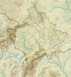 Mokra Gora Location in Kosovo | |
| Location | Serbia, Kosovo, Montenegro |

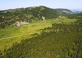
Mokra Gora (Serbian Cyrillic: Мокра Гора, lit. ''Wet Mountain'', pronounced [môkraː ɡǒra]; Albanian: Malet e Moknës is a mountain on the border between Serbia, Kosovo[a] and Montenegro. It is part of the Accursed Mountains range. It has two peaks higher than 2,000 m (6,562 ft). The highest is Pogled at 2,156 m (7,073 ft), and the other is Beleg at 2,142 m (7,028 ft). The Pogled peak is shared between Serbia and Kosovo, while Beleg is on the tripoint. The peak Berim is also part of this mountain.[2] In Kosovo, the town of Istok lies just south of the mountain on the Dukagjin plain, which borders the mountain to the south.
Notes and references[]
Notes:
| a. | ^ Kosovo is the subject of a territorial dispute between the Republic of Kosovo and the Republic of Serbia. The Republic of Kosovo unilaterally declared independence on 17 February 2008. Serbia continues to claim it as a part of its own sovereign territory. The two governments began to normalise relations in 2013, as part of the 2013 Brussels Agreement. Kosovo is currently recognised as an independent state by 97 out of the 193 United Nations member states. In total, 112 UN member states have recognised Kosovo at some point, of which 15 states later withdrew their recognition. |
References:
- ^ Jovan Đokić. "Katalog planina Srbije". PSD Kopaonik Beograd. Archived from the original on 2011-05-18.
- ^ "Ibarski Kolašin - Mokra Gora". www.ibarski-kolasin.org. Retrieved 2017-07-14.
This Kosovo location article is a stub. You can help Wikipedia by . |
This Montenegro location article is a stub. You can help Wikipedia by . |
- Accursed Mountains
- Two-thousanders of Kosovo
- Two-thousanders of Montenegro
- Kosovo geography stubs
- Montenegro geography stubs