Monadnock Mountain (Vermont)
| Monadnock Mountain | |
|---|---|
| Highest point | |
| Elevation | 3,148 ft (960 m)[1] |
| Prominence | 1,528 ft (466 m) |
| Isolation | 5.91 mi (9.51 km) |
| Coordinates | 44°53′51″N 71°32′40″W / 44.89750°N 71.54444°WCoordinates: 44°53′51″N 71°32′40″W / 44.89750°N 71.54444°W |
| Geography | |
| Location | Essex County, Vermont, U.S. |
| Topo map | USGS Monadnock Mountain |

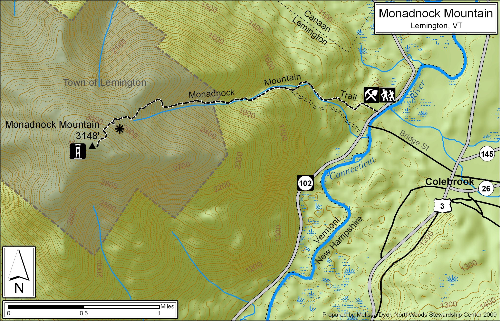
Monadnock Mountain, also called Mount Monadnock, is an inselberg located in the town of Lemington in the Northeast Kingdom region of the U.S. state of Vermont. The mountain overlooks the Connecticut River and the town of Colebrook, New Hampshire to the east. At its highest point, the mountain is 3,148 ft (960 m) high.[2] At the summit, an old fire tower offers excellent views of both Vermont and New Hampshire.[3] On a clear day, the view extends as far east as Maine and as far north as Quebec.[4]
The Monadnock Mountain Trail ascends the eastern slope of the mountain. The trailhead is adjacent to Vermont Route 102, 7.7 mi (12.4 km) south of Canaan and 13 mi (21 km) north of Bloomfield. The hike from the trailhead to the summit is 2.5 mi (4.0 km) with a gain in elevation of 2,130 ft (650 m).[5]
See also[]
- List of mountains in Vermont
References[]
- ^ "Monadnock Mountain, Vermont". Peakbagger.com. Retrieved 3 July 2021.
- ^ "Monadnock Mountain trail map". NorthWoods Stewardship Center. Retrieved 3 July 2021.
- ^ "Monadnock Mountain (Lemington, Vt)". Trail Finder. Retrieved 11 January 2021.
- ^ "Hiking in Vermont's Northeastern Corner". experiencethenortheastkingdom.com. Retrieved 3 July 2021.
- ^ Green Mountain Club (2019). Northeast Kingdom Hiking Trail Map (Topographic map) (3rd ed.). Cartography by MapleRidge Solutions LLC. ISBN 978-1-888021-56-1.
External links[]
- U.S. Geological Survey Geographic Names Information System: Monadnock Mountain
- "Monadnock Mountain, Vermont". TopoQuest.com. Retrieved 3 July 2021.
- "Monadnock Mountain trail info" (PDF). NorthWoods Stewardship Center. Retrieved 3 July 2021.
This article about a location in Vermont is a stub. You can help Wikipedia by . |
- Mountains of Vermont
- Inselbergs of North America
- Landforms of Essex County, Vermont
- Vermont geography stubs