Vermont
Vermont | |
|---|---|
State | |
| State of Vermont | |
| Nickname(s): The Green Mountain State | |
| Motto(s): Freedom and Unity and Stella quarta decima fulgeat (May the 14th star shine bright) | |
| Anthem: These Green Mountains | |
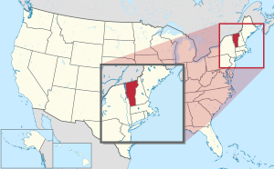 Map of the United States with Vermont highlighted | |
| Country | United States |
| Before statehood | Vermont Republic |
| Admitted to the Union | March 4, 1791 (14th) |
| Capital | Montpelier |
| Largest city | Burlington |
| Largest metro and urban areas | Greater Burlington |
| Government | |
| • Governor | Phil Scott (R) |
| • Lieutenant Governor | Molly Gray (D) |
| Legislature | General Assembly |
| • Upper house | Senate President pro tempore: Becca Balint (D) |
| • Lower house | House of Representatives Speaker: Jill Krowinski (D) |
| Judiciary | Vermont Supreme Court |
| U.S. senators | Patrick Leahy (D) Bernie Sanders (I)[1] |
| U.S. House delegation | Peter Welch (D) (list) |
| Area | |
| • Total | 9,616 sq mi (24,923 km2) |
| • Land | 9,250 sq mi (23,957.39 km2) |
| • Water | 382 sq mi (989 km2) 4.1% |
| Area rank | 45th |
| Dimensions | |
| • Length | 160 mi (260 km) |
| • Width | 80 mi (130 km) |
| Elevation | 1,000 ft (300 m) |
| Highest elevation | 4,395 ft (1,340 m) |
| Lowest elevation | 95 to 100 ft (29 to 30 m) |
| Population (2020) | |
| • Total | 643,503[5] |
| • Rank | 49th |
| • Density | 67.7/sq mi (26.1/km2) |
| • Density rank | 30th |
| • Median household income | $57,513[6] |
| • Income rank | 28th |
| Demonym(s) | Vermonter |
| Language | |
| Time zone | UTC−05:00 (Eastern) |
| • Summer (DST) | UTC−04:00 (EDT) |
| USPS abbreviation | VT |
| ISO 3166 code | US-VT |
| Traditional abbreviation | Vt. |
| Latitude | 42°44′ N to 45°1′ N |
| Longitude | 71°28′ W to 73°26′ W |
| Website | www |

| hideVermont state symbols | |
|---|---|
 | |
 | |
| Living insignia | |
| Amphibian | Northern leopard frog Rana pipiens |
| Bird | Hermit thrush Catharus guttatus |
| Fish | Brook trout Salvelinus fontinalis Walleye Sander vitreous vitreous |
| Flower | Red clover Trifolium pratense |
| Insect | Western honey bee Apis mellifera |
| Mammal | Morgan horse |
| Reptile | Painted turtle |
| Tree | Sugar maple Acer saccharum |
| Inanimate insignia | |
| Beverage | Milk |
| Food | Apple pie |
| Fossil | Woolly mammoth, Beluga whale[7] |
| Gemstone | Grossular garnet |
| Mineral | Talc |
| Rock | Granite, marble, slate |
| Soil | Tunbridge |
| State route marker | |
 | |
| State quarter | |
 Released in 2001 | |
| Lists of United States state symbols | |
Vermont (/vərˈmɒnt/ (![]() listen))[8] is a state in the New England region of the United States. It borders the states of Massachusetts to the south, New Hampshire to the east, and New York to the west, and the Canadian province of Quebec to the north. Vermont is the only state in New England that does not border the Atlantic Ocean. Vermont is the second-least-populated U.S. state and the sixth-smallest by area of the 50 U.S. states with a recorded population of 643,503 according to the 2020 U.S. census.[5] The state capital is Montpelier, the least-populous state capital in the United States. The most-populous city, Burlington, is the least-populous city to be the most-populous city in a state.
listen))[8] is a state in the New England region of the United States. It borders the states of Massachusetts to the south, New Hampshire to the east, and New York to the west, and the Canadian province of Quebec to the north. Vermont is the only state in New England that does not border the Atlantic Ocean. Vermont is the second-least-populated U.S. state and the sixth-smallest by area of the 50 U.S. states with a recorded population of 643,503 according to the 2020 U.S. census.[5] The state capital is Montpelier, the least-populous state capital in the United States. The most-populous city, Burlington, is the least-populous city to be the most-populous city in a state.
For some 12,000 years, indigenous peoples inhabited this area. The historically competitive tribes of the Algonquian-speaking Abenaki and Iroquoian-speaking Mohawk were active in the area at the time of European encounter. During the 17th century, French colonists claimed the territory as part of the Kingdom of France's colony of New France. After the Kingdom of Great Britain began to settle colonies to the south along the Atlantic coast, the two nations competed in North America in addition to Europe. After being defeated in 1763 in the Seven Years' War, France ceded its territory east of the Mississippi River to Great Britain.
Thereafter, the nearby British Thirteen Colonies, especially the provinces of New Hampshire and New York, disputed the extent of the area called the New Hampshire Grants to the west of the Connecticut River, encompassing present-day Vermont. The provincial government of New York sold land grants to settlers in the region, which conflicted with earlier grants from the government of New Hampshire. The Green Mountain Boys militia protected the interests of the established New Hampshire land grant settlers against the newly arrived settlers with land titles granted by New York. Ultimately, a group of settlers with New Hampshire land grant titles established the Vermont Republic in 1777 as an independent state during the American Revolutionary War. The Vermont Republic abolished slavery before any of the other states.[9][10]
Vermont was admitted to the newly established United States as the fourteenth state in 1791. During the mid-19th century, Vermont was a strong source of abolitionist sentiment, although it was also tied to King Cotton through the development of textile mills in the region, which relied on southern cotton. It sent a significant contingent of soldiers to participate in the American Civil War.
The geography of the state is marked by the Green Mountains, which run north–south up the middle of the state, separating Lake Champlain and other valley terrain on the west from the Connecticut River valley that defines much of its eastern border. A majority of its terrain is forested with hardwoods and conifers, and a majority of its open land is devoted to agriculture. The state's climate is characterized by warm, humid summers and cold, snowy winters.
Vermont's economic activity of $34 billion in 2018 ranked 52nd on the list of U.S. states and territories by GDP (every state plus Washington, D.C. and Puerto Rico were larger), but 34th in GDP per capita. In 2000, the state legislature was the first to recognize civil unions for same-sex couples.
Etymology[]
Samuel de Champlain claimed the area around what is now Lake Champlain, giving the name Vert Mont (Green Mountain) to the region he found, on a 1647 map.[11] Evidence suggests that this name came into use among English settlers, before it morphed to "Vermont", ca. 1760.[12][13] In 1777, Thomas Young introduced the name in writing with a broadside "To the Inhabitants of Vermont, a Free and Independent State".[12]
History[]
Native American[]
Between 8500 and 7000 BCE, at the time of the Champlain Sea, Native Americans inhabited and hunted in present-day Vermont. During the Archaic period, from the 8th millennium BCE to 1000 BCE, Native Americans migrated year-round. During the Woodland period, from 1000 BCE to 1600 CE, they established villages and trade networks, and developed ceramic and bow and arrow technology. Their population in 1500 CE was estimated to be around 10,000 people.[14]
During colonial times, where encounters and settlement were initiated by French colonists, the territory was occupied mainly by an Abenaki tribe known as the Sokoki, or Missisquois. The eastern part of the state may have also been occupied by the Androscoggin and Pennacook peoples.[14]
To the west, the Missisquois competed with the Iroquoian Mohawk, based in the Mohawk valley but with a large territory, and the Algonquin Mohican peoples.[14] Many of the tribes later formed the Wabanaki Confederacy during King Philip's War. The warfare by English colonists defeated and scattered most of the surviving Abenaki tribes.[15]
Colonial[]


The first European to see Vermont is thought to have been French explorer Jacques Cartier in 1535. On July 30, 1609, French explorer Samuel de Champlain claimed this territory as part of New France. In 1666, French settlers erected Fort Sainte Anne on Isle La Motte,[16] the first European settlement in Vermont.
The "violent" 1638 New Hampshire earthquake was centered in the St. Lawrence Valley and reported throughout New England. This was the first seismic event noted in Vermont.[17] In 1690, a group of Dutch-British settlers from Albany established a settlement and trading post at Chimney Point, 8 miles (13 km) west of present-day Addison.[citation needed] During Dummer's War, the first permanent English settlement was established in 1724 with the construction of Fort Dummer. It was intended to protect the nearby settlements of Dummerston and Brattleboro.[18]
From 1731 to 1734, the French constructed Fort St. Frédéric, which gave them control of the New France–Vermont frontier region in the Lake Champlain Valley. With the outbreak of the French and Indian War in 1754, the North American front of the Seven Years' War between the French and British, the French began construction in 1755 of Fort Carillon at present-day Ticonderoga, New York. The British failed to take either fort between 1755 and 1758. In 1759 a combined force of 12,000 British regular and provincial troops under Sir Jeffery Amherst captured Carillon, after which the French abandoned Fort St. Frédéric. Amherst constructed Fort Crown Point next to the remains of the Fort St. Frédéric, securing British control over the area.[citation needed]
Following France's loss in the French and Indian War, through the 1763 Treaty of Paris, it ceded control of land east of the Mississippi River to the British. The Crown attempted to limit colonial settlement to lands east of the Appalachians, in order to prohibit encroachment on Native American lands. The territory of Vermont was divided nearly in half in a jagged line running from Fort William Henry in Lake George diagonally north-eastward to Lake Memphremagog.[citation needed] With the end of the war, new settlers arrived in Vermont. Ultimately, Massachusetts, New Hampshire and New York all claimed this frontier area.[citation needed]
On July 20, 1764, King George III established the boundary between New Hampshire and New York along the west bank of the Connecticut River, north of Massachusetts, and south of 45 degrees north latitude.[19] New York refused to recognize the land titles known as the New Hampshire Grants (towns created by land grants sold by New Hampshire Governor Benning Wentworth) and dissatisfied New Hampshire settlers organized in opposition. In 1770 Ethan Allen, his brothers Ira and Levi, and the Allens' cousins Seth Warner and Remember Baker, recruited an informal militia known as the Green Mountain Boys to protect the interests of the original New Hampshire settlers against newcomers from New York.[citation needed]
In 1775, after the outbreak of the American Revolutionary War, the Green Mountain Boys assisted a force from Connecticut, led by Benedict Arnold, in capturing the British fort at Ticonderoga. Thereafter, the Continental Congress in Philadelphia directed the New York colony's revolutionary congress to fund and equip Allen's militia as a ranger regiment of the Continental Army, which it did. Seth Warner was chosen by the men of the regiment to lead, while Ethan Allen later served as a colonel in Schuyler's Army of Northern New York.[20]
Sovereignty[]

On January 15, 1777, representatives of the New Hampshire Grants declared the independence of Vermont.[21] For the first six months of its existence, it was called the Republic of New Connecticut.[22]
On June 2, 1777, a second convention of 72 delegates met and adopted the name "Vermont." This was on the advice of a friendly Pennsylvanian, Dr. Thomas Young, friend and mentor of Ethan Allen. He was advising them on how to achieve admission into the newly independent United States of America as the 14th state.[22] On July 4, they completed the drafting of the Constitution of Vermont at the Windsor Tavern, and adopted it on July 8. This was the first written constitution in North America to ban adult slavery,[23] saying male slaves become free at the age of 21 and females at 18. It provided for universal adult male suffrage and required support of public schools. It was in effect from 1777 to 1786.[24]
Revolutionary War[]
The Battle of Bennington, fought on August 16, 1777, was a seminal event in the history of the state of Vermont and the United States. A combined American force, under General John Stark's command, attacked the Hessian column at Hoosick, New York, just across the border from Bennington. It killed or captured virtually the entire Hessian detachment. General Burgoyne never recovered from this loss and eventually surrendered the remainder of his 6,000-man force at Saratoga, New York, on October 17 that year.[25]
The battles of Bennington and Saratoga together are recognized as the turning point in the Revolutionary War because they were the first major defeat of a British army. The anniversary of the battle is still celebrated in Vermont as a legal holiday.
The Battle of Hubbardton (July 7, 1777) was the only Revolutionary battle within the present boundaries of Vermont. Although the Continental forces were technically defeated, the British forces were damaged to the point that they did not pursue the Americans (retreating from Fort Ticonderoga) any further.
Admission to the Union[]

Vermont continued to govern itself as a sovereign entity based in the eastern town of Windsor for 14 years. The independent state of Vermont issued its own coinage from 1785 to 1788[26] and operated a national postal service. Thomas Chittenden was the Governor in 1778–89 and in 1790–91.
Because the state of New York continued to assert a disputed claim that Vermont was a part of New York, Vermont could not be admitted to the Union under Article IV, Section 3 of the Constitution until the legislature of New York consented. On March 6, 1790, the legislature made its consent contingent upon a negotiated agreement on the precise boundary between the two states. When commissioners from New York and Vermont met to decide on the boundary, Vermont's negotiators insisted on also settling the property ownership disputes with New Yorkers, rather than leaving that to be decided later in a federal court.[27] The negotiations were successfully concluded in October 1790 with an agreement that Vermont would pay $30,000 to New York to be distributed among New Yorkers who claimed land in Vermont under New York land patents.[28] In January 1791, a convention in Vermont voted 105–4[29] to petition Congress to become a state in the federal union. Congress acted on February 18, 1791, to admit Vermont to the Union as the 14th state as of March 4, 1791.[30] Vermont became the first to enter the Union after the original 13 states.
The revised constitution of 1786, which established a greater separation of powers, continued in effect until 1793, two years after Vermont's admission to the Union.
Under the Act "To Secure Freedom to All Persons Within This State,"[31] slavery was officially banned by state law on November 25, 1858, less than three years before the American Civil War.[32][33][34] Vermonters provided refuge in several sites for escaped slaves, fleeing to Canada, as part of what was called the Underground Railroad.[35]
Civil War[]

From the mid-1850s on, some Vermonters became activists opposing slavery, which they had previously worked to contain in the South. Abolitionist Thaddeus Stevens was born in Vermont and later represented a district in Pennsylvania in Congress. He developed as a national leader and later promoted Radical Republican goals after the American Civil War. While the Whig Party shriveled, and the Republican Party emerged, Vermont supported Republican candidates. In 1860 it voted for Abraham Lincoln, giving him the largest margin of victory of any state.[36]
During the American Civil War, Vermont sent 33,288 men into United States service. 5,224 Vermonters (more than 15 percent) were killed.[37]
The northernmost land action of the war was the St. Albans Raid—the robbery of three St. Albans banks, perpetrated in October 1864 by 21 Confederate agents. A posse pursued the Confederate raiders into Canada and captured several of them. They had to turn their captives over to Canadian officials. Canada reimbursed the banks, released, and later re-arrested some of the perpetrators.[38][39]
Postbellum era to present[]
Demographic changes and rise of eugenics in 20th century[]
As English speakers came to dominate the population in Vermont, they anglicized the names of many ethnic French residents and often discriminated against them. In the mid-20th century, descendants began to reclaim their French names, especially surnames.
Beginning in the mid-19th century, Vermont industries attracted numerous Irish, Scots-Irish and Italian immigrants, adding to its residents of mostly English and some French-Canadian ancestry. Many of the immigrants migrated to Barre, where the men worked as stonecutters of granite, for which there was a national market. Vermont granite was used in major public buildings in many states.
In this period, many Italian and Scottish women operated boarding houses to support their families. Such facilities also helped absorb new residents and help them learn the new culture; European immigrants peaked in number between 1890 and 1900. Typically immigrants boarded with people of their own language and ethnicity, but sometimes they boarded with others.[40]
Gradually the new immigrants were absorbed into the state. Times of tension aroused divisions. In the early 20th century, some people in Vermont became alarmed about what they considered to be a decline in rural areas; people left farming to move to cities and others seemed unable to fit within society. In addition, there was a wave of immigration by French Canadians, and those of Protestant Yankee stock feared being overtaken by the new people, who added to the Catholic population of Irish and Italians. Based on the colonial past, some Yankee residents considered the French Canadians to have intermarried too frequently with Native Americans.[41]
In an era influenced by ideas of Social Darwinism, some Vermont leaders promoted eugenics, an idea that the population could be managed and improved by limiting marriage and reproduction by certain members classified as unfit or defective. It passed a marriage law, to limit marriage by people considered unfit. In 1915 the Brandon State School opened, the beginning of a related effort to segregate and control those judged unfit to reproduce.[41]
The state followed efforts to improve children's welfare by establishing other institutions to house the mentally ill or disabled. From 1925 to 1928 the conducted research and recorded the histories of families it determined were degenerate or dependent. It also attempted to educate the public about why restrictive measures, including voluntary sterilization, were desirable. Review by current historians reveals the results were socially prejudiced, as the surveys tended to target the poor and disenfranchised minorities, including French Canadians, Abenaki, and disabled.[41]
In 1931 Vermont was the 29th state to pass a eugenics law. Vermont like other states, sterilized some patients in institutions and persons it had identified through surveys as degenerate or unfit. It nominally had permission from the patients or their guardians, but abuses have been documented. Two-thirds of the sterilizations were done on women, and poor, unwed mothers were targeted, among others. The surgery was performed at institutions and hospitals in the state supposedly devoted to care of people in need. There is disagreement about how many sterilizations were performed; most were completed from 1931 to 1941, but such procedures were recorded as late as 1970.[41]
Natural disasters[]
In addition to the increased intensity and flooding caused by climate change,[42] the state has suffered several extreme natural disasters in the 20th and 21st centuries related to hurricanes, and extensive rain and flooding.
Large-scale flooding occurred in early November 1927. During this incident, 84 people died, including the state's lieutenant governor.[43]
The 1938 New England hurricane in the fall of that year blew down 15,000,000 acres (61,000 km2) of trees, one-third of the total forest at the time in New England. Three billion board feet were salvaged. Today many of the older trees in Vermont are about 75 years old, dating from after this storm.[44]
A major flood occurred in 1973, causing the deaths of two people and millions of dollars in property damage.[45]
The state suffered severe flooding in late August 2011 caused by Tropical Storm Irene. Heavy rains caused flooding in many towns built along narrow river valleys. The governor described it as one of the worst natural disasters of the 20th and 21st centuries, second only to the flood of 1927. The state was classified as a federal disaster area.[46]
Political changes[]
Vermont approved women's suffrage decades before it became part of the national constitution. Women were first allowed to vote in the elections of December 18, 1880, when women were granted limited suffrage. They were first allowed to vote in town elections, and later in state legislative races.
In 1964, the U.S. Supreme Court decision in Reynolds v. Sims required "one man, one vote" redistricting in all states. It had found that many state legislatures had not redistricted and were unjustly dominated by rural interests, years after the development of densely populated and industrial urban areas. In addition, it found that many states had an upper house based on geographical jurisdictions, such as counties. This gave disproportionate power to rural and lightly populated counties. The court ruled there was no basis for such a structure. Major changes in political apportionment took place in Vermont and other affected states.
This ruling required districts to be reassessed after every census and to be based on roughly equal population, rather than geography (such as counties). Under redistricting, residents in urban areas were to gain an equitable share of apportionment in both houses in every state. Vermont and some other northern states had long been dominated by rural districts, as were several Southern states in those years, who had not redistricted since the turn of the century.[47] Until that time, apportionment of upper houses was often based on county jurisdictions, which had given more power to rural counties and failed to acknowledge the increased population in urban areas. This arrangement had meant that urban areas did not have proportionate political power and often suffered from underinvestment in needed infrastructure; other urban issues were also neglected by rural-dominated legislatures.[47]
In July 2000, Vermont became the first state to introduce civil unions. In 2009, Vermont became the first state to legalize same-sex marriage, unforced by court challenge or ruling.[48]
Since the late 20th century, Abenaki peoples in Vermont lobbied for recognition. In 2011 the state officially recognized their continued presence in the region by recognizing the Elnu Tribe of the Abenaki and the Nulhegan Band of the Coosuk Abenaki Nation; in 2012 it recognized the Abenaki Nation of Missisquoi and the Koasek Traditional Band of the Koos Abenaki Nation. In 2016 the state governor proclaimed Columbus Day as Indigenous Peoples Day.[49]
On January 22, 2018, Vermont became the first of the United States to legalize cannabis for recreational use by legislative action, and the ninth state in the United States to legalize marijuana for medical purposes. This law was signed by Republican Governor Phil Scott.[50]
Geography[]


Vermont is located in the New England region of the northeastern United States and comprises 9,614 square miles (24,900 km2), making it the 45th-largest state. It is the only state that does not have any buildings taller than 124 feet (38 m).[52] Land comprises 9,250 square miles (24,000 km2) and water comprises 365 square miles (950 km2), making it the 43rd-largest in land area and the 47th in water area. In total area, it is larger than El Salvador and smaller than Haiti. It is the only landlocked state in New England, and it is the easternmost and the smallest in area of all landlocked states.
The Green Mountains in Vermont form a north–south spine running most of the length of the state, slightly west of its center. In the southwest portion of the state are located the Taconic Mountains.[53] In the northwest, near Lake Champlain, is the fertile Champlain Valley. In the south of the valley is Lake Bomoseen.
The west bank of the Connecticut River marks the state's eastern border with New Hampshire, though much of the river flows within New Hampshire's territory.[54] 41% of Vermont's land area is part of the Connecticut River's watershed.[55]
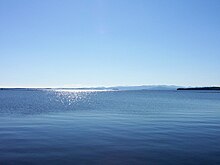
Lake Champlain, the sixth-largest body of fresh water in the United States, separates Vermont from New York in the northwest portion of the state. From north to south, Vermont is 159 miles (256 km) long. Its greatest width, from east to west, is 89 miles (143 km) at the Canada–U.S. border; the narrowest width is 37 miles (60 km) near the Massachusetts border. The width averages 60.5 miles (97.4 km). The state's geographic center is approximately three miles (5 km) east of Roxbury, in Washington County. There are fifteen U.S. federal border crossings between Vermont and Canada.
Several mountains have timberlines with delicate year-round alpine ecosystems, including Mount Mansfield, the highest mountain in the state; Killington Peak, the second-highest; Camel's Hump, the state's third-highest; and Mount Abraham, the fifth-highest peak.[56] Areas in Vermont administered by the National Park Service include the Marsh-Billings-Rockefeller National Historical Park (in Woodstock) and the Appalachian National Scenic Trail.[57]
Cities[]
Vermont has nine incorporated cities.
| City | Population |
|---|---|
| Burlington | 42,417
|
| South Burlington | 17,904
|
| Rutland | 16,495
|
| Barre | 9,052
|
| Montpelier | 7,855
|
| Winooski | 7,267
|
| St. Albans | 6,918
|
| Newport | 5,005
|
| Vergennes | 2,741
|
The most populous city in Vermont is Burlington. Its metropolitan area is also the most populous in the state, with an estimate of 218,395 as of 2017.
Largest towns[]
Although these towns are large enough to be considered cities, they are not incorporated as such.
| Town | Population |
|---|---|
| Essex | 19,587
|
| Colchester | 17,067
|
| Bennington | 15,764
|
| Brattleboro | 12,046
|
| Milton | 10,352
|
| Hartford | 9,952
|
| Springfield | 9,373
|
| Williston | 8,698
|
| Middlebury | 8,496
|
| Barre | 7,924
|
| St. Johnsbury | 7,603
|
| Shelburne | 7,144
|
Climate[]

The annual mean temperature for the state is 43 °F (6 °C).[58] Vermont has a humid continental climate, with muddy springs, in general a mild early summer, hot Augusts; it has colorful autumns: Vermont's hills reveal red, orange, and (on sugar maples) gold foliage as cold weather approaches.[59] Winters are colder at higher elevations.[60] It has a Köppen climate classification of Dfb, a temperate continental climate.[61]
The rural northeastern section known as the "Northeast Kingdom" often averages 10 °F (5.6 °C) colder than the southern areas of the state during winter. The annual snowfall averages between 60 and 100 inches (1,500 and 2,500 mm) depending on elevation. Vermont is the seventh coldest state in the country.[62]
The highest recorded temperature was 105 °F (41 °C), at Vernon, on July 4, 1911. The lowest recorded temperature was −50 °F (−46 °C), at Bloomfield, on December 30, 1933; this is the lowest temperature recorded in New England alongside Big Black River, which recorded a verified −50 °F (−46 °C) in 2009.[63][64] The agricultural growing season ranges from 120 to 180 days.[65] The United States Department of Agriculture plant hardiness zones for the state range between zone 3b, no colder than −35 °F (−37 °C), in the Northeast Kingdom and northern part of the state and zone 5b, no colder than −15 °F (−26 °C), in the southern part of the state.[66] The state receives between 2,200 and 2,400 hours of sunshine annually. New England as a whole receives a range of less than 2,000 hours of sunshine in part of New Hampshire to as much as 2,600 hours of sunshine per year in Connecticut and Rhode Island.[67]
Climate change[]
Climate change in Vermont encompasses the effects of climate change, attributed to man-made increases in atmospheric carbon dioxide, in the U.S. state of Vermont.
The state is already seeing effects of climate change that affect its ecosystems, economy and public health. According to the Vermont state government, rainfall has significantly increased in the last 50 years, storms and flooding have increased, and winters have become warmer and shorter.[68] These changes have led to significant impacts on both the winter tourism industry,[69] and a decline in critical agricultural and woodland industries like maple sugaring.[70]
The state openly acknowledges and is developing programs that respond to global warming.[71] Vermont was one of the first states in the United States to adopt greenhouse gas emissions goals in 2006.
Geology[]

There are five distinct physiographic regions of Vermont.[72] Categorized by geological and physical attributes, they are the Northeastern Highlands, the Green Mountains, the Taconic Mountains, the Champlain Lowlands, and the Vermont Piedmont.[73]
About 500 million years ago, Vermont was part of Laurentia and located in the tropics.[74] The central and southern Green Mountain range include the oldest rocks in Vermont, formed about one billion years ago during the first mountain building period (or orogeny). Subsequently, about 400 million years ago, the second mountain building period created Green Mountain peaks that were 15,000–20,000 feet (4,600–6,100 m) tall, three to four times their current height and comparable to the Himalayas. The geological pressures that created those peaks remain evident as the Champlain Thrust, running north–south to the west of the mountains (now the eastern shore of Lake Champlain). It is an example of geological fault thrusting where bedrock is pushed over the newer rock formation.
As a result of tectonic formation, Vermont east of the Green Mountains tends to be formed from rocks produced in the Silurian and Devonian periods, and western Vermont mainly from the older Pre-Cambrian and Cambrian material.[75] Several large deposits within the state contain granite.[76] The remains of the Chazy Formation can be observed in Isle La Motte. It was one of the first tropical reefs. It is the site of the limestone Fisk Quarry, which contains a collection of ancient marine fossils, such as stromatoporoids, that date to 200 million years ago. At one point, Vermont is believed to have been connected to Africa (Pangaea); the fossils found and the rock formations found on the coasts in both Africa and America are evidence affirming the Pangaea theory.[77][78][79]
In the past four centuries, Vermont has experienced a few earthquakes, rarely centered under the state. The highest ranked, in 1952, had a Richter magnitude scale 6.0 and was based in Canada.[17]
Fauna[]

The state contains 41 species of reptiles and amphibians, 89 species of fish, of which 12 are non native;[80] 193 species of breeding birds, 58 species of mammals, more than 15,000 insect species, and 2,000 higher plant species, plus fungi, algae, and 75 different types of natural communities.[81] Vermont contains one species of venomous snake, the timber rattlesnake, which is confined to a few acres in western Rutland County.[82]
Wildlife has suffered because of human development of the state. By the mid-19th century, wild turkeys were exterminated in the state through overhunting and destruction of habitat. Sixteen were re-introduced in 1969, and had grown to a flock estimated to number 45,000 in 2009.[83] In 2013, hunters killed 6,968 of these.[84] Since 1970, reduction of farmland has resulted in reduced environment for, and resulted in a decline in numbers of various shrubland birds, including the American woodcock, brown thrasher, eastern towhee, willow flycatcher, golden-winged warbler, blue-winged warbler, field sparrow, and Baltimore oriole.[85]
The use of DDT for insect control resulted in ospreys laying eggs that were too thin to support the development of young. This species disappeared from the state. It began to reappear in 1998, when ospreys were observed again locally. As of 2010, they were no longer endangered in the state.[86]
From 2008 to 2010, White-nose syndrome killed an estimated two-thirds of all cave-wintering bats in the state.[87]
The New England cottontail disappeared from the state in the early 1970s, out-competed by the eastern cottontail rabbit, imported in the 1800s for hunting. It is better able to detect and avoid predators.[88]
Out of a total of 33 species of bumblebee, by 2013 the number declined to 19 or 20 species in the state. Bombus terricola (the yellow-banded bumblebee), although once common in Vermont, has not been seen in most of its range since 1999 and is now absent from the state.[89] For honey bees, colony collapse disorder has affected bee population in the state, as elsewhere.[90]
Invasive species included the Asian spotted-wing drosophila, which started damaging berry crops in 2012. Vermont was the initial point of invasion in New England.[91]
Since 2010, the Vermont Department of Health has worked with the Centers for Disease Control and Prevention to conduct blood serum surveys of the state's deer and moose populations. Tests for eastern equine encephalitis virus antibodies were positive in moose or deer in each of Vermont's counties. In 2012, 12% of deer and 2.4% of moose tested positive.[92]
Flora[]
Vermont is in the temperate broadleaf and mixed forests biome. Much of the state, in particular the Green Mountains, is covered by the conifers and northern hardwoods of the New England-Acadian forests. The western border with New York and the area around Lake Champlain lies within the Eastern Great Lakes lowland forests. The southwest corner of the state and parts of the Connecticut River are covered by northeastern coastal forests of mixed oak.[93]
Invasive wild honeysuckle has been deemed a threat to the state's forests, native species of plants, and wildlife.[94] Many of Vermont's rivers, including the Winooski River, have been subjected to man-made barriers to prevent flooding.[citation needed]
Climate change appears to be affecting the maple sugar industry. Sugar maples have been subject to stress by acid rain, asian longhorn beetles, and pear thrips. In 2011 the deer herd had grown too large for habitat, and many resorted to eating bark to survive the winter, destroying trees in the process. In addition, the sugar maples need a certain period of cold to produce sap for maple syrup. The time to tap these trees has shrunk to one week in some years. The tree may be replaced by the more aggressive Norway maples, in effect forcing the sugar maples to "migrate" north to Canada.[95]
Demographics[]
| Historical population | |||
|---|---|---|---|
| Census | Pop. | %± | |
| 1790 | 85,425 | — | |
| 1800 | 154,465 | 80.8% | |
| 1810 | 217,895 | 41.1% | |
| 1820 | 235,981 | 8.3% | |
| 1830 | 280,652 | 18.9% | |
| 1840 | 291,948 | 4.0% | |
| 1850 | 314,120 | 7.6% | |
| 1860 | 315,098 | 0.3% | |
| 1870 | 330,551 | 4.9% | |
| 1880 | 332,286 | 0.5% | |
| 1890 | 332,422 | 0.0% | |
| 1900 | 343,641 | 3.4% | |
| 1910 | 355,956 | 3.6% | |
| 1920 | 352,428 | −1.0% | |
| 1930 | 359,611 | 2.0% | |
| 1940 | 359,231 | −0.1% | |
| 1950 | 377,747 | 5.2% | |
| 1960 | 389,881 | 3.2% | |
| 1970 | 444,330 | 14.0% | |
| 1980 | 511,456 | 15.1% | |
| 1990 | 562,758 | 10.0% | |
| 2000 | 608,827 | 8.2% | |
| 2010 | 625,741 | 2.8% | |
| 2020 | 643,077 | 2.8% | |
| Source: 1910–2020[96] | |||
Population[]
According to the United States Census Bureau, the state of Vermont had a population of 643,503 in the 2020 U.S. census.[5] At the of July 1, 2019 Population Estimates Program, Vermont had an estimated population of 623,989.[97] This included a natural increase of 3,178 (31,716 births minus 28,538 deaths) and a decrease due to net migration of 2,432 people out of the state.[98] In 2006 it had the second lowest birthrate in the nation, 42/1000 women.[99] The center of population of Vermont is located in Washington County, in the town of Warren.[100]
As of 2014, 51.3% of Vermont's population was born in the state (compared with 58.7% for the United States).[101] The changing demographics between those with multi-generational ties to the state and those who are newcomers, bringing different values with them, has resulted in a degree of tension between the two perspectives. This tension is expressed in the terms, "Woodchuck", being applied to those established in the state, and "Flatlander", applied to the newcomers.[102] Vermont is the least populous New England state. As of 2012, Vermont was one of only two states in the U.S. with fewer people than the District of Columbia (Wyoming was the other).[103]
From 2010 to 2013, 16 out of Vermont's 251 towns experienced an increase in population. All towns in Chittenden increased with the exception of Burlington. More than 180 towns experienced a decrease, which hadn't happened since the mid-19th century.[104]
Birth data[]
Note: Births in table do not add up, because Hispanics are counted both by their ethnicity and by their race, giving a higher overall number.
| Race | 2013[105] | 2014[106] | 2015[107] | 2016[108] | 2017[109] | 2018[110] | 2019[111] |
|---|---|---|---|---|---|---|---|
| White: | 5,696 (95.3%) | 5,825 (95.0%) | 5,554 (94.1%) | ... | ... | ... | ... |
| > Non-Hispanic White | 5,597 (93.7%) | 5,724 (93.4%) | 5,370 (91.0%) | 5,208 (90.5%) | 5,134 (90.8%) | 4,934 (90.8%) | 4,856 (90.6%) |
| Asian | 153 (2.6%) | 163 (2.7%) | 175 (3.0%) | 154 (2.7%) | 159 (2.8%) | 152 (2.8%) | 122 (2.3%) |
| Black | 115 (1.9%) | 126 (2.1%) | 149 (2.5%) | 70 (1.2%) | 115 (2.0%) | 118 (2.2%) | 133 (2.5%) |
| American Indian | 11 (0.2%) | 16 (0.3%) | 25 (0.4%) | 11 (0.2%) | 16 (0.3%) | 12 (0.2%) | 11 (0.2%) |
| Hispanic (of any race) | 92 (1.5%) | 92 (1.5%) | 139 (2.3%) | 136 (2.3%) | 123 (2.2%) | 121 (2.2%) | 124 (2.3%) |
| Total Vermont | 5,975 (100%) | 6,130 (100%) | 5,903 (100%) | 5,756 (100%) | 5,655 (100%) | 5,432 (100%) | 5,361 (100%) |
- Since 2016, data for births of White Hispanic origin are not collected, but included in one Hispanic group; persons of Hispanic origin may be of any race.
Of the population, 94.3% of the state identified as white not of Hispanic or Latino origin in a 2013 U.S. census estimate.[112] As of the 2010 census, Vermont was the second-whitest state in the U.S. after Maine.[113] It has the smallest number of Hispanics of any state in the country but not the lowest percentage of Hispanics, which is found in West Virginia.[114]
In 2009, 12.6% of people over 15 were divorced. This was the fifth highest percentage in the nation.[115] As of 2008, the median age of Vermonters was 40.6 and that of the work force was 43.7, compared with the national average of 41.1 years.[116]
Vermont leads U.S. states with the highest rates of LGBT identification, at 5.3%.[117] Its LGBT population density is second in the U.S. only to the District of Columbia.[117]
Following national trends for opioid use, people seeking treatment for opioid addiction in Vermont increased from 650 in 2011 to 7,500 in 2016.[118]
Dialect[]
Linguists have identified speech patterns found among Vermonters as belonging to Western New England English, a dialect of New England English, which features full pronunciation of all r sounds, pronouncing horse and hoarse the same, and pronouncing vowels in father and bother the same, none of which are features traditionally shared in neighboring Eastern New England English.[119] Some rural speakers realize the t as a glottal stop (mitten sounds like "mi'in" and Vermont like "Vermon' "[a]).[120] A dwindling segment of the Vermont population, generally both rural and male, pronounces certain vowels in a distinctive manner (e.g. cows with a raised vowel as [kʰɛʊz] and ride with a backed, somewhat rounded vowel as [ɹɒɪd]).[121]
Eastern New England English—also found in New Hampshire, Maine and eastern Massachusetts—was common in eastern Vermont in the mid-twentieth century and before, but has become rare.[122] This accent drops the r sound in words ending in r (farmer sounds like "farm-uh") and adds an r sound to some words ending in a vowel (idea sounds like "idee-er") was common.[123][122] Those characteristics in eastern Vermont appear to have been inherited from West Country[124] and Scots-Irish ancestors.[125]
Religion[]
According to the Pew Research Center in 2014, 37% reported no religion, the highest rate of irreligion of all U.S. states.[127] The Pew Research Center also determined the largest religion was Christianity;[128] Catholics made 22% of the population and Protestants were 30%. In contrast with Southern U.S. trends, the majority of Protestants are Mainline Protestant dominated by Methodism. The United Methodist Church was the largest Mainline Protestant denomination in Vermont, followed by the American Baptist Churches USA and United Church of Christ. Evangelical Protestants were dominated by independent Baptist churches. Major non-Christian religions were Judaism, Islam, Buddhism, Hinduism, and other faiths. The largest non-Christian religious group outside of irreligion were Unitarians. An estimated 3.1% of the irreligious were atheist.[128]
Economy[]
In 2016, Vermont had a total employment of 262,705, and the total employer establishments were 21,174.[129] In 2019, VermontBiz reported a WalletHub ranking of Vermont 43rd as place to start a business, citing Vermont as 49th in average growth of small businesses and 50th in the availability of human capital.[130] CNBC ranked Vermont 32nd as a place to do business in 2018, citing access to capital as the largest impediment.[131] While U.S. News ranked Vermont 37th for "business environment", it ranked it 18th for employment in 2019.[132]Forbes magazine as the 42nd best state in which to do business in 2015,[133] 32nd in 2007, and 30th in 2006.[134]
As of 2017, Vermont's gross regional domestic product (GDP) was $19.3 billion, making it the second smallest among the 50 states. Its per capita GDP was $51,600, ranking it 34th among the states.[135]
Components of GSP were:[136][137]
- Government $3 billion (13.4%)
- Real estate, rental, and leasing $2.6 billion (11.6%)
- Durable goods manufacturing $2.2 billion (9.6%)
- Health care and social assistance $2.1 billion (9.4%)
- Retail trade $1.9 billion (8.4%)
- Finance and insurance $1.3 billion (5.9%)
- Construction $1.2 billion (5.5%)
- Professional and technical services $1.2 billion (5.5%)
- Wholesale trade $1.1 billion (5.1%)
- Accommodations and food services $1 billion (4.5%)
- Information $958 million (4.2%)
- Non-durable goods manufacturing $711 million (3.1%)
- Other services $563 million (2.4%)
- Utilities $553 million (2.4%)
- Educational services $478 million (2.1%)
- Transportation and warehousing $484 million (2.1%)
- Administrative and waste services $436 million (1.9%)
- Agriculture, forestry, fishing, and hunting $375 million (1.6%)
- Arts, entertainment, and recreation $194 million (.8%)
- Mining $100 million (.4%)
- Management of companies $35 million (.2%)
Canada was Vermont's largest foreign trade partner in 2007. The state's second-largest foreign trade partner was Taiwan.[138] The state had $4 billion worth of commerce with Quebec.[139] One measure of economic activity in Vermont is retail sales. The state had $5.2 billion in 2007.[140] In 2008, 8,631 new businesses were registered in Vermont, a decline of 500 from 2007.[141]
Personal income[]
In 2019, the state had a median household income of $61,973. Approximately 10.2% of the population lived at or below the poverty line.[142] The median household income from 2002 to 2004 was $45,692. This was 15th nationally.[143] The median wage in the state in 2008 was $15.31 hourly or $31,845 annually.[144] In 2007 about 80% of the 68,000 Vermonters who qualify for food stamps received them.[145] 40% of seniors 75 years or older live on annual incomes of $21,660 or less.[146] In 2011, 15.2% of Vermonters received food stamps. This compares to 14.8% nationally.[147]
In 2011, 91,000 seniors received an annual average of $14,000 from Social Security. This was 59% of the average senior's income. This contributed $1.7 billion to the state's economy.[148]
Agriculture[]

Agriculture contributed 2.2% of the state's domestic product in 2000.[149] In 2000 about 3% of the state's working population engaged in agriculture.[150] As of 2014, the Pew Research Center estimated that farms in the state employed fewer than 5,000 illegal immigrants.[151] In 2017, Vermont Governor Phil Scott announce that the state was "exploring a legal challenge" to the executive order signed by President Donald Trump for Vermont law enforcement authorities to cooperate with U.S. Immigration and Customs Enforcement and "perform the functions of immigration officers in relation to the investigation, apprehension, or detention of aliens".[152]
Dairy farming[]
Dairy farming is the primary source of agricultural income. In the second half of the 20th century, developers had plans to build condos and houses on what was relatively inexpensive, open land. Vermont's government responded with a series of laws controlling development and with some pioneering initiatives to prevent the loss of Vermont's dairy industry. Still, the number of Vermont dairy farms has declined more than 85% from the 11,206 dairy farms operating in 1947. In 2003 there were fewer than 1,500 dairy farms in the state; in 2006 there were 1,138; in 2019 there were 658.[153] The number of dairy farms has been diminishing by 10% annually.[154] 80% of open land is controlled by dairy farms.[153]
The number of cattle in Vermont had declined by 40%; however, milk production has doubled in the same period due to tripling the production per cow.[155] While milk production rose, Vermont's market share declined. Within a group of states supplying the Boston and New York City markets (called "Federal order Class I"),[156] Vermont was third in market share, with 10.6%; New York has 44.9% and Pennsylvania has 32.9%.[157] In 2007 dairy farmers received a record $23.60 for 100 pounds (45 kg) (11.63 gallons at $2.03/gallon) of milk. This dropped in 2008 to $17 ($1.46/gallon).[158] The average dairy farm produced 1.3 million pounds of milk annually in 2008.[159]
The dairy barn remains an iconic image of Vermont, but the 87% decrease in active dairy farms between 1947 and 2003[160] means that preservation of the dairy barns has increasingly become dependent upon a commitment to maintaining a legacy rather than basic need in the agricultural economy. The Vermont Barn Census, organized by a collaboration of educational and nonprofit state and local historic preservation programs, has developed educational and administrative systems for recording the number, condition, and features of barns throughout Vermont.[161]
In 2009, there were 543 organic farms. Twenty percent of the dairy farms were organic and 23% (128) vegetable farms were organic. Organic farming increased in 2006–07, but leveled off in 2008–09.[162]
A significant amount of milk is shipped into the Boston market. Therefore the Commonwealth of Massachusetts certifies that Vermont farms meet Massachusetts sanitary standards. Without this certification, a farmer may not sell milk for distribution into the bulk market.[163] In 2019, two-thirds of all milk in New England was produced by Vermont dairies.[153]
Forestry[]
Forest products have always been a staple to the economy, comprising 1% of the total gross state output and 9% of total manufacturing as of 2013.[164] In 2007, Windham County contained the largest concentration of kilns for drying lumber east of the Mississippi River. The decline of farms has resulted in a regrowth of Vermont's forests due to ecological succession. Today, most of Vermont's forests are secondary. The state and non-profit organizations are actively encouraging regrowth and careful forest management. Over 78% of the land area of the state is forested compared to only 37% in the 1880s, when sheep farming was at its peak and large amounts of acreage were cleared for grazing.[165] Over 85% of that area is non-industrial, private forestland owned by individuals or families. In 2013, 73,054 million cubic feet (2,068.7 million cubic meters) of wood was harvested in Vermont.[166] A large amount of Vermont forest products are exports with 21,504 million feet (6.554×10⁹ meters) being shipped overseas plus an additional 16,384 million cubic feet (463.9 million cubic meters) to Canada.[166] Most of it was processed within the state. In this century the manufacture of wood products has fallen by almost half. The annual net growth has been estimated at 172,810 million cubic feet (4,893 million cubic meters).[166] The USDA estimates that 8,584 billion cubic feet (243.1 billion cubic meters) remain in the state.[166] Forest products also add to carbon sequestration since lumber and timber used in houses and furniture hold carbon for long periods of time while the trees that were removed are replaced overtime with new growing stock.[167]
In 2017, the price of wood products had either plummeted or remained the same when compared to previous decades, which meant there was cause for concern with jobs in the industry. For example, in 1994, the price of a thousand board feet was $300, the same as it was in 2017. The price of wood chips has halved in the same time frame. In 1980, the price for a cord of wood was $50; in 2017, $25. For lack of demand, Vermont's forests are growing twice as fast as they are being cut.[168]
Other[]
An important and growing part of Vermont's economy is the manufacture and sale of artisan foods, fancy foods, and novelty items trading in part upon the Vermont "brand," which the state manages and defends. Examples of these specialty exports include Cabot Cheese, the Vermont Teddy Bear Company, Fine Paints of Europe, Vermont Butter and Cheese Company, several microbreweries, ginseng growers, Burton Snowboards, King Arthur Flour, and Ben and Jerry's Ice Cream.
As of 2019, Vermont was the leading producer of maple syrup in the United States.[169] There were about 2,000 maple products producers in 2010.[170] Production rose to 920,000 US gallons (3,500,000 l; 770,000 imp gal) in 2009.[171] The state's share of the nation's production rose to 42% in 2013. It had the second lowest price at $33.40/gallon.[172]
The wine industry in Vermont started in 1985. As of 2007, there were 14 wineries.[173]
Manufacturing[]
As of 2015, GlobalFoundries was the largest private employer in the state and provides jobs to 3,000 employees at its plant in the village of Essex Junction within Chittenden County.[174]
A 2010 University of Connecticut study reported that Vermont, Rhode Island, and New Hampshire tied as the most costly states in the U.S. for manufacturers.[175]
Energy[]
Vermont has no fossil-fuel reserves, however its forest products industry provides fuel for electricity generation and home heating. Electricity consumption per capita ranks it among the lowest 20% of states, and total electricity consumption was the lowest in the United States. Vermont consumed three times more electricity than it generated in-state in 2019, and imported its largest share of electricity from Canada. Vermont's 99.9% share of in-state electricity generation from renewable sources was the highest among all 50 states.[176]
Health[]
An increasingly aging population is expected to improve the position of aging services and health care in the state economy. The University of Vermont Medical Center, with approximately 6,400 employees, is the largest employer in the state.[177]
In 2010, all of Vermont's hospitals billed patients $3.76 billion, and collected $2 billion.[178] 92,000 people are enrolled in Medicare. In 2011, Medicare spent $740 million on health care in the state.[148]
Housing[]
In 2007, Vermont was the 17th highest state in the nation for mortgage affordability. However, in 41 other states, inhabitants contributed within plus or minus 4% of Vermont's 18.4% of household income to a mortgage.[179]
Because housing prices did not rise much during the early 2000s, the collapse in real estate values was not that precipitous either. While foreclosure rose significantly in 2007, the state stood 50th—the most favorable—in ratio of foreclosure filings to households.[180] While housing sales dropped annually from 2004 to 2008, prices continued to rise.[181]
In 2007, Vermont was best in the country for construction of new energy efficient homes as evaluated by the United States Environmental Protection Agency under the Energy Star program.[182] However, about 60% of Vermont homes were heated with oil in 2008.[183] In August 2008, the cost in Vermont of various heating sources per 1 million BTU ranged from $14.39 for cord wood to $43.50 for kerosene.
While the number of houses sold in the state has dropped from 8,318 in 2004 to 8,120 in 2005, 6,919 in 2006, and 5,820 in 2007, the average price has continued to rise to $202,500 in 2008 ($200,000 in 2007).[184]
In 2009, the average rent for a two-bedroom apartment was $920 per month. Rental vacancy was 5.4%, the lowest in the nation. 2,800 people were counted as homeless in January 2010, 22% more than in 2008.[185]
In 2011, Vermont was fifth among the states with the greatest backlog of foreclosures needing court processing, taking an estimated 18 years. The national average was eight years.[186]
Labor[]
In 2009, the state attained a high of 361,290 workers.[187]
As of 2006, there were 305,000 workers in Vermont. Eleven percent of these are unionized.[188][189] Out of a workforce of 299,200 workers, 52,000 were government jobs, federal, state, and local.[190]
A modern high unemployment rate of 9% was reached in June 1976. A modern low of 2.4% was measured in February 2000.[191] As of October 2019, the unemployment rate was 2.2%.[192]
Employment grew 7.5% from 2000 to 2006. From 1980 to 2000, employment grew by 3.4%; nationally it was up 4.6%. Real wages were $33,385 in 2006 constant dollars and remained there in 2010; the nation, $36,871.[193]
Insurance[]
Captive insurance plays an increasingly large role in Vermont's economy. With this form of alternative insurance, large corporations or industry associations form standalone insurance companies to insure their own risks, thereby substantially reducing their insurance premiums and gaining a significant measure of control over types of risks to be covered. There are also significant tax advantages to be gained from the formation and operation of captive insurance companies. According to the Insurance Information Institute, Vermont in 2009 was the world's third-largest domicile for captive insurance companies, following Bermuda and the Cayman Islands.[194] In 2009, there were 560 such companies.[195] In 2010, the state had 900 such companies.[196]
Tourism[]
Summer camps such as Camp Abenaki, Camp Billings, Camp Dudley, and Camp Hochelaga contribute to Vermont's tourist economy.
In 2005, visitors made an estimated 13.4 million trips to the state, spending $1.57 billion.[197] In 2012, fall accounted for $460 million of income, about one-quarter of all tourism.[198]
In 2011, the state government earned $274 million in taxes and fees from tourism. 89% of the money came from out-of-state visitors. Tourism supported over 26,000 jobs, 7.2% of total employment.[199]
According to the 2000 Census, almost 15% of all housing units in Vermont were vacant and classified "for seasonal, recreational, or occasional use".[200][clarification needed] This was the second highest percentage nationwide, after Maine. In some Vermont cities, vacation homes owned by wealthy residents of New England and New York constitute the bulk of all housing stock. According to one estimate, as of 2009, 84% of all houses in Ludlow were owned by out-of-state residents.[201] Other notable vacation-home resorts include Manchester and Stowe.
Autumn[]

Hunting is controlled for black bear, wild turkeys, deer, and moose.[202] There are 5,500 bears in the state. The goal is to keep the numbers between 4,500 and 6,000.[203] In 2010, there were about 141,000 deer in the state, which is in range of government goals. However, these are distributed unevenly and when in excess of 10–15 per square mile (4–6/km2), negatively impact timber growth.[204]
In 2012, hunting of migratory birds was limited to October 13 to December 16. Waterfowl hunting is also controlled by federal law.[205]
Winter[]

Some of the largest ski areas in New England are located in Vermont. Skiers and snowboarders visit Burke Mountain Ski Area, Bolton Valley, Smugglers' Notch, Killington Ski Resort, Mad River Glen, Stowe Mountain Resort, Cochrans Ski Area, Sugarbush, Stratton, Jay Peak, Okemo, Suicide Six, Mount Snow, Bromley, and Magic Mountain Ski Area. Summer visitors tour resort towns like Stowe, Manchester, Quechee, Wilmington and Woodstock. The effects of global warming have been predicted to shorten the length of the ski season across Vermont, which would continue the contraction and consolidation of the and threaten individual ski businesses and communities that rely on ski tourism.[206]
In winter, Nordic and backcountry skiers visit to travel the length of the state on the Catamount Trail. Several horse shows are annual events. Vermont's state parks, historic sites, museums, golf courses, and new boutique hotels with spas were designed to attract tourists.
In 2000–01, there were 4,579,719 skier and snowboarder visits to the state. There were 4,125,082 visits in 2009–2010, a rise from recent years.[207]
In 2008, there were 35,000 members of 138 snowmobiling clubs in Vermont. The combined association of clubs maintains 6,000 miles (9,700 km) of trail often over private lands. The industry is said to generate "hundreds of millions of dollars worth of business."[208]
Quarrying[]
The towns of Rutland and Barre are the traditional centers of marble and granite quarrying and carving in the U.S. For many years Vermont was also the headquarters of the smallest union in the U.S., the Stonecutters Association, of about 500 members. The first marble quarry in America was on Mount Aeolus overlooking East Dorset.[209] The granite industry attracted numerous skilled stonecutters in the late 19th century from Italy, Scotland, and Ireland. Barre is the location of the Rock of Ages quarry, the largest dimension stone granite quarry in the United States. Vermont is the largest producer of slate in the country. The highest quarrying revenues result from the production of dimension stone.[citation needed] The Rock of Ages quarry in Barre is one of the leading exporters of granite in the country. The work of the sculptors of this corporation can be seen 3 miles (4.8 km) down the road at the Hope Cemetery, where there are gravestones and mausoleums.[citation needed]
Non-profits and volunteerism[]
There were 2,682 non-profit organizations in Vermont in 2008, with $2.8 billion in revenue.[210] The state ranked ninth in the country for volunteerism for the period 2005–08. 35.6% of the population volunteered during this period. The national average was 26.4%.[211]
Education[]

Vermont was named the nation's smartest state in 2005 and 2006.[212] In 2006, there was a gap between state testing standards and national, which is biased in favor of the state standards by 30%, on average. This puts Vermont 11th-best in the nation. Most states have a higher bias.[213] However, when allowance for race is considered, a 2007 U.S. Government list of test scores shows Vermont white fourth graders performed 25th in the nation for reading (229) and 26th for math (247).[214] White eighth graders scored 18th for math (292) and 12th for reading (273). The first three scores were not considered statistically different from average. White eighth graders scored significantly above average in reading. Statistics for black students were not reliable because of their small representation in the testing.
In 2017, spending $1.6 billion on education for 76,000 public school children, represents more than $21,000 per student.[215]
Education Week ranked the state second[216] in high school graduation rates for 2007.[217]
In 2011, 91% of the population had graduated from high school compared with 85% nationally. Almost 34% have at least an undergraduate degree compared with 28% nationally.[218]
In 2013, the ratio of pupils to teachers was the lowest in the country.[219]
Higher education[]

Old Mill, the oldest building of the university
Experimentation at the University of Vermont by George Perkins Marsh, and later the influence of Vermont-born philosopher and educator John Dewey brought about the concepts of electives and learning by doing.
Vermont has five colleges within the Vermont State Colleges system, University of Vermont (UVM), and thirteen other private, degree-granting colleges, including Bennington College, Champlain College, Goddard College, Marlboro College, Middlebury College, Saint Michael's College, the Vermont Law School, and Norwich University.
In 2016, the University of Vermont charged the second highest tuition in the nation for four years, $61,000 for in-state students, to $147,000 for out-of-state students. This compares with an average of 34,800 nationally for in-state students.[220]
Transportation[]

Vermont's main mode of travel is by automobile. 5.7% of Vermont households did not own a car in 2008.[221] In 2012, there were 605,000 motor vehicles registered, nearly one car for every person in the state. This is similar to average car ownership nationwide.[222] In 2012, about half the carbon emissions in the state resulted from vehicles.[223]
In 2007, Vermont was ranked the third safest state for highway fatalities.[224] One third of these fatal crashes involved a drunken driver.[225] On average, 20–25 people die each year from drunk driving incidents, and 70–80 people are in fatal car crashes in the state.[226] In northern Vermont particularly, moose are not uncommon, including in urban areas.[227] They constitute a traffic threat since they are unaware of vehicles. There are several deaths each year from automobiles striking moose.
In 2009, 93% of Vermont motorists were insured, tying the state with Pennsylvania for the highest percentage.[228] In 2008, Vermont was the fifth best state for fewest uninsured motorists—6%.[229]
In 2010, Vermont owned 2,840 miles (4,570 km) of highway. This was the third smallest quantity among the 50 states. 2.5% of the highways were listed as "congested," the 5th lowest in the country. The highway fatality rate was one per 100,000,000 miles (160,000,000 km), tenth lowest in the nation. The highways cost $28,669 per mile ($17,814/km) to maintain, the 17th highest in the states. 34.4% of its bridges were rated deficient or obsolete, the 8th worst in the nation.[230]
Individual communities and counties have public transit, but their breadth of coverage is frequently limited. Greyhound Lines services a number of small towns. Two Amtrak trains serve Vermont, the Vermonter[231] and the Ethan Allen Express.[232] In early 2011, Amtrak evaluated the track used by the Ethan Allen Express between Rutland and Whitehall as the worst in the nation,[233] but subsequent improvements to the track later in 2011 vastly improved its performance going forward.[234]
Trucks weighing less than 80,000 pounds (36,000 kg) can use Vermont's interstate highways. The limit for state roads is 99,000 pounds (45,000 kg). This means that vehicles too heavy for the interstates can legally use only secondary roads.[235][236]
In 1968, Vermont outlawed the use of billboards for advertisement along its roads. It is one of four states in the U.S. to have done this, along with Hawaii, Maine, and Alaska.[237][238]
Major routes[]
The state has 2,843 miles (4,575 km) of highways under its control.[239] Three Interstate highways and five U.S. highways enter Vermont, in addition to its own state highway network.
North–south routes[]
 Interstate 89 runs a northwest–southeast path through Vermont, beginning in White River Junction and heading northwest to serve the cities of Montpelier, Burlington, and St. Albans en route to the Canada–U.S. border. I-89 intersects I-91 in White River Junction and has a short spur route, Interstate 189, just outside of Burlington.
 Interstate 91 runs a north–south path from the Massachusetts state line to the Canada–U.S. border, connecting the towns of Brattleboro, White River Junction, St. Johnsbury, and the city of Newport. I-91 intersects I-89 in White River Junction, and I-93 in St. Johnsbury.
 Interstate 93 runs a short, 11-mile (18 km) distance from the New Hampshire state line to its northern terminus in St. Johnsbury, where it intersects I-91. I-93 connects the Northeast Kingdom region of Vermont with the White Mountains region of New Hampshire, and points south.
 U.S. Route 5 runs a north–south path in eastern Vermont from the Massachusetts state line to the Canada-U.S. border. U.S. Route 5 is a surface road that runs parallel to I-91 for its entire length in the state, and serves nearly all the same towns. The two routes also parallel the New Hampshire state line between Brattleboro and St. Johnsbury.
 U.S. Route 7 runs a north–south path in western Vermont from the Massachusetts state line to the Canada-U.S. border. U.S. Route 7 connects the cities and towns of Bennington, Rutland, Middlebury, Burlington, and St. Albans. Between Bennington and Dorset, U.S. Route 7 runs as a Super 2 freeway. It also parallels I-89 between Burlington and the Canada–U.S. border.
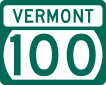
 Vermont Route 100 runs a north–south path directly through the center of the state, along the length of the Green Mountains. VT Route 100 generally parallels both U.S. Route 5 (which runs to its east) and U.S. Route 7 (which runs to its west). Many of the state's major ski areas are located either directly on, or very close to, VT Route 100. The largest town by population along VT Route 100 is Morristown.
- Vermont Route 30 is a 111.870-mile-long north–south road that runs from Brattleboro to Middlebury. Vermont Route 30 runs through the state's historic West River Valley, where it passes through the colonial towns of Newfane, Townshend, West Townshend, East Jamaica, Jamaica, Rawsonville and Bondville.
East–west routes[]
 U.S. Route 2 runs a generally east–west path across central and northern Vermont, from Alburgh (on the New York state line) to Guildhall (on the New Hampshire state line). U.S. Route 2 connects the Lake Champlain Islands and the Northeast Kingdom to the population centers of Burlington, Montpelier, and St. Johnsbury. U.S. Route 2 runs parallel to I-89 between Colchester and Montpelier. Although the portion of the road from Alburgh to Burlington follows a north–south orientation, U.S. Route 2 in Vermont is entirely signed as east–west.
 U.S. Route 4 runs east–west across south-central Vermont from Fair Haven (on the New York state line) to White River Junction (on the New Hampshire state line). U.S. Route 4 also connects the city of Rutland and the towns of Killington and Woodstock. Between Fair Haven and Rutland, U.S. Route 4 runs as a four-lane freeway that is mostly up to Interstate design standards.
 U.S. Route 302 runs an east–west path from its western terminus in Montpelier to the village of Wells River, where it intersects both I-91 and U.S. Route 5, and then crosses into New Hampshire. U.S. Route 302 is one of the main roads connecting Montpelier and Barre in central Vermont.
 Vermont Route 9 runs an east–west path across the southern part of the state. VT Route 9 connects the towns of Bennington, Wilmington, and Brattleboro.
 Vermont Route 105 runs a generally east–west path across the northernmost parts of Vermont (sometimes within a few miles of the Canada–U.S. border) from St. Albans to Bloomfield (on the New Hampshire state line). VT Route 105 ultimately connects the cities of St. Albans and Newport.
A 2005–06 study ranked Vermont 37th out of the states for "cost-effective road maintenance", a decline of thirteen places since 2004–05.[240]
Federal data indicates that 16% of Vermont's 2,691 bridges had been rated structurally deficient by the state in 2006.[241] In 2007 Vermont had the sixth worst percentage of structurally deficient bridges in the country.[242]
Rail[]

The state is served by Amtrak's Vermonter and Ethan Allen Express, the New England Central Railroad, the Vermont Railway, and the Green Mountain Railroad.
The Ethan Allen Express serves Castleton and Rutland,[232] while the Vermonter serves St. Albans, Essex Junction, Waterbury, Montpelier, Randolph, White River Junction, Windsor, Bellows Falls, and Brattleboro.[231]
Bus[]
Intercity[]
Greyhound Lines stops at Bellows Falls, Brattleboro, Burlington, Montpelier, and White River Junction.[243] Megabus, as of November 2014, stops in Burlington and Montpelier.[244] Vermont Translines, an intercity bus company started by Premier Coach in 2013 partnering with Greyhound and starting service on June 9, 2014, serves Milton, Colchester, Burlington, Middlebury, Brandon, Rutland, Wallingford, Manchester and Bennington on its Burlington to Albany line, and Rutland, Killington, Bridgewater, Woodstock, Queechee and White River Junction along the U.S. Route 4 corridor.[245] The town of Bennington also has the weekday-operating Albany-Bennington Shuttle, an intercity bus operated by Yankee Trails World Travel.[246]
Local[]
Other transportation includes:[247]
- Addison County Transit Resources (ACTR) services Addison County, including the college town of Middlebury, Bristol, and Vergennes.
- Bennington County has the Green Mountain Community Network (GMCN) out of Bennington.
- Brattleboro in Windham County is served by the BeeLine (Brattleboro Town Bus), which is part of Connecticut River Transit ("the Current"). Southern Windham County and southern Bennington County is served, out of West Dover, by the MOOver (Southeast Vermont Transit or SEVT, formerly the Deerfield Valley Transit Association or DVTA).
- Burlington has Chittenden County Transportation Authority (CCTA) and CATS (University of Vermont Campus Area Transportation System).
- Colchester in Chittenden County is serviced by the SSTA (Special Services Transportation Agency).
- Rutland County has "the Bus" (Marble Valley Regional Transit District, MVRTD) out of Rutland.
- Windsor County:
- Ludlow (in Windsor County) is served by the LMTS (Ludlow Municipal Transit System).
- The Current (CRT) division of Southeast Vermont Transit (SEVT), out of Rockingham, serves parts of Windham and Windsor County.
- In parts of Windsor County, including Norwich and Hartford, as well as in White River Junction and in parts of New Hampshire there is a free public transportation service called Advance Transit.[248] It has routes and many different lines all throughout the Upper Valley region.
- Stowe in Lamoille County is serviced by STS (Stowe Trolley System, Village Mountain Shuttle, Morrisville Shuttle).
- Stagecoach Transportation Services (STS) out of Randolph in Orange County also serves parts of Windsor County.
- In Washington County, the Green Mountain Transit Authority (GMTA) runs out of the capital city, Montpelier.
- The Network (Northwest Vermont Public Transit Network, NVPT) running out of Saint Albans services Franklin and Grand Isle counties.
- Rural Community Transportation (RCT) runs out of Saint Johnsbury and services Caledonia, Essex, Lamoille and Orleans Counties. There is a shuttle bus linking the various local networks.[249]
Ferry[]
There is a year-round ferry service to and from New York State across Lake Champlain from Burlington, Charlotte, Grand Isle, and Shoreham. All but the Shoreham ferry are operated by the LCTC (Lake Champlain Transportation Company).
Airports[]
- Burlington International Airport is the largest in the state, with regular flights to Atlanta, Charlotte, Chicago, Denver, Detroit, Washington Dulles, JFK, LaGuardia, Newark, Orlando, and Philadelphia. Airlines serving the airport include: American, Delta, Frontier, JetBlue, and United.[250] This is also the airport where the 134th fighter squadron of the 158th fighter wing is located. Known as the "Green Mountain Boys," this squadron is armed with the Block 30 F-16C/D Fighting Falcon and is tasked with protecting the Northeastern United States from the air.
- Rutland Southern Vermont Regional Airport has regular flights to Boston via Cape Air.[251]
Media[]
Newspapers of record[]
Vermont statute[252] requires the Vermont Secretary of State to designate newspapers that provide general coverage across the state as the "Newspapers of Record." This is the list, as of 2019:[253]
- Addison Independent
- Bennington Banner
- Brattleboro Reformer
- Burlington Free Press
- Caledonian Record
- The Chronicle
- Islander
- Newport Daily Express
- News & Citizen / The Transcript
- Rutland Herald
- Seven Days
- St. Albans Messenger
- Times Argus
- Valley News
- Vermont Lawyer
- White River Valley Herald (a.k.a. Herald of Randolph)
Broadcast media[]
Vermont hosts 93 radio broadcast stations. The top categories are talk/information (11), country (9) and classic rock (9). The top owner of radio broadcast stations is Vermont Public Radio (11 broadcast frequencies and 13 low-power, local transmitters).[254] Other companies had five or fewer stations. The state has 15 online radio stations.[255]
Vermont hosts 10 high-power television broadcast stations, three of which are satellites of a primary station. Represented are the following networks and number of high-power transmitters, ABC (1), CBS (1), Fox (1), NBC (2), PBS (4), and RTV (1). In addition, it has 17 low-power television broadcast stations, which in several cases are satellites of the high-power stations.
Utilities[]
Electricity[]
2008 peak demand in the state was 1,100 megawatts (MW).[256]
In May 2009, Vermont created the first state-wide renewable energy feed-in law.[257] In 2010, there were about 150 methane digesters in the nation, Vermont led the nation with six online.[258]
While Vermont paid the lowest rates in New England for power in 2007, it is still ranked among the highest eleven states in the nation; that is, about 16% higher than the national average.[259]
In 2009, the state paid the highest rates for energy (including heating) in the U.S. and had the worst affordability gap nationwide.[146]
In 2009, the state received one-third (400 MW)[256] of its power from Hydro-Québec and one-third from Vermont Yankee.[260] In total, the state got half its power from Canada and other states. It received 75% of the power it generated in the state from Vermont Yankee.[261] The state is part of the Northeast Power Coordinating Council for the distribution of electricity.
The state's largest electric utility, Green Mountain Power Corporation, serves 80% of Vermont households.[146]
The state has 78 hydropower dams. They generate 143 MW, about 12% of the state's total requirement.[256] Vermont experts estimate that the state has the capacity to ultimately generate from 134 to 175 megawatts of electricity from hydro power.[262]
In 2006, the total summer generating capacity of Vermont was 1,117 megawatts.[263] In 2005, the inhabitants of the state used an average of 5,883 kilowatt-hours (21,180 MJ) of electricity per capita.[264] Another source says that each household consumed 7,100 kilowatt-hours (26,000 MJ) annually in 2008.[265]
Until the Vermont Yankee nuclear power plant was shut down in 2014, Vermont had the highest rate of nuclear-generated power in the nation, 73.7%.[266] Vermont is one of two states with no coal-fired power plants.[267]
All Vermont utilities get their power from lines run by ISO New England. Each utility pays a share of transmitting power over these lines. Vermont's share is about 4.5%.[268]
Communication[]
A 2013 survey found that of 18,790 miles (30,240 km) of roads surveyed, all but 3,118 mi had cellular coverage by at least one carrier. The roads surveyed are concentrated in the more heavily populated areas.[269]
A June 2013 survey found that of nearly 249,976 addresses surveyed, 84.7% had fixed (as opposed to mobile) broadband available. It was projected that all but 29 addresses would have fixed broadband available by the end of 2013.[270]
Public health[]
In 2010, Vermont was the sixth highest ranked state for Well-Being in a study by Gallup and Healthways.[271] In 2010, the state stood third in physical well-being of children.[272]
In 2010, Vermont was ranked the highest in the country for health outcomes.[273]
In 2000, the state implemented the Vermont Child Health Improvement Program to improve preventive services and management of chronic conditions. In 2011, the state ranked third in the nation in child health system performance.[274] In 2011, the March of Dimes gave Vermont an "A," ranking it number one in the country on its Prematurity Report Card.[275]
In 2008, Vermont was ranked number one in the nation as the healthiest place to live for the seventh time in eight years. Criteria included low teenage birth rate, strong health coverage, the lowest AIDS rate in the country, and 18 other factors.[276] The state scored well in cessation of smoking, obesity, fewer occupational fatalities, prevalence of health insurance, and low infant mortality. A problem area was a high prevalence of binge drinking.[277] While ranking sixth from best for adults in obesity in 2009, the state still had 22% obese with a rate of 27% for children 10–17. The ranking for children was ninth best in the nation.[278] In 1993, the obesity rate for adults was 12%. Vermonters spend $141 million annually in medical costs related to obesity.[279] The combined figures for overweight and obese adults rose from 40.7% in 1990 to 58.4% in 2010. This is better than most other states.[280]
In 2011, Vermont led the nation in the rate of young people who had consumed alcohol in the past month; one-third of people aged 11 through 20. One-fifth of that group had binged during that time. The state was second for the use of marijuana by young people; 30% of adults 18 to 25 in the past month.[281]
In 2009, Vermont was ranked second in the nation for safety. Crime statistics on violence were used for the criteria.[282]
In 2007, Vermont was ranked among the best five states in the country for preventing "premature death" in people under 75 years of age. The rate of survival was twice that of the five lowest performing states.[283]
Parts of the state have been declared federal disaster areas on 28 occasions from 1963 to 2008.[284]
In 2007, the Environmental Protection Agency cited Chittenden and Bennington as counties with 70 parts per billion of smog which is undesirable.[285]
In 2008, about 100,000 Vermonters got their health care through the federal government, Medicare, Tri-Care, and the Veteran's Administration. An additional 10,000 Vermonters work for employers who provide insurance under federal law under ERISA. About 20% of Vermonters receive health care outside of Vermont; 20% of the care provided within the state is to non-Vermonters.[286] In 2008, the state had an estimated 7.6% with no medical insurance, down from 9.8% in 2005.[287] In 2008, the Vermont Health Access Program for low-income, uninsured adults cost from $7 to $49 per month.[288] A "Catamount Health" premium assistance program was available for Vermonters who do not qualify for other programs. Total monthly premiums ranged from $60 to $393 for an individual. There was a $250 deductible. Insured paid $10 toward each generic prescription. 16.9% of residents 18 to 35 were uninsured, the highest group.[289]
Health care spending increased from $2.3 billion in 2000 to $4.8 billion in 2009.[290] In 2009, adult day care services cost more in Vermont than any other state—$150 daily.[291]
The state started air drops of rabies bait for raccoons in 1997. Known rabies cases in raccoons peaked in 2007 at 165. The program is in cooperation with neighboring states and Canada.[292]
Law and government[]

Vermont is federally represented in the United States Congress by two senators and one representative.
The state is governed by a constitution which divides governmental duties into legislative, executive and judicial branches: the Vermont General Assembly, the governor of Vermont and the Vermont Supreme Court. The governorship and the General Assembly serve two-year terms including the governor and 30 senators. There are no term limits for any office. The state capital is in Montpelier.
There are three types of incorporated municipalities in Vermont: towns, cities, and villages. Like most of New England, there is slight provision for autonomous county government. Counties and county seats are merely convenient repositories for various government services such as state courts, with several elected officers such as a state's Attorney and sheriff. All county services are directly funded by the state of Vermont. The next effective governmental level below state government are municipalities. Most of these are towns.[293]
Finances and taxation[]
Vermont is the only state in the union not to have a balanced-budget requirement, yet it has had a balanced budget every year since 1991.[294] In 2007 Moody's gave its top bond credit rating (Aaa) to the state.[295]
The state uses enterprise funds for operations that are similar to private business enterprises. The Vermont Lottery Commission, the Liquor Control Fund, and the Unemployment Compensation Trust Fund, are the largest of the State's enterprise funds.[296]
In 2007, Vermont was the 14th highest out of 50 states and the District of Columbia for state and local taxation, with a per capita load of $3,681. The national average was $3,447.[297] However, CNNMoney ranked Vermont highest in the nation based on the percentage of per capita income. The rankings showed Vermont had a per capita tax load of $5,387, 14.1% of the per capita income of $38,306.[298]
Vermont collects a state personal income tax in a progressive structure of five different income brackets, with marginal tax rates ranging from 3.6% to 9.5%. In 2008, the top 1% of Vermont residents provided 30% of the income tax revenue; around 2,000 people had sufficient income to be taxed at the highest marginal rate of 9.5%.[299]
Vermont's general state sales tax rate is 6%, which is imposed on sales of tangible personal property, amusement charges, fabrication charges, some public utility charges and some service contracts. Some towns and cities impose an additional 1% Local Option Tax. There are 46 exemptions from the sales tax, including exemptions for food, medical items, manufacturing machinery, equipment and fuel, residential fuel and electricity, clothing, and shoes. A use tax is imposed on the buyer at the same rate as the sales tax. The buyer pays the use tax when the seller fails to collect the sales tax or the items are purchased from a source where no tax is collected. The use tax applies to items taxable under the sales tax.
Vermont does not collect inheritance taxes, but does impose a state estate tax; a Vermont estate tax return must be filed if the estate must file a federal estate tax return (the requirement for which depends on federal law).[300]
Vermont does not collect a state gift tax.[300]
Property taxes are levied by municipalities for the support of education and municipal services. Vermont does not assess tax on personal property.[301] Property taxes are based on appraisal of the fair market value of real property.[301] Rates vary from 0.97% on homesteaded property in Ferdinand, Essex County, to 2.72% on nonresidents' property in Barre City.[302] Statewide, towns average 1.77% to 1.82% tax rate. In 2007, Vermont counties were among the highest in the country for property taxes. Chittenden ($3,809 median), Windham ($3,412), Addison ($3,352), and Windsor ($3,327) ranked in the top 100, out of 1,817 counties in the nation with populations greater than 20,000. Twelve of the state's 14 counties stood in the top 20%.[303] Median annual property taxes as a percentage of median homeowners income, 5.4%, was rated as the third highest in the nation in 2011.[304][305]
To equitably support education, some towns are required by Act 60 to send some of their collected taxes to be redistributed to school districts lacking adequate support.[306]
Politics[]
Vermont is one of four states that were once independent nations (Texas, California, and Hawaii are the others). Notably, Vermont is the only state to have voted for a presidential candidate from the Anti-Masonic Party, and Vermont was one of only two states to vote against Franklin D. Roosevelt in all four of his presidential campaigns (the other was Maine).
Vermont's history of independent political thought has led to movements for the establishment of the Second Vermont Republic and other plans advocating secession.
Vermont is the only state in the United States that requires voters to be sworn in,[307] having established the voter's oath or affirmation in 1777.
State politics[]

Republicans dominated local Vermont politics from the party's founding in 1854 until the mid-1970s. Before the 1960s, rural interests dominated the legislature. As a result, cities, particularly the older sections of Burlington and Winooski, were neglected and fell into decay, and people began to move out to newer suburbs.
Vermont was for many years a stronghold of the Republican Party. Ethno-political culture of the last century has seen a dramatic shift in voter turnout in the Green Mountain State. Since 1992, Vermont has voted for the Democrat in every Presidential election. Before 1992, Vermont voted for the Republican in every single Presidential election with the exception of 1964.[308][309][310][311]
A series of one man, one vote decisions made by the United States Supreme Court in the 1960s required states to redraw their legislative districts to accurately reflect population. As a result, urban areas in Vermont gained political power.
The legislature was redistricted under one-person, one-vote in the 1960s. It passed the Land Use and Development Law (Act 250) in 1970 to discourage suburban sprawl and to limit major growth to already developed areas. The law, the first of its kind in the nation, created nine District Environmental Commissions appointed by the Governor, who judged land development and subdivision plans that would have a significant impact on the state's environment and many small communities. As a result of Act 250, Vermont was the last state to get a Wal-Mart (there are now six Wal-Marts in the state, as of November 2017, but only three—in Williston, St. Albans, and Derby—were newly built from the ground up). Because of the successful attempts to dilute what is perceived as the original intent of Act 250,[312] and other development pressures, Vermont has been designated one of America's most "endangered historic places" by the National Trust for Historic Preservation.[313]
In 1995, the state banned the spreading of manure from December 15 to April 1, to prevent runoff and protect the water. Therefore farms must have environmentally approved facilities to store manure during this time frame.[314]
While the state voted largely Democratic, Republican Governor Douglas won all counties but Windham in the 2006 election.
A controversy dating from 1999 has been over the adoption of civil unions, an institution which grants same-sex couples nearly all the rights and privileges of marriage at the state, but not federal, level. In Baker v. Vermont (1999), the Vermont Supreme Court ruled that, under the Constitution of Vermont, the state must either allow same-sex marriage or provide a separate but equal status for them. The state legislature chose the second option by creating the institution of civil union; the bill was passed by the legislature and signed into law by Governor Howard Dean. In April 2009, the state legislature overrode governor Jim Douglas's veto to allow same-sex marriage, becoming the first state in the nation to legalize same-sex marriage through legislation.[315] In September 2009, Vermont became the fourth state in which same-sex couples could marry. The previous three were Massachusetts, Connecticut, Iowa.
In 2007, the state's House of Representatives rejected a measure which would have legalized assisted suicide for the terminally ill, by a vote of 82–63. With the governor's signature on May 20, 2013, Vermont became the fourth state to pass a "death with dignity" law—the first to be passed through legislation rather than by ballot initiative.[316]
Minor parties and independents flourish. Rules which eliminate smaller parties from the ballot in most states do not exist in Vermont. As a result, voters often have extensive choices for general elections. Among others, this more open policy enabled independents like Bernie Sanders to win election as mayor of Burlington, as a U.S. Congressman, and as a U.S. Senator.
A political issue has been Act 60, which balances taxation for education funding. This has resulted in the town of Killington trying to secede from Vermont and join New Hampshire due to what the locals say is an unfair tax burden.[317][318]
The Vermont constitution and the courts supports the right of a person to walk (fish and hunt) on any unposted, unfenced land. That is, trespass must be proven by the owner; it is not automatically assumed.[319]
Vermont has some of the least restrictive gun control laws in the country. A permit or license is not required for purchasing or carrying firearms. Concealed carry and open carry of a firearm is legal over the age of 16, with those below 16 requiring parental permission.[320][321][322][323]
Vermont has a pro-sanctuary city law.[324]
The state is an alcoholic beverage control state. In 2007, through the Vermont Department of Liquor Control, it took in over $14 million from the sale and distribution of liquor.[325]
In 2013, Vermont became the 17th state to decriminalize marijuana. The statute makes possession of less than an ounce of the drug punishable by a small fine rather than arrest and possible jail time.[326]
In 2014, Vermont became the first state to call for a constitutional convention to overturn the Supreme Court's decision in Citizens United v. FEC.[327]
In 2014, Vermont became the first state to mandate labeling of genetically modified organisms in the retail food supply.
In January 2018, Governor Phil Scott opted to sign H.511, the Vermont marijuana legalization bill, which allows adults 21 and older to possess up to one ounce of marijuana and grow up to two mature plants starting July 1, 2018.[328]
Federal politics[]

Historically, Vermont was considered one of the most reliably Republican states in the country in terms of national elections. From 1856 to 1988, Vermont voted Democratic only once, in Lyndon B. Johnson's landslide victory of 1964 against Barry M. Goldwater. It was also one of only two states—Maine is the other—where Franklin D. Roosevelt was completely shut out in all four of his presidential bids. In the late 19th and early 20th centuries, Republican presidential candidates frequently won the state with over 70% of the vote.
In the 1980s and 1990s, many people moved in from out of state.[102][329][330] Much of this immigration included the arrival of more liberal political influences of the urban areas of New York and the rest of New England in Vermont.[329] The brand of Republicanism in Vermont has historically been a moderate one, and combined with the newcomers from out of state, this made Vermont friendlier to Democrats as the national GOP moved to the right. As evidence of this, in 1990 Bernie Sanders, a self-described democratic socialist, was elected to Vermont's lone seat in the House as an independent. Sanders became the state's junior Senator in 2007. However, for his entire career in the House and Senate, Sanders has caucused with the Democrats and is counted as a Democrat for the purposes of committee assignments and voting for party leadership.[331]
After narrowly supporting George H. W. Bush in 1988, it gave Democrat Bill Clinton a 16-point margin in 1992—the first time the state had gone Democratic since 1964. Vermont has voted Democratic in every presidential election since.
Since 2004, Vermont has been one of the Democrats' most loyal states. It gave John Kerry his fourth-largest margin of victory in the presidential campaign against George W. Bush; he won the state's popular vote by 20 percentage points, taking almost 59% of the vote. (Kerry, from neighboring Massachusetts, also became the first Northern Democrat ever to carry Vermont; Johnson was from Texas, Clinton from Arkansas and Al Gore, triumphant in the Green Mountain State in 2000, from Tennessee.) Essex County in the state's northeastern section was the only county to vote for Bush. Vermont is the only state that did not receive a visit from George W. Bush during his tenure as President of the United States.[332] Indeed, George W. Bush and Donald Trump are the only Republicans to win the White House without carrying Vermont. In 2008, Vermont gave Barack Obama his third-largest margin of victory (37 percentage points) and third-largest vote share in the nation by his winning the state 68% to 31%. Only Obama's birth state of Hawaii and Washington, D.C. were stronger Democratic victories. The same held true in 2012, when Obama carried Vermont 67% of the vote to 31% for Romney, and in 2016, when Hillary Clinton won with 57% of the vote to 30% for Donald Trump.
Vermont's two Senators are Democrat Patrick Leahy, the longest-serving member of the Senate, and independent Bernie Sanders.[333] The state is represented by an at-large member of the House, Democrat Peter Welch, who succeeded Sanders in 2007.
Culture[]

Vermont festivals include the Vermont Maple Festival, Festival on the Green,[334] The Vermont Dairy Festival in Enosburg Falls,[335] the Apple Festival (held each Columbus Day Weekend), the Marlboro Music Festival, and the Vermont Brewers Festival.[336] The Vermont Symphony Orchestra is supported by the state and performs throughout the area.
Since 1973 the Sage City Symphony, formed by composer Louis Calabro, has performed in the Bennington area. In 1988 a number of Vermont-based composers including Gwyneth Walker formed the Vermont Composers Consortium,[337][338] which was recognized by the governor proclaiming 2011 as The Year of the Composer.[339]
Burlington, Vermont's largest city, hosts the annual Vermont International Film Festival, which presents ten days in October of independent films.[340] The Brattleboro-based Vermont Theatre Company presents an annual summer Shakespeare festival. Brattleboro also hosts the summertime Strolling of the Heifers parade which celebrates Vermont's dairy culture. The annual Green Mountain Film Festival is held in Montpelier.[341]
In the Northeast Kingdom, the Bread and Puppet Theatre holds weekly shows in Glover in a natural outdoor amphitheater.[342]
One of Vermont's best known musical acts is the rock band Phish, whose members met while attending school in Vermont and spent much of their early years playing at venues across the state.[343][344]
The Vermont-based House of LeMay[345] performs several shows a year, hosts the annual "Winter is a Drag Ball,"[346] and performs for fundraisers. Amber LeMay, founder of the House of LeMay, hosts the Vermont based drag queen comedy talk show, .[347]
Examples of folk art found in Vermont include the Vermontasaurus in Post Mills, a community in Thetford.[348]
The rate of volunteerism in Vermont was eighth in the nation with 37% in 2007. The state stood first in New England.[349] In 2011 Vermont residents were ranked as the healthiest in the country.[350] Also in 2011, Vermont was ranked as the fourth most peaceful state in the United States.[351] In 2011 Vermont residents were ranked as the sixth most fit/leanest in the country.[352] Vermonters were the second most active citizens of state with 55.9% meeting the Centers for Disease Control and Prevention's physical activity requirements.[353] Vermont was ranked as the 12th happiest state in the country.[354]
Sports[]
Winter sports[]
Winter sports are popular in New England, and Vermont's winter sports attractions are a big part of Vermont tourism. Some well known attractions include Burke Mountain ski area, Jay Peak Resort, Killington Ski Resort, Stowe Mountain Resort, the Quechee Club Ski Area, and Smugglers' Notch Resort.
Vermont natives in the snowboarding profession include Kevin Pearce, Ross Powers, Hannah Teter, and Kelly Clark. Others learned snowboarding in the state, such as Louie Vito and Ellery Hollingsworth.
Vermont Olympic gold medalists include Barbara Cochran,[355] Hannah Kearney,[356] Kelly Clark,[357] Ross Powers,[358] and Hannah Teter.[359]
Baseball[]
The largest professional franchise is the Vermont Lake Monsters, a single-A minor league baseball affiliate of the Oakland Athletics, based in Burlington. They were named the Vermont Expos before 2006.[360] Up until the 2011 season, they were the affiliate of the Washington Nationals (formerly the Montreal Expos).
Basketball[]
Currently the highest-ranked teams in basketball representing Vermont are the NCAA's Vermont Catamounts—male and female.[361]
The Vermont Frost Heaves, the 2007 and 2008 American Basketball Association national champions, were a franchise of the Premier Basketball League, and were based in Barre and Burlington from the fall of 2006 through the winter of 2011.
Football[]
The Vermont Bucks, an indoor football team, were based in Burlington and began play in 2017 as the founding team in the Can-Am Indoor Football League.[362] For 2018, the Bucks joined the American Arena League, but folded prior to playing in the new league.[363]
Hockey[]
Vermont is home to the University of Vermont Men's and Women's hockey teams. Vermont's only professional hockey team was the Vermont Wild who played in the Federal Hockey League during the 2011–12 season, but the team folded before the season ended.
Soccer[]
The Vermont Voltage were a USL Premier Development League soccer club that played in St. Albans.
Annually since 2002, high school statewide all stars compete against New Hampshire in ten sports during "Twin State" playoffs.[364]
Motorsport[]
Vermont also has a few auto racing venues. The most popular of them is Thunder Road International Speedbowl in Barre, Vermont. It is well known for its tight racing and has become well known in short track stock car racing. Other racing circuits include the USC sanctioned , and the NASCAR sanctioned Devil's Bowl Speedway. Some NASCAR Cup drivers have come to Vermont circuits to compete against local weekly drivers such as Tony Stewart, Clint Bowyer, Kyle Busch, Kenny Wallace, Ken Schrader,[365] and Christopher Bell.[366] Kevin Lepage from Shelburne, Vermont is one of a few professional drivers from Vermont. Racing series in Vermont include NASCAR Whelen All-American Series, American Canadian Tour, and Vermont's own .
Residents[]
The following were either born in Vermont or resided there for a substantial period during their lives and whose names are widely known.
- Pearl S. Buck, author
- Jake Burton Carpenter, inventor of the snowboard
- Calvin Coolidge, 30th President of the United States
- John Deere, founder of Deere & Company
- George Dewey, the only Admiral of the Navy in U.S. history
- John Dewey, philosopher, psychologist, and educator
- Stephen Douglas, 19th-century politician
- Carlton Fisk, Baseball Hall of Fame catcher
- James Fisk, financier
- Robert Frost, poet
- Richard Morris Hunt, architect
- Rudyard Kipling, author
- Bill McKibben, environmentalist
- Samuel Morey, inventor of the steam-powered paddle wheel boat
- Norman Rockwell, painter, author, and illustrator
- Bernie Sanders, politician and legislator
- Joseph Smith, founder of the Latter Day Saint movement
- Alexander Solzhenitsyn, Russian author and Soviet dissident
- Rudy Vallée, singer and actor
- Brigham Young, prophet of The Church of Jesus Christ of Latter-day Saints
In fiction[]
- Vermont was also the home of Dick Loudon, Bob Newhart's character on the 1980s sitcom Newhart. All action supposedly took place in Vermont.
- Vermont was the home of Pollyanna and her Aunt Polly in the novel Pollyanna, later made into the 1960 Disney film starring Hayley Mills and Jane Wyman.[367]
- In H. P. Lovecraft's The Whisperer in Darkness, Vermont is the home of folklorist Henry Akeley (and the uninhabited hills of Vermont serve as one of the earth bases of the extraterrestrial Mi-Go).
- Donna Tartt's novel The Secret History is a story set mostly in a fictitious town of Hampden, Vermont, and college of the same name, where several students conspire to murder a classmate.[368]
- Sinclair Lewis' 1935 anti-fascist novel It Can't Happen Here is largely set in Vermont, as local newspaper editor Doremus Jessup opposes a newly elected dictatorial government.
- Annie Baker's Circle Mirror Transformation, Body Awareness, and The Aliens all take place in the fictional town of Shirley, Vermont.
See also[]
- Outline of Vermont
- Index of Vermont-related articles
- French language in the United States
 Vermont portal
Notes[]
- ^ Often pronounced [vəɹˈmɑ̃ʔ] in rural areas of the state.
References[]
- ^ "Senators of the 114th Congress". www.senate.gov. U.S. Senate. n.d. Retrieved February 25, 2020.
Sanders, Bernard (I—VT)
- ^ "Mt Mansfield Highest Point". NGS data sheet. U.S. National Geodetic Survey. Retrieved July 20, 2015.
- ^ Jump up to: a b "Elevations and Distances in the United States". United States Geological Survey. 2001. Archived from the original on July 22, 2012. Retrieved October 24, 2011.
- ^ Jump up to: a b Elevation adjusted to North American Vertical Datum of 1988.
- ^ Jump up to: a b c "2020 Census Apportionment Results". census.gov. United States Census Bureau. Archived from the original on April 26, 2021. Retrieved April 30, 2021.
- ^ "Median Annual Household Income". The Henry J. Kaiser Family Foundation. Retrieved April 8, 2019.
- ^ State terrestrial fossil is the woolly mammoth of Mount Holly, state marine fossil is the beluga whale of Charlotte:
- Vermont State Fossil - Mount Holly Mammoth & Charlotte Whale. FossilEra.
- Beluga Whale Skeleton - Vermont State Marine Fossil. State Symbols USA.
- Perkins Geology Museum, University of Vermont.
- Paul Heller: History Space: Woolly mammoth of Mount Holly (Careful: mammoth mixed up with mastodon)
- ^ "Vermont". Oxford English Dictionary (Online ed.). Oxford University Press. (Subscription or participating institution membership required.)
- ^ "Vermont Constitution of 1777". Chapter I, Section I: State of Vermont. Archived from the original on December 28, 2019. Retrieved April 12, 2019.
Therefore, no male person, born in this country, or brought from over sea, ought to be holden by law, to serve any person, as a servant, slave, or apprentice, after he arrives to the age of twenty-one years; nor female, in like manner, after she arrives to the age of eighteen years, unless they are bound by their own consent, after they arrive to such age, or bound by law for the payment of debts, damages, fines, costs, or the like.
- ^ Cox, Lee Ann (January 29, 2014). "Patchwork Freedom". University of Vermont. Archived from the original on July 2, 2019.
- ^ Conway, Michael J. Vieira & J. North (2017). New England Rocks: Historic Geological Wonders. Arcadia Publishing. p. 18. ISBN 978-1-4396-6034-8.
- ^ Jump up to: a b Senecal, Joseph-Andre (Fall 1966). "The name Vermont". Journal of the Vermont French Canadian Genealogical Society. 1 (1). Retrieved February 13, 2018 – via LINKS.
- ^ Van DeWater; Frederic F. (1974) [1941]. The Reluctant Republic, Vermont 1724–1791. The Countryman Press. pp. 195, 218–219. ISBN 978-0-914378-02-0.
- ^ Jump up to: a b c "Abenaki". tolatsga.org. Archived from the original on April 11, 2010.
- ^ "King Philip's War—Native American History—HISTORY.com". HISTORY.com.
- ^ Hahn, Michael (February 2007). Vintage Cabin Fever: First Vermont Winter for Europeans. Northland Journal.
- ^ Jump up to: a b "Canada quake shakes Vt". Burlington Free Press. Burlington, Vermont. June 24, 2010. pp. 1A, 4A.
- ^ "Town History | Town of Bronson". www.townofbronson.org. Archived from the original on October 2, 2016. Retrieved September 28, 2016.
- ^ Long, John H.; Sinko, Peggy Tuck, eds. (2007), New Hampshire: Consolidated Chronology of State and County Boundaries, The Newberry Library, archived from the original on October 17, 2016, retrieved June 6, 2016
- ^ John J. Duffy; Samuel B. Hand; Ralph H. Orth (2003). The Vermont Encyclopedia. UPNE. p. 37. ISBN 978-1-58465-086-7.
- ^ "Second Vermont Republic". Vermont's Declaration of Independence (1777). Archived from the original on September 27, 2007. Retrieved January 17, 2007.
- ^ Jump up to: a b Esther Munroe Swift, Vermont Place-Names: Footprints in History Picton Press, 1977
- ^ "New Connecticut (Vermont) declares independence". History Channel. A+E Networks. March 5, 2019.
Vermont's constitution was not only the first written national constitution drafted in North America, but also the first to prohibit slavery and to give all adult males, not just property owners, the right to vote.
- ^ The Old Constitution House State Historic Site Archived September 30, 2009, at the Wayback Machine, Historic Vermont
- ^ The Battle of Bennington: Soldiers & Civilians By Michael P. Gabriel page 54
- ^ Bucholt, Margaret (1991), "Manchester and the Mountains Chamber of Commerce", An Insider's Guide to Southern Vermont, Penguin, archived from the original on December 6, 2013
- ^ Mello, Robert, Moses Robinson and the Founding of Vermont, Vermont Historical Society, 2014, p. 260
- ^ Mello (2014), Moses Robinson, p. 264
- ^ Mello (2014), Moses Robinson, pp. 270–271
- ^ First Congress, Third Session (February 18, 1791). "An Act for the admission of the State of Vermont into this Union". The Avalon Project. Yale Law School. Retrieved November 24, 2014.
- ^ "An Act To Secure Freedom to All Persons Within This State" (PDF). Vermont Secretary of State. Retrieved July 19, 2019.
- ^ Barton Chronicle book review. Retrieved August 21, 2009. Archived May 10, 2009, at the Wayback Machine
- ^ Child, Lydia Maria (1860). The Duty of Civil Disobedience to the Fugitive Slave Act: An Appeal to the Legislators of Massachusetts. Boston: American Anti-Slavery Society. pp. Anti–Slavery Tracts No. 9, 36.
- ^ Bunch, Lonnie. "Vermont 1777: Early Steps Against Slavery". Smithsonian National Museum of African American History and Culture. Retrieved February 12, 2014.
- ^ "Underground Railroad: Vermont Sites to Open". The New York Times. June 25, 1995.
- ^ Trefousse, Hans (1997). Thaddeus Stevens: Nineteenth-Century Egalitarian. Chapel Hill, NC: University of North Carolina Press. ISBN 978-0-8078-5666-6.
- ^ "Union—Troops Furnished and Deaths". The Civil War Home Page. Archived from the original on June 11, 2004. Retrieved April 28, 2016.
- ^ "Saint Albans Raid". Encyclopædia Britannica. Retrieved May 2, 2014.
- ^ Wilson, Dennis K. (1992). Justice under Pressure: The Saint Albans Raid and Its Aftermath. University Press of America. p. 203. ISBN 978-0819185099.
- ^ Susan Richards (2005). "Making Home Pay: Italian and Scottish Boardinghouse Keepers in Barre, 1880–1910" (PDF). Vermont History Journal. Retrieved October 23, 2013.
- ^ Jump up to: a b c d Lutz Kaelber (2009). "Eugenics: Compulsory Sterilization in 50 American States: Vermont". University of Vermont. Retrieved May 14, 2019.
- ^ "Climate Change in Vermont | Climate Change in Vermont". climatechange.vermont.gov. Retrieved November 23, 2019.
- ^ btv webmaster (August 1, 2007). "National Weather Service—Burlington, VT—The Flood of 1927". Erh.noaa.gov. Retrieved July 31, 2010.
- ^ Long, Stephen (September 7, 2011). "Remembering the hurricane of 1938". The Chronicle. Barton, Vermont. p. 3.
- ^ Page, NWS Flood Safety Home; Service, US Department of Commerce, NOAA, National Weather. "NWS Flood Safety Home Page". www.floodsafety.noaa.gov. Archived from the original on March 18, 2018. Retrieved February 1, 2018.
- ^ Remsen, Nancy (September 2, 2011). "Obama declares disaster in Vermont, federal aid on way". Burlington Free Press. Burlington, Vermont. pp. 1A. Archived from the original on February 15, 2013.
- ^ Jump up to: a b Udall, Morris K. (October 14, 1964). "Reapportionment—I "One Man, One Vote" . . . That's All She Wrote!". Congressman's Report. University of Arizona. Archived from the original on October 10, 2017. Retrieved January 3, 2018.
- ^ Goodnough, Abby (April 7, 2009). "Vermont Legislature Makes Same-Sex Marriage Legal". The New York Times. Retrieved May 23, 2010.
- ^ Angela Evancie (November 4, 2016). "What Is The Status Of The Abenaki Native Americans In Vermont Today?". VPR (Vermont Public Radio). Retrieved May 14, 2019.
- ^ Ring, Wilson (January 22, 2018). "Associated Press". Burlington Free Press. Burlington, Vermont: Gannett Co. Retrieved January 23, 2018.
- ^ "The NGS Data Sheet". Silver Spring, Maryland: NOAA—National Geodetic Survey (NGS). January 15, 2020. Retrieved February 11, 2020.
- ^ "Burlington high rise gets facelift", Burlington Free Press.
- ^ Edward Day Collins (1903). A History of Vermont: With Geological and Geographical Notes, Bibliography, Chronology, Maps, and Illustrations. Ginn. p. 1.
- ^ Vermont v. New Hampshire 289 U.S. 593 (1933)
- ^ "Fast Facts about the Connecticut River" Archived August 8, 2016, at the Wayback Machine. Crjc.org (October 9, 2008). Retrieved April 12, 2014.
- ^ Green Mountain Club (April 24, 2007). "Alpine Tundra". Archived from the original on November 19, 2015.
- ^ "Vermont". National Park Service. Archived from the original on June 16, 2008. Retrieved July 15, 2008.
- ^ Chisholm, Hugh, ed. (1911). . Encyclopædia Britannica. 27 (11th ed.). Cambridge University Press. p. 2016.
- ^ "Study in Vermont. Universities & Colleges in Vermont". graduateshotline.
- ^ "accessed September 15, 2007". Academics.smcvt.edu. July 4, 1911. Archived from the original on August 13, 2010. Retrieved July 31, 2010.
- ^ "Climate: Vermont". Climate-Data.org. Retrieved May 29, 2019.
- ^ "Average Annual Temperatures by State". Current Results. Retrieved January 25, 2012.
- ^ Though this was tied by Big Black River, Maine, in 2009
- ^ Adams, Glenn (February 11, 2009). Maine ties Vt. for record low temperature. Burlington Free Press.
- ^ "National Gardening Association". Garden.org. Retrieved July 31, 2010.
- ^ "Vermont USDA Plant Hardiness Zone Map". Retrieved March 21, 2011.
- ^ "Mean Total Sunshine Hours". El Dorado Weather. Retrieved May 29, 2019.
- ^ "Climate Change in Vermont | Climate Change in Vermont". climatechange.vermont.gov. Retrieved November 23, 2019.
- ^ "Tourism and Recreation | Climate Change in Vermont". climatechange.vermont.gov. Retrieved November 23, 2019.
- ^ "Farms and Forests | Climate Change in Vermont". climatechange.vermont.gov. Retrieved November 23, 2019.
- ^ "Climate Change in Vermont". Vermont Official State Website.
- ^ "Physiographic Regions". Archived from the original on November 13, 2019. Retrieved June 3, 2018.
- ^ "Academics Content Server at Saint Michael's". The Physiographic Regions of Vermont. Archived from the original on May 14, 2011. Retrieved January 3, 2007.
- ^ Baird, Joel Banner (July 24, 2011). "Tremors of discovery". Burlington Free Press. Burlington, Vermont. pp. 1–3D. Archived from the original on July 23, 2012.
- ^ "Generalized geologic map of Vermont" (PDF). Retrieved February 23, 2012.
- ^ "Granite | Department of Environmental Conservation". dec.vermont.gov. Department of Environmental Conservation. Retrieved March 3, 2020.
- ^ "Geology and Mineral Resources—Vermont Geological Survey". Anr.state.vt.us. Retrieved January 25, 2012.
- ^ Slayton, Thomas (December 1, 2009). "The Outside Story | Vermont's Farmers Have Geology to Thank". Northern Woodlands. Retrieved January 25, 2012.
- ^ "Report" (PDF). uvm.edu.
- ^ Gresser, Joseph (November 24, 2010). "How all those fish got to Vermont". Barton, Vermont: the chronicle. p. 17.
- ^ "Vermont Fish and Wildlife Department". Vtfishandwildlife.com. Archived from the original on May 22, 2010. Retrieved July 31, 2010.
- ^ Page, Candace (July 9, 2009). "Sightings of milk snakes, rattlesnake mimics, shake residents". Burlington Free Press. Burlington, Vermont. pp. 1B.
- ^ Editors (September 2009). "Hunting Wild Turkeys". Newport, Vermont: Newport Daily Express. pp. THREE, HUNTING GUIDE.CS1 maint: extra text: authors list (link)
- ^ Fish and Wildlife (January 15, 2014). "Turkey hunters had record year". The Chronicle. Barton, Vermont. pp. 31A.
- ^ Page, Candace (July 6, 2010). "Saving shrubland". Burlington Free Press. Burlington, Vermont. pp. 1B.
- ^ Diblasio, Natalie (July 30, 2010). "Lake Arrowhead failure is first in 12 years". Burlington Free Press. Burlington, Vermont. pp. 1B.[permanent dead link]
- ^ Page, Candace (July 27, 2010). "Bats struggle to survive". Burlington Free Press. Burlington, Vermont. pp. 1B, 4B.[permanent dead link]
- ^ Macalaster, Elizabeth (April 11, 2012). "New England cottontail: Rabbit, come back!". the Chronicle. Barton, Vermont. p. 15.
- ^ Editors. "Bumble bees: yellowbanded bumble bee (Bombus terricola)". Xerces Society. Archived from the original on April 24, 2014. Retrieved April 5, 2014.CS1 maint: extra text: authors list (link)
- ^ Dunbar, Bethany (April 24, 2013). "Keep an eye out for rare bumblebees". the Chronicle. Barton, Vermont. pp. 2C.
- ^ Gresser, Joseph (April 24, 2013). "Tiny pest cuts through New England fruit". The Chronicle. Barton, Vermont. pp. 1B.
- ^ Secretary (2014). "Eastern Equine Encephalitis Virus Deer and Moose Serosurvey Project". Vermont Department of Public Health. Retrieved April 9, 2014.
- ^ Olson, D. M; E. Dinerstein; et al. (2001). "Terrestrial Ecoregions of the World: A New Map of Life on Earth". BioScience. 51 (11): 933–938. doi:10.1641/0006-3568(2001)051[0933:TEOTWA]2.0.CO;2.
- ^ Dimarlo, Larson (June 13, 2010). "Using undiluted herbicides to fight invasive species". Burlington Free Press. Burlington, Vermont. pp. 2D.
- ^ Winston, Keith (November 29, 2011). "Wildlife habitats shift as winters grow warmer". Florida Today. Melbourne, Florida. pp. 7B. Archived from the original on November 30, 2011.
- ^ "Historical Population Change Data (1910–2020)". Census.gov. United States Census Bureau. Archived from the original on April 29, 2021. Retrieved May 1, 2021.
- ^ "QuickFacts Vermont; UNITED STATES". 2019 Population Estimates. United States Census Bureau, Population Division. March 14, 2019. Retrieved March 14, 2019.
- ^ "Estimates of the Components of Resident Population Change: April 1, 2010, to July 1, 2015—2015 Population Estimates". U.S. Census Bureau. December 2015. Retrieved March 27, 2016.
- ^ Vt. birth rate ranks second lowest in U.S. Burlington Free Press. Associated Press. August 22, 2008.
- ^ "Population and Population Centers by State: 2000". U.S. Census Bureau. Archived from the original on May 8, 2013. Retrieved May 11, 2008.
- ^ United States Census Bureau (2014). "Vermont Residents Born in-State by County". Vermont Insights. Archived from the original on April 15, 2016. Retrieved March 27, 2016.
American Community Survey (ACS), 5-year estimates, United States Census Bureau: Table B05002
- ^ Jump up to: a b "Modern Vermont 1940-today: Flatlanders vs. Woodchucks". Vermont Historical Society. Retrieved December 5, 2012.
- ^ "2012 State Population Census Estimates". Governing.com. January 11, 2013. Retrieved May 9, 2013.
- ^ Woolf, Art (June 19, 2014). "Population shrinking in many Vermont cities". Burlington Free Press. Burlington, Vermont. pp. 2D. Retrieved June 19, 2014.
- ^ "Statistics" (PDF). cdc.gov.
- ^ "Statistics" (PDF). cdc.gov.
- ^ "Statistics" (PDF). cdc.gov.
- ^ "Data" (PDF). www.cdc.gov.
- ^ "Births: Final Data for 2017" (PDF). National Vital Statistics Report. U.S. Department of Health and Human Services. 67 (8). 2018.
- ^ "Data" (PDF). www.cdc.gov. Retrieved December 21, 2019.
- ^ "Data" (PDF). www.cdc.gov. Retrieved April 9, 2021.
- ^ "United States—White alone, not Hispanic or Latino, percent, 2013 by State". IndexMundi. Retrieved February 24, 2016.
- ^
editors (April 10, 2011). "Census Finds Least Diverse Part of Nation". ABC News. Retrieved March 21, 2017.
Maine tops the nation with 96.9 percent of its population described as white, while 96.7 percent of Vermont and 96 percent of New Hampshire are white, according to the census.
CS1 maint: extra text: authors list (link) - ^ "Hispanic Population By State 2020". WorldPopulationReview. Retrieved June 11, 2020.
- ^ Lush, Tamara; Martin, Deanna (September 25, 2009). "Indiana, Florida counties tops in divorce". Burlington Free Press. Burlington, Vermont. pp. 3A.
- ^ Wong, Michelle; et al. (March 2008). "Vermont Indicators: Aging & Work" (PDF). State Profile Series. Boston College. Retrieved February 25, 2014.
- ^ Jump up to: a b "Vermont Leads States in LGBT Identification". Gallup.com. Retrieved October 25, 2017.
- ^ Gresser, Joseph (February 1, 2017). "Former addicts discuss routes to recovery". The Chronicle. Barton, Vermont. pp. 1A. Retrieved February 10, 2017.
- ^ Labov, William; Ash, Sharon; Boberg, Charles (2006), The Atlas of North American English, Berlin: Mouton-de Gruyter, ISBN 978-3-11-016746-7
- ^ Nagy, Naomi; Roberts, Julie (December 10, 2008), "New England: phonology", in Schneider, Edgar W. (ed.), The Americas and the Caribbean, Walter de Gruyter, p. 60, ISBN 978-3-11-020840-5
- ^ Stanford, James N. (2019). New England English: Large-Scale Acoustic Sociophonetics and Dialectology. Oxford University Press, USA.
- ^ Jump up to: a b Stanford, James N.; Leddy-Cecere, Thomas A.; Baclawski Jr., Kenneth P. "Farewell To The Founders: Major Dialect Changes Along The East–West New England Border." American Speech 87.2 (2012): pp. 126–169. Communication & Mass Media Complete. Web. November 2, 2015.
- ^ Walsh, Molly. "Vermont Accent: Endangered Species?". Burlington Free Press. Archived from the original on July 25, 2009. Retrieved November 20, 2007.
- ^ Fischer, David Hackett (1989). Albion's Seed: Four British Folkways in America. Oxford University Press. ISBN 978-0-19-506905-1.
- ^ MacQuarrie, Brian (February 12, 2004). "Taking bah-k Vermont". The Boston Globe.
- ^ "Religious Landscape Study". pewforum.org. May 11, 2015. Retrieved January 14, 2018.
- ^ "America's Changing Religious Landscape". Pew Research Center: Religion & Public Life. May 12, 2015. Retrieved February 17, 2019.
- ^ Jump up to: a b "Religion in America: U.S. Religious Data, Demographics and Statistics". Pew Research Center's Religion & Public Life Project. Retrieved April 27, 2021.
- ^ "U.S. Census Bureau QuickFacts: Vermont". www.census.gov.
- ^ "Vermont ranked low as place to start a business | Vermont Business Magazine". vermontbiz.com. Retrieved April 14, 2021.
- ^ Staff, CNBC com (July 10, 2018). "Top States for Business: Vermont". www.cnbc.com. Retrieved April 14, 2021.
- ^ "Vermont Rankings". U.S. News and World Report. 2019.
- ^ "Vermont". Forbes-Best States for Business and Careers. Forbes Magazine. November 3, 2014. Retrieved January 11, 2016.
- ^ Gram, David (July 14, 2007). Forbes ranks Vt. 30th (sic) for business. Burlington Free Press.
- ^ Woolf, Art (May 17, 2018). "Vermont has second smallest GDP in nation. Here's what that means for your taxes". Burlington Free Press. Retrieved December 17, 2019.
- ^ Percentages may not add up to exactly 100% because of rounding
- ^ "Gross Domestic Product (GDP) by State". Bea.gov. December 22, 2008. Archived from the original on October 30, 2008. Retrieved July 31, 2010.
- ^ Creaser, Richard (October 24, 2007). Illuzi learns about economy of Taiwan during visit. the Chronicle.
- ^ Curran, John (October 7, 2008). Vt. Quebec leaders promote 'green zone'. Burlington Free Press.
- ^ McLean, Dan (July 13, 2008). Retail Sales by the numbers. Burlington Free Press.
- ^ Fewer businesses launched in '08. Burlington Free Press. Associated Press. January 26, 2009.
- ^ "U.S. Census Bureau QuickFacts: Vermont in 2019". www.census.gov. Retrieved April 27, 2021.
- ^ "Income 2004—Three-Year-Average Median Household Income by State: 2001–2004". September 24, 2005. Archived from the original on September 24, 2005.
- ^ "What Vermonters Earn", Burlington Free Press[dead link]. Retrieved August 23, 2009.
- ^ Ober, Lauren (November 9, 2008). Food stamp program set for expansion. Burlington Free Press.
- ^ Jump up to: a b c Coutts, Jim (June 28, 2009). "My Turn:Vermont's energy support program is long overdue". Burlington Free Press. Burlington, Vermont. pp. 7B.
- ^ Guerin, Emily (May 28, 2014). "Use of food stamps rises in Orleans County". The Chronicle. Barton, Vermont. pp. 13A.
- ^ Jump up to: a b AARP Vermont (December 12, 2012). "How fiscal cliff debate affects seniors". the Chronicle. Barton, Vermont. p. 6.
- ^ John J. Duffy; Samuel B. Hand; Ralph H. Orth (2003). The Vermont Encyclopedia. UPNE. p. 104. ISBN 978-1-58465-086-7.
- ^ Liz Halloran (2007). Vermont's War. US News and World Report, January 22, page 45.
- ^ Editors (November 3, 2016). "U.S. unauthorized immigration population estimates: Estimated unauthorized immigrant population, by state, 2014". Pew Research Center.CS1 maint: extra text: authors list (link)
- ^ Hirschfield, Peter; Dillon, John (January 30, 2017). "Gov. Scott Issues Sweeping Rebuff To Trump's Immigration Orders". vpr.net. Vermont Public Radio. Retrieved December 26, 2017.
- ^ Jump up to: a b c Starr, Tena (January 29, 2020). "Report says agriculture faces challenges in new climate". The Chronicle. Barton, Vermont. pp. 1A, 18A–19A.
- ^ Dunbar, Bethany M. (September 10, 2008). Vermont Milk Commission considers price premium. the Chronicle.
- ^ "Dairy Farm Numbers—Vermont Dairy". Vermontdairy.com. Archived from the original on October 2, 2010. Retrieved July 31, 2010.
- ^ Mielke, Lee (May 28, 2019). "US butter prices climbing". capitalpress.com. Retrieved May 30, 2019.
- ^ Dunbar, Bethany (November 14, 2007). Vermont Milk Commission takes a look at hauling costs. the Chronicle.
- ^ Dunbar, Bethany M. quoting from book by James Maroney Jr. (December 4, 2008). Former farmer has a plan for profits in Vermont dairying. the Chronicle.
- ^ Lefebvre, Paul (February 11, 2009). Average Vermont dairy farmer expected to lose $92,000. the Chronicle.
- ^ "Dairy Farm Numbers". Vermont Dairy. Archived from the original on October 2, 2010. Retrieved July 31, 2010.
- ^ "Vermont Barn Census". Uvm.edu. Retrieved July 31, 2010.
- ^ Hallenbeck, Terri (September 6, 2009). "A look at Vermont organic farming". Burlington Free Press. Burlington, Vermont. pp. 5D.
- ^ LeClair vs Saunders Archived May 24, 2013, at the Wayback Machine. Retrieved April 21, 1980.
- ^ "The Economic Importance of Vermont's Forest-Based Economy" (PDF).
- ^ Klyza, Christopher McGrory; Trombulak, Stephen C. (January 6, 2015). The Story of Vermont: A Natural and Cultural History, Second Edition. University Press of New England. ISBN 978-1-61168-686-9.
- ^ Jump up to: a b c d Morin, Randall S.; Pugh, Scott A. (2014). Forests of Vermont, 2013 (PDF) (Report). Newtown Square, PA: U.S. Department of Agriculture, Forest Service, Northern Research Station. Resource Update FS-30.
- ^ Hearn, Suzanne. "The Role of Wood Products in Forest Carbon Accounting | Forest2Market, the Wood and Fiber Supply Chain Experts". www.forest2market.com. Retrieved May 20, 2016.
- ^ Starr, Tena (August 2, 2017). "Blek outlook for forestry industry". The Chronicle. Barton, Vermont. pp. 1A, 20A, 21A. Retrieved August 9, 2017.
- ^ "US Department of Agriculture—UNITED STATES MAPLE SYRUP PRODUCTION" (PDF). Retrieved July 13, 2019.
- ^ Dunbar, Bethany (March 17, 2010). "Maple season starts early with record sap run". Barton, Vermont: the Chronicle. p. 23.
- ^ Burlington Free Press, June 18, 2009, page 17B, "Bumper season for sugar makers"
- ^ Hormilla, Natalie (July 16, 2014). "Vermont leads the nation in sugarmaking again". Barton, Vermont: the Chronicle. p. 1.
- ^ Curran, John (July 29, 2007). Winemakers hope new state council will help them grow. Burlington Free Press.
- ^ Mansfield, Erin (July 1, 2015). "GlobalFoundries takes over IBM's workforce and 16,000 patents". VTDigger.org.
- ^ Singer, Stephen (September 9, 2010). "UConn study says Vermont costliest for manufacturers". Burlington Free Press. Burlington, Vermont. pp. 6B.[permanent dead link]
- ^ "Vermont Electricity Profile Analysis". U.S. EIA. Retrieved March 4, 2021.
- ^ "America's Career InfoNet: Largest Employers". www.careerinfonet.org. CareerOneStop. Retrieved March 3, 2020.
- ^ Gresser, Joseph (September 28, 2009). "State officials scrutinize hospital revenues". the Chronicle. Barton, Vermont: the Chronicle. p. 11.
- ^ "Vermont Business Roundtable" (PDF). Housing Prices, Availability, and Affordability in Vermont. Archived from the original (PDF) on June 5, 2007. Retrieved January 7, 2007.
- ^ Braithwaite, Chris (December 19, 2007). Vermont weathers mortgage storm. the Chronicle.
- ^ Ryan, Matt (August 3, 2008). Moving In: Essex home prices edge higher. Burlington Free Press.
- ^ Gresser, Joseph (October 3, 2007). Vermont is top in N.E. for new energy efficient homes. the Chronicle.
- ^ Pollak, Sally (September 14, 2008). In from the cold. Burlington Free Press.
- ^ Ryan, Matt & Hart, Melissa (November 30, 2008). Vermont Numbers. Burlington Free Press.
- ^ Remsen, +Nancy (June 16, 2010). "Home ownership still difficult goal in Vermont". Burlington Free Press. Burlington, Vermont. pp. 1B, 3B.
- ^ Schmit, Julie (April 1, 2011). "Foreclosures go nowhere fast". Florida Today. Melbourne, Florida. pp. 4A.
- ^ Buxton, Sarah (February 21, 2018). "Expanding the labor force is essential". The Chronicle. Barton, Vermont. pp. 7A. Retrieved March 11, 2018.
- ^ "Unions Shrink Even in NY, Data Show". Empirecenter.org. January 26, 2007. Archived from the original on March 22, 2007. Retrieved July 31, 2010.
- ^ "A separate study shows over 325,000 workers in 2000" (PDF). Archived from the original (PDF) on June 14, 2007. Retrieved July 31, 2010.
- ^ "Regional Plan Volume II. Chapter 6. Economic Development" (PDF). 2003.
- ^ "BLS Local Area Unemployment Statistics—History". Data.bls.gov. Archived from the original on February 4, 2009. Retrieved July 31, 2010.
- ^ "Vermont's Unemployment Rate Increases to 2.2 Percent for September" (PDF). State of Vermont, Department of Labor. Retrieved November 2, 2019.
- ^ Briggs, John (June 21, 2010). "25 years of numbers". Burlington Free Press. Burlington, Vermont. pp. 1B, 4B.
- ^ "Insurance Information Institute". Captives & Other Risk-Financing Options. Retrieved January 7, 2007.
- ^ Sutkoski, Matt (August 1, 2009). "State unconcerned about insurance report". Burlington Free Press. Burlington, Vermont. pp. 9B.
- ^ Hallenbeck, Terri (August 11, 2010). "Captive industry descends on Vt". Burlington Free Press. Burlington, Vermont. pp. 1B.
- ^ Dunbar, Bethany M. (December 1, 2008). I can remember Barton when it was a booming town. The Chronicle.
- ^ Hormilia, Natalie (October 9, 2013). "Foliage brightened area tourist economy". The Chronicle. Barton, Vermont. pp. 1A.
- ^ Starr, Tena (July 24, 2013). "Needed soon:1,300 hospitality and tourism workers". The Chronicle. Barton, Vermont. pp. 1A, 31A.
- ^ "Vacant housing units, Vermont, 2000 Census". Retrieved August 9, 2009.
- ^ Picard, Ken (November 19, 2008). "Cottage industry". Seven Days.
- ^ "Hunting Season Opening Dates". Newport, Vermont: Newport Daily Express. September 2009. pp. TWO, HUNTING GUIDE.
- ^ "Vermont bear hunting season opens on Sept. 1". Barton, Vermont: the Chronicle. September 1, 2010. p. 8.
- ^ "Estimates place the deer herd at 141,000". the chronicle. Barton, Vermont. January 26, 2011. p. 21.
- ^ "Migratory bird hunting dates". the Chronicle. Barton, Vermont. September 19, 2012. p. 15.
- ^ "Climate Change Vulnerability of the Northeast US Winter Tourism Sector" (PDF). University of Ottawa Department of Geography and Institute of Science. doi:10.1007/s11027-007-9136-z. S2CID 153991472. Retrieved February 3, 2019. Cite journal requires
|journal=(help) - ^ "Vt. ski area visits rise 1.4%". Burlington Free Press. Burlington, Vermont. June 10, 2010. pp. 6C.
- ^ McLean, Dan (December 14, 2008). Hard times may slow snowmobiling. Burlington Free Press.
- ^ "VirtualVermont.com". VirtualVermont.com. June 13, 2010. Archived from the original on November 29, 2010. Retrieved July 31, 2010.
- ^ "Vermont Nonprofit Association Folds". Where Most Needed. June 8, 2006. Retrieved July 31, 2010.
- ^ Sutkoski, Matt (July 29, 2009). "Vermont volunteering thrives". Burlington Free Press. Burlington, Vermont. pp. 1B.
- ^ Walsh, Molly (June 8, 2007). Vermont doing better than most. Burlington Free Press.
- ^ King, Ledyard (June 8, 2007). State tests put image ahead of performance. Burlington Free Press.
- ^ US Department of Education. Retrieved July 6, 2008.
- ^ "Lawmaker's education tax overhaul aims to slow spending—VTDigger". vtdigger.org. January 9, 2018. Retrieved January 14, 2018.
- ^ Behind New Jersey
- ^ "Vermont is No. 2 in grad rates". Burlington Free Press. Burlington, Vermont. June 19, 2010. pp. 1A.
- ^ Starr, Tina (June 15, 2013). "Historically, rural areas have lost population". The Chronicle. Barton, Vermont. p. 11.
- ^ Lefebvre, Paul (March 13, 2013). "Vermont has lowest student-to-teacher ratio in U.S.". the chronicle. Barton, Vermont. p. 14.
- ^ "Higher education in Britain is still good value compared with America". Economist. March 2, 2017. Retrieved March 2, 2017.
- ^ Johnson, Tim (June 20, 2010). "Ditch the ride and catch a ride". Burlington Free Press. Burlington, Vermont. pp. 1C.
- ^ Woolf, Art (July 18, 2013). "Vehicle registration declines with population in Vt". The Burlington Free Press. Burlington, Vermont. pp. 2C. Archived from the original on July 18, 2013. Retrieved July 18, 2013.
- ^ Page, Candace (July 28, 2013). "Riding Green". The Burlington Free Press. Burlington, Vermont. pp. 1C.
- ^ Vermont information Times Daily. Retrieved October 14, 2007.
- ^ Sutkowski, Matt (December 7, 2008). Mixed drinks, mixed feelings. Burlington Free Press.
- ^ "Vermont DUI Laws". Archived from the original on January 14, 2010.
- ^ Burlington Free Press[dead link]. Retrieved June 30, 2008.
- ^ "Date" (PDF). Archived from the original (PDF) on September 2, 2011. Retrieved January 25, 2012.
- ^ staff, wire reports (January 23, 2009). Vt. has few uninsured motorists. Burlington Free Press.
- ^ "Roadwork:Vermont highways don't measure up". Burlington Free Press. Burlington, Vermont. September 7, 2010. pp. 1B.
- ^ Jump up to: a b "Vermonter Train". Amtrak.
- ^ Jump up to: a b "Ethan Allen Express". Amtrak.
- ^ "Amtrak ranks Vermont last as worst railroad". Burlington Free Press. Burlington Free Press. February 24, 2011. Archived from the original on July 30, 2012.
- ^ "Rail News—Vermont Rail System's bolstered track improves Amtrak transit times. For Railroad Career Professionals". Progressive Railroading.
- ^ Office of Senator Patrick Leahy (December 22, 2009). "Pilot program will route heavy trucks onto interstate". the Chronicle. Barton, Vermont: the Chronicle. p. 33.
- ^ Starr, Tena (September 28, 2011). "Leahy tries again, to move trucks to the interstate". the Chronicle. Barton, Vermont: the Chronicle. p. 10.
- ^ "Communities Prohibiting Billboards". Scenic America.
- ^ "Hawaii Fact 15 of 50: No Billboards In The 50th State". Go Visit Hawaii. July 17, 2009.
- ^ Fahy, Jill (August 1, 2008). Vermont roads in the middle of the pack. Burlington Free Press.
- ^ "Microsoft Word—ps360final.doc" (PDF). Reason.org. June 1, 2007. Archived from the original (PDF) on October 25, 2007. Retrieved July 31, 2010.
- ^ "State to inspect bridges similar to Minn. span". Burlington Free Press. August 4, 2007. page 1B
- ^ Creaser, Richard (November 14, 2007). The bridges of Orleans County await repair. the Chronicle.
- ^ "Locations: Vermont". Greyhound.com. Archived from the original on March 16, 2010. Retrieved July 31, 2010.
- ^ Bus Stops Archived November 4, 2014, at the Wayback Machine, Megabus. Retrieved November 4, 2014.
- ^ VT NY NH Bus Service, Vermont Translines. Retrieved November 4, 2014.
- ^ Bennington, VT Bus Service Archived November 23, 2015, at the Wayback Machine, Yankee Trails World Travel. Retrieved November 11, 2015.
- ^ Local Bus Providers, Vermont Agency of Transportation. Retrieved November 4, 2014.
- ^ "Advance Transit Home". Advancetransit.com. June 16, 2010. Retrieved July 31, 2010.
- ^ Annual City & School Report, City of Newport, Vermont. Memphremagog Press, Inc., Newport, Vermont. 2007.
- ^ Staff (February 8, 2019). "BTV secures second Denver direct flight". Vermont Business Magazine. Retrieved May 23, 2019.
- ^ "Rutland Southern Vermont Regional Airport (RUT) – Connecting Southern Vermont to the World". flyrutlandvt.com.
- ^ "3 V.S.A. § 839 (d) Publication of proposed rules". Title 3: Executive (Chapter 25: Administrative Procedure). 2009. Retrieved February 15, 2011.
- ^ "Newspapers of Record". Vermont Secretary of State. Retrieved April 10, 2019.
- ^ "Radio: Frequencies, Stations, Find a Station, Coverage Map". Vpr.net. Retrieved January 25, 2012.
- ^ "USA—Vermont Radio Stations Live Internet Radio Feeds—Instantly Listen to USA—Vermont Radio Online". Radiotower.com. Archived from the original on January 3, 2012. Retrieved January 25, 2012.
- ^ Austin, Anna. "Vermont first state to pass renewable energy feed-in law". Biomassmagazine.com. Retrieved July 31, 2010.
- ^ Dunbar, Bethany M. (February 10, 2010). "Dairy farmers are making more than milk these days". the Chronicle. Barton, Vermont. p. 1.
- ^ Handelsman, Richard (December 1, 2008). My Turn:Truths, half-truths about energy. Burlington Free Press.
- ^ Dunbar, Bethany M. (October 22, 2008). Ten candidates talk business. the Chronicle.
- ^ McMahon, Dennis (September 20, 2009). "My Turn:Getting real on electricity challenges". Burlington Free Press. Burlington, Vermont. pp. 7B.
- ^ Gresser, Joseph (August 20, 2008). Panel considers small hydro power potential. the Chronicle.
- ^ "State Electric Profiles". Eia.doe.gov. Retrieved July 31, 2010.
- ^ U.S. Per Capita Electricity Use By State In 2005. "Data—Swivel". Swivel.com. Retrieved July 31, 2010.
- ^ Bill Morris (December 4, 2009). "What's the Greenest Place in America? Hint: It Has 8 Million People". Archived from the original on June 28, 2013.
- ^ Hemingway, Sam (July 20, 2008). Nukes by the numbers. Burlington Free Press.
- ^ Handelsman, Richard (December 1, 2008). My Turn: Truths, half-truths about energy. Burlington Free Press.
- ^ Gresser, Joseph (November 5, 2008). VEC seeks a 9.2 percent rate hike. the Chronicle.
- ^ Stone Environmental Inc. (2013). "Wireless Communications Service by Road Segment 2010 to 2013" (PDF). BroabandVT.org. Archived from the original (PDF) on September 23, 2015.
- ^ Budreski, Kate (2013). "Address Summary of 768/200 Broadband Service Without Mobile by 2010 Census Block as of June 30, 2013 by Statewide" (Excel spreadsheet). BroabandVT.org.[permanent dead link]
- ^ "Vermont Ranked #6 for Well-Being—". Vermontbusiness.com. February 15, 2010. Archived from the original on May 13, 2011. Retrieved July 31, 2010.
- ^ "Study ranks Vermont third in well-being of children". Burlington Free Press. Burlington, Vermont. July 28, 2010. pp. 1B.
- ^ "County Health Rankings: National Comparisons". Robert Wood Johnson Foundation and the University of Wisconsin. 2010. Archived from the original on February 20, 2010.
- ^ "State Partnership Supports Quality Improvement in Pediatric Practices, Leading to More Evidence-Based Care, Better Care Coordination, and High Satisfaction in Participating Practices". Agency for Healthcare Research and Quality. October 2, 2013. Retrieved October 21, 2013.
- ^ "State Partnership Supports Quality Improvement in Pediatric Practices, Leading to More Evidence-Based Care, Better Care Coordination, and High Satisfaction in Participating Practices". Agency for Healthcare Research and Quality. June 5, 2013. Retrieved June 6, 2013.
- ^ "Healthiest States 2007—AOL Money & Finance". Money.aol.com. Archived from the original on January 22, 2009. Retrieved July 31, 2010.
- ^ Remsen, Nancy (December 4, 2008). Vermont tops healthy list again. Burlington Free Press.
- ^ Staff (July 2, 2009). "Fairly fit Vermont still gaining with U.S.". Burlington Free Press. Burlington, Vermont. pp. 1A.
- ^ Baird, Joel Banner (June 30, 2010). "Study:Vermont among least obsese states". Burlington Free Press. Burlington, Vermont. pp. 1A.
- ^ Remsen, Nancy (July 8, 2011). "Vermont is getting fatter". Burlington Free Press. Burlington, Vermont. pp. 1A. Archived from the original on January 18, 2013.
- ^ "Study:Alcohol, pot use high among Vt. youths". Burlington Free Press. Burlington, Vermont. Associated Press. August 4, 2011. pp. 1C.
- ^ "Morgan Quitno Press". Money.aol.com. Archived from the original on January 29, 2009. Retrieved July 31, 2010.
- ^ "South Lags In Report Card on Health Care—AOL Body". Body.aol.com. November 30, 2009. Archived from the original on September 17, 2018. Retrieved July 31, 2010.
- ^ Sutkowski, Matt (August 16, 2008). Disaster declarations in Vermont. Burlington Free Press.
- ^ Overberg, Paul, Hundreds of counties would fail smog standards, USA Today, June 22, 2007
- ^ Moore, Mark (October 31, 2008). Letter to the editor:Question credibility of single-payer plans. Burlington Free Press.
- ^ Hallenbeck, Terri (December 23, 2008). Vermont uninsured rate falls to 7.6%, survey shows. Burlington Free Press.
- ^ "Green Mountain Care Programs|Green Mountain Care". Archived from the original on May 14, 2010.
- ^ Remsen, Nancy (January 24, 2009). HEALTH: Changes are among budget's most controversial. Burlington Free Press.
- ^ Remsen, Nancy (August 10, 2009). "Health reform criticized". Burlington Free Press. Burlington, Vermont. pp. 6A.
- ^ "Long term care costs rise across the board from 2008 to 2009" (PDF). metlife.com. October 27, 2009. Archived from the original (PDF) on January 13, 2013. Retrieved March 21, 2013.
- ^ Vermont Department of Health (September 2, 2009). "Aircraft to drop rabies vaccines". Barton, Vermont: the Chronicle. p. 25.
- ^ "town offices". Sec.state.vt.us. Archived from the original on November 25, 2010. Retrieved July 31, 2010.
- ^ Ron Snell (March 4, 2004). "State Balanced Budget Requirements: Provisions and Practice". Ncsl.org. Archived from the original on July 28, 2010. Retrieved July 31, 2010.
- ^ "Moody's gives highest bond rating to Vermont" (PDF). Burlington Free Press. February 6, 2007. p. 7A. Archived from the original (PDF) on March 4, 2016.
- ^ "State Auditor: Lottery is a highly visible government activity". Archived from the original on August 4, 2008. Retrieved March 8, 2009. August 3, 2007, by Tom Salmon, CPA, Vermont State Auditor. Retrieved March 8, 2009.
- ^ DatabankUSA,AARP Bulletin, April 2007, compiled from figures from the U.S. Census
- ^ Ellis, David. "Where does your state rank?". CNN. Retrieved May 27, 2010.
- ^ Win Smith, My Turn: Taxes put sustainability at risk, Burlington Free Press (June 16, 2009), 6A.
- ^ Jump up to: a b Major Vermont Taxes, Vermont Department of Taxes.
- ^ Jump up to: a b Property Valuation and Review, Vermont Department of Taxes. Retrieved March 10, 2009.
- ^ "2005 Combined School And Municipal Effective Property Tax Rates" (PDF). Archived from the original (PDF) on December 31, 2006. Retrieved March 4, 2007. (111 KB)
- ^ McLean, Dan (December 17, 2008). Property tax bills among highest. Burlington Free Press.
- ^ Michael B. Sauter; Douglas A. McIntyre (April 5, 2011). "The Ten States With The Worst Property Taxes". 247Wallst.com.
- ^ Average Property Taxes as % of Median Income: 5.4% (3rd Most in nation). Average Median Property Taxes Paid on Homes: $4,618 (3rd Most in nation); Unemployment Rate: 5.6% (5th lowest in the country); Average Median Income for Home Owners: $77,161 (7th Highest in the US)
- ^ "Laws & Regulations: Act 60 Links & Resources". Education.vermont.gov. July 29, 2004. Archived from the original on May 10, 2013. Retrieved July 31, 2010.
- ^ "A Comprehensive Guide on 'How to Vote in Every State'". August 11, 2016 – via www.bloomberg.com.
- ^ Changing Patterns of Voting in the Northern United States: Electoral Realignment, 1952–1996 page 45 "historian Charles Morrissey has noted that Canadian support for the democratic party ..." "Table 3.5 Frenchest towns were most Democrat voting towns" Page 50, table 3.6 also shows towns with highest portion of French ancestry have highest portion of Democrat voters, highest portion of English ancestry corresponds with highest portion of Republican voters
- ^ The Princeton Encyclopedia of American Political History. (Two volume set) edited by Michael Kazin, Rebecca Edwards, Adam Rothman page 535
- ^ Franco-Americans of New England: Dreams and Realities By Yves Roby page 239
- ^ Real Democracy: The New England Town Meeting and How It Works By Frank M. Bryan page 264
- ^ DeWeese-Boyd, Margaret (July 3, 2006). "Community versus development? Land use and development policy in Vermont as a tool toward community viability" (PDF). Community Development Journal. 41 (3): 334–351. doi:10.1093/cdj/bsi060. Retrieved December 22, 2013.
- ^ Rimer, Sara (July 4, 1993). Vermont Debates Value of Saving a Rural Image. The New York Times.
- ^ "Winter manure spreading ban in effect". the chronicle. Barton, Vermont. December 19, 2012. p. 21.
- ^ "Vermont lawmakers legalize gay marriage—Life—NBC News". NBC News. Retrieved July 31, 2010.
- ^ Muller, Sarah (May 20, 2013). "Assisted suicide: Vermont governor signs 'death with dignity' measure". The Last Word with Lawrence O'Donnell / Society / Health. MSNBC. Retrieved July 27, 2014.
- ^ "Killington Secession Not Too Popular in VT New Hampshire Public Radio". Nhpr.org. March 16, 2005. Retrieved July 31, 2010.
- ^ "CNN.com—Killington residents vote to secede from Vermont—March 4, 2004". Archived from the original on April 7, 2008.
- ^ Vermont Constitution. Retrieved May 29, 2008.
- ^ "Vermont Attorney General Gun Laws". Archived from the original on July 4, 2012. Retrieved July 2, 2012.
- ^ "Brady Campaign Gun Laws". Archived from the original on January 2, 2013. Retrieved June 2, 2012.
- ^ "NRA ILA Gun Laws". Archived from the original on June 15, 2012. Retrieved July 2, 2012.
- ^ "Law Center to prevent Gun Violence". Retrieved July 2, 2012.
- ^ Shoichet, Catherine E. (May 9, 2019). "Florida is about to ban sanctuary cities. At least 11 other states have, too". CNN.
- ^ "2007 Annual Report of the Department of Liquor Control" (PDF). Archived from the original (PDF) on June 17, 2010. Retrieved July 31, 2010.
- ^ "Vermont becomes 17th state to decriminalize marijuana, making possession of less than an ounce of pot punishable by fine". NY Daily News. Retrieved June 6, 2013.
- ^ MORGAN TRUE, March 5, 2014, Brattleboro Reformer, Vermont first state to call for constitutional convention to get money out of politics Archived May 5, 2014, at the Wayback Machine, Accessed May 5, 2014, "... Vermont became the first state to call for a convention to amend the U.S. Constitution to reverse the U.S. Supreme Court's Citizens United decision ... Monetta is the organizing director for Wolf PAC ..."
- ^ Ledbetter, Stewart. "Vermont governor will sign marijuana legalization bill privately". Retrieved January 18, 2018.
- ^ Jump up to: a b Cohen, Micah (October 1, 2014). "'New' Vermont Is Liberal, but 'Old' Vermont Is Still There". The New York Times. Retrieved February 23, 2015.
- ^ Capen, David. "A Planning Tool for Conservationists: Spatial Modeling of Past and Future Land Use in Vermont Towns". University of Vermont. Archived from the original on November 3, 2012. Retrieved December 5, 2012.
- ^ Powell, Michael (November 5, 2006). "Exceedingly Social, But Doesn't Like Parties". The Washington Post. Retrieved July 28, 2021.
- ^ Hallenbeck, Terri (March 31, 2012). "President Obama tells Vermont crowd there's 'more work to do'". The Burlington Free Press. Gannett Company. Archived from the original on January 18, 2013. Retrieved December 12, 2012.
- ^ Seitz-Wald, Alex (March 5, 2019). "Bernie Sanders signs DNC loyalty pledge: 'I am a member of the Democratic Party'". NBC News.
- ^ "Middlebury Festival on the Green". Retrieved July 31, 2010.
- ^ "The Official Home of the Vermont Dairy Festival". June 6, 2010. Retrieved July 31, 2010.
- ^ "Welcome to Vermont Brewers Festival". Archived from the original on December 2, 2010. Retrieved July 31, 2010.
- ^ Bathory-Kitsz, Dennis. "Article on Composers Consortium". New Music Box. Archived from the original on January 27, 2012. Retrieved October 4, 2011.
- ^ "List of members". Vermont Composers Consortium. July 1997. Retrieved October 4, 2011.
- ^ Shumlin, Gov Peter. "Proclamation for Year of the Composer". Governor's Proclamation. The government of Vermont. Archived from the original on February 23, 2012. Retrieved October 4, 2011.
- ^ Hallenbeck, Brent (October 20, 2016). "10 days, 70 events at VT International Film Festival". burlingtonfreepress.com. Burlington Free Press. Retrieved April 20, 2017.
- ^ Smith, Jen Rose (May 24, 2016). Moon Vermont. Avalon Publishing. p. 161. ISBN 978-1-63121-337-3.
- ^ "Summer Schedule | Bread and Puppet Theater". Retrieved June 17, 2021.
- ^ Puterbaugh, Parke (October 26, 2010). Phish: The Biography. Hachette Books. ISBN 978-0-306-81920-9.
- ^ The Phish Companion: A Guide to the Band and Their Music. Hal Leonard Corporation. 2000. ISBN 978-0-87930-631-1.
- ^ "The Babes of Beaver Pond, Cathy Resmer, Seven Days, February 7, 2006". 7dvt.com. Retrieved July 31, 2010.
- ^ "Slideshow: Winter is a Drag Ball 2009, Seven Days, February 16, 2009". 7dvt.com. February 14, 2009. Retrieved July 31, 2010.
- ^ "Amber Live!". amberlive.tv. Retrieved July 28, 2021.
- ^ Curran, John (July 11, 2010). "Vt. scrap-wood dinosaur posing modern-day problem". Associated Press. Archived from the original on August 16, 2013. Retrieved July 31, 2010.
- ^ "State-by-state volunteer rates". Burlington Free Press. July 27, 2008.
- ^ "And The Healthiest State Is". The Huffington Post. December 7, 2011.
- ^ Bradford, Harry (April 20, 2011). "The 10 Most Peaceful States". The Huffington Post.
- ^ "Mississippi is the fattest state for 6th straight year, Colorado still leanest, Rhode Island getting fatter, Alaska slimmer". CalorieLab. June 30, 2011. Archived from the original on July 7, 2013. Retrieved May 9, 2013.
- ^ "The Most Active States in America". Fit sugar. Archived from the original on May 11, 2013. Retrieved May 9, 2013.
- ^ "List of Happiest US States". Gallup-Healthways Well-Being Index. LiveScience. February 27, 2012. Retrieved February 23, 2015.
- ^ Pennington, Bill (January 23, 2013). "Short Hillside's Long Legacy". New York Times. Sports. Retrieved January 17, 2015.
- ^ Editors. "Hannah Kearney". Freestyle Programs. US Ski Team. Archived from the original on January 18, 2015. Retrieved January 17, 2015.CS1 maint: extra text: authors list (link)
- ^ Editors. "Kelley Clark". Snowboarding Programs. US Snowboarding. Archived from the original on February 6, 2015. Retrieved January 17, 2015.CS1 maint: extra text: authors list (link)
- ^ Editors (2014). "Ross Powers Ski and Snowboard". Team USA. United States Olympic Committee. Retrieved January 18, 2015.CS1 maint: extra text: authors list (link)
- ^ Stroup, Matt. "Hannah Teter-Biography". NBC Universal. Retrieved January 9, 2010.
- ^ "Lake Monsters website". Vermontlakemonsters.com. Retrieved January 11, 2011.
- ^ 2013–14 Basketball Season Tickets. Uvmathletics.com. Retrieved July 12, 2013.
- ^ "Vermont Bucks land with new indoor football league". The Burlington Free Press. August 16, 2016.
- ^ "WEEKLY SPORTS LEAGUE & FRANCHISE REPORT". OurSports Central. April 17, 2017. Retrieved April 17, 2017.
- ^ Fantino, John A. (July 20, 2008). Vermont breaks through. Burlington Free Press.
- ^ Staff (July 3, 2017). "NASCAR'S Kyle Busch to race at Thunder Road". Burlington Free Press. Retrieved June 30, 2020.
- ^ Staff, SPEED SPORT (January 23, 2019). "Christopher Bell To Race In Vermont Governor's Cup". SPEED SPORT. Retrieved June 30, 2020.
- ^ Book Review. Retrieved September 12, 2008.
- ^ Kakutani, Michiko (September 4, 1992). "Books of The Times; Students Indulging In Course of Destruction". The New York Times. Retrieved November 7, 2018.
Bibliography[]
Sources[]
- Albers, Jan (2000), Hands on the Land: A History of the Vermont Landscape, MIT Press, ISBN 978-0-262-01175-4.
- Allen, Ira (1969) [1798]. The natural and political history of the State of Vermont, one of the United States of America. Charles E Tuttle Co. ISBN 978-0-8048-0419-6.
- Bryan, Frank; McClaughry, John (1989), The Vermont Papers: Recreating Democracy on a Human Scale, Chelsea Green, ISBN 978-0-930031-19-0.
- Burlington (city) QuickFacts, US: Census Bureau, October 18, 2011, archived from the original on March 27, 2012.
- Cohen, David Elliot; Smolan, Rick (2004), Vermont 24/7, DK, ISBN 978-0-7566-0086-0.
- Coffin, Howard (1995), Full Duty: Vermonters in the Civil War, The Countryman, ISBN 978-0-88150-349-4.
- Doyle, William T (1987), The Vermont Political Tradition and Those Who Helped Make It, Doyle, ISBN 978-0-9615486-1-2.
- Duffy, John J (2000), Vermont: An Illustrated History, American Historical Press, ISBN 978-1-892724-08-3.
- Duffy, John J.; Hand, Samuel B.; Orth, Ralph H., eds. (2003), The Vermont Encyclopedia, Lebanon, New Hampshire: University Press of New England, ISBN 978-1-58465-086-7.
- Editors (1937), "Vermont: A guide to the Green Mountain State", Federal Writers' Project of the Works Progress Administration for the State of Vermont, Houghton MifflinCS1 maint: extra text: authors list (link).
- Grant, Kim; et al. (2002), Vermont: An Explorer's Guide, The Countryman, ISBN 978-0-88150-519-1.
- Klyza, Christopher McGrory; Trombulak, Stephen C (1999), The Story of Vermont: A Natural and Cultural History, University Press of New England, ISBN 978-0-87451-936-5.
- Potash, P Jeffrey; et al. (2004), Freedom and Unity: A History of Vermont, Vermont Historical Society, ISBN 978-0-934720-49-6.
- Hall, Benjamin Homer (1858), History of eastern Vermont, p. 480.
- Meeks, Harold A (1968), Vermont's Land and Resources, The New England Press, ISBN 978-0-933050-40-2.
- Rodgers, Stephen 'Steve' (1998), Country Towns of Vermont, McGraw-Hill, ISBN 978-1-56626-195-1.
- Sherman, Joseph 'Joe' (2000), Fast Lane on a Dirt Road: A Contemporary History of Vermont, Chelsea Green, ISBN 978-1-890132-74-3.
- Sletcher, Michael (2004), New England, Westport, CT.
- Vermont Atlas & Gazetteer, DeLorme, 2000, ISBN 978-0-89933-322-9.
- Van de Water, Frederic Franklyn (1974). The Reluctant Republic: Vermont 1724–1791. The Countryman Press. ISBN 978-0-914378-02-0.
External links[]
 Definitions from Wiktionary
 Media from Wikimedia Commons
 News from Wikinews
 Quotations from Wikiquote
 Texts from Wikisource
 Textbooks from Wikibooks
 Travel guide from Wikivoyage
 Resources from Wikiversity
General[]
Government[]
- Official website
- Energy Data and Statistics for Vermont
- Vermont Agriculture
- Vermont League of Cities and Towns
- USDA Vermont State Facts
- Roads compared to other states
Geology[]
- Rodinia to Pangea: The Lithotectonic Record of the Appalachian Region
- Laurentia-Gondwana connections before Pangea
- Bedrock Geologic Map of Vermont United States Geological Survey
Maps and demographics[]
- Earthquake History of Vermont
- USGS real-time, geographic, and other scientific resources of Vermont
 Geographic data related to Vermont at OpenStreetMap
Tourism and recreation[]
Business[]
Culture and history[]
- Vermont Native American Museum & Cultural Center
- Central Vermont: Explore History in the Heart of the Green Mountains, a National Park Service Discover Our Shared Heritage Travel Itinerary
- Vermont Arts Council
- Vermont Historical Society.
- Center for Digital Initiatives, University of Vermont Libraries
- Vermont International Film Foundation
| show Places adjacent to Vermont |
|---|
| hide | |||||||||||||||||||||||||
|---|---|---|---|---|---|---|---|---|---|---|---|---|---|---|---|---|---|---|---|---|---|---|---|---|---|
| |||||||||||||||||||||||||
| show New England |
|---|
| show |
|---|
| show Authority control |
|---|
Coordinates: 44°00′N 72°42′W / 44°N 72.7°W

- Vermont
- 1791 establishments in the United States
- New England
- Northeastern United States
- States and territories established in 1791
- States of the United States