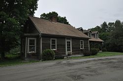
Barre (town), Vermont
Barre, Vermont | |
|---|---|
 | |
 Location in Washington County and the state of Vermont | |
 Barre Location in the United States | |
| Coordinates: 44°11′7″N 72°29′10″W / 44.18528°N 72.48611°WCoordinates: 44°11′7″N 72°29′10″W / 44.18528°N 72.48611°W | |
| Country | United States |
| State | Vermont |
| County | Washington |
| Area | |
| • Total | 30.7 sq mi (79.5 km2) |
| • Land | 30.6 sq mi (79.4 km2) |
| • Water | 0.1 sq mi (0.1 km2) |
| Elevation | 988 ft (301 m) |
| Population (2020) | |
| • Total | 7,923 |
| • Density | 258/sq mi (99.8/km2) |
| Time zone | UTC-5 (Eastern (EST)) |
| • Summer (DST) | UTC-4 (EDT) |
| ZIP code | 05641, 05649, 05654, 05670, 05678 |
| Area code(s) | 802 |
| FIPS code | 50-03250[1] |
| GNIS feature ID | 1462036[2] |
| Website | www |
Barre /ˈbæri/ is a town in Washington County, Vermont, United States. The population was 7,923 at the 2020 census. Popularly referred to as "Barre Town", the Town of Barre almost completely surrounds the City of Barre, which is a separate municipality. The original town now known as Barre was first chartered in 1780 as the town of Wildersburgh. In 1793 the name Wildersburgh was unpopular with the inhabitants and the name of the town was changed to Barre. In 1895 the City of Barre was incorporated and separated from the Town of Barre, and both continue to exist as separate municipalities.
Geography[]
According to the United States Census Bureau, the town has a total area of 30.7 square miles (79.5 km2), of which 30.6 square miles (79.4 km2) is land and 0.1 square mile (0.1 km2) (0.16%) is water. Barre is known for its granite quarries.
Communities[]
- "Barre City" is incorporated separately from the town ("Barre Town").
- East Barre is an unincorporated village and census-designated place (CDP) located near the eastern border of the town at the intersection of U.S. Route 302 and Vermont Route 110 next to the Jail Branch River.
- Graniteville, a CDP near the southern border of the town, is home to the Rock of Ages E.L. Smith Quarry, the world's largest deep hole quarry.[3] It was used as a backdrop in Batman & Robin and Star Trek.[4]
- South Barre is an unincorporated village and CDP.
- Websterville is an unincorporated village and CDP.
Demographics[]
| Historical population | |||
|---|---|---|---|
| Census | Pop. | %± | |
| 1800 | 919 | — | |
| 1810 | 1,669 | 81.6% | |
| 1820 | 1,955 | 17.1% | |
| 1830 | 2,012 | 2.9% | |
| 1840 | 2,126 | 5.7% | |
| 1850 | 1,845 | −13.2% | |
| 1860 | 1,839 | −0.3% | |
| 1870 | 1,882 | 2.3% | |
| 1880 | 2,060 | 9.5% | |
| 1890 | 6,812 | 230.7% | |
| 1900 | 3,346 | −50.9% | |
| 1910 | 4,194 | 25.3% | |
| 1920 | 3,882 | −7.4% | |
| 1930 | 4,280 | 10.3% | |
| 1940 | 4,052 | −5.3% | |
| 1950 | 4,145 | 2.3% | |
| 1960 | 4,580 | 10.5% | |
| 1970 | 6,509 | 42.1% | |
| 1980 | 7,090 | 8.9% | |
| 1990 | 7,411 | 4.5% | |
| 2000 | 7,602 | 2.6% | |
| 2010 | 7,924 | 4.2% | |
| 2020 | 7,923 | 0.0% | |
| U.S. Decennial Census[5][6] | |||
As of the census[1] of 2000, there were 7,602 people, 2,951 households, and 2,216 families residing in the town. The population density was 248.1 people per square mile (95.8/km2). There were 3,046 housing units at an average density of 99.4 per square mile (38.4/km2). The racial makeup of the town was 98.47% White, 0.18% Black or African American, 0.09% Native American, 0.29% Asian, 0.18% from other races, and 0.78% from two or more races. Hispanic or Latino of any race were 1.51% of the population.
There were 2,951 households, out of which 34.4% had children under the age of 18 living with them, 64.0% were couples living together and joined in either marriage or civil union, 7.6% had a female householder with no husband present, and 24.9% were non-families. 20.3% of all households were made up of individuals, and 8.9% had someone living alone who was 65 years of age or older. The average household size was 2.57 and the average family size was 2.95.
In the town, the population was spread out, with 25.6% under the age of 18, 6.1% from 18 to 24, 27.7% from 25 to 44, 26.7% from 45 to 64, and 13.9% who were 65 years of age or older. The median age was 40 years. For every 100 females, there were 94.7 males. For every 100 females age 18 and over, there were 93.4 males.
The median income for a household in the town was $46,563, and the median income for a family was $53,565. Males had a median income of $32,873 versus $26,061 for females. The per capita income for the town was $21,609. About 3.7% of families and 5.2% of the population were below the poverty line, including 6.9% of those under age 18 and 1.9% of those age 65 or over.
Education[]
Barre Town has its own school, Barre Town Middle and Elementary School, which hosts students from pre-school through grade eight. The public high school is Spaulding High School and is located in Barre City.
Notable people[]
- Jodi Cilley, film producer, educator and entrepreneur
- Lui Collins, singer-songwriter (folk)
- Madelyn Davidson, Vermont State Treasurer
- A. Clarke Dodge (1834-1916), Wisconsin businessman and politician
- Norman Dubie, poet
- D. C. Jarvis (1881–1966), physician
- Miranda July, performance artist, musician, writer, and film director
- Dave Moody, Nascar commentator
- Katherine Paterson, Newbery Award-winning author of books for children
- Helen Bonchek Schneyer, folk musician
See also[]
References[]
- ^ a b "U.S. Census website". United States Census Bureau. Retrieved 2008-01-31.
- ^ "US Board on Geographic Names". United States Geological Survey. 2007-10-25. Retrieved 2008-01-31.
- ^ "Rock of Ages" (PDF). Central-VT.com. Archived from the original (PDF) on 2008-12-19. Retrieved 2009-05-12.
- ^ Delcore, David (May 5, 2009). "E.L. Smith Quarry has role in new Star Trek movie". Times Argus. Archived from the original on 2009-05-18. Retrieved 2009-05-12.
- ^ "Census of Population and Housing". Census.gov. Retrieved June 4, 2015.
- ^ "Vermont History Explorer". Retrieved August 7, 2015.
External links[]
| Wikimedia Commons has media related to Barre (town), Vermont. |
- Barre (town), Vermont
- Towns in Vermont
- Barre, Vermont
- Towns in Washington County, Vermont

