Brattleboro, Vermont
Brattleboro, Vermont | |
|---|---|
Town | |
 The Gothic Revival Municipal Center (1884), built as Brattleboro's High School, served the town in that capacity until 1951 | |
| Motto(s): The One and Only Brattleboro | |
 Brattleboro Location in the United States | |
| Coordinates: 42°51′0″N 72°34′56″W / 42.85000°N 72.58222°WCoordinates: 42°51′0″N 72°34′56″W / 42.85000°N 72.58222°W | |
| Country | |
| State | |
| County | Windham |
| Chartered | 1753[1] |
| Government | |
| • Type | Municipal |
| • Town Manager | Peter Elwell |
| • Assistant Town Manager | Patrick Moreland |
| • Town Moderator | Lawrin Crispe |
| • Executive Secretary | Jan Anderson |
| Area | |
| • Total | 32.4 sq mi (84.0 km2) |
| • Land | 32.0 sq mi (82.9 km2) |
| • Water | 0.5 sq mi (1.2 km2) |
| Elevation | c. 200−1,768 ft (c. 61−539 m) |
| Population (2010) | |
| • Total | 12,046 |
| • Density | 375.3/sq mi (144.9/km2) |
| Time zone | UTC−5 (Eastern (EST)) |
| • Summer (DST) | UTC−4 (EDT) |
| ZIP Codes | 05301–05304 |
| Area code(s) | 802 |
| FIPS code | 50-07900[2] |
| GNIS feature ID | 1462049[3] |
| Website | www.brattleboro.org |


Brattleboro (/ˈbrætəlbʌroʊ/),[4] originally Brattleborough, is a town in Windham County, Vermont, United States. The most populous municipality abutting Vermont's eastern border with New Hampshire, which is the Connecticut River, Brattleboro is located about 10 miles (16 km) north of the Massachusetts state line, at the confluence of Vermont's West River and the Connecticut. In 2010, Brattleboro's population was 12,046.
Marlboro College Center for Graduate and Professional Studies[5] and SIT Graduate Institute[6] were located in the town until 2020.[7][8] There are satellite campuses of three colleges as well: Community College of Vermont,[9] Union Institute and University,[10] and Vermont Technical College.[11] The town is home to the New England Center for Circus Arts[12] and the Vermont Jazz Center.[13]
The Brattleboro Retreat, a not-for-profit mental health and addictions psychiatric hospital, is also located in the town.
History[]
Abenaki land[]
Because Native Americans in the region tended to name places and regions after their rivers or watersheds, the site of today's Brattleboro, the confluence of the West River and the Connecticut River, was called 'Wantastiquet'[14] by the Abenaki people, a name meaning, according to various translations, "lost river", "river that leads to the west", or "river of the lonely way". Today known mostly by its English-translated name, the West River remains demarcated by New Hampshire's towering Mount Wantastiquet, rising 1,000 feet above water level directly opposite its mouth, and Lake Wantastiquet, near where it rises at its source. The Abenaki would transit this area annually between (their summer hunting grounds near the current-day town of Swanton) in northwestern Vermont, and (their winter settlement or camps) near what is now Northfield, Massachusetts. The specific Abenaki band who lived here and traversed this place were called Sokoki, meaning "people who go their own way" or "people of the lonely way". The Abenaki's inclusive name for what is now Vermont was "Ndakinna" ("our land"), and in the 17th and 18th centuries, as more Europeans moved into the region, their often vigorous measures of self-defense culminated in Dummer's War (also known variously as Greylock's War, Three Years War, Lovewell's War, the 4th Indian War, and in Maine as Father Rasle's War). Most Abenaki allied with the French during this period, and following what is now known as the French and Indian War (1754–1763), they were largely driven north or fled into Quebec, further opening the way for English – and later United States – settlements in the area.[citation needed]
Frontier fort[]
To defend the Massachusetts Bay Colony against Chief Gray Lock and others during Dummer's War, the Massachusetts General Court voted on December 27, 1723 to build a blockhouse and stockade on the Connecticut River near the site of what would later become known as Brattleboro. Lieutenant-governor William Dummer signed the measure, and construction of Fort Dummer began on February 3, 1724. It was completed before summer. On October 11 of that year, the French attacked the fort and killed some soldiers.[15] In 1725, Dummer's War ended.
By 1728, and in subsequent peaceful periods, the fort served as a trading post for commerce among the colonial settlers and the Indians. But violence flared up from time to time throughout the first half of the 18th century. In 1744, what became known as King George's War broke out, lasting until 1748. During this period a small body of British colonial troops were posted at the fort, but after 1750 this was considered unnecessary.
Although the area was originally part of the Equivalent Lands, the township became one of the New Hampshire grants, and was chartered (founded) as such on December 26, 1753, by Governor Benning Wentworth. It was named Brattleborough, after Colonel William Brattle, Jr. of Boston, a principal proprietor. Ironically there is no record that Brattle ever visited the locality, and settlement activities remained tentative until after the 1763 Treaty of Paris, when France abandoned their claims to Vermont, part of the region which they had called New France.[15]
Hostilities having ceased, Brattleboro developed quickly in peacetime, and soon was second to no other settlement in the state for business and wealth. In 1771, Stephen Greenleaf opened Vermont's first store in the east village, and in 1784, a post office was established. A bridge was built across the Connecticut River to Hinsdale, New Hampshire in 1804.[16]

In 1834, the Brattleboro Retreat, then called the Vermont Asylum for the Insane,[17] was established through a generous bequest by Anna Marsh of Hinsdale, New Hampshire. In 1844, the Brattleboro Hydropathic Establishment was opened by Robert Wesselhoeft; this was the third "water cure" establishment in the country, utilizing waters from a spring near the current downtown fire station. Until the water cure closed in 1871, the town was widely known as a curative health resort.[18][19][20]

Other industries began to appear in the town under the initiation of the businessman John Holbrook, who initiated firms like the Brattleboro Typographic Company.[21] These businesses initiated a decade of very successful printing industry in the town.[21]

Mill town[]

Whetstone Falls, very close to where Brattleboro's Whetstone Brook flows into the Connecticut River, was a handy source of water power for watermills, initially a sawmill and a gristmill. By 1859, when the population had reached 3,816, Brattleboro had a woolen textile mill, a paper mill, a manufacturer of papermaking machinery, a factory making melodeons, two machine shops, a flour mill, a carriage factory, and four printing establishments.[15] Connected by the Vermont & Massachusetts Railroad and the Vermont Valley Railroad, the town prospered as a regional center for trade in commodities including grain, lumber, turpentine, tallow and pork.[22] In 1888, the spelling of the town's name was shortened to Brattleboro.[18][23]
The Estey Organ company, the largest organ manufacturer in the United States, operated in Brattleboro for about a century beginning in 1852. The company's main factory was located southwest of downtown Brattleboro, on the south side of Whetstone Brook between Birge and Organ Streets. At its height, the complex had more than 20 buildings, many of which were interconnected by raised walkways and covered bridges. One of the buildings now houses the Estey Organ Museum. The entire surviving complex was listed on the National Register of Historic Places in 1980, both for its architecture, and for having been a major economic force in Brattleboro for many years.

British author Rudyard Kipling settled in Brattleboro after marrying a young Brattleboro woman, Carrie Balestier, in 1892. The couple built a home called Naulakha, just over the town line to the north in neighboring Dummerston. Kipling wrote The Jungle Book and other works there. He also wrote about local life in the early 1890s: heavy snowfalls, ox-teams drawing sledges, and people in the small towns beset with what he called a "terrifying intimacy" about each other's lives. He recorded the death of men who had left, going to seek their fortunes in the cities or out west, and the consequent loneliness and depression in the lives of local women; the long length of the workday for farmers, even in winter, often for lack of help; and the abandonment of farms.[24]
The first person ever to receive a Social Security benefit check, issued on January 31, 1940, was Ida May Fuller from Brattleboro.[25]
On May 12, 1950, auctioneer Emma Bailey held her first auction in Brattleboro, selling a rocking chair for $2.50. She was the first American woman auctioneer, and later became the first woman admitted to the National Auctioneers Association.[26]
Geography[]

According to the United States Census Bureau, the town has a total area of 32.5 square miles (84.0 km2), of which 32.0 square miles (82.9 km2) is land and 0.5 square mile (1.2 km2, 1.42%) is water. Brattleboro is drained by the West River, Ames Hill Brook and Whetstone Brook. The town is in the Connecticut River Valley, and its eastern boundary (and the Vermont state line) is the western bank of the Connecticut River. Hills and mountains surround the town.
Climate[]
Brattleboro experiences a humid continental climate (Köppen Dfa) with cold, snowy winters and hot, humid summers. The town can experience snowfall as early as November and as late as April, and in the adjacent mountains and high country as late as May. Nor'easters often come with the potential of dumping a foot or more of snow on Brattleboro when they move through; such storms are not uncommon during the winter months. Summers are warm to hot and generally humid, with abundant sunshine and heavy showers and thunderstorms associated with passing cold fronts. Tornadoes are rare.
The record high is 100 °F (38 °C), set in 1955, and the record low is −33 °F (−36 °C), set in 1958. In terms of average annual precipitation, May is typically the wettest month, and February is the driest. Brattleboro averages 92.58 inches (235 cm) of snow annually.[27]
Brattleboro lies in USDA plant hardiness zone 5a.[28]
| hideClimate data for Brattleboro, Vermont | |||||||||||||
|---|---|---|---|---|---|---|---|---|---|---|---|---|---|
| Month | Jan | Feb | Mar | Apr | May | Jun | Jul | Aug | Sep | Oct | Nov | Dec | Year |
| Record high °F (°C) | 62 (17) |
65 (18) |
83 (28) |
97 (36) |
95 (35) |
100 (38) |
99 (37) |
100 (38) |
100 (38) |
91 (33) |
78 (26) |
68 (20) |
100 (38) |
| Average high °F (°C) | 32 (0) |
36 (2) |
45 (7) |
57 (14) |
70 (21) |
79 (26) |
84 (29) |
82 (28) |
73 (23) |
62 (17) |
49 (9) |
36 (2) |
59 (15) |
| Average low °F (°C) | 11 (−12) |
13 (−11) |
24 (−4) |
34 (1) |
45 (7) |
54 (12) |
59 (15) |
57 (14) |
49 (9) |
37 (3) |
29 (−2) |
18 (−8) |
36 (2) |
| Record low °F (°C) | −30 (−34) |
−33 (−36) |
−19 (−28) |
5 (−15) |
22 (−6) |
31 (−1) |
39 (4) |
36 (2) |
24 (−4) |
10 (−12) |
−16 (−27) |
−24 (−31) |
−33 (−36) |
| Average precipitation inches (mm) | 3.92 (100) |
3.15 (80) |
3.94 (100) |
3.97 (101) |
4.32 (110) |
4.07 (103) |
3.87 (98) |
4.20 (107) |
3.78 (96) |
4.03 (102) |
4.13 (105) |
3.69 (94) |
47.07 (1,196) |
| Source: The Weather Channel[29] | |||||||||||||
Demographics[]
| Historical population | |||
|---|---|---|---|
| Census | Pop. | %± | |
| 1790 | 1,589 | — | |
| 1800 | 1,867 | 17.5% | |
| 1810 | 1,891 | 1.3% | |
| 1820 | 2,017 | 6.7% | |
| 1830 | 2,141 | 6.1% | |
| 1840 | 2,623 | 22.5% | |
| 1850 | 3,816 | 45.5% | |
| 1860 | 3,855 | 1.0% | |
| 1870 | 4,933 | 28.0% | |
| 1880 | 5,880 | 19.2% | |
| 1890 | 6,862 | 16.7% | |
| 1900 | 6,640 | −3.2% | |
| 1910 | 7,541 | 13.6% | |
| 1920 | 8,332 | 10.5% | |
| 1930 | 9,816 | 17.8% | |
| 1940 | 10,983 | 11.9% | |
| 1950 | 11,522 | 4.9% | |
| 1960 | 11,734 | 1.8% | |
| 1970 | 12,239 | 4.3% | |
| 1980 | 11,886 | −2.9% | |
| 1990 | 12,241 | 3.0% | |
| 2000 | 12,005 | −1.9% | |
| 2010 | 12,046 | 0.3% | |
| 2020 | 12,184 | 1.1% | |
| U.S. Decennial Census[30] | |||
As of the census[2] of 2010, there were 12,046 people, 5,364 households, and 2,880 families residing in the town. Almost all of the population is concentrated in two census-designated places identified in the town: Brattleboro and West Brattleboro. The results of the 2010 census indicate very little change in the overall number of people living in the town. Despite this, Brattleboro remains the most populous town along Vermont's eastern border.
The population density of the town was 375.3 people per square mile (144.9/km2). There were 5,686 housing units at an average density of 177.7 per square mile (68.6/km2). The racial makeup of the town was 92.1% White, 1.9% Black or African American, 0.3% Native American, 2.2% Asian, 0.04% Pacific Islander, 0.6% from other races, and 2.8% from two or more races. Hispanic or Latino of any race were 2.7% of the population.
There were 5,364 households, out of which 27.2% had children under the age of 18 living with them, 37.8% were married couples living together, 12.8% had a female householder with no husband present, and 46.3% were non-families. 37.8% of all households were made up of individuals, and 13.3% had someone living alone who was 65 years of age or older. The average household size was 2.15 and the average family size was 2.84.
In the town, the population was spread out, with 22.3% under the age of 18, 6.6% from 18 to 24, 29.2% from 25 to 44, 25.3% from 45 to 64, and 16.6% who were 65 years of age or older. The median age was 40 years. For every 100 females, there were 84.0 males. For every 100 females age 18 and over, there were 79.9 males.
The median income for a household in the town was $31,997, and the median income for a family was $44,267. Males had a median income of $31,001 versus $25,329 for females. The per capita income for the town was $19,554. About 9.2% of families and 13.1% of the population were below the poverty line, including 18.0% of those under age 18 and 9.2% of those age 65 or over.
Economy[]
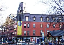
Both a commercial and touristic gateway for the state of Vermont, Brattleboro is the first major town one encounters crossing northward by automobile from Massachusetts on Interstate 91, and is accessed via Vermont exits 1, 2, and 3 from that thoroughfare. It offers a mix of a rural atmosphere and urban amenities including a number of lodging establishments. Brattleboro also hosts art galleries, stores, and performance spaces, mostly located in the downtown area.
In 2007, after meeting qualifying criteria, the local Selectboard passed a resolution designating Brattleboro a Fair Trade Town, becoming the second Fair Trade certified town in the nation after Media, Pennsylvania.[31]
C&S Wholesale Grocers, the northeast's largest regional food distributor, made its headquarters here until 2005, when they moved their administrative offices to Keene, New Hampshire; however, because of close proximity to Interstate 91, C&S still operates a large shipping and warehouse facility in Brattleboro near I-91's Exit 3.[32]
Ehrmann Commonwealth Dairy is headquartered in Brattleboro and operates a dairy processing facility in the town that opened in 2011.[33]
| Employer | Employees | Industry |
|---|---|---|
| C&S Wholesale Grocers | 1,200 | Grocery wholesale, distribution |
| Brattleboro Memorial Hospital | 400 | Healthcare |
| Brattleboro Retreat | 400 | Healthcare |
| Retreat Healthcare | 400 | Healthcare |
Development[]
This section does not cite any sources. (October 2016) |
The town's densely populated center is located near Vermont's lowest elevation point in the Connecticut river valley. Because of the surrounding steep hills there is very little flat land, and many of its buildings and houses are situated on steep hillsides, necessarily closely bunched together. This concentrated topography and population density have helped to create a semi-urban, cosmopolitan atmosphere in the downtown.
Since the 1950s, additional construction and development have expanded outside the concentrated downtown area; in the west, south, and north of the township. The southeast quarter of the town, near to and abutting the riverbank, is where its population has historically been the densest, and is composed largely of one- or two-family houses, with apartment buildings such as "triple deckers" interspersed among them. Commercial and industrial operations are concentrated along the north-south Canal Street (Route 5) artery. The town's high school and the Regional Career Center are also located in this section, as is Fort Dummer State Park, which is named after the first European settlers' 1724 stockade. The original Fort's site, however, was flooded in the early 20th century by a flood-control and hydro-electric dam built just downstream in Vernon, Vermont. An historical marker is located near the Fort's now-underwater site, on the west bank of the Connecticut River on Vernon Road (VT Route 142), at the corner of Cotton Mill Hill.
The western section of town, built up around Vermont's east-west Route 9, was formally designated a village in 2005. It is mostly lower-density residential in character, and features the state's largest mobile home park and several planned housing developments and subdivisions. Away from the Route 9 conduit, other parts of western Brattleboro and some areas north of the West River have a decidedly rural character, with dirt roads, sparse housing, wooded Green Mountains foothills, and the last few farms left in the town following the 1970s' decline of the dairy industry. At its peak, the immediate Brattleboro area had over 170 farms; there are now less than a dozen remaining.
The section of Brattleboro north of the West River, formerly farmland, was mostly subdivided and developed during the 1960s and 1970s following the construction of Interstate 91, which runs north-south through the town. The area has little residential development and is dominated by larger commercial and industrial establishments and suburban-style shopping areas along Putney Road, including seven chain hotels and motels located within a short distance of each other.
Brattleboro is also the headquarters of the Holstein/Friesian Cattle Association, which houses and maintains the worldwide registries for those two breeds.

Arts and culture[]


Brattleboro has a thriving arts community. It was listed in John Villani's book The 100 Best Small Art Towns in America,[36] in which it was ranked #9 among 'arts towns' with a population of 30,000 or less.
On the first Friday of every month, an event known as Gallery Walk[37] is held, during which galleries, artists, arts organizations, and even ordinary stores display new art works or hold performances. Included in the organizations that participate are the Brattleboro Museum and Art Center,[38] the ,[39] the ,[40] ,[41] Through the Music,[42] and the .[43] Gallery Walk is a mid-1990s creation of, and continues to be sponsored by, the .[44]
Other notable arts organizations in Brattleboro include the ,[45] the ,[46] the ,[47] the Brattleboro Women's Chorus,[48] the New England Center for Circus Arts (NECCA),[49] the ,[50] and the Vermont Jazz Center.[51][52]
Annual events[]
- February's annual Winter Carnival[53]
- Alpine Ski Jumping's renowned Fred Harris Memorial Tournament, held each February at the world-class Harris Hill Ski Jump (est. 1922)[54]
- The Brattleboro Women's Film Festival held each March[55]
- Maple Open House Weekend each March[56]
- Annual Benefit Auction for River Gallery School each March[57]
- The Winston Prouty Center's Taste of the Town fund raiser each May[58]
- The annual Slow Living Summit in late May or early June[59]
- The annual Strolling of the Heifers gala parade and festival, held the first full weekend each June[60]
- Vermont Theatre Company's Shakespeare-in-the-Park in June and July[61]
- Brattleboro Free Folk Festival, begun in 2003[62]
- Brattleboro Literary Festival in October[63]
- Brattleboro Film Festival first two weeks of November[64]
Recreation and Parks[]
The town operates and maintains the Gibson-Aiken Center, a large recreation and community activities facility, located downtown on Main Street,[65] along with a number of parks and outdoor recreation centers, including , whose features include an outdoor swimming pool and a municipal skiing facility. There are bicycle lanes on Putney Road in the northern portion of town, on Guilford Street near Living Memorial Park, and on a short segment of Western Avenue in West Brattleboro. Open during the summer months, Fort Dummer State Park is named for, and located near, the original site of a Dummer's War-era stockade. The state park consists of 218 acres of protected forest, featuring hiking trails and a State campground, just south of the population center on wooded hills overlooking the Connecticut River.[66]
Brattleboro sees a substantial seasonal influx of recreational skiers and snowboarders, many of them bound for the resorts at nearby Mount Snow and Stratton, but it is also a winter sports destination in and of itself. The town played an important role in the development and popularization of the skiing industry as a winter sport, with pioneering Brattleboro native and Dartmouth College alumnus Fred Harris,[67] founder of the Dartmouth Outing Club (1909–10),[68] also establishing the Brattleboro Outing Club (in 1922),[69] contributing to the first North American use of motor-driven ski lifts, and building the Harris Hill olympic-scale ski jumping facility,[70] the site of international competitions every February that still attract daring ski-jumping athletes from all over the world.
Government[]
Brattleboro employs a Representative Town Meeting local government, wherein its citizens are represented at-large by a Select Board of five members, and by several dozen Town Representatives elected from three municipal districts. The Select Board, meeting on average every week or two, is considered part of the 'executive branch' of town government; its five members being elected to fill three one-year positions and two three-year positions. In turn, the Select Board hires and supervises a full-time Town Manager.[71] The town's three districts also each elect a representative to the Vermont State Legislature.
State and federal representation[]
Brattleboro is represented at the national level by Senators Bernie Sanders and Patrick Leahy, and by Rep. Peter Welch, who also represents Vermont's entire at-large federal congressional district.
At the state level in Montpelier:[72]
- Sen. Becca Balint (D)
- Sen. Jeannette White (D)
- Rep. Mollie Burke (P/D)
- Rep. Emilie Kornheiser (D)
- Rep. Tristan Toleno (D)
Ballot initiatives[]
- Brattleboro voted in support of a measure calling on the town's police force to arrest and indict President George W. Bush and Vice President Dick Cheney in March 2008. The vote was 2012–1795.[73]
- In March 2017, Brattleboro voted in support of a ban on grocery store plastic bags by a 3 to 1 margin.[74]
Education[]
Brattleboro has a diverse mix of public and private primary, secondary and post-secondary schools and career centers. Sub-campuses of the Community College of Vermont and Vermont Technical College are located in Brattleboro;[75] in the downtown's newly renovated Brooks House. Brattleboro is also home to the New England Academic Center of Union Institute and University, housed in the building.
SIT Graduate Institute, formerly known as the School for International Training, is a private higher education institution in northern Brattleboro. An outgrowth of The Experiment in International Living, which was founded in 1932 in nearby Putney, Vermont, the Graduate Institute offers master's degrees in several internationally-oriented concentrations.[76] Its students and faculty hail from all regions of the globe, giving Brattleboro a decidedly eclectic and international flair, and its notable alumni include native Vermonter and 1997 Nobel Peace Prize laureate Jody Williams.
Brattleboro currently has three public K-6 elementary schools. They are:[77]
- Green Street School
- Oak Grove School
- Academy School
There is one public middle school, the Brattleboro Area Middle School (BAMS),[78] and one public high school, the Brattleboro Union High School (BUHS).[79] The Windham Southeast Supervisory Union,[80] which oversees the public school system in the southeastern corner of Windham County, also administers a dedicated vocational education unit, the Windham Regional Career Center.[81] Oak Meadow, a K-12 homeschool curriculum provider and distance learning school is also based out of downtown Brattleboro.
Brooks Memorial Library is Brattleboro's partially municipally-funded and modestly-endowed library. It also houses a town historical archive and more than a few excellent fine art paintings and sculptures.
Media[]
Print[]
The town is home to the Brattleboro Reformer (est. 1876 as the 'Windham County Democrat'), a daily newspaper with a weekday circulation of just over 10,000,[82] and The Commons, a non-profit community weekly newspaper.[83] The Parent Express, a community newspaper, circulates in Brattleboro; Keene, New Hampshire; and throughout Windham County, Vermont and Cheshire County, New Hampshire.[84] Local news is also carried in the Keene Sentinel and Rutland Herald.
Radio[]
There are several radio stations which broadcast from Brattleboro.
- FM
- WVBA 88.9 FM, Vermont Public Radio outlet
- WKVT-FM 92.7 (classic hits)[85]
- WRSI 101.5 (repeater station at Marlboro, Vermont of station broadcasting from Deerfield, Massachusetts on 93.9, with studios in Northampton, Massachusetts)[86][87]
- WTSA-FM 96.7 (hot adult contemporary)[88]
- WVEW-LP 107.7 (community-supported low power station)[89]
- AM
Television[]
Brattleboro is not reached by terrestrial broadcast television due to the surrounding mountains, in addition to being just far enough away from major cities like Boston, Springfield, and Albany. However, it is considered part of the Boston television market.[90] Comcast is the major supplier of cable television programming for Brattleboro. Local stations offered on Comcast include most major Boston-area stations, as well as WMUR-TV (ABC) and WEKW-TV (NHPTV) from New Hampshire; WCAX-TV (CBS), WNNE (The CW) and WVTA (Vermont PBS) from the Burlington / Plattsburgh market, and WGBY-TV from Springfield, Massachusetts.
Infrastructure[]
Transportation[]
Roads and highways[]


Brattleboro is crossed by six highways, including one Interstate highway. They are:
 Interstate 91
 U.S. Route 5 ("Connecticut River Byway")
 Vermont Route 9 ("Molly Stark Trail")
 Vermont Route 30
 Vermont Route 119
 Vermont Route 142
Vermont Route 9 runs from the New York border with Vermont, west of Bennington, traverses the southern backbone of the Green Mountains well west of Brattleboro, and eventually arrives in the heart of Brattleboro's downtown as High Street. Its other local names are The Molly Stark Trail, Marlboro Road, Western Avenue, Main Street, and Putney Road. It meets I-91 at a partial cloverleaf interchange (from where it is Exit 2 from the Interstate), then as it advances eastward into downtown, it overlaps U.S. Route 5 at the intersection of Main and High Streets. The road then runs north with Main Street into Putney Road then to the traffic circle at Interstate 91's Exit 3 (connected to that highway via a trumpet interchange westward from this roundabout), where it diverges from Route 5 and runs eastward into New Hampshire, becoming New Hampshire Route 9.
U.S. Route 5 enters Brattleboro at its border with the town of Guilford and runs north-south, through downtown, eventually exiting Brattleboro at its northern border with the town of Dummerston. Route 5's local names are Canal Street, Main Street, and Putney Road. Southbound, Route 5 detours along Park Place and part of Linden Street, as part of a one-way 'traffic triangle' at the north end of Main Street. Route 5, designated throughout Vermont as the Connecticut River Byway, is the only scenic byway in Vermont to receive national byway status.[91][92]
Scenic Vermont Route 30 has its southern terminus in Brattleboro at the intersection of Park Place and Linden Street. From this point, it runs for about 12 miles on a very gently graded roadbed along the West River's southern bank, affording a stunning vista and connecting Brattleboro with picturesque New England towns and recreational areas elsewhere in Windham County and Vermont. Its wide riverside paved shoulder makes it a favorite cycling route. Route 30 exits Brattleboro at its border with Dummerston and continues northwest along the West River. Its local names within Brattleboro are Linden Street and West River Road.
Interstate 91, originating in Connecticut and terminating at the Canada–U.S. border, runs north-south through town, arcing westward around the town center. Its first three Vermont exits are in Brattleboro: Exit 1 serves the southern part of town, Exit 2 serves the western section of town connecting to local ski areas via Route 9, and Exit 3 serves the northern section of town and neighboring southwest New Hampshire. I-91's majestic twin-structure is, as of 2015, being rebuilt with a completely new design.[93]
Vermont Route 119 begins at a 5-way intersection locally known as "Malfunction Junction" with U.S. Route 5 and VT Route 142. Route 119's local name within Brattleboro is Bridge Street. It continues east with an at-grade crossing of the New England Central Railroad just before crossing into New Hampshire over the Connecticut River, whose border lies just 0.08 miles (0.13 km) from the road's western end.
Vermont Route 142 begins at Malfunction Junction (mentioned above), continuing southward, closely paralleling the New England Central Railroad for much of its length within town. Its local names are Vernon Street and Vernon Road, as it continues southward into the town of Vernon and eventually into Massachusetts.
Rail[]
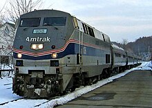
Amtrak, the national passenger rail system, operates its Vermonter service daily through Brattleboro, connecting the town by rail with Washington, D.C. and St. Albans, Vermont and many stations in between. Brattleboro was recently part of a $70 million re-alignment of the Vermonter's route to the old Montrealer route, restoring passenger rail service between Brattleboro and the western Massachusetts cities of Northampton and Greenfield.[94] Recent upgrades to railroad tracks in Massachusetts and Connecticut, to the south, have significantly reduced rail travel time to New York and points south.
Bus[]
Southeast Vermont Transit operates both the Current and the MOOver, local public transit bus routes.[95][96]
Greyhound and Megabus operate long-distance bus routes.[97][98]
Air[]
The closest small-craft airports to Brattleboro are the Deerfield Valley Regional Airport in West Dover to the west, and Dillant-Hopkins Airport in Keene, New Hampshire to the east. The closest airports (both within 70 miles (110 km) north of the town) offering regularly-scheduled domestic commercial flights include Lebanon Municipal Airport in West Lebanon, New Hampshire and the Rutland – Southern Vermont Regional Airport, close to Rutland. Both airports feature daily Cape Air flights to and from Boston and White Plains, New York. The closest airports with regularly-scheduled domestic and international flights are Bradley International Airport to the south, Manchester-Boston Regional Airport to the east, and Albany International Airport to the west, all of them less than two hours' driving distance from the town.

Fire department[]
The town of Brattleboro is protected by the Brattleboro Fire Department,[99] founded in 1831 and located on Elliot Street in the downtown business district. There is also a sub-station in West Brattleboro. The Department's current Chief is Michael Bucossi.[100]
Police[]
Brattleboro and West Brattleboro are protected by the Brattleboro Police Department.[101]
The Windham County Sheriff's Department provides prisoner transport and serves civil documents across Brattleboro and the rest of Windham County.[102]
The Vermont State Police have a substation in Westminster and also serve the town.[103]
Health care[]
- Brattleboro is home to the Brattleboro Memorial Hospital, a 61-bed community hospital serving southeastern Vermont since 1904. As of 2014, the hospital has 137 primary care and specialist physicians on its staff.[104]
- Rescue Inc. provides EMT and ambulance service for Brattleboro, as well as Cheshire County, New Hampshire.
- Brattleboro is also home to the Brattleboro Retreat, a large private, non-profit psychiatric hospital founded in 1834. The Retreat, as it is known locally, was one of the first acute mental health care facilities founded in the United States.[105] It is the third largest employer in the town, and 45th largest in Vermont, with a workforce of about 400 as of 2013.[106]
- Health Care and Rehabilitation Services of Vermont (HCRS)[107] provides Brattleboro, and the rest of Windham and Windsor Counties, with outpatient services for mental health, substance abuse and developmental disabilities. The agency is headquartered in Springfield and also has other satellite offices in Bellows Falls, Windsor and White River Junction.
Utilities[]
Brattleboro's electricity is supplied by Green Mountain Power.[108] Brattleboro's surface water supply is the Pleasant Valley Reservoir, which the Pleasant Valley Water Plant siphons through Brattleboro at a daily average of 1.0 to 1.5 million gallons per day. Also, backup water pumps are adjacent to West River Road just north of the Brattleboro Retreat.[109]
Cable television in Brattleboro is provided by Comcast. Comcast and Consolidated Communications also provide the town with landline phone and high speed Internet service.[110]
Notable people[]
Brattleboro is notable for having been home to two Nobel Laureates in Literature: Rudyard Kipling (1907) and Saul Bellow (1976).
Frederick Holbrook (1813–1909) was an agriculturist, politician, and the 27th Governor of Vermont during the Civil War. The Deacon John Holbrook House, built in 1825 by Governor Holbrook's father, John Holbrook still stands at 80 Linden Street. It is on the National Register of Historic Places. The "Father of American Contract Bridge," Ely Culbertson lived in West Brattleboro for several years, where he wrote several of his treatises on World Government. He is buried in Brattleboro and a street is named after him.
Brattleboro is the birthplace and burial site of William Morris Hunt , the noted and influential 19th-century American painter and the birthplace of his brothers; the famed architect Richard Morris Hunt, and the pioneering photographer and attorney Leavitt Hunt.[111][112][113][114] Their father Vermont U.S. Congressman Jonathan Hunt Jr. though born in nearby Vernon, Vermont; later lived in Brattleboro, maintained his law practice there, and is buried in the old cemetery on the hill in town.[115]
In popular culture[]
This section appears to contain trivial, minor, or unrelated references to popular culture. (December 2018) |
- Brattleboro is the setting for much of H. P. Lovecraft's story The Whisperer in Darkness.[116]
- Brattleboro is mentioned once in David Foster Wallace's novel Infinite Jest.[117]
- The popular Joe Gunther mystery series written by Archer Mayor is largely set in Brattleboro.[118]
- The psychiatric hospital in the 2011 action movie Sucker Punch is located in Brattleboro.[citation needed]
- Brattleboro placed 11th on "The 20 Best Small Towns in America of 2012" list by Smithsonian Magazine in May 2012.[119]
See also[]
- National Register of Historic Places listings in Windham County, Vermont
- Vermont Center for the Deaf and Hard of Hearing
References[]
- ^ Sanford 1986, p. 20.
- ^ Jump up to: a b "U.S. Census website". United States Census Bureau. Retrieved January 31, 2008.
- ^ "US Board on Geographic Names". United States Geological Survey. October 25, 2007. Retrieved January 31, 2008.
- ^ Wells, John C. (2008), Longman Pronunciation Dictionary (3rd ed.), Longman, p. 101, ISBN 9781405881180
- ^ Marlboro College Academics Retrieved August 14, 2016.
- ^ "SIT Graduate Institute". Archived from the original on February 9, 2016. Retrieved February 9, 2016.
- ^ Brinker, Andrew (November 23, 2019). "Marlboro graduate school staff left unaware of closure track". The Berkeley Beacon. Retrieved December 18, 2020.
- ^ "SIT Graduate Institute ends full-time programs in Vermont in favor of new global campus model". www.insidehighered.com. Retrieved December 18, 2020.
- ^ "CCV Brattleboro - Community College of Vermont".
- ^ "Locations - Union Institute & University".
- ^ "Archived copy". Archived from the original on January 5, 2016. Retrieved February 9, 2016.CS1 maint: archived copy as title (link)
- ^ "Home". New England Center for Circus Arts.
- ^ Center, Vermont Jazz. "the Vermont Jazz Center".
- ^ DeLorme (1996). Vermont Atlas & Gazetteer. Yarmouth, Maine: DeLorme. ISBN 0-89933-016-9.
- ^ Jump up to: a b c A. J. Coolidge & J. B. Mansfield, A History and Description of New England; Boston, Massachusetts 1859. Books.google.com.
- ^ Brattleboro in 1824. Web.archive.org (October 27, 2009).
- ^ "Data". usgennet.org.
- ^ Jump up to: a b Brattleboro. Virtual Vermont.
- ^ Nichols, Mary S. Gove (1855). "Experience in the Water Cure: A familiar exposition of the Principles and Results of Water Treatment, in the Cure of Acute and Chronic Diseases". in Fowlers and Wells' Water-Cure Library: Embracing all the most popular works on the subject. Vol. 2 of 7. New York: Fowlers and Wells. p. 30 (n85 in electronic page field). Retrieved October 29, 2009.
|volume=has extra text (help) Full text at Internet Archive (archive.org). - ^ Cabot 1922.
- ^ Jump up to: a b Duffy, John J.; Hand, Samuel B.; Orth, Ralph H. (2003). "Holbrook, John". The Vermont Encyclopedia. UPNE. p. 160. ISBN 9781584650867.
- ^ Hayward's New England Gazetteer of 1839. Newenglandtowns.org.
- ^ U.S. postal authorities decided that all towns ending in borough should be shortened to boro, and Vermont complied.
- ^ Kipling, Rudyard (April 1, 2004). "Letters of Travel (1892-1913)" – via Project Gutenberg.
- ^ Her check number was 00-000-001 and it was for $22.54; Social Security Online. "The First Social Security Beneficiary". Social Security Administration. Retrieved June 28, 2007.
- ^ "Emma Bailey: reflections on life as America's first woman auctioneer". Christian Science Monitor. May 19, 1983. ISSN 0882-7729. Retrieved May 24, 2018.
- ^ Brattleboro, VT Weather, USA.com. Retrieved January 5, 2014.
- ^ USDA Plant Hardiness Zone Map Archived February 27, 2014, at the Wayback Machine, US Department of Agriculture. Retrieved January 5, 2014.
- ^ "Climate Statistics for Brattleboro, Vermont". Retrieved June 22, 2012.
- ^ "U.S. Decennial Census". United States Census Bureau. Retrieved May 16, 2015.
- ^ About, Fair Trade Campaigns USA. Retrieved June 28, 2015.
- ^ Brattleboro, VT, C&S Wholesale Grocers.
- ^ "State commits over $2 million in incentives to Commonwealth Dairy expansion". Vermont Business Magazine. December 14, 2016. Retrieved December 16, 2016.
- ^ "CareerOneStop". careeronestop.org.
- ^ "Largest Employers in Vermont - NextUP Vermont". Archived from the original on June 30, 2015. Retrieved June 28, 2015.
- ^ The 100 Best Small Art Towns in America, by John Villani, John Muir Publications, Santa Fe, NM 1998
- ^ Gallery Walk, Brattleboro, Vermont – a Monthly First-Friday Celebration!. Gallerywalk.org (October 4, 2012).
- ^ Brattleboro Museum & Art Center » home. Brattleboromuseum.org.
- ^ Hooker-Dunham Theater – Great Stuff's Happening!. Hookerdunham.org.
- ^ "In-Sight Photography Project". In-Sight Photography Project.
- ^ River Gallery School. River Gallery School.
- ^ Welcome to Through the Music. Throughthemusic.com.
- ^ May, 2008. Windham Art Gallery.
- ^ "acwc". acwc.
- ^ bmcvt.org
- ^ Home Archived July 19, 2013, at the Wayback Machine. Vermont Theatre Company.
- ^ New England Youth Theater. Neyt.org.
- ^ Brattleboro Women's Chorus. Brattleborowomenschorus.org (September 12, 2012).
- ^ New England Center for Circus Arts (NECCA). Necenterforcircusarts.org.
- ^ Vermont Performance Lab. Vermont Performance Lab.
- ^ the Vermont Jazz Center. Vtjazz.org.
- ^ Center, Vermont Jazz. "Contact Us - Contact Us". Archived from the original on February 10, 2016. Retrieved February 9, 2016.
- ^ Brattleboro - Non-profitorganisatie | Facebook. Brattleboro Winter Carnival. Retrieved on April 12, 2014.
- ^ Harris Hill Ski Jump. Harris Hill Ski Jump
- ^ Women's Film Festival 2008 – Home. Womensfilmfestival.org.
- ^ "Maple Open House Weekend". Vermont Maple Sugar Makers.
- ^ "Benefit Auction at the Brattleboro Museum and Art Center]". December 27, 2005. Archived from the original on December 27, 2005.
- ^ The Winston Prouty Center for Child Development. Winstonprouty.org.
- ^ Slow Living Summit, June 5–7, 2013. Slowlivingsummit.org (June 1, 2012).
- ^ Friday, June 7 – Sunday, June 9, 2013. Strolling of the Heifers (June 1, 2012).
- ^ Home Archived September 28, 2007, at the Wayback Machine. Vermont Theatre Company.
- ^ Folk Music's New Genre Benders Utne Reader. Retrieved August 14, 2016.
- ^ Welcome to the 2007 Brattleboro Literary Festival. Brattleboroliteraryfestival.org.
- ^ Home, Brattleboro Film Festival. Retrieved April 28, 2016.
- ^ Recreation and Parks, brattleboro.org. Retrieved December 18, 2014.
- ^ Fort Dummer State Park Archived October 17, 2010, at the Wayback Machine, Vermont State Parks. Retrieved December 18, 2014.
- ^ debholm (December 16, 2010). "About BOC Founder Fred Harris".
- ^ "History of the DOC".
- ^ amacfarl. "Brattleboro Outing Club".
- ^ "Welcome!".
- ^ Brattleboro Town Charter. "Town Charter". Retrieved June 29, 2007.
- ^ State Legislators, Brattleboro Chamber of Commerce. Retrieved 2017-05-22.
- ^ Associated Press. "Vt. towns put Bush, Cheney on arrest list" USA Today (March 5, 2008)
- ^ Brattleboro votes down plastic bags[permanent dead link], WCAX. Retrieved 2017-05-22.
- ^ CCV Brattleboro, Community College of Vermont. Retrieved January 5, 2014.
- ^ SIT Graduate Institute. Retrieved March 3, 2017.
- ^ Schools Archived July 2, 2014, at the Wayback Machine, Windham Southeastern Supervisory Union. Retrieved January 5, 2014.
- ^ "Page Redirection".
- ^ "Vernon Brattleboro Union High School". Brattleboro Union High School. Archived from the original on May 15, 2014. Retrieved May 14, 2014.
- ^ "Windham Southeast Supervisory Union". Windham Southeast Supervisory Union.
- ^ Windham Regional Career Center. Retrieved January 5, 2014.
- ^ [Newsroom Diversity Report for the Brattleboro Reformer], John S. and James L. Knight Foundation. Retrieved December 16, 2015.
- ^ Welcome to THE COMMONS – News and Views for Windham County, Vermont. Commonsnews.org.
- ^ Parent Express. Parent Express.
- ^ Jump up to: a b WKVT radio station. Wkvt.com.
- ^ Radio-Locator database. Radio-locator.com.
- ^ WRSI radio station. Wrsi.com.
- ^ Jump up to: a b WTSA radio station. Wtsa.net (April 21, 2009).
- ^ WVEW radio station. Wvew.org (October 21, 2012).
- ^ Per Zap2it, zip code 05301.
- ^ Connecticut River National Byway Archived December 5, 2013, at the Wayback Machine, Explore Vermont's Byways. Retrieved January 5, 2014.
- ^ The Connecticut River Byway. Retrieved January 5, 2014.
- ^ I-91 Brattleboro Bridge, VTrans. Retrieved April 25, 2015.
- ^ Amtrak's Vermonter returns to Connecticut River route to Springfield, Mass., starting Dec. 29, The Commons. Retrieved December 18, 2014.
- ^ Wilmington-Brattleboro, MOOver Route 10, Deerfield Valley Transit Association. Retrieved January 4, 2014.
- ^ Home, The Current. Retrieved October 25, 2016.
- ^ Greyhound to resurrect service from Brattleboro to Boston, Brattleboro Reformer. Retrieved March 4, 2015.
- ^ Megabus service begins in Brattleboro, The Commons. Retrieved September 21, 2016.
- ^ Brattleboro Fire Department. Retrieved March 25, 2016.
- ^ Staff Archived April 3, 2016, at the Wayback Machine, Brattleboro Fire Department. Retrieved March 25, 2016.
- ^ Chief Archived January 6, 2014, at the Wayback Machine, Brattleboro Police Department. Retrieved January 5, 2014.
- ^ The Sheriff: Biography and Programs, Windham County Sheriff's Office. Retrieved December 18, 2014.
- ^ /brattleboro Westminster Barracks, Vermont State Police. Retrieved October 25, 2016.
- ^ About Brattleboro Memorial Hospital, Brattleboro Memorial Hospital. Retrieved January 5, 2014.
- ^ Mission and History, Brattleboro Retreat. Retrieved January 5, 2014.
- ^ State Profile: Largest Employers, America's Career InfoNet. Retrieved January 5, 2014.
- ^ Home, Health Care and Rehabilitation Services. Retrieved 2017-07-08.
- ^ Service Area, Green Mountain Power. Retrieved June 28, 2015.
- ^ Water Supply, Public Works Department, Town of Brattleboro, VT. Retrieved June 28, 2015.
- ^ Network Map & Fiber Route Miles, Consolidated Communications. Retrieved 2019-01-02.
- ^ "Hunt, William Morris".
- ^ "Hunt, William Morris (1824-1879), Victorian Art History". www.avictorian.com.
- ^ "Richard Morris Hunt | American architect". Encyclopedia Britannica.
- ^ "Hunt, Leavitt".
- ^ "Loading..." www.reformer.com.
- ^ The Whisperer in Darkness by H. P. Lovecraft. Dagonbytes.com.
- ^ Infinite Jest, pp. 901: "C.T. was the infant son she'd brought to the new union, his father a ne'er-do-well killed in a freak accident playing competitive darts in a Brattleboro tavern just as they were trying to adjust the obstetric stirrups for the achondroplastic Mrs. Tavis's labor and delivery."
- ^ Mayor, Archer. "A Brief Biography of "Joe Gunther"". Archived from the original on September 22, 2007. Retrieved December 12, 2011.
- ^ The 20 Best Small Towns in America of 2012", Susan Spano and Aviva Shen, Smithsonian Magazine. Retrieved August 17, 2013.
Further reading[]
- Cabot, Mary R., ed. (1922). The Annals of Brattleboro 1681–1895. Vol. 2 of 2. Brattleboro, Vermont: E.L. Hildreth & Co. Retrieved December 14, 2009.
|volume=has extra text (help) - Sanford, D. Gregory, ed. (1986). Vermont Municipalities: An Index to their Charters and Special Acts (PDF). State Papers of Vermont. 19. Montpelier: Vermont Secretary of State. Archived from the original (PDF) on November 29, 2014. Retrieved November 15, 2014.
- "Brattleboro in 1748-1790". Vermont Phoenix. Brattleboro, Vermont. October 31, 1890 – via Newspapers.com.

External links[]
 Media from Wikimedia Commons
 Travel guides from Wikivoyage
- Town of Brattleboro official website
- Brattleboro, Vermont at Curlie
- Brattleboro Area Chamber of Commerce
- Brattleboro Historical Society
- Beach, Chandler B., ed. (1914). . . Chicago: F. E. Compton and Co.
| show Places adjacent to Brattleboro, Vermont |
|---|
| show Municipalities and communities of Windham County, Vermont, United States |
|---|
| show Authority control |
|---|
- Brattleboro, Vermont
- Artist colonies
- Vermont populated places on the Connecticut River
- Towns in Vermont
- Towns in Windham County, Vermont