Mount Orne Covered Bridge
Mount Orne Bridge | |
|---|---|
 Bridge in New Hampshire & Vermont | |
| Coordinates | 44°28′N 71°39′W / 44.46°N 71.65°W |
| Crosses | Connecticut River |
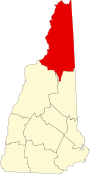
| Locale | Lancaster, New Hampshire to Lunenburg, Vermont |
| Maintained by | Towns of Lancaster and Lunenburg |
| ID number | 29-04-08 (NH #30) |
| Characteristics | |
| Design | Howe truss bridge[1] |
| Total length | 266.25 ft (81.15 m) |
| Width | 20.5 ft (6.25 m) (maximum), 14.42 ft (4.395 m) (roadway) |
| Longest span | 127.33 ft (38.81 m) |
| Load limit | 6 tons |
| Clearance above | 12.75 ft (3.89 m) |
| History | |
| Opened | 1911 November 23, 1983 |
| Closed | July 5, 1983 |
Mount Orne Covered Bridge | |
U.S. National Register of Historic Places | |
 | |
| Location | Lancaster, New Hampshire & Lunenburg, Vermont |
| Coordinates | 44°27′36″N 71°39′10″W / 44.46000°N 71.65278°WCoordinates: 44°27′36″N 71°39′10″W / 44.46000°N 71.65278°W |
| Area | 1 acre (0.40 ha) |
| Architect | Berlin Iron Bridge Co. |
| Architectural style | Howe truss covered bridge |
| NRHP reference No. | 76000124[2] |
| Added to NRHP | December 12, 1976 |


The Mount Orne Bridge is a covered bridge over the Connecticut River between Lancaster, New Hampshire, and Lunenburg, Vermont. It joins Elm Street (New Hampshire Route 135) in South Lancaster with River Road (Town Highway 1) in Lunenburg. Built in 1911, it is one of two Howe truss bridges across the Connecticut River. It was listed on the National Register of Historic Places in 1976.[2]
Description and history[]
The Mount Orne Covered Bridge is located in a rural area of eastern Lunenburg and southwestern Lancaster. It spans the Connecticut River in a roughly northwest-southeast orientation. It consists of two spans of wood-and-iron Howe trusses, resting on stone abutments and piers which have been partially faced in concrete. The overall length of the bridge is 267 feet (81 m), with the western span measuring 134 feet (41 m) and the eastern span one foot less. The bridge has an overall width of 20.5 feet (6.2 m), with a roadway of 15.5 feet (4.7 m). The bridge is covered by a corrugated metal gable roof, and is sided in vertical boarding that extends only partway to the eaves. The siding extends around to the insides of the portals.[3]
The bridge was built in 1911 by the Berlin Construction Company, replacing one that was washed away by flooding in 1905. It is one of only two Howe truss bridges over the Connecticut River; the other, the Columbia Bridge, was built in 1912. The two bridges are among the last to be built during the historic period of covered bridge construction in either state. The costs of construction and maintenance are shared by the two towns.[3] The most recent rededication of the bridge took place on November 23, 1983.
See also[]
- List of crossings of the Connecticut River
- List of covered bridges in Vermont
- List of covered bridges in New Hampshire
- List of bridges on the National Register of Historic Places in Vermont
- List of bridges on the National Register of Historic Places in New Hampshire
- National Register of Historic Places listings in Essex County, Vermont
- National Register of Historic Places listings in Coös County, New Hampshire
References[]
- ^ Official New Hampshire site about this bridge
- ^ a b "National Register Information System". National Register of Historic Places. National Park Service. July 9, 2010.
- ^ a b "NRHP nomination for Mount Orne Covered Bridge". National Park Service. Retrieved 2014-10-25.
External links[]
| Wikimedia Commons has media related to Mount Orne Covered Bridge. |
Crossings of the Connecticut River | ||||
|---|---|---|---|---|
| ||||
National Register of Historic Places in Coös County, New Hampshire | ||
|---|---|---|
| National Historic Landmark |
|  |
| Historic districts | ||
| Historic properties |
| |
| Footnotes | ‡This historic property also has portions in an adjacent state. | |
National Register of Historic Places in Essex County, Vermont | ||
|---|---|---|
| Districts |  | |
| Buildings | ||
| Structures | ||
| Footnotes | ‡ This historic property also has portions in an adjacent state. | |
- 1911 establishments in Vermont
- 1911 establishments in New Hampshire
- Buildings and structures in Lunenburg, Vermont
- Covered bridges in New Hampshire
- Covered bridges in Vermont
- Bridges over the Connecticut River
- Covered bridges on the National Register of Historic Places in New Hampshire
- Covered bridges on the National Register of Historic Places in Vermont
- Bridges completed in 1911
- Wooden bridges in Vermont
- Wooden bridges in New Hampshire
- Tourist attractions in Coös County, New Hampshire
- Bridges in Coös County, New Hampshire
- Bridges in Essex County, Vermont
- Tourist attractions in Essex County, Vermont
- Road bridges in New Hampshire
- Road bridges in Vermont
- National Register of Historic Places in Coös County, New Hampshire
- National Register of Historic Places in Essex County, Vermont
- Lancaster, New Hampshire
- Road bridges on the National Register of Historic Places in New Hampshire
- Road bridges on the National Register of Historic Places in Vermont
- Howe truss bridges in the United States
- Interstate vehicle bridges in the United States