Windsor County, Vermont
Windsor County | |
|---|---|
U.S. county | |
 Windsor County courthouse in Woodstock | |
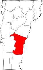 Location within the U.S. state of Vermont | |
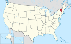 Vermont's location within the U.S. | |
| Coordinates: 43°33′30″N 72°31′59″W / 43.55827°N 72.53299°W | |
| Country | |
| State | |
| Founded | 1781 |
| Named for | Windsor, Vermont, which was named for Windsor, Connecticut |
| Shire Town | Woodstock |
| Largest town | Hartford |
| Area | |
| • Total | 977 sq mi (2,530 km2) |
| • Land | 969 sq mi (2,510 km2) |
| • Water | 7.4 sq mi (19 km2) 0.8%% |
| Population (2010) | |
| • Total | 56,670 |
| • Estimate (2019) | 55,062 |
| • Density | 58/sq mi (22/km2) |
| Time zone | UTC−5 (Eastern) |
| • Summer (DST) | UTC−4 (EDT) |
| Congressional district | At-large |
| Website | www |

Windsor County is a county located in the U.S. state of Vermont. As of the 2010 census, the population was 56,670.[1] The shire town (county seat) is the town of Woodstock.[2] The county's largest municipality is the town of Hartford.
History[]
Windsor County is one of several Vermont counties created from land ceded by the State of New York on 15 January 1777 when Vermont declared itself to be a distinct state from New York.[3][4][5] The land originally was contested by Massachusetts, New Hampshire, and New Netherland, but it remained undelineated until July 20, 1764 when King George III established the boundary between Province of New Hampshire and Province of New York along the west bank of the Connecticut River, north of Massachusetts and south of the parallel of 45 degrees north latitude. New York assigned the land gained to Albany County.[6][7] On March 12, 1772 Albany County was partitioned to create Charlotte County,[8] and this situation remained until Vermont's independence from New York and Britain.
Windsor County was established on February 16, 1781 from parts of Cumberland County and organized the same year.[9]
Windsor County is notable for being the birthplace (1805) of Joseph Smith, Jr., founder of the Latter Day Saint movement. Calvin Coolidge, the 30th U.S. president, was also born in Windsor County.
Geography[]
According to the U.S. Census Bureau, the county has a total area of 977 square miles (2,530 km2), of which 969 square miles (2,510 km2) is land and 7.4 square miles (19 km2) (0.8%) is water.[10] It is the largest county by area in Vermont.
Adjacent counties[]
- Orange County - north
- Grafton County, New Hampshire - northeast
- Sullivan County, New Hampshire - east
- Windham County - south
- Bennington County - southwest
- Rutland County - west
- Addison County - northwest
National parks[]
- Green Mountain National Forest (part)
- Marsh-Billings-Rockefeller National Historical Park
- White Rocks National Recreation Area (part)
Major highways[]
Demographics[]
| Historical population | |||
|---|---|---|---|
| Census | Pop. | %± | |
| 1790 | 15,740 | — | |
| 1800 | 26,944 | 71.2% | |
| 1810 | 34,877 | 29.4% | |
| 1820 | 38,233 | 9.6% | |
| 1830 | 40,625 | 6.3% | |
| 1840 | 40,356 | −0.7% | |
| 1850 | 38,504 | −4.6% | |
| 1860 | 37,193 | −3.4% | |
| 1870 | 36,063 | −3.0% | |
| 1880 | 35,196 | −2.4% | |
| 1890 | 31,706 | −9.9% | |
| 1900 | 32,225 | 1.6% | |
| 1910 | 33,681 | 4.5% | |
| 1920 | 36,984 | 9.8% | |
| 1930 | 37,416 | 1.2% | |
| 1940 | 37,862 | 1.2% | |
| 1950 | 40,885 | 8.0% | |
| 1960 | 42,483 | 3.9% | |
| 1970 | 44,082 | 3.8% | |
| 1980 | 51,030 | 15.8% | |
| 1990 | 54,055 | 5.9% | |
| 2000 | 57,418 | 6.2% | |
| 2010 | 56,670 | −1.3% | |
| 2020 | 57,753 | 1.9% | |
| U.S. Decennial Census[11] 1790–1960[12] 1900–1990[13] 1990–2000[14] 2010–2018[1] | |||
2000 census[]
As of the 2000 census,[15] there were 57,418 people, 24,162 households, and 15,729 families living in the county. The population density was 59 people per square mile (23/km2). There were 31,621 housing units at an average density of 33 per square mile (13/km2). The racial makeup of the county was 97.72% White, 0.33% Black or African American, 0.23% Native American, 0.63% Asian, 0.03% Pacific Islander, 0.15% from other races, and 0.91% from two or more races. 0.82% of the population were Hispanic or Latino of any race. 20.1% were of English, 12.9% Irish, 10.9% American, 9.9% French, 7.7% German, 6.7% French Canadian and 5.5% Italian ancestry. 96.4% spoke English and 1.5% French as their first language.
There were 24,162 households, out of which 29.20% had children under the age of 18 living with them, 52.70% were married couples living together, 9.00% had a female householder with no husband present, and 34.90% were non-families. 28.10% of all households were made up of individuals, and 11.10% had someone living alone who was 65 years of age or older. The average household size was 2.35 and the average family size was 2.86. In the county, the population was spread out, with 23.30% under the age of 18, 5.90% from 18 to 24, 27.30% from 25 to 44, 27.60% from 45 to 64, and 15.80% who were 65 years of age or older. The median age was 41 years. For every 100 females, there were 94.80 males. For every 100 females age 18 and over, there were 92.10 males.
The median income for a household in the county was $40,688, and the median income for a family was $59,002. Males had a median income of $42,648 versus $25,696 for females. The per capita income for the county was $22,369. About 3.20% of families and 5.70% of the population were below the poverty line, including 7.50% of those under age 18 and 7.60% of those age 65 or over.
In 2007, the census department estimated that Windsor had the oldest average age in the state, 44.7. This compares with the actual census in 2000 of 41.3 years.[16]
2010 census[]
As of the 2010 United States Census, there were 56,670 people, 24,753 households, and 15,420 families living in the county.[17] The population density was 58.5 inhabitants per square mile (22.6/km2). There were 34,118 housing units at an average density of 35.2 per square mile (13.6/km2).[18] The racial makeup of the county was 96.3% white, 0.9% Asian, 0.6% black or African American, 0.3% American Indian, 0.2% from other races, and 1.7% from two or more races. Those of Hispanic or Latino origin made up 1.2% of the population.[17]
Of the 24,753 households, 25.9% had children under the age of 18 living with them, 49.1% were married couples living together, 9.0% had a female householder with no husband present, 37.7% were non-families, and 30.0% of all households were made up of individuals. The average household size was 2.25 and the average family size was 2.77. The median age was 45.8 years.[17]
The median income for a household in the county was $50,893 and the median income for a family was $63,387. Males had a median income of $44,610 versus $34,150 for females. The per capita income for the county was $29,053. About 5.6% of families and 9.7% of the population were below the poverty line, including 12.5% of those under age 18 and 7.6% of those age 65 or over.[19]
Politics[]
This article is in list format, but may read better as prose. (May 2020) |
In 1828, Windsor County was won by National Republican Party candidate John Quincy Adams.
In 1832, the county was won by Anti-Masonic Party candidate William Wirt.
From William Henry Harrison in 1836 to Winfield Scott in 1852, the county would be won by Whig Party candidates.
From John C. Frémont in 1856 to Richard Nixon in 1960 (barring 1912, when the county was won by Progressive Party candidate and former president Theodore Roosevelt), the Republican Party would have a 104-year winning streak in the county.
In 1964, Windsor County was won by Democratic Party incumbent President Lyndon B. Johnson, who became not only the first Democratic presidential candidate to win the county, but the first to win the state of Vermont entirely.
Following the Democrats victory in 1964, the county went back to voting for Republican candidates for another 20 year winning streak starting with Richard Nixon in 1968 and ending with George H. W. Bush in 1988, who became the last Republican presidential candidate to win the county.
Bill Clinton won the county in 1992 and it has been won by Democratic candidates ever since.
Transportation[]
In 2009, the United States Department of Transportation measured 113.6 miles (182.8 km) of "major arteries", the highest in the state.[21]
Because US Route 4 had the "feel" of a highway, motorists were inclined to speed. As a result, the Windsor County Sheriff's Department wrote 2,452 tickets in 2007.[22]
Communities[]
Towns[]
Villages[]
Villages are census divisions, but have no separate corporate existence from the surrounding towns.
Census-designated places[]
Unincorporated communities[]
See also[]
- List of counties in Vermont
- List of towns in Vermont
- National Register of Historic Places listings in Windsor County, Vermont
- USS Windsor (APA-55), an attack transport named for Windsor County
References[]
- ^ Jump up to: a b "State & County QuickFacts". United States Census Bureau. Archived from the original on July 22, 2011. Retrieved December 30, 2013.
- ^ "Find a County". National Association of Counties. Retrieved June 7, 2011.
- ^ Slade, William, Jr., comp. Vermont State Papers: Being a collection of Records and Documents Connected with the Assumption and Establishment of Government by the People of Vermont, Together with the Journal of the Council of Safety, the First Constitution, the Early Journals of the General Assembly, and the Laws from the Year 1779 to 1786, Inclusive. Middlebury, 1823. P. 70-73.
- ^ Van Zandt, Franklin K. Boundaries of the United States and the Several States. Geological Survey Professional Paper 909. Washington, DC; Government Printing Office, 1976. The Standard Compilation for its subject. P. 64.
- ^ Williamson, Chilton. Vermont in Quandary: 1763-1825. Growth of Vermont series, Number 4. Montpelier: Vermont Historical Series, 1949. PP. 82-84; map facing 95, 100-102, 112-113.
- ^ Slade, William, Jr., comp. Vermont State Papers: Being a collection of Records and Documents Connected with the Assumption and Establishment of Government by the People of Vermont, Together with the Journal of the Council of Safety, the First Constitution, the Early Journals of the General Assembly, and the Laws from the Year 1779 to 1786, Inclusive. Middlebury, 1823. pp.13-19.
- ^ Van Zandt, Franklin K. Boundaries of the United States and the Several States. Geological Survey Professional Paper 909. Washington, DC; Government Printing Office, 1976. The Standard Compilation for its subject. P. 63.
- ^ New York Colonial Laws, Chapter 1534; Section 5; Paragraph 321)
- ^ "Vermont: Individual County Chronologies". Vermont Atlas of Historical County Boundaries. The Newberry Library. 2008. Retrieved June 30, 2015.
- ^ "2010 Census Gazetteer Files". United States Census Bureau. August 22, 2012. Retrieved June 29, 2015.
- ^ "U.S. Decennial Census". United States Census Bureau. Retrieved June 29, 2015.
- ^ "Historical Census Browser". University of Virginia Library. Retrieved June 29, 2015.
- ^ Forstall, Richard L., ed. (March 27, 1995). "Population of Counties by Decennial Census: 1900 to 1990". United States Census Bureau. Retrieved June 29, 2015.
- ^ "Census 2000 PHC-T-4. Ranking Tables for Counties: 1990 and 2000" (PDF). United States Census Bureau. April 2, 2001. Retrieved June 29, 2015.
- ^ "U.S. Census website". United States Census Bureau. Retrieved 2011-05-14.
- ^ Sutkowski, Matt (August 7, 2008). Census: State older, a little more diverse. Burlington Free Press.
- ^ Jump up to: a b c "DP-1 Profile of General Population and Housing Characteristics: 2010 Demographic Profile Data". United States Census Bureau. Archived from the original on February 1, 2015. Retrieved January 20, 2016.
- ^ "Population, Housing Units, Area, and Density: 2010 - County". United States Census Bureau. Archived from the original on February 13, 2020. Retrieved January 20, 2016.
- ^ "DP03 SELECTED ECONOMIC CHARACTERISTICS – 2006-2010 American Community Survey 5-Year Estimates". United States Census Bureau. Archived from the original on February 13, 2020. Retrieved January 20, 2016.
- ^ Leip, David. "Dave Leip's Atlas of U.S. Presidential Elections". uselectionatlas.org. Retrieved 2018-03-26.
- ^ Heath, Brad; McLean, Dan (September 25, 2009). "Funds bypass worst roads". Burlington Free Press. pp. 1A.
- ^ Shinn, Peggy (January 18, 2009). "Not so fast (or else) on these Vermont highways". Boston Globe. Retrieved January 23, 2019.
External links[]
| show Places adjacent to Windsor County, Vermont |
|---|
| show Municipalities and communities of Windsor County, Vermont, United States |
|---|

| show Authority control |
|---|
- Vermont counties
- Windsor County, Vermont
- 1781 establishments in Vermont
- Populated places established in 1781
- Lebanon micropolitan area