West Windsor, Vermont
West Windsor, Vermont | |
|---|---|
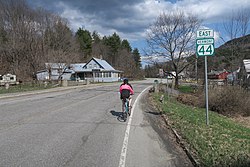 Vermont Route 44 eastbound | |
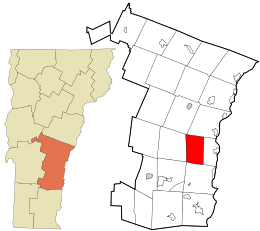 Location in Windsor County and the state of Vermont. | |
 West Windsor, Vermont Location in the United States | |
| Coordinates: 43°29′8″N 72°29′3″W / 43.48556°N 72.48417°WCoordinates: 43°29′8″N 72°29′3″W / 43.48556°N 72.48417°W | |
| Country | United States |
| State | Vermont |
| County | Windsor |
| Area | |
| • Total | 24.7 sq mi (64.0 km2) |
| • Land | 24.6 sq mi (63.8 km2) |
| • Water | 0.08 sq mi (0.2 km2) |
| Elevation | 1,047 ft (319 m) |
| Population (2020) | |
| • Total | 1,344 |
| • Density | 54/sq mi (21/km2) |
| Time zone | UTC-5 (Eastern (EST)) |
| • Summer (DST) | UTC-4 (EDT) |
| ZIP code | 05089 |
| Area code(s) | 802 |
| FIPS code | 50-83050[1] |
| GNIS feature ID | 1462257[2] |
| Website | www |

West Windsor is a town in Windsor County, Vermont, United States. The population was 1,344 at the 2020 census.[3]
Geography[]
According to the United States Census Bureau, the town has a total area of 24.7 square miles (64.0 km2), of which 24.6 square miles (63.8 km2) is land and 0.077 square miles (0.2 km2), or 0.37%, is water.[4]
The unincorporated village of Brownsville is one of the few urban areas in the town.
Demographics[]
| Historical population | |||
|---|---|---|---|
| Census | Pop. | %± | |
| 1850 | 1,002 | — | |
| 1860 | 924 | −7.8% | |
| 1870 | 708 | −23.4% | |
| 1880 | 690 | −2.5% | |
| 1890 | 570 | −17.4% | |
| 1900 | 513 | −10.0% | |
| 1910 | 569 | 10.9% | |
| 1920 | 514 | −9.7% | |
| 1930 | 512 | −0.4% | |
| 1940 | 494 | −3.5% | |
| 1950 | 504 | 2.0% | |
| 1960 | 539 | 6.9% | |
| 1970 | 571 | 5.9% | |
| 1980 | 763 | 33.6% | |
| 1990 | 923 | 21.0% | |
| 2000 | 1,067 | 15.6% | |
| 2010 | 1,099 | 3.0% | |
| 2020 | 1,344 | 22.3% | |
| U.S. Decennial Census[5] | |||
This section needs to be updated. (July 2020) |
At the 2000 census there were 1,067 people, 456 households, and 327 families in the town. The population density was 43.2 people per square mile (16.7/km2). There were 716 housing units at an average density of 29.0 per square mile (11.2/km2). The racial makeup of the town was 98.31% White, 0.28% African American, 0.28% Native American, 0.19% Asian, and 0.94% from two or more races. Hispanic or Latino of any race were 1.59%.[1]
Of the 456 households 28.9% had children under the age of 18 living with them, 63.4% were married couples living together, 5.5% had a female householder with no husband present, and 28.1% were non-families. 22.8% of households were one person and 7.0% were one person aged 65 or older. The average household size was 2.34 and the average family size was 2.74.
The age distribution was 21.6% under the age of 18, 5.0% from 18 to 24, 23.1% from 25 to 44, 34.9% from 45 to 64, and 15.6% 65 or older. The median age was 45 years. For every 100 females, there were 99.4 males. For every 100 females age 18 and over, there were 99.3 males.
The median household income was $54,792 and the median family income was $63,456. Males had a median income of $33,309 versus $35,750 for females. The per capita income for the town was $28,360. About 5.1% of families and 5.6% of the population were below the poverty line, including 7.7% of those under age 18 and 3.1% of those age 65 or over.
Notable person[]
- Rollin Amsden, U.S. Marshal for Vermont[6]
- Charles Bronson, Legendary Actor, is interred at Brownsville Cemetery in West Windsor, Vermont.
References[]
- ^ a b "U.S. Census website". United States Census Bureau. Retrieved 2008-01-31.
- ^ "US Board on Geographic Names". United States Geological Survey. 2007-10-25. Retrieved 2008-01-31.
- ^ "Census - Geography Profile: West Windsor town, Windsor County, Vermont". United States Census Bureau. Retrieved January 7, 2022.
- ^ "Geographic Identifiers: 2010 Demographic Profile Data (G001): West Windsor town, Windsor County, Vermont". United States Census Bureau. Retrieved August 1, 2012.
- ^ "U.S. Decennial Census". United States Census Bureau. Retrieved May 16, 2015.
- ^ "Hon. Rollin Amsden". Vermont Journal. Windsor, VT. February 4, 1899. p. 8 – via Newspapers.com.
External links[]
Municipalities and communities of Windsor County, Vermont, United States | ||
|---|---|---|
Shire town: Woodstock | ||
| Towns | ||
| Villages | ||
| CDPs | ||
| Other communities | ||
| ||
- West Windsor, Vermont
- Towns in Vermont
- Towns in Windsor County, Vermont