Mongar
Mongar | |
|---|---|
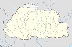 Mongar Location in Bhutan | |
| Coordinates: 27°16′30″N 91°14′24″E / 27.27500°N 91.24000°ECoordinates: 27°16′30″N 91°14′24″E / 27.27500°N 91.24000°E | |
| Country | |
| District | Mongar District |
| Elevation | 5,200 ft (1,600 m) |
| Population (2005) | |
| • Total | 3,502 |
| Time zone | UTC+6 (BTT) |
| Area code(s) | 05 |


View of Mongar town

Regional Referral Hospital, Mongar
Mongar (Dzongkha: མོང་སྒར) is a town and the seat of Mongar District in eastern Bhutan.[1] As of 2005 it had a population of 3502. Mongar is on the road from Thimphu to Trashigang. It is one of the oldest educational hubs of the country. It has a regional hospital and a good standard hotel, among other facilities. The important Yagang Lhakhang monastery is on the outskirts of the town. The post code for Mongar post office is 43001.[2]
References[]
| Wikimedia Commons has media related to Mongar (town). |
- ^ National Geospatial Intelligence Agency
- ^ Bhutan Post post codes list http://www.bhutanpost.bt/documents/postcodes.pdf Archived 2017-12-26 at the Wayback Machine
External links[]
| hide Authority control | |
|---|---|
| General |
|
| National libraries | |
This Bhutan location article is a stub. You can help Wikipedia by . |
Categories:
- Populated places in Bhutan
- Bhutan geography stubs