Mongnai State
| Mongnai (Mone) | |||||||
|---|---|---|---|---|---|---|---|
| State of the Shan States | |||||||
| bf. 1800–1959 | |||||||
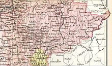 Möng Nai State in an Imperial Gazetteer of India map | |||||||
| Capital | Mong Nai | ||||||
| Area | |||||||
• 1901 | 5,129 km2 (1,980 sq mi) | ||||||
| Population | |||||||
• 1901 | 44252 | ||||||
| History | |||||||
• State founded | bf. 1800 | ||||||
• Abdication of the last Saopha | 1959 | ||||||
| |||||||

The Gate at Mongnai in a picture by Sir James George Scott.
Mongnai, also known as Möngnai, Mone, Mōng Nai or Monē,[1] was a Shan state in what is today Burma. It belonged to the Eastern Division of the Southern Shan States.[1] Its capital was Mongnai town.[2]
History[]
Möngnai state was founded before 1800. According to tradition a predecessor state named Saturambha had existed previously in the area.[3]
Mongnai included the substates of Kengtawng[1] and Kenghkam. The latter was annexed in 1882.[citation needed]
Rulers (title Myoza)[]
- c.1802 – 1848: Maung Shwe Paw
- 1848 – 1850: Maung Yit
- 1850 – 1851: U Po Ka
- 1852: U Shwe Kyu
Rulers (title Saopha)[]
Ritual style Kambawsa Rahta Mahawunthiri Pawara Thudamaraza.[4]
- 1852 – 1875: Hkun Nu Nom
- 1875 – 1882: Hkun Kyi (1st time) (1847–1914)
- 1882 – 1888: Twet Nga Lu (usurper) (d. 1888)
- 1888 – 1914: Hkun Kyi (2nd time) (s.a.)
- 1914 – 1928: Hkun Kyaw Sam
- 1928 – 1949: Hkun Kyaw Ho (d. 1949)
- 1949 – 1958: Sao Pye
References[]
- ^ Jump up to: a b c Chisholm, Hugh, ed. (1911). . Encyclopædia Britannica. 18 (11th ed.). Cambridge University Press. p. 710.
- ^ Imperial Gazetteer of India, v. 17, p. 405.
- ^ Ben Cahoon (2000). "World Statesmen.org: Shan and Karenni States of Burma". Retrieved 21 December 2010.
- ^ "WHKMLA : History of the Shan States". 18 May 2010. Retrieved 21 December 2010.
External links[]
Coordinates: 20°31′N 97°52′E / 20.517°N 97.867°E
This Burmese history article is a stub. You can help Wikipedia by . |
This Shan State location article is a stub. You can help Wikipedia by . |
Categories:
- States and territories disestablished in 1959
- Shan States
- Myanmar history stubs
- Shan State geography stubs