Monida, Montana
Monida, Montana | |
|---|---|
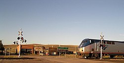 American Orient Express in Monida | |
 Monida, Montana | |
| Coordinates: 44°33′43″N 112°18′49″W / 44.56194°N 112.31361°WCoordinates: 44°33′43″N 112°18′49″W / 44.56194°N 112.31361°W | |
| Country | United States |
| State | Montana |
| County | Beaverhead |
| Elevation | 6,788 ft (2,069 m) |
| Time zone | UTC-7 (Mountain (MST)) |
| • Summer (DST) | UTC-6 (MDT) |
| Area code(s) | 406 |
| GNIS feature ID | 787554[1] |


Monida is an unincorporated community in Beaverhead County, Montana, United States. Monida is located on Interstate 15 at the top of Monida Pass, 14.7 miles (23.7 km) east-southeast of Lima. The community is situated on the Continental Divide at the Idaho state line. It has a permanent population of two. It also serves as the southernmost settlement in the state.
The Monida post office opened in 1891.[2] The name derives from the first three letters of Montana and Idaho.
References[]
- ^ "Monida". Geographic Names Information System. United States Geological Survey.
- ^ "Monida". Montana Place Names Companion. Montana Historical Society. Retrieved 7 April 2021.
Municipalities and communities of Beaverhead County, Montana, United States | ||
|---|---|---|
| City |  | |
| Town | ||
| CDPs | ||
| Other communities | ||
| Ghost towns | ||
| ||
This Beaverhead County, Montana state location article is a stub. You can help Wikipedia by . |
Categories:
- Unincorporated communities in Beaverhead County, Montana
- Unincorporated communities in Montana
- Great Divide of North America
- Montana geography stubs