Montagudet
Montagudet | |
|---|---|
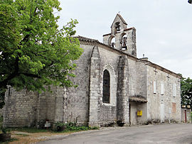 The church of Saint-Sulpice-de-Bourges, in Montagudet | |
show Location of Montagudet | |
 Montagudet | |
| Coordinates: 44°14′42″N 1°05′32″E / 44.245°N 1.0922°ECoordinates: 44°14′42″N 1°05′32″E / 44.245°N 1.0922°E | |
| Country | France |
| Region | Occitanie |
| Department | Tarn-et-Garonne |
| Arrondissement | Castelsarrasin |
| Canton | Pays de Serres Sud-Quercy |
| Intercommunality | Pays de Serres en Quercy |
| Government | |
| • Mayor (2020–2026) | Jean Benois[1] |
| Area 1 | 12.18 km2 (4.70 sq mi) |
| Population (Jan. 2018)[2] | 196 |
| • Density | 16/km2 (42/sq mi) |
| Time zone | UTC+01:00 (CET) |
| • Summer (DST) | UTC+02:00 (CEST) |
| INSEE/Postal code | 82116 /82110 |
| Elevation | 91–237 m (299–778 ft) (avg. 200 m or 660 ft) |
| 1 French Land Register data, which excludes lakes, ponds, glaciers > 1 km2 (0.386 sq mi or 247 acres) and river estuaries. | |


Montagudet (French pronunciation: [mɔ̃taɡydɛ]) is a commune in the Tarn-et-Garonne department in the Occitanie region in southern France.
Geography[]
The Séoune forms part of the commune's northern border. The Barguelonnette forms most of the commune's southern border.
See also[]
- Communes of the Tarn-et-Garonne department
References[]
- ^ "Répertoire national des élus: les maires". data.gouv.fr, Plateforme ouverte des données publiques françaises (in French). 2 December 2020. Retrieved 7 December 2020.
- ^ "Populations légales 2018". INSEE. 28 December 2020.
| Wikimedia Commons has media related to Montagudet. |
This Tarn-et-Garonne geographical article is a stub. You can help Wikipedia by . |
Categories:
- Communes of Tarn-et-Garonne
- Tarn-et-Garonne geography stubs