Montech
Montech | |
|---|---|
 The church of Our Lady of the Visitation, in Montech | |
 Coat of arms | |
show Location of Montech | |
 Montech | |
| Coordinates: 43°57′28″N 1°13′50″E / 43.9578°N 1.2306°ECoordinates: 43°57′28″N 1°13′50″E / 43.9578°N 1.2306°E | |
| Country | France |
| Region | Occitanie |
| Department | Tarn-et-Garonne |
| Arrondissement | Montauban |
| Canton | Montech |
| Intercommunality | Grand Sud Tarn et Garonne |
| Government | |
| • Mayor (2020–2026) | Jacques Moignard[1] |
| Area 1 | 50.14 km2 (19.36 sq mi) |
| Population (Jan. 2018)[2] | 6,406 |
| • Density | 130/km2 (330/sq mi) |
| Time zone | UTC+01:00 (CET) |
| • Summer (DST) | UTC+02:00 (CEST) |
| INSEE/Postal code | 82125 /82700 |
| Elevation | 82–133 m (269–436 ft) (avg. 112 m or 367 ft) |
| 1 French Land Register data, which excludes lakes, ponds, glaciers > 1 km2 (0.386 sq mi or 247 acres) and river estuaries. | |


Montech (French pronunciation: [mɔ̃tɛʃ]; Occitan: Montuèg) is a commune in the Tarn-et-Garonne department in the Occitanie region in southern France.
On the Canal de Garonne is the unique Montech water slope, a type of canal inclined plane built in 1974. The slope has been out of service since an engine failure in 2009.
Monuments[]

City Hall

The church 'Our Lady of Feuillade'
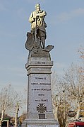
The War Memorial
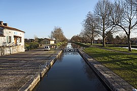
Canal locks of Peyrets
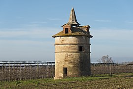
The dovecote of St. Cry


See also[]
- Communes of the Tarn-et-Garonne department
- André Abbal
References[]
- ^ "Répertoire national des élus: les maires". data.gouv.fr, Plateforme ouverte des données publiques françaises (in French). 2 December 2020. Retrieved 7 December 2020.
- ^ "Populations légales 2018". INSEE. 28 December 2020.
| Wikimedia Commons has media related to Montech. |
| show Authority control |
|---|
This Tarn-et-Garonne geographical article is a stub. You can help Wikipedia by . |
Categories:
- Communes of Tarn-et-Garonne
- Languedoc
- Tarn-et-Garonne geography stubs