Montaukett
 Indian Field by Little Reed Pond | |
| Regions with significant populations | |
|---|---|
| United States (Long Island) | |
| Languages | |
| English, formerly Mohegan-Pequot | |
| Religion | |
| Christianity, Native | |
| Related ethnic groups | |
| Shinnecock, Pequot, and Narragansett |
The Montaukett, ("Metoac"[1]) or Montauk native american people are an Algonquian-speaking Native American culture from the eastern end of Long Island, New York. Historically, they are related in language and ethnicity to the Pequot and Narragansett peoples who live across Long Island Sound in what is now Connecticut and Rhode Island, and they were initially speakers of the "N" dialect of Algonquin language until about 1600 when they moved to the "Y" dialect. Relics and ruins of their settlements are visible at Theodore Roosevelt County Park, on the edge of the village of Montauk, New York. While descendants of this tribe still live among the neighboring tribes in the region, the Montaukett are not a New York State recognized tribe yet (though efforts towards recognition are being made).
Recognition[]
Recognition does not define whether an indigenous culture exists. Rather it defines whether members of that culture are eligible to have their own tribal government according to US laws. See Tribal sovereignty in the United States for more information.
RECOGNITION Closer by New York State – web news article by By Jon Kuperschmid – July 30, 2020 – East Hampton Star
Culture and language[]
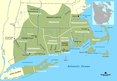
Montauk people originally, historically spoke the Mohegan-Pequot language, also known as the Algonquian "N" - dialect, until about 1600, when they began using the "Y" dialect. Native Americans living on Long Island are often known in colonial writings by the place name of their geographic territories, such as the Montauk and the Shinnecock, which may or may not be the same as their name for themselves. European colonists tended to mistakenly assume that the different bands they encountered were different tribes, even in cases where the bands clearly shared the same culture and language.[2] The Native Americans of the east end of the Island shared a common culture with each other and with other Lenape groups along most of the northern shore of what is now called Long Island Sound.
Those in the western part of Long Island were also Lenape / Algonquin groups, and not culturally and linguistically entirely distinct but related to Algonquin peoples who lived in a large Atlantic Coastal Plain territory surrounding the Long Island Sound, that extended from what is today; Canada to the Carolinas.[3]
The pre-colonial Montaukett derived great wealth from the wampompeag (or wampum) available on Long Island. Before the Montaukett obtained metal awls from the Europeans, the Montaukett artisans would make "disk-shaped beads from quahog shells...used for trade and for tribute payments" with the nearby tribes.[4] Since the wampum became desired for trade and payment by Native Americans and the English and Dutch colonial powers, the Montaukett were raided and made politically subject by more powerful New England tribes, who demanded tribute or just stole the wampum.
The Montaukett divided their roles to obtain and process foods. The Montaukett "were farmers and fishermen" ("hunter / gatherers"). The colonial Montauketts participated in the new European economic and cultural systems by using their traditional skills: hunting to provide game and fowl for colonists' tables: woodworking to make bowls, scrubs, tools, toys, and later, houses and mills, craft work to make baskets, eel pots, and rush and cane bottoms for chairs. The "women would harvest corn, squash and beans."[5] While the men fished and hunted whales, by using their dugout canoes, made by hollowing out large trees.[5] They also participated in the economy by purchasing their guns and sometimes furniture from the local colonial craftsmen. The Montauketts skilled at whaling were eagerly sought after by those engaged in the trade. Between 1677 and 1684, a documented system of credit allowed indigenous men (and their families) to purchase goods from local merchants and traders, in exchange for their share (or “lay”) of the catch during the following whaling season.
The Montauketts received attention from New Light preachers during and after the First Great Awakening, most notably James Davenport and Azariah Horton. The Settler colonists continued to pursue an idea of making the Montauketts become Christianized and therefore integrated into society by having the Rev. Azarlah Horton, originally of Southold, to minister to them from 1740 to about 1750. Staying and preaching in their wigwams, the reverend traveled a circuit from Jamaica to Montauk, but spending most of his time at Montauk. In a diary entry from December 1741, Rev. Horton mentioned visiting the wigwams of Montaukett people in Montauk who were suffering from illnesses.
In 1749, Samson Occom a Mohegan Native American of Connecticut, came to Montauk to minister and to educate them, and began to take over Azariah Horton’s mission, and Rev. Horton eventually left for New Jersey. Rev. Occom was an exceptionally talented man, not formally educated until 16, but mastering English, Greek, and Latin, as well as theology beginning in 1743. Later he was ordained a Presbyterian minister by East Hampton's Rev. Samuel Buell. They formed the Brothertown group along with members of the neighboring Shinnecock band. They moved from Long Island to escape colonial encroachment, first to Oneida County, New York, and later most of the people relocated to Brothertown, Wisconsin and throughout the United States. They have married into many of the northeastern native tribes and live on many reservations throughout the country. Today they are part of the Brothertown Indians movement. [6] Because of his presence, the Montauk were probably the best educated Native group on Long Island.
Eventually the in-shore whaling operations over-fished the local seas, and Indigenous labor from the Montauketts and other Native American groups was vital to deep-sea whaling throughout the late eighteenth century. Even both Rev. Horton and Rev. Occum mentioned in their records (as late as ca. 1740–1760) that Montaukett men were working at sea during their visits.
The attempts at assimilation continued for sometime afterwards for those who stayed behind when the Brothertown group left; for example – in 1830 while the Rev. Thomas James (minister) was in Sag Harbor on an anti-slavery ministry for the free black former slaves in the whaling industry, he was engaged to preach to the Montauketts too. The Reverend James gave the Montauketts shelter near the village during their problems with the Narragansett, and allegedly got them to sell from Napeague to Montauk Point to himself and a few other men. Rev. James allegedly composed a Catechism In the Montauk language, a variant of Mohegan-Pequot, which has never been found.
Off-shore / deep sea whaling operations continued even well into the nineteenth century even though exploitative labor practices continued, but not all indigenous men in southern New England faced coercion, debt, and indentured servitude in seafaring. Through the nineteenth-century, whaling ships often included tri-racial and multi-national crews. White, indigenous, and African-American seamen encountered sailors from international ports as vessels travelled for sometimes years at a time. The 1859 discovery of petroleum in Pennsylvania, along with the growing demand for kerosene and the onset of the Civil War, led to whaling’s demise. Men sailed from ships out of Sag Harbor until 1871, a year that marked the final deep-sea departure from the port. After 1871, Montaukett men sailed out of New Bedford.[7] Men of all backgrounds left whaling for employment in factories. From 1830–1920, indigenous whale-men went to work as free agents. Indigenous men voluntarily went to sea, as viable alternative to mainland and reservation opportunities and indigenous men from eastern Long Island continued to work in whaling through the early twentieth century.

Some Montaukett remained in the area around Montauk, chiefly because the land was often considered inaccessible.[8] But over time, the Montauketts were increasingly dispersing from the "reservation" at the tip of Montauk peninsula, to enclaves in Freetown (a multicultural neighborhood north of E.Hampton[7]), Eastville (eastern Sag Harbor), the Shinnecock Reservation, and were appearing, (through the Federal censuses) in Southampton, East Hampton, Sag Harbor, Southold, Greenport, Brookhaven Town, Smithtown, Oyster Bay, and New York City – and other areas of Long Island and the nation – usually as laborers, farm hands, domestic servants, seamstresses, etc.
An interesting 200+ page dissertation by A. Manfra-McGovern[7] who studied the archeology of Montauketts over time (ca. 1750–1885), and over distances (2 houses @ Indian Fields compared to Freetown) presents the cultural conclusion that "...despite the seemingly remote location of Indian Fields, Montaukett men and women were deeply entangled in local and global markets as producers and consumers; and they maintained social relationships with other laborers, employers, and kin throughout and beyond the East Hampton Town...". Additionally, a work by Stonybrook University[9] puts forth some similarly interesting cultural observations when they studied the Pharoah Home(s) also at Indian Fields. Amazingly; the Montauketts did more than survive during the crush of the industrial revolution and the American Revolution on their culture and society, and all that while forces were bearing upon them from a cultural extinction level series of colonization events.
History[]
Following Giovanni Verrazano in 1524 and the 1609 expedition by Henry Hudson, Adriaen Block, visited in 1619, naming it Visscher's Hoek while mapping the area around the point and nearby "Block" Island.
In 1637, during the Pequot War, the Montauketts sided with the Settlers for protection, but Cockenoe, a Montaukett native, was captured and wound up working with John Eliot in Boston in the 1640s to translate the first parts of the Eliot Indian Bible, before returning to Long Island.
In 1639 during the aftermath of the war, a settler / colonist named Lion Gardiner purchased an island from the Montaukett chief Wyandanch, and named it Gardner's Island.[10] It is one of the largest privately owned islands in the United States.
1n 1648 the Settlers purchased from Conneticutt the lands that would become the town of East Hampton, with the western boundary of today's Hither Hills State Park is also known as the 1648 purchase line... leaving only the lands to the east to the point for the Montaukett.
Through the 1650s as the white settlement was expanding, the Montaukett population was in decline. In 1653, Narragansetts under Ninigret attacked and burned the Montaukett village, killing 30 and capturing one of Chief Wyandanch's daughters. The daughter was recovered with the aid of Lion Gardiner (who in turn was given a large portion of Smithtown, New York in appreciation). The Montauketts, ravaged by smallpox and fearing extermination by the Narragansetts, were provided temporary refuge by white settlers in East Hampton. Many short but famous battles ensued. The skirmishes ended in 1657.
After 1653, three different groups of East Hampton colonial settlers purchased Native land, each expanding East Hampton rights further and further east.[9]
Further purchase agreements were entered into in 1660, 1661, 1672 and 1686 which, among other things, allowed Easthampton townsmen to graze cattle on the Montaukett lands. Fort Pond Bay derives its name from a Montaukett "fort" on its shores.
In 1660, Wyandanch's widow sold all of Montauk from Napeague to the tip of the island for 100 pounds to be paid in 10 equal installments of "Indian corn or good wampum at six to a penny".[11]
In 1661, A deed was issued titled "Ye deed of Guift" which granted all of the lands east of Fort Pond to be for the common use of both the Indians and the townsmen.[12]
In 1686, Governor of New York Thomas Dongan issued a patent creating the governing system for East Hampton. The patent did not extend beyond Napeague to Montauk. This lack of authority has formed the basis for various control disputes ever since. The Dongan Patent allowed the Montauk Proprietors to purchase the remaining unpurchased lands between the ponds and east of Lake Wyandanee (Lake Montauk). This further separated the Montauketts from governing their tribal lands.
In a purchase that was finalized in 1687 in which the East Hampton town purchased the remaining Native lands east of Fort Pond for 100 pounds, and granted the Montauketts residency rights in perpetuity (but no governance). The Montauketts agreed to accept two pounds per year instead of the lump sum of one hundred pounds (in addition to amounts that they already received yearly for grazing access). The Montaukett noted in 1702 that the fees had never been paid. Dissatisfied with their treatment by the town, the Montauketts negotiated a more lucrative sale of the same lands east of Fort Pond to two wealthy men from New York. This deal, however, violated a previous agreement between the Montauketts and the town which permitted the Town Trustees exclusive rights to the purchase of Montauk lands. The town challenged the Montaukett sale to the New York men, and moved quickly to establish a new agreement with the Montauketts, detailing transactions and rights between the two parties.[1]
A 1703 agreement included a limit on Montaukett livestock to 250 swine and 50 head of cattle or horses.[1] The subsequent 1703 “Agreement Between the Trustees of East Hampton and the Indians of Montauk” (reprinted in Stone 1993:69) specified that the Montauketts were to inhabit the land referred to as North Neck (between Great Pond and Fort Pond), establishing fencing where necessary. The land east of Great Pond (including Indian Fields) was reserved for English use, which primarily consisted of cattle grazing. The Montauketts were permitted to move east of Great Pond if they did not interfere with the English right to graze. The agreement also specified how the Montauketts were able to use their land: fields were expected to remain open for the English’s livestock grazing and they were permitted to keep a 30-acre field enclosed to protect crops of winter wheat. If the Montauketts were to move from North Neck and relocate to Indian Fields, they must take possessions with them; they could return to North Neck, but not inhabit both locations concurrently.[1]
Despite the enforced limitations on lifeways, the Montaukett population grew in small numbers and reinforced social and economic networks through exogamous marriage practices. The English responded to this threat of an expanding Montaukett population in 1719 with yet another “agreement” that prohibited Montaukett marriages with non-Montauketts. Altogether, these eighteenth-century encumbrances left the Montauketts, resentful of their white neighbors, in a position of tenancy on their ancestral homelands.[1]
By the 1740s, the population was around 160 people.
In 1775, during the Siege of Boston in the Revolutionary War, a British ship visited Fort Pond Bay, in search of provisions—notably cattle. Given the East Hampton Settlers where using Montauk to graze their animals, it would be logical to assume they found some as well as interacted with the Local Montauketts.
In 1781, the British HMS Culloden ran aground near what today is called Culloden Point while pursuing a French frigate. Again it would be logical to assume contact was had with the Indigenous Montaukett people given this event.
In 1792, Congress authorized construction of the Montauk Lighthouse. It was completed in 1796.
In 1839, slaves who had seized the schooner La Amistad came ashore in the hamlet ( "Indian Fields" ? ) looking for provisions after being told by the white crew they had returned to Africa. American authorities were alerted, and the slaves were recaptured and ultimately freed in a historically significant trial.
In 1851; A judgment was entered against the Trustees of the Freeholders and Commonalty of the Town of Easthampton, and on March 9, 1852, a deed to Montauk was given to plaintiffs Henry P. Hedges and others including A.W. Benson, because their predecessors had contributed the money to purchase Montauk from the native Montaukett Indians in the 1600s. Mr. Benson paid US$151,000 for 10,000 acres (40 km2) for the east end. The deed releasing claim to Montauk was entered on March 9, 1852. Benson also received clear title to the Montaukett property at Big Reed Pond, buying it from tribesmen for $10 each. This deed caused the lands covered by the Dongan Patent to be split, leaving the still unsettled lands at Montauk without government. Less than one month later, on April 2, 1852, a NY state law was passed that incorporated the Proprietors Montauks, establishing the corporation of the trustees of Montauk and affirming its right to govern.
In 1879, an extension of the Long Island Rail Road began construction to Montauk. This potential increasing tourism sparked the idea of the sale of Montauk peninsula by the Town Trustees to Arthur W. Benson in 1879 for development as a resort.
Mr. Benson began buying up any land in the area with an eye to future development. The entirety of Montauk that was not already owned by Mr. Benson was eventually sold in 1890 to Mr. Benson "subject to the rights of the Montauk tribe of indians," noting that a few members and their families still survived. According to Marla Pharoah's autobiography; the remaining Montaukett families were allegedly contestibly "bought out" and two of those houses were moved off Montauk to Freetown, while the others were simply burned down and all their possessions stolen.
The first train from the Austin Corbin extension of the Long Island Rail Road pulled into Montauk in 1895, (to the station built in fort pond bay) the land having been bought in 1882.
A court case was begun by the Montauketts In 1896 to regain their land: It continued until 1917 and bankrupted them.
In 1898, after the Benson/Corbin plan did not work out as planned, the United States Army bought the Benson property to establish a base called Camp Wikoff to quarantine Army personnel returning from the Spanish–American War – and that's how Teddy Roosevelt and His Rough Riders wound up exposed to the few remaining Montauketts as they stayed in what became known as "Second House".
In 1906; Amid their court case, New York State passed legislation to enable the Montaukett to establish land claims through colonial deeds from 1660 through 1702 – but – as a result of the court battle, the Montaukett lost their legal status and right to compensation, and Judge Abel Blackmar declared to more than 20 Montauketts in the courtroom and scores waiting outside that the tribe had ceased to exist and that they had therefore lost their claim to the reservation. This was probably the proverbial straw that broke the camels back for a while at least.
In 1924, Robert Moses began condemning the Benson land to establish state parks on either end of Montauk − Hither Hills State Park in the west and Montauk Point State Park in the east. The two parks were to be connected via the Montauk Point State Parkway.(State Route 27)
In 1926, Carl G. Fisher bought all of the remaining (non-state park) Montaukett Lands in Long Island (10,000 acres (40 km2)) for only $2.5 million. He planned to turn Montauk into the "Miami Beach of the North", a "Tudor village by the sea". His projects included blasting a hole through the freshwater Lake Montauk to access Block Island Sound to replace the shallow Fort Pond Bay as the hamlet's port; establishing the Montauk Yacht Club and the Montauk Downs Golf Course; and building Montauk Manor, a luxury resort hotel; the Montauk Tennis Auditorium, which became a movie theater (and is now the Montauk Playhouse); and the six-story Carl Fisher Office Building (later the Montauk Improvement Building and now The Tower at Montauk, (commonly called the "white elephant") a residential condominium).
In the Great Hurricane of 1938, water flooded across Napeague, turning Montauk into an island. Floodwaters from the hurricane inundated the main downtown, which was then located in fort pond bay, and it was moved 3 miles (5 km) to the south, immediately next to the Atlantic Ocean, with State Route 27 as the main drag. Through all of this the Montaukett stayed strong and continued to petition for federal recognition and the return of their ancestral lands.
Montauketts today[]
The Montauk tribe is not federally recognized.[13] Many Montauk descendants today live in Wisconsin with the Brotherton Mohegans. Others live on the Shinnecock Reservation. Montauk history is interesting and important, but the Montauks are still here as a people today. Today, there are people of Shinnecock heritage living among other tribes such as the Montauk, Pequot, and Mohegan tribes—and vice versa. Unlike many other Native Americans in the United States, the Montauk Native American Indian tribe does not have its own reservation. Reservations are lands that belong to an Indian tribe and are under their control.
Legislation introduced by Assemblyman Fred Thiele Jr. to restore state recognition of the Montaukett Indians was unanimously passed by the New York State Assembly in July of 2020.[14]
Notable Montauk people[]
- Olivia Ward Bush (1869–1944), African American-Montaukett author, poet, and journalist[15]
- Cockenoe, early translator for the Eliot Indian Bible, the first Bible printed in America[16]
- Stephen Talkhouse – At the end of the 19th century, the most notable Montaukett was Stephen Talkhouse (Stephen Taukus "Talkhouse" Pharaoh). He was known to walk 30 to 50 miles round-trip per day from Montauk to East Hampton or Sag Harbor. Various stones on his routes, part of the present-day Paumanok Path hiking trail, have been marked with this account. P.T. Barnum featured Pharaoh as "The Last King of the Montauks", despite his being neither a king nor the last Montauk.[17]
See also[]
- Montauk land claim
- Tribal sovereignty in the United States
- Shinnecock Reservation
- Mohegan-Pequot language
- Praying town
- Metoac or Matouwac
- Matouwac Research Center
Notes[]
- ^ a b c d e Strong, John (2001). THE MONTAUKETT INDIANS OF EASTERN LONG ISLAND.
- ^ Strong, John A. We Are Still Here: The Algonquian Peoples of Long Island Today, 2nd edition. New York: Heart of the Lakes Publishing, June 1998. ISBN 978-1-55787-152-7
- ^ Pritchard, Evan (2002). "The Major Alqonquin* Nations Throughout North America and What They Call Themselves". Wilkes Web.
- ^ "Montauk". Encyclopedia of North American Indians, Houghton Mifflin. Credo Reference. Retrieved 28 November 2012.[permanent dead link]
- ^ a b Redish, Laura. "Montauk Indian Fact Sheet". Native Languages of the Americas. Retrieved 28 November 2012.
- ^ "?". Dartmouth.
- ^ a b c MANFRA-MCGOVERN, ALLISON (2015). "DISRUPTING THE NARRATIVE: LABOR AND SURVIVANCE FOR THE MONTAUKETTS OF EASTERN LONG ISLAND". academicworks.cuny.edu.
- ^ "?". Dartmouth.
- ^ a b ?, ? (2016). "The Materiality of a "Bold Mariner": Jeremiah Pharaoh's Home at Indian Fields" (PDF). stonybrook.edu.CS1 maint: numeric names: authors list (link)
- ^ Weigold, Mary E. (2015). Peconic Bay: Four Centuries of History on Long Island's North and South Forks. Syracuse University Press. pp. 16–17. ISBN 9780815653097.
- ^ Thompson, Benjamin Franklin (1839). History of Long Island; Containing an Account of the Discovery and Settlement; with Other Important and Interesting Matters to the Present Time. New York: E. French. p. 185. Retrieved 2010-04-17.
- ^ http://www.montauk.com/legal/town_biase/MtnLeave2000v2OSC.pdf
- ^ "Montaukett". On This Site. Retrieved 2020-05-02.
- ^ Kuperschmid, Jon (30 July 2020). "Continuing Push for Montaukett Recognition". East Hampton Star.
- ^ "Olivia Ward Bush: 1869–1944", New York State Hall of Governors, Retrieved 9 July 2012.
- ^ Newell, Margaret (2015). Brethren By Nature: New England Indians, Colonists, and the Origins of American Slavery. Ithaca and London: Cornell University Press. p. 94.
- ^ Laskin, David (1989-08-27). "History at the Tip of Long Island". The New York Times. ISSN 0362-4331. Retrieved 2020-05-02.
Further reading[]
- Strong, John A. The Montaukett Indians of Eastern Long Island (Iroquois and Their Neighbors). New York: Heart of the Lakes Publishing, June 1998. ISBN 0-8156-2883-8.
- A. Manfra-McGovern's Dissertation argues that the social and economic networks established by Montauketts were central to their ability to survive the consequences of settler colonialism (which include dispossession, migrations, racialization, tribalization, and detribalization).
- Matouwac Research Center
External links[]
- Montauk artifacts, National Museum of the American Indian
- "Montaukett", Gurney's Quarter Website
- [1], Bigorrin Mountauk people
- [2], Mountauk perspective on recognition issues.
- [3], Shinnecock people
- Montauketts wait and wonder. article by Dan's Pappers
- NY State Assembly Bill A5411 – PASSED
- NY State Senate Bill S3691 – In Progress ?
| Authority control: National libraries |
|---|
- East Hampton (town), New York
- Native American tribes in New York (state)
- African–Native American relations
- Algonquian ethnonyms
- Non-recognized Native American tribes