Montcerf-Lytton
Montcerf-Lytton | |
|---|---|
Municipality | |
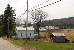 | |
 Montcerf-Lytton Location in western Quebec. | |
| Coordinates: 46°32′N 76°03′W / 46.533°N 76.050°WCoordinates: 46°32′N 76°03′W / 46.533°N 76.050°W[1] | |
| Country | |
| Province | |
| Region | Outaouais |
| RCM | La Vallée-de-la-Gatineau |
| Constituted | September 19, 2001 |
| Government | |
| • Mayor | Alain Fortin |
| • Federal riding | Pontiac |
| • Prov. riding | Gatineau |
| Area | |
| • Total | 379.80 km2 (146.64 sq mi) |
| • Land | 354.12 km2 (136.73 sq mi) |
| Population (2011)[3] | |
| • Total | 687 |
| • Density | 1.9/km2 (5/sq mi) |
| • Pop (2006–11) | |
| • Dwellings | 390 |
| Time zone | UTC−5 (EST) |
| • Summer (DST) | UTC−4 (EDT) |
| Postal code(s) | J0W 1N0 |
| Area code(s) | 819 |
| Website | www |


Montcerf-Lytton is a municipality in La Vallée-de-la-Gatineau Regional County Municipality, Quebec, Canada. Its territory spans both shores of the Désert River, a tributary of the Gatineau River.
Its population centres include: Brodeur, Chute-Rouge, Lytton, and Montcerf.
Montcerf has one of the best soil for cultivation across the Gatineau Valley region, supplemented by a network of lakes (most notably Clair, Desrivières, and Lytton Lakes) and forests, which are part of the Bras-Coupé–Désert ZEC.[4] Fishing and hunting are popular sport activities in this place.[5]
History[]
The Township of Lytton was formed in 1869, named after Lord Edward Bulwer-Lytton (1803-1873). The township municipality was set up in 1909.[4] with M.W.P. O'Connor as first mayor. In 1916, telephone service is established in Lytton, but not until 1952 did electricity arrive.[6]
Montcerf was opened for colonization in 1870. Formerly spelled "Moncerf" or "Mont Cerf", it became Montcerf (French for "Mount Deer") during the nineteenth century and the name presumably refers to a mountain which rises near the village and once teemed with deer and moose. The mission of Sainte-Philomène-de-Montcerf was established in 1872 and the Montcerf Post Office opened in 1886. The Municipality of Montcerf was officially set up in 1920[5] with Abraham Mathieu as first mayor. In 1929, electricity arrived in Montcerf, followed by telephone service in 1948.[6]
On September 19, 2001, the Municipality of Montcerf and the Lytton Township Municipality were merged into the new Municipality of Montcerf-Lytton[5] with Fernand Lirette (mayor of Montcerf since 1974) as first mayor.[6]
Demographics[]
Population trend:[7]
- Population in 2011: 687 (2006 to 2011 population change: -7.0%)
- Population in 2006: 739
- Population total in 2001: 703
- Montcerf: 422
- Lytton: 281
- Population in 1996:
- Montcerf: 474
- Lytton: 252
- Population in 1991:
- Montcerf: 484
- Lytton: 240
Private dwellings (occupied by usual residents): 302
Languages:
- French as first language: 100%
In popular culture[]
Montcerf is mentioned in David Foster Wallace's novel Infinite Jest. The character John ("no relation") Wayne originally hails from Montcerf.
References[]
- ^ Reference number 370022 of the Commission de toponymie du Québec (in French)
- ^ Jump up to: a b Geographic code 83088 in the official Répertoire des municipalités (in French)
- ^ Jump up to: a b "(Code 2483088) Census Profile". 2011 census. Statistics Canada. 2012.
- ^ Jump up to: a b "Lytton (Canton)" (in French). Commission de toponymie du Québec. Retrieved 2008-08-21.
- ^ Jump up to: a b c "Montcerf (Municipalité)" (in French). Commission de toponymie du Québec. Retrieved 2008-08-21.
- ^ Jump up to: a b c "Historique Montcerf-Lytton" (in French). Municipalité de Montcerf-Lytton. Archived from the original on 2008-09-08. Retrieved 2008-08-21.
- ^ Statistics Canada: 1996, 2001, 2006, 2011 census
| show Places adjacent to Montcerf-Lytton |
|---|
| hide | |
|---|---|
| Cities | |
| Municipalities |
|
| Townships | |
| Unorganized territories |
|
| |
| Authority control |
|
|---|
- Incorporated places in Outaouais
- Municipalities in Quebec