Papineau Regional County Municipality
Papineau | |
|---|---|
 | |
| Coordinates: 45°53′N 75°03′W / 45.883°N 75.050°WCoordinates: 45°53′N 75°03′W / 45.883°N 75.050°W[1] | |
| Country | |
| Province | |
| Region | Outaouais |
| Effective | January 1, 1983 |
| County seat | Papineauville |
| Government | |
| • Type | Prefecture |
| • Prefect | M. Benoit Lauzon |
| Area | |
| • Total | 3,205.90 km2 (1,237.80 sq mi) |
| • Land | 2,941.79 km2 (1,135.83 sq mi) |
| Population (2016)[3] | |
| • Total | 22,832 |
| • Density | 7.8/km2 (20/sq mi) |
| • Change 2011-2016 | |
| • Dwellings | 15,893 |
| Time zone | UTC−5 (EST) |
| • Summer (DST) | UTC−4 (EDT) |
| Area code(s) | 819 |
| Website | www |

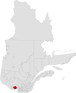
Papineau is a regional county municipality in the Outaouais region of Quebec, Canada. The seat is Papineauville.
Subdivisions[]
There are 24 subdivisions within the RCM:[2]
| Name | Type | Population (2016) |
Area (km2) |
Density (inhab./km2) |
|---|---|---|---|---|
| Boileau | Municipality | 335 | 136.33 | 2.5 |
| Bowman | Municipality | 658 | 129.30 | 5.1 |
| Chénéville | Municipality | 764 | 66.76 | 11.4 |
| Duhamel | Municipality | 430 | 434.57 | 1.0 |
| Fassett | Municipality | 431 | 12.49 | 34.5 |
| Lac-des-Plages | Municipality | 431 | 152.94 | 2.8 |
| Lac-Simon | Municipality | 944 | 97.48 | 9.7 |
| Lochaber | Township | 415 | 60.70 | 6.8 |
| Lochaber-Partie-Ouest | Township | 856 | 57.45 | 14.9 |
| Mayo | Municipality | 601 | 73.25 | 8.2 |
| Montebello | Municipality | 983 | 8.62 | 114.0 |
| Montpellier | Municipality | 985 | 249.14 | 4.0 |
| Mulgrave-et-Derry | Municipality | 369 | 293.75 | 1.3 |
| Namur | Municipality | 572 | 56.76 | 10.1 |
| Notre-Dame-de-Bonsecours | Municipality | 301 | 264.97 | 1.1 |
| Notre-Dame-de-la-Paix | Municipality | 648 | 106.62 | 6.1 |
| Papineauville | Municipality | 2,101 | 61.33 | 34.3 |
| Plaisance | Municipality | 1,088 | 36.15 | 30.1 |
| Ripon | Municipality | 1,542 | 131.47 | 11.7 |
| Saint-André-Avellin | Municipality | 3,749 | 137.99 | 27.2 |
| Saint-Émile-de-Suffolk | Municipality | 477 | 56.68 | 8.4 |
| Saint-Sixte | Municipality | 469 | 85.33 | 5.5 |
| Thurso | City | 2,818 | 6.28 | 449.0 |
| Val-des-bois | Municipality | 865 | 225.42 | 3.8 |
| Total | 22,832 | 2,941.79 | 7.8 | |
Demographics[]
| hideCanada census – Papineau Regional County Municipality community profile | |||
|---|---|---|---|
| 2016 | 2011 | ||
| Population: | 22,832 (1.3% from 2011) | 22,541 (3.1% from 2006) | |
| Land area: | 2,941.79 km2 (1,135.83 sq mi) | 2,941.82 km2 (1,135.84 sq mi) | |
| Population density: | 7.8/km2 (20/sq mi) | 7.7/km2 (20/sq mi) | |
| Median age: | 52.1 (M: 52.2, F: 52.0) | 49.9 (M: 49.8, F: 50.1) | |
| Total private dwellings: | 15,893 | 14,569 | |
| Median household income: | $51,196 | $44,308 | |
| References: 2016[4] 2011[5] earlier[6] | |||
| Year | Pop. | ±% |
|---|---|---|
| 1986 | 18,790 | — |
| 1991 | 19,526 | +3.9% |
| 1996 | 20,308 | +4.0% |
| 2001 | 20,367 | +0.3% |
| 2006 | 21,863 | +7.3% |
| 2011 | 22,541 | +3.1% |
| 2016 | 22,832 | +1.3% |
Mother tongue from Canada 2016 Census[3]
| Language | Population | Pct (%) |
|---|---|---|
| French only | 21,015 | 92.6% |
| English only | 1,150 | 5.1% |
| Both English and French | 250 | 1.1% |
| Other languages | 270 | 1.19% |
In 2016, the population of Papineau was 22,832 inhabitants. The population of Papineau is roughly 93% francophone and 5% anglophone.[3]
Transportation[]
Access Routes[]
Highways and numbered routes that run through the municipality, including external routes that start or finish at the county border:[7]
|
|
|
See also[]
References[]
- ^ Reference number 141047 of the Commission de toponymie du Québec (in French)
- ^ Jump up to: a b c Geographic code 800 in the official Répertoire des municipalités (in French)
- ^ Jump up to: a b c d "Census Profile, 2016 Census: Papineau, Municipalité régionale de comté [Census division], Quebec". Statistics Canada. Retrieved December 3, 2019.
- ^ "2016 Community Profiles". 2016 Canadian Census. Statistics Canada. February 21, 2017. Retrieved 2019-12-20.
- ^ "2011 Community Profiles". 2011 Canadian Census. Statistics Canada. July 5, 2013. Retrieved 2019-12-20.
- ^ "2001 Community Profiles". 2001 Canadian Census. Statistics Canada. February 17, 2012.
- ^ "Official Transport Quebec Road Map". Archived from the original on 2011-02-24. Retrieved 2009-05-30.
External links[]
| Wikimedia Commons has media related to Papineau Regional County Municipality. |
| show Adjacent Counties & Equivalent Territories |
|---|
| show Authority control |
|---|
Categories:
- Regional county municipalities in Outaouais
- Census divisions of Quebec