Les Laurentides Regional County Municipality
Les Laurentides | |
|---|---|
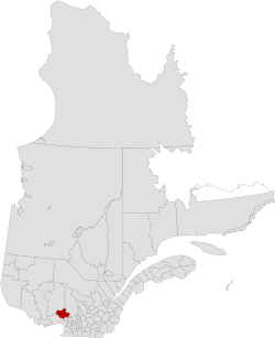 Location in province of Quebec. | |
| Coordinates: 46°07′N 74°36′W / 46.117°N 74.600°WCoordinates: 46°07′N 74°36′W / 46.117°N 74.600°W[1] | |
| Country | |
| Province | |
| Region | Laurentides |
| Effective | January 1, 1983 |
| County seat | Saint-Faustin–Lac-Carré |
| Government | |
| • Type | Prefecture |
| • Prefect | Ronald Provost |
| Area | |
| • Total | 2,599.70 km2 (1,003.75 sq mi) |
| • Land | 2,479.05 km2 (957.17 sq mi) |
| Population (2016)[3] | |
| • Total | 45,902 |
| • Density | 18.5/km2 (48/sq mi) |
| • Change 2011-2016 | |
| • Dwellings | 36,150 |
| Time zone | UTC−5 (EST) |
| • Summer (DST) | UTC−4 (EDT) |
| Area code(s) | 819 |
| Website | www |

Les Laurentides (The Laurentians) is a regional county municipality in the Laurentides region of Quebec, Canada. The seat is in Saint-Faustin–Lac-Carré. It is named after the Laurentian Mountains.
The population was 45,902 according to the 2016 Canadian Census.[3]
Subdivisions[]
|
|
|
|
|
Transportation[]
Access Routes[]
Highways and numbered routes that run through the municipality, including external routes that start or finish at the county border:[4]
|
|
|
See also[]
References[]
- ^ Reference number 141069 of the Commission de toponymie du Québec (in French)
- ^ Jump up to: a b Geographic code 780 in the official Répertoire des municipalités (in French)
- ^ Jump up to: a b c "Census Profile, 2016 Census: Les Laurentides, Municipalité régionale de comté [Census division], Quebec". Statistics Canada. Retrieved November 27, 2019.
- ^ Official Transport Quebec Road Map
External links[]
| show Adjacent Counties & Equivalent Territories |
|---|
| show Authority control |
|---|
This Quebec location article is a stub. You can help Wikipedia by . |
Categories:
- Regional county municipalities in Laurentides
- Census divisions of Quebec
- Quebec geography stubs