Quebec Route 117
  | ||||
|---|---|---|---|---|
| Route Transcanadienne | ||||
 | ||||
| Route information | ||||
| Maintained by Transports Québec | ||||
| Length | 661 km[1] (411 mi) | |||
| Major junctions | ||||
| South end | ||||
| North end | ||||
| Highway system | ||||
| ||||

Route 117, the Trans Canada Highway Northern Route, is a provincial highway within the Canadian province of Quebec, running between Montreal and the Quebec/Ontario border where it continues as Highway 66 east of Kearns, Ontario. It is an important road as it is the only direct route between southern Quebec and the Abitibi-Témiscamingue region.
Route 117 was formerly Route 11 and ran from Montreal north towards Mont-Laurier, then followed the Gatineau River south towards Gatineau. This routing is joined with Autoroute 15 from Montreal northwards towards Mont Tremblant. Route 117 also takes in the former Quebec Routes 58 and 59.
Along with Autoroute 15 to Sainte-Agathe-des-Monts, it is also listed as a branch of the Trans-Canada Highway. Ontario Highway 17 is also a branch of the Trans-Canada Highway though it is an unrelated route that parallels it by approx. 200 km.
Route description[]
This description of Route 117 follows it from the south-east to north-west direction.
Route 117 starts in Montreal at the Decarie Interchange where Autoroute 40 and Autoroute 15 (Decarie Expressway) meet. Montrealers sometimes unofficially extend Route 117 south along the portion of Decarie Boulevard that runs parallel to the Decarie Expressway.

From the Decarie Interchange Route 117 goes north on Boulevard Marcel-Laurin to KellerBoulevard (formerly Laurentian Boulevard in Saint-Laurent only). On Laurentian Boulevard in Cartierville to Keller Boulevard, south bound only. On Lachapelle Street, from Keller Boulevard north bound only, crossing the Rivière des Prairies over the Lachapelle Bridge to Île Jésus, continuing through the Laval communities of Chomedey, Fabreville and Sainte-Rose, north bound as Boulevard Curé-Labelle, Boulevard Chomedey at the former Chenoy's deli, left turn at Boulevard Cartier and back into Boulevard Curé-Labelle, south bound as Boulevard Curé-Labelle.
At the Rivière des Mille Îles, it crosses over the to the "North Shore" (of the Rivière des Mille Îles). From here Route 117 runs parallel to Autoroute 15 until Sainte-Agathe-des-Monts, going through the Laurentian mountains. Towns along the route in this section include:
- Rosemère
- Sainte-Thérèse
- Blainville
- Mirabel
- Saint-Jérôme (Saint-Antoine)
- Saint-Jérôme
- Saint-Jérôme (Lafontaine)
- Prévost
- Piedmont
- Sainte-Adèle
- Val Morin
- Val-David
- Sainte-Agathe-des-Monts
After Sainte-Agathe-des-Monts, Route 117 continues as a four-lane divided highway winding its way through Laurentides Regional County Municipality until it reaches the town of Labelle. From this point on to the Ontario border, Route 117 is mostly a standard 2-lane highway. In Grand-Remous, Route 117 crosses the Gatineau River and intersects with Route 105 which goes south-west to Maniwaki and Gatineau. Towns along the route in this section include:
- Saint-Faustin-Lac-Carré
- Mont-Tremblant (going through the area which, until the merger in 2000, formed the village and parish of Saint-Jovite).
- La Conception
- Labelle
- Rivière-Rouge
- Lac-Saguay
- Lac-des-Écorces
- Mont-Laurier
- Mont-Laurier (Saint-Jean-sur-le-Lac)
- Mont-Laurier (Lac-Gatineau)
- Grand-Remous

From Grand-Remous, the route heads north, travelling some 220 km through undeveloped wilderness, most of it part of La Vérendrye Wildlife Reserve. While the reserve is popular for a variety of outdoor activities, services along the road are sparse. This section is often considered one of the most dangerous routes in the province due to numerous fatal accidents, some involving tractor-trailers. During the winter, the route is often extremely slippery, even during dry and clear days. The few communities along this section are:
- Val-d'Or (Louvicourt)
After the intersection with Route 113 (which continues north to Lebel-sur-Quévillon), Route 117 heads west to Ontario where it becomes Highway 66. The section between Rouyn-Noranda and Arntfield runs concurrent with Route 101. Towns along the route in this section include:
- Val-d'Or
- Val-d'Or (Dubuisson)
- Malartic
- Rivière-Héva
- Rouyn-Noranda (Cadillac)
- Rouyn-Noranda (McWatters)
- Rouyn-Noranda
- Rouyn-Noranda (Évain)
- Rouyn-Noranda (Arntfield)
See also[]
- List of Quebec provincial highways
- Golden Highway (Ontario)
References[]
- ^ Ministère des transports, "Distances routières", page 59-60, Les Publications du Québec, 2005
External links[]
| Wikimedia Commons has media related to Quebec Route 117. |
Route map:

| ( • help)
|
Portions of the Trans-Canada Highway system | ||
|---|---|---|
| British Columbia | 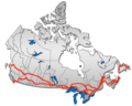 | |
| Alberta | ||
| Saskatchewan |
| |
| Manitoba | ||
| Ontario |
| |
| Quebec |
| |
| New Brunswick | ||
| ||
| Prince Edward Island | ||
| Nova Scotia | ||
| Newfoundland | ||
| ||
- Quebec Routes
- Trans-Canada Highway
- Roads in Laval, Quebec
- Roads in Montreal
- Transport in Rouyn-Noranda
- Roads in Abitibi-Témiscamingue
- Roads in Laurentides