Newfoundland and Labrador Route 1
 | ||||
|---|---|---|---|---|
| Route Transcanadienne | ||||
| Trans-Canada Highway | ||||
 Route 1 highlighted in red | ||||
| Route information | ||||
| Maintained by | ||||
| Length | 903 km (561 mi) | |||
| Major junctions | ||||
| West end | ||||
| ||||
| East end | ||||
| Highway system | ||||
Highways in Newfoundland and Labrador
| ||||
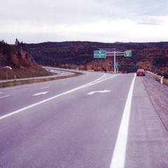
Route 1 is a highway in the Canada province of Newfoundland and Labrador, and is the easternmost stretch of the Trans-Canada Highway. Route 1 is the primary east–west road on the island of Newfoundland.[1]
The eastern terminus of Route 1 is St. John's. From there, the highway crosses the island 903 kilometres (561 mi) to Channel-Port aux Basques, its western terminus.
From there, the Trans-Canada Highway is carried across the Cabot Strait by ferry to North Sydney, Nova Scotia.
Route description[]
The following description details the highway from its eastern terminus to its western terminus.
Route 1's official eastern terminus is at the interchange with Logy Bay Road in the northeastern part of the city. The highway begins as a freeway, proceeding west on the Outer Ring Road. Route 1 maintains the name Outer Ring Road, intersecting with St. John's roads such as Aberdeen Avenue, Portugal Cove Road, Torbay Road, Allandale Road, Thorburn Road, Topsail Road and Kenmount Road until the interchange with Pitts Memorial Drive, 20 km to the west.
Route 1 proceeds in a generally southwestern direction for another 25 km as it follows the southern shore of Conception Bay (several kilometres inland) until it reaches the interchange with Route 13 where it turns west and then northwest, continuing for another 29 km on a 4-lane expressway to Whitbourne where the freeway ends at the interchange with Route 80/81.
Route 1 transitions to a 2-lane controlled access highway and continues northwest from Whitbourne along the isthmus of the Avalon Peninsula and 188 km north to Glovertown, bypassing Clarenville, small communities like Arnold's Cove, Goobies and passing through Terra Nova National Park; park admission is not required to use Route 1. The Bonavista Peninsula and Burin Peninsula can be accessed via interchanges near Clarenville and Goobies, respectively.
From Glovertown, the highway proceeds northwest 182 km to Badger, bypassing Gander, Glenwood. Lewisporte (about 11 km north on Route 340), Norris Arm Bishop's Falls and Grand Falls-Windsor; Route 1 has a 6 km 4-lane section through Grand Falls-Windsor. As of August 2008, there are no gas stations along the highway between the towns of Gander and Bishop's Falls. The Isles of Notre Dame region of the province, which includes Fogo, the Twillingate Islands, New World Island and surrounding areas, can be accessed via Route 340 at the interchange near Lewisporte. The Bay d'Espoir region can be accessed via the Bay D'Espoir Highway near Botwood. Botwood, Point Leamington and Leading Tickles can be accessed via the Botwood Highway, officially Route 350 at an interchange in the Bishop's Falls-Grand Falls-Windsor area.
From Badger, Route 1 heads due north for 64 km to Springdale where the highway swings southwest for 137 km to Pasadena, passing through Deer Lake.
At Pasadena, the highway transitions to a 4-lane expressway and continues southwest along the south shore of Deer Lake before following the Humber River through the narrow Humber Valley. The 4-lane section proceeds for 38 km in a southwest direction, where it transitions back to a 2-lane controlled access highway west of the interchange with Route 450 (Lewin Parkway), southwest of Corner Brook.
From the Confederation Drive interchange, Route 1 proceeds for 213 km in a southwest direction, bypassing Stephenville (accessible via Route 460 and Route 490) and passing through the Codroy Valley (where it is a 2-lane uncontrolled access highway) to Port aux Basques. It terminates southeast of the town at the Marine Atlantic ferry terminal.
New alignment[]
New highway construction during the 1990s extended Route 1 on what is called the Outer Ring Road to the interchange with Logy Bay Road in the northeast part of St. John's, including passing by the Stavanger Drive Shopping Area. Prior to this construction, Route 1 and the Trans-Canada Highway designation began at St. John's City Hall on New Gower Street and proceeded west on Pitts Memorial Drive and then on the current alignment of Route 1 to the southwest. It is for this reason that the city named its hockey arena and convention centre Mile One Centre, adjacent to the city hall.
To follow an unofficial alignment of Route 1 from St. John's City Hall, one must head geographically east for 1.5 km into the southeastern part of the city, continuing onto Duckworth Street (Route 60). Proceed north for 1 km on Ordnance Street and King's Bridge Road before turning east for 1.5 km along the north shore of Quidi Vidi Lake on The Boulevard.
Continue north on East White Hills Road, which becomes controlled access several hundred metres north of its intersection with The Boulevard. The East White Hills Road transitions into the Outer Ring Road 4 km to the north at the interchange with the Logy Bay Road.
Exit list[]
| Location | km | mi | Exit | Destinations | Notes |
|---|---|---|---|---|---|
| Cabot Strait | 903 | 561 | |||
| Channel-Port aux Basques | 903 | 561 | |||
| 902 | 560 | 1 | Provides access to | ||
| 901 | 560 | - | High Street | Unnumbered Exit | |
| 899 | 559 | - | Grand Bay West | At-grade intersection | |
| | 895 | 556 | - | Edna's Road - | At-grade intersection |
| | 893 | 555 | - | J.T. Cheeseman Provincial Park main entrance | At-grade intersection; access road into park |
| | 877 | 545 | - | At-grade intersection | |
| Tompkins | 868 | 539 | - | At-grade intersection | |
| 865 | 537 | - | At-grade intersection | ||
| South Brook | 848 | 527 | - | South Brook | At-grade intersection |
| 844 | 524 | - | South Brook | At-grade intersection | |
| | 808 | 502 | - | At-grade intersection | |
| | 807 | 501 | - | main entrance | At-grade intersection; access road into park |
| | 804 | 500 | - | At-grade intersection | |
| Robinsons | 798 | 496 | - | At-grade intersection | |
| | 770 | 480 | - | At-grade intersection | |
| | 765 | 475 | - | At-grade intersection | |
| Barachois Brook | 759 | 472 | 2 | Katarina Roxon Way | |
| Barachois Pond Provincial Park | 750 | 470 | - | Barachois Pond Provincial Park main entrance | At-grade intersection; access road into park |
| 747 | 464 | - | At-grade intersection; provides access to | ||
| 735 | 457 | 3 | |||
| | 731 | 454 | - | At-grade intersection | |
| Corner Brook | 691 | 429 | 4 | ||
| 688 | 428 | 5 | Massey Drive | ||
| 686 | 426 | 6 | |||
| 682 | 424 | 7 | Admiral Palliser's Trail | ||
| Steady Brook | 679 | 422 | 8 | Marble Drive | Marble Mountain |
| Humber Village | 673 | 418 | 9 | Marble Drive | |
| Little Rapids | 669 | 416 | 10 | Strawberry Loop, Strawberry Lane | |
| 666 | 414 | 11 | Bonnell Drive, Boom Siding Road | ||
| Pasadena | 659 | 409 | 12 | Main Street, Boom Siding Road | |
| 649 | 403 | 13 | Stentaford Avenue | ||
| St. Jude's | 643 | 400 | 14 | Ridgeview Road | |
| Deer Lake | 639 | 397 | 15A | Glide Lake Road | |
| 638 | 396 | 15 | High Street | ||
| 636 | 395 | 16 | Viking Trail | ||
| 637 | 396 | - | Airport road - | At-grade intersection; access road into airport | |
| | 610 | 380 | - | At-grade intersection | |
| 594 | 369 | - | At-grade intersection | ||
| Sheppardville | 542 | 337 | - | At-grade intersection; Dorset Trail | |
| 541 | 336 | - | Sheppardville | At-grade intersection | |
| | 521 | 324 | - | At-grade intersection | |
| | 520 | 320 | - | At-grade intersection; access road into airport | |
| South Brook | 508 | 316 | - | At-grade intersection; provides access to | |
| | 465 | 289 | - | main entrance | At-grade intersection; access road into park |
| Badger | 456 | 283 | - | At-grade intersection; Buchans Highway | |
| | 435 | 270 | - | Now closed at-grade intersection | |
| | 433 | 269 | - | At-grade intersection | |
| Grand Falls-Windsor | 429 | 267 | 17 | Main Street | |
| 427 | 265 | - | Duggan Street | Unnumbered Exit; westbound exit and entrance only | |
| 426 | 265 | 18 A/B | Cromer Avenue | ||
| 425 | 264 | 19 | Union Street | ||
| 424 | 263 | 20 | Scott Avenue | ||
| Bishops Falls | 412 | 256 | 21 | Main Street - Bishops Falls | |
| 408 | 254 | 22 | |||
| 407 | 253 | - | At-grade intersection; Bay d’Espior Highway | ||
| Norris Arm | 403 | 250 | - | At-grade intersection | |
| 385 | 239 | - | At-grade intersection | ||
| | 383 | 238 | - | Norris Arm North Side | At-grade intersection |
| 377 | 234 | 23 | Road to the Isles; provides access to | ||
| 376 | 234 | - | main entrance | At-grade intersection; access road into park | |
| Glenwood | 360 | 220 | - | Forest Resource Road - Salmon Pond, Lumber Yard | Unnumbered Exit |
| 359 | 223 | - | Spruce Avenue | At-grade intersection | |
| 358 | 222 | - | Main Street / River Drive | At-grade intersection | |
| Appleton | 357 | 222 | - | River Road / Richards Road | At-grade intersection |
| 356 | 221 | - | Bowater Road / Simms Road | At-grade intersection | |
| Gander | 334 | 208 | - | Magee Road - Gander | At-grade intersection |
| 333 | 207 | - | Caldwell Street - Gander | At-grade intersection | |
| 332 | 206 | - | Cobhan Street - Gander | At-grade intersection | |
| 331 | 206 | - | At-grade intersection; Road to the shore; provides access to Gander International Airport and Canadian Forces Base Gander | ||
| Benton | 315 | 196 | - | Benton | At-grade intersection |
| Gambo | 291 | 181 | 24 | Road to the Shore | |
| Glovertown | 274 | 170 | 25 | Road to the Beaches | |
| Terra Nova National Park | 265 | 165 | - | At-grade intersection | |
| 249 | 155 | - | At-grade intersection | ||
| 242 | 150 | - | Charlottetown | At-grade intersection | |
| Port Blandford | 222 | 138 | - | Main Street - Port Blandford | At-grade intersection |
| 219 | 136 | - | Blackmore’s Road - Port Blandford | At-grade intersection | |
| 218 | 135 | - | At-grade intersection | ||
| George's Brook | 202 | 126 | 26 | Discovery Trail | |
| Clarenville | 192 | 119 | - | At-grade intersection | |
| Deep Bight | 182 | 113 | - | Deep Bight, Adeytown | At-grade intersection |
| Adeytown | 177 | 110 | - | Adeytown, Deep Bight | At-grade intersection |
| Hillview | 174 | 108 | - | At-grade intersection | |
| Ivany's Cove | 171 | 106 | - | Ivany's Cove, North West Brook | At-grade intersection |
| North West Brook | 168 | 104 | - | At-grade intersection | |
| Goobies | 159 | 99 | - | At-grade intersection; provides access to | |
| Come By Chance | 148 | 92 | 26B | Main Road - Come By Chance, Sunnyside | |
| Arnold's Cove | 141 | 88 | 26A | Refinery Road - Arnold's Cove | |
| | 134 | 83 | - | Southern Harbour | At-grade intersection |
| | 121 | 75 | - | At-grade intersection; Osprey Trail | |
| Bellevue Beach | 114 | 71 | - | At-grade intersection | |
| Chapel Arm | 99 | 62 | 27 | Osprey Trail (Route 201) | |
| Whitbourne | 88 | 55 | - | At-grade intersection; provides access to | |
| 86 | 53 | 28 | Baccalieu Trail (Route 80) | ||
| 78 | 48 | 29 | Ocean Pond Road | ||
| 75 | 47 | 30 | |||
| Roaches Line | 71 | 44 | 31 | Baccalieu Trail | |
| Brigus Junction | 68 | 42 | 32 | Brigus Junction Road - Brigus Junction | |
| 63 | 39 | 33 | Middle Gull Pond Road | ||
| Avondale | 61 | 38 | 34 | ||
| Holyrood | 57 | 35 | 35 | Western portion of Irish Loop Drive | |
| 49 | 30 | 36 | |||
| 47 | 29 | 37 | |||
| 43 | 27 | 38 | Butter Pot Provincial Park | ||
| Conception Bay South | 30 | 19 | 39 | ||
| St. John's | 25 | 16 | 40 | Paddy's Pond/Cochrane Pond | |
| 19 | 12 | 41 A/B | Outer Ring Road | ||
| Mount Pearl | 17 | 11 | 42 A/B | Kenmount Road - Mount Pearl | Outer Ring Road |
| Paradise | 16 | 9.9 | 43 | Outer Ring Road | |
| St. John's | 12 | 7.5 | 44 | Outer Ring Road | |
| 10 | 6.2 | 45 | Outer Ring Road | ||
| 6 | 3.7 | 46 | Allandale Road - Confederation Building, Pippy Park | Outer Ring Road | |
| 4 | 2.5 | 47 A/B | Outer Ring Road. Provides access to St. John's International Airport and the | ||
| 3 | 1.9 | 48 A/B | Outer Ring Road. No access from Route 20 to Route 1 eastbound | ||
| 2 | 1.2 | 49 | Aberdeen Avenue, Stavanger Drive | Outer Ring Road | |
| 0 | 0.0 | 50 | Outer Ring Road. Eastern terminus; eastbound exit and westbound entrance; road continues east as E White Hills Road | ||
1.000 mi = 1.609 km; 1.000 km = 0.621 mi
| |||||
References[]
External links[]
Route map:

| ( • help)
|
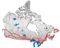
Portions of the Trans-Canada Highway system | ||
|---|---|---|
| British Columbia |
|  |
| Alberta |
| |
| Saskatchewan |
| |
| Manitoba |
| |
| Ontario |
| |
| Quebec | ||
| New Brunswick |
| |
| ||
| Prince Edward Island | ||
| Nova Scotia | ||
| Newfoundland | ||
| ||
| Wikimedia Commons has media related to Newfoundland and Labrador Route 1. |
- Newfoundland and Labrador provincial highways
- Trans-Canada Highway
- Conception Bay South
- Corner Brook
- Grand Falls-Windsor
- Streets in St. John's, Newfoundland and Labrador