Louis-Hippolyte Lafontaine Bridge–Tunnel
show This article may be expanded with text translated from the corresponding article in French. (December 2017) Click [show] for important translation instructions. |
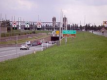 Montreal entrance to tunnel, 2009 | |
| Overview | |
|---|---|
| Location | Montreal, Quebec, Canada |
| Route | Autoroute 25/Trans-Canada Highway |
| Crosses | St. Lawrence River |
| Operation | |
| Opened | March 11, 1967 |
| Traffic | 120,000[1] |
| Character | Limited access highway |
| Technical | |
| Length | 1,391 m (4,563.6 ft) (tunnel section) 409 m (1,341.9 ft) (causeway section) |
| No. of lanes | 6 |
| Tunnel clearance | 4.4 m (14 ft 5+1⁄4 in) |
| Width | 37 m (121.4 ft) |
 Louis-Hippolyte Lafontaine Bridge–Tunnel (Montreal) | |
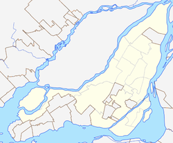
The Louis-Hippolyte Lafontaine Bridge–Tunnel (French: Pont-Tunnel Louis-Hippolyte-La Fontaine) is a highway bridge–tunnel running over and beneath the Saint Lawrence River. It connects the Montreal borough of Mercier–Hochelaga-Maisonneuve with the south shore of the river at Longueuil, Quebec.
Named after Lower Canada political reformer Louis-Hippolyte Lafontaine, the Lafontaine Tunnel is an immersed tube structure, measuring 1,391 m (4,563.6 ft) long. It carries the Autoroute 25 expressway and passes beneath the main shipping channel in the Saint Lawrence River immediately downstream from the Saint Lawrence Seaway. It surfaces on Île Charron (Îles de Boucherville at entrance/exit #1 of Autoroute 25), then continues by bridge to Longueuil. The bridge-tunnel sees about 120,000 daily crossings, of which 13% are trucks.[1] Its construction began in 1963 and it opened on March 11, 1967.[2][3]
History[]
In 1960, the construction of the Trans-Canada Highway (TCH) through Quebec from the Ontario border to Rivière-du-Loup was announced. In Montreal, to avoid having to build a huge bridge that would have disfigured the city and destroyed a neighbourhood, engineers opted for the construction of a tunnel located under the Saint Lawrence River and dug a trench under the river bed and buried the tunnel sections 4.6 metres (15 ft) to 6.1 metres (20 ft) under the river bed.
The Longue-Pointe church had to be demolished to make way for the tunnel, and 300 families were expropriated from the village in 1964.[4] The construction was completed in March 1967, just before the opening of Expo 67. Construction cost $75 million.[5]
A major four-year refurbishment of the tunnel is slated to begin in 2020.[1]
Specifications[]

Each of the seven tunnel sections weighs 32,000 t (31,000 long tons; 35,000 short tons),[3] is 110 metres (360 ft) long, 37 metres (121 ft) wide and rises to a height of 8 metres (26 ft). In total, the bridge–tunnel is 1.8 kilometres (1.1 mi) long.
The tunnel was built with sections prefabricated in dry dock and then sunk in the river,[6] 24 metres (79 ft) below the surface of the water.
It is one of the largest prestressed concrete structures in the world and is the longest bridge-tunnel in Canada.[2]
See also[]
- List of crossings of the Saint Lawrence River
- List of bridges in Montreal
References[]
- ^ Jump up to: a b c "Rebuilding Louis-Hippolyte-La Fontaine Tunnel a four-year ordeal". Montreal Gazette. 2018-06-21. Retrieved 2018-11-03.
- ^ Jump up to: a b "Louis-Hippolyte-Lafontaine, the longest bridge-tunnel in Canada, turns 50". Montreal Gazette. 2017-03-11. Retrieved 2017-12-20.
- ^ Jump up to: a b "Il y a 50 ans, le pont-tunnel était inauguré". Métro (in French). 2017-03-09. Retrieved 2017-12-20.
- ^ "Un village sacrifié pour le pont-tunnel". Métro (in French). 2017-03-09. Retrieved 2017-12-20.
- ^ "At 50, the Louis-Hippolyte-La Fontaine bridge-tunnel still a world-class wonder". CBC News. Retrieved 2017-12-20.
- ^ Ministère des Transports (2014-03-28). "Construction du Pont-tunnel Louis-Hippolyte-La Fontaine" (in French). Retrieved 2017-12-21.
External links[]
- Louis-Hippolyte Bridge–Tunnel (A-25) at Steve Anderson's montrealroads.com
- Louis-Hippolyte Lafontaine Tunnel at Structurae
| hide Bridges of the St. Lawrence River | ||||
|---|---|---|---|---|
| ||||
Coordinates: 45°34′46″N 73°28′46″W / 45.57944°N 73.47944°W

This article about a specific bridge in Quebec is a stub. You can help Wikipedia by . |
This tunnel-related article is a stub. You can help Wikipedia by . |
- Tunnels in Quebec
- Bridges in Montreal
- Bridge–tunnels in North America
- Transport in Longueuil
- Bridges over the Saint Lawrence River
- Tunnels completed in 1967
- Bridges on the Trans-Canada Highway
- Buildings and structures in Longueuil
- Mercier–Hochelaga-Maisonneuve
- Road bridges in Quebec
- Road tunnels in Canada
- Immersed tube tunnels in Canada
- 1967 establishments in Quebec
- Canadian bridge (structure) stubs
- Quebec building and structure stubs
- Quebec transport stubs
- Tunnel stubs