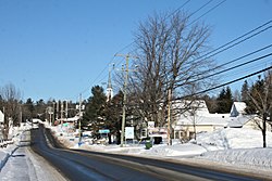
Saint-Colomban, Quebec
Saint-Colomban | |
|---|---|
City | |
 | |
 Location within La Rivière-du-Nord RCM | |
 St-Colomban Location in central Quebec | |
| Coordinates: 45°44′N 74°08′W / 45.73°N 74.13°WCoordinates: 45°44′N 74°08′W / 45.73°N 74.13°W[1] | |
| Country | |
| Province | |
| Region | Laurentides |
| RCM | La Rivière-du-Nord |
| Constituted | July 1, 1855 |
| Government | |
| • Mayor | Xavier-Antoine Lalande |
| • Federal riding | Mirabel |
| • Prov. riding | Argenteuil |
| Area | |
| • Total | 94.00 km2 (36.29 sq mi) |
| • Land | 93.56 km2 (36.12 sq mi) |
| Population (2011)[3] | |
| • Total | 13,080 |
| • Density | 139.8/km2 (362/sq mi) |
| • Pop 2006–2011 | |
| Time zone | UTC−5 (EST) |
| • Summer (DST) | UTC−4 (EDT) |
| Postal code(s) | J5K 1A1 |
| Area code(s) | 450 and 579 |
| Highways | No major routes |
| Website | www |

Saint-Colomban is a city in the regional county municipality of La Rivière-du-Nord in Québec, Canada. It is situated in the Laurentides region of Québec and was named in honour of Saint Columbanus.
The pioneer responsible for developing the village was the priest John Falvey, who constructed the parish and preached to the first parishioners.
Saint-Colomban was also the birthplace of Mr. Justice Emmett Hall, a justice of the Supreme Court of Canada widely considered to be one of the fathers of Medicare.

Town hall of St-Colomban
Education[]
The Commission scolaire de la Rivière-du-Nord operates French-language public schools.[4]
- École à l'Orée-des-Bois
- École de la Volière
- École des Hautbois
- New primary school (unnamed)
- The primary schools Bellefeuille and Prévost in Saint-Jérôme serve other sections
- and École polyvalente Saint-Jérôme, both in Saint-Jérôme
The Sir Wilfrid Laurier School Board operates English-language public schools:
- Laurentian Elementary School in Lachute[5]
- Laurentian Regional High School in Lachute[6]
Sources[]
- ^ Reference number 403498 of the Commission de toponymie du Québec (in French)
- ^ Jump up to: a b Geographic code 75005 in the official Répertoire des municipalités (in French)
- ^ Jump up to: a b "(Code 2475005) Census Profile". 2011 census. Statistics Canada. 2012.
- ^ "Trouver une école ou un centre." Commission scolaire de la Rivière-du-Nord. Retrieved on September 24, 2017. For attendance boundary information, click "Par bassin d'école"
- ^ "LAURENTIAN ELEMENTARY ZONE." Sir Wilfrid Laurier School Board. Retrieved on September 16, 2017.
- ^ "LAURENTIAN REGIONAL HS ZONE." Sir Wilfrid Laurier School Board. Retrieved on September 4, 2017.
- (in French) Répertoire des municipalités du Québec
- (in French) Commission de toponymie du Québec
- (in French) Affaires municipales et régions - cartes régionales
External links[]
 Media related to Saint-Colomban, Quebec at Wikimedia Commons
- (in French) Site officiel Saint-Colomban
- (in English) Site dedicated to Irish history of the original settlers
| show Places adjacent to Saint-Colomban, Quebec |
|---|
| hide | |
|---|---|
| Towns | |
| Municipalities | |
| |
| show Authority control |
|---|
This Quebec location article is a stub. You can help Wikipedia by . |
Categories:
- Incorporated places in Laurentides
- Cities and towns in Quebec
- Greater Montreal
- Quebec geography stubs