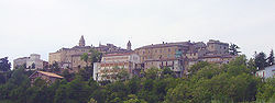
Monte Rinaldo
Monte Rinaldo | |
|---|---|
| Comune di Monte Rinaldo | |
 | |
 Coat of arms | |
Location of Monte Rinaldo  | |
 Monte Rinaldo Location of Monte Rinaldo in Italy | |
| Coordinates: 43°2′N 13°35′E / 43.033°N 13.583°E | |
| Country | Italy |
| Region | Marche |
| Province | Fermo (FM) |
| Government | |
| • Mayor | Marcello Vallorani |
| Area | |
| • Total | 7.8 km2 (3.0 sq mi) |
| Elevation | 485 m (1,591 ft) |
| Population | |
| • Total | 409 |
| • Density | 52/km2 (140/sq mi) |
| Demonym(s) | Monterinaldesi |
| Time zone | UTC+1 (CET) |
| • Summer (DST) | UTC+2 (CEST) |
| Postal code | 63020 |
| Dialing code | 0734 |
| Website | comune |


Monte Rinaldo is a comune (municipality) in the Province of Fermo in the Italian region Marche, located about 75 kilometres (47 mi) south of Ancona, about 30 kilometres (19 mi) north of Ascoli Piceno and 25 kilometres (16 mi) west of Fermo.
Monte Rinaldo borders the following municipalities: Monsampietro Morico, Montalto delle Marche, Montelparo, Montottone, Ortezzano.
References[]
- ^ "Superficie di Comuni Province e Regioni italiane al 9 ottobre 2011". Italian National Institute of Statistics. Retrieved 16 March 2019.
- ^ All demographics and other statistics: Italian statistical institute Istat.
- ^ "Popolazione Residente al 1° Gennaio 2018". Italian National Institute of Statistics. Retrieved 16 March 2019.
Categories:
- Cities and towns in the Marche
- Marche geography stubs