Montescheno
Montescheno | |
|---|---|
| Comune di Montescheno | |
show Location of Montescheno | |
 Montescheno Location of Montescheno in Italy | |
| Coordinates: 46°4′N 8°14′E / 46.067°N 8.233°ECoordinates: 46°4′N 8°14′E / 46.067°N 8.233°E | |
| Country | Italy |
| Region | Piedmont |
| Province | Province of Verbano-Cusio-Ossola (VB) |
| Frazioni | Barboniga, Cad Mater, Cat Pera, Cresti, Croppo, Ovesco, Progno, Sasso, Selve, Valeggia, Vallemiola, Zonca |
| Area | |
| • Total | 22.5 km2 (8.7 sq mi) |
| Elevation | 512 m (1,680 ft) |
| Population (December 2004)[2] | |
| • Total | 452 |
| • Density | 20/km2 (52/sq mi) |
| Demonym(s) | Monteschenesi |
| Time zone | UTC+1 (CET) |
| • Summer (DST) | UTC+2 (CEST) |
| Postal code | 28030 |
| Dialing code | 0324 |


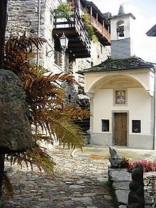
Montescheno is a comune (municipality) in the Province of Verbano-Cusio-Ossola in the Italian region Piedmont, located about 120 kilometres (75 mi) northeast of Turin and about 30 kilometres (19 mi) northwest of Verbania. As of 31 December 2004, it had a population of 452 and an area of 22.5 square kilometres (8.7 sq mi).[3]
The municipality of Montescheno contains the frazioni (subdivisions, mainly villages and hamlets) Barboniga, Cad Mater, Cat Pera, Cresti, Croppo, Ovesco, Progno, Sasso, Selve, Valeggia, Vallemiola, and Zonca.
Montescheno borders the following municipalities: Antrona Schieranco, Bognanco, Borgomezzavalle, Domodossola, Villadossola.
Demographic evolution[]

References[]
- ^ "Superficie di Comuni Province e Regioni italiane al 9 ottobre 2011". Istat. Retrieved 16 March 2019.
- ^ "Popolazione Residente al 1° Gennaio 2018". Istat. Retrieved 16 March 2019.
- ^ All demographics and other statistics: Italian statistical institute Istat.
| Authority control |
|
|---|
This article on a location in the Province of Verbano-Cusio-Ossola is a stub. You can help Wikipedia by . |
- Municipalities of the Province of Verbano-Cusio-Ossola
- Cities and towns in Piedmont
- Province of Verbano-Cusio-Ossola geography stubs