Moqhaka Local Municipality
Moqhaka | |
|---|---|
 Seal | |
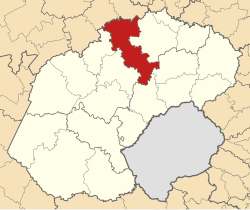 Location in the Free State | |
| Country | South Africa |
| Province | Free State |
| District | Fezile Dabi |
| Seat | Kroonstad |
| Wards | 25 |
| Government | |
| • Type | Municipal council |
| • Mayor | Cllr. M. Mokgosi |
| • Municipal Manager | Mr. S.M Mqwathi |
| Area | |
| • Total | 7,925 km2 (3,060 sq mi) |
| Population (2011)[2] | |
| • Total | 160,532 |
| • Density | 20/km2 (52/sq mi) |
| Racial makeup (2011) | |
| • Black African | 87.2% |
| • Coloured | 2.9% |
| • Indian/Asian | 0.3% |
| • White | 9.3% |
| First languages (2011) | |
| • Sotho | 74.6% |
| • Afrikaans | 13.6% |
| • Xhosa | 3.9% |
| • English | 2.5% |
| • Other | 5.4% |
| Time zone | UTC+2 (SAST) |
| Municipal code | FS201 |
Moqhaka is a municipality in the Fezile Dabi District, Free State Province, South Africa.[3] In 2001 the population was 267 881 with a total area of 7925 km ². The seat of local government is Kroonstad.[4] The community name is the South-Sotho-word for "crown".[5]
Main places[]
The 2001 census divided the municipality into the following main places:[6]
| Place | Code | Area (km2) | Population | Most spoken language |
|---|---|---|---|---|
| Kroonstad | 41701 | 232.04 | 23,992 | Afrikaans |
| Maokeng | 41702 | 12.62 | 67,929 | Sotho |
| Matlwangtlwang | 41703 | 1.59 | 6,441 | Sotho |
| Rammulutsi | 41705 | 4.03 | 24,578 | Sotho |
| Steynsrus | 41706 | 1.66 | 1,192 | Afrikaans |
| 41707 | 12.04 | 5,050 | Sotho | |
| Vierfontein | 41708 | 2.84 | 832 | Afrikaans |
| Viljoenskroon | 41709 | 13.73 | 2,514 | Afrikaans |
| Remainder of the municipality | 41704 | 7,619.38 | 35,362 | Sotho |
Politics[]
The municipal council consists of forty-five members elected by mixed-member proportional representation. Twenty-three councillors are elected by first-past-the-post voting in twenty-three wards, while the remaining twenty-two are chosen from party lists so that the total number of party representatives is proportional to the number of votes received. In the election of 3 August 2016 the African National Congress (ANC) won a majority of twenty-seven seats on the council. The following table shows the results of the election.[7][8]
| Party | Votes | Seats | ||||||
|---|---|---|---|---|---|---|---|---|
| Ward | List | Total | % | Ward | List | Total | ||
| ANC | 25,188 | 25,084 | 50,272 | 60.1 | 20 | 7 | 27 | |
| Democratic Alliance | 10,350 | 10,397 | 20,747 | 24.8 | 3 | 8 | 11 | |
| EFF | 3,301 | 3,451 | 6,752 | 8.1 | 0 | 4 | 4 | |
| Freedom Front Plus | 1,462 | 1,369 | 2,831 | 3.4 | 0 | 2 | 2 | |
| COPE | 882 | 819 | 1,701 | 2.0 | 0 | 1 | 1 | |
| African People's Convention | 127 | 232 | 359 | 0.4 | 0 | 0 | 0 | |
| ACDP | 170 | 175 | 345 | 0.4 | 0 | 0 | 0 | |
| PAC | 171 | 155 | 326 | 0.4 | 0 | 0 | 0 | |
| Azanian People's Organisation | 108 | 175 | 283 | 0.3 | 0 | 0 | 0 | |
| Independent | 25 | – | 25 | 0.0 | 0 | – | 0 | |
| Total | 41,784 | 41,857 | 83,641 | 100.0 | 23 | 22 | 45 | |
| Spoilt votes | 666 | 705 | 1,371 | |||||
References[]
- ^ "Contact list: Executive Mayors". Government Communication & Information System. Archived from the original on 14 July 2010. Retrieved 22 February 2012.
- ^ Jump up to: a b c "Statistics by place". Statistics South Africa. Retrieved 27 September 2015.
- ^ Website of Moqhaka Local Municipality
- ^ Municipal Demarcation Board
- ^ "South African Place Names explained". Retrieved 2013-10-06.
- ^ Lookup Tables - Statistics South Africa
- ^ "Results Summary – All Ballots: Moqhaka" (PDF). Independent Electoral Commission. Retrieved 25 December 2016.
- ^ "Seat Calculation Detail: Moqhaka" (PDF). Independent Electoral Commission. Retrieved 25 December 2016.
External links[]
| show Municipalities of the Free State |
|---|

| show Authority control |
|---|

- Local municipalities of the Fezile Dabi District Municipality
- Moqhaka