Mount Carbine, Queensland
| Mount Carbine Queensland | |||||||||||||||
|---|---|---|---|---|---|---|---|---|---|---|---|---|---|---|---|
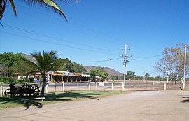 View from the service station on the eastern side of the Mulligan Highway across to the Mount Carbine hotel on the western side. | |||||||||||||||
 Mount Carbine | |||||||||||||||
| Coordinates | 16°31′39″S 145°08′03″E / 16.5276°S 145.1341°ECoordinates: 16°31′39″S 145°08′03″E / 16.5276°S 145.1341°E | ||||||||||||||
| Population | 101 (2016 census)[1] | ||||||||||||||
| • Density | 0.1013/km2 (0.2623/sq mi) | ||||||||||||||
| Postcode(s) | 4871 | ||||||||||||||
| Area | 997.2 km2 (385.0 sq mi) | ||||||||||||||
| Time zone | AEST (UTC+10:00) | ||||||||||||||
| LGA(s) | Shire of Mareeba | ||||||||||||||
| State electorate(s) | Cook | ||||||||||||||
| Federal Division(s) | Leichhardt | ||||||||||||||
| |||||||||||||||

Mount Carbine is a rural town and locality in the Shire of Mareeba, Queensland, Australia.[2][3] In the 2016 census, Mount Carbine had a population of 101 people.[1]
History[]
The town of Mount Carbine is said to be named after the horse that won the 1890 Melbourne Cup. The town had been first settled around that time by those who had come to mine the wolfram, discovered here that same year. These early miners, perhaps believing that their new settlement would become well known for its wealth, apparently decided that the famous Cup winner’s name was the most suitable.
In its early years, the town was entirely reliant upon the area’s wolfram deposits for its viability. The main period of growth in mining was from 1907, with John Moffat’s Irvinebank Company undertaking the major development of the mines. In this early period, Mount Carbine’s residents were predominantly those who were associated in some way with the wolfram mines, as well as their families.
Mine production expanded quite rapidly in the period up to World War One and at its height the town boasted around three hundred residents along with three hotels, a police station and a school as well as a range of small businesses.
Mount Carbine’s mines ceased operations in 1914, but were reopened after the First World War, thereafter being worked intermittently in line with positive price as well as demand influences. But during the 1920s, demand slowed substantially rendering the mines uneconomic. There was however another brief period of resurgence towards the end of the 1960s with mining again being undertaken. This lasted for some twenty years before the mines were again closed in the 1980s. The surviving useful plant and equipment was subsequently sold progressively or otherwise disposed of, mainly during the early 1990s. Over time, as with other similar mining areas, progressive rehabilitation of the old mine sites has been undertaken.[4]
Mount Carbine Post Office opened by September 1907 (a receiving office had been open from 1906) and closed in 1970.[5]
In the 2006 census, Mount Carbine had a population of 91.[6]
Between 2008 and 2013, Mount Carbine was within the Tablelands Region.
Geography[]
The Mitchell River forms part of the southern boundary before flowing through the west and forming the north- western boundary. The Mcleod River forms part of the northern boundary on its way to join the Mitchell.[7]
Road infrastructure[]
The Mulligan Highway runs through from east to north-west.
References[]
- ^ Jump up to: a b Australian Bureau of Statistics (27 June 2017). "Mount Carbine (SSC)". 2016 Census QuickStats. Retrieved 20 October 2018.

- ^ "Mount Carbine – town in Shire of Mareeba (entry 22985)". Queensland Place Names. Queensland Government. Retrieved 30 October 2019.
- ^ "Mount Carbine – locality in Shire of Mareeba (entry 48779)". Queensland Place Names. Queensland Government. Retrieved 30 October 2019.
- ^
 This Wikipedia article incorporates CC-BY-4.0 licensed text from: "Queensland Places - Mount Carbine". John Oxley Library Blogs - State Library of Queensland. State Library of Queensland. 19 June 2014. Retrieved 27 May 2021.
- ^ Phoenix Auctions History. "Post Office List". Phoenix Auctions. Retrieved 24 January 2021.
- ^ Australian Bureau of Statistics (25 October 2007). "Mount Carbine (Mareeba Shire) (State Suburb)". 2006 Census QuickStats. Retrieved 13 June 2011.
- ^ Google (20 August 2021). "Mount Carbine, Queensland" (Map). Google Maps. Google. Retrieved 20 August 2021.
| show Authority control |
|---|
This Queensland location article is a stub. You can help Wikipedia by . |
- Towns in Queensland
- Mining towns in Queensland
- Shire of Mareeba
- Localities in Queensland
- Queensland geography stubs