Mount Moriah (New Hampshire)
| Mount Moriah | |
|---|---|
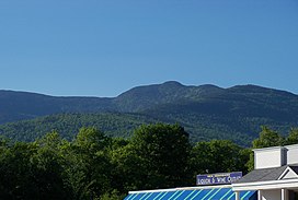 Mt. Moriah (center) from Gorham | |
| Highest point | |
| Elevation | 4,049 ft (1,234 m)[1] |
| Prominence | 922 ft (281 m)[1] |
| Parent peak | North Carter Mountain[1] |
| Listing | AMC New England Hundred Highest[2] |
| Coordinates | 44°20′25″N 71°07′53″W / 44.3403408°N 71.1314634°WCoordinates: 44°20′25″N 71°07′53″W / 44.3403408°N 71.1314634°W[3] |
| Geography | |
 Mount Moriah | |
| Location | Coös County, N.H., U.S. |
| Parent range | Carter-Moriah Range |
| Topo map | USGS Carter Dome |

Mount Moriah is a mountain located in Coos County, New Hampshire. The mountain is part of the Carter-Moriah Range of the White Mountains, which runs along the northern east side of Pinkham Notch. The summit is approximately 5 miles (8 km) southeast of the center of the town of Gorham. Mount Moriah is flanked to the northeast by Middle Moriah Mountain and to the southwest by Imp Mountain. The summit is located on the Appalachian Trail and affords views in all directions.[4]

Presidential Range as seen from the summit of Mount Moriah
See also[]
- List of mountains in New Hampshire
- White Mountain National Forest
References[]
- ^ a b c "Mount Moriah". Peakbagger.com. Retrieved 2019-07-07.
- ^ "Northeast USA 4000-foot Peaks". Peakbagger.com. Retrieved 2019-07-07.
- ^ "Mount Moriah". Geographic Names Information System. United States Geological Survey. Retrieved 2019-07-07.
- ^ "Mount Moriah". SummitPost.org. Retrieved 2019-07-07.
External links[]
This New Hampshire state location article is a stub. You can help Wikipedia by . |
Categories:
- Mountains of New Hampshire
- Mountains of Coös County, New Hampshire
- Mountains on the Appalachian Trail
- New England Four-thousand footers
- New Hampshire geography stubs