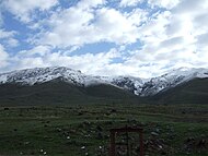
Mountains of Armenia
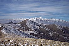
A view of Mount Aragats.
Armenia a land of rugged mountains and extinct volcanoes, its highest point is Mount Aragats, 13,435 ft (4,095 m).
Mountain ranges[]
- Javakheti mountain range
- , spanning east–west in the Shirak and Lori provinces in Northern Armenia
- , spanning northwest–southeast in the Lori and Kotayk provinces
- , east of Lake Sevan along the border with Azerbaijan
- Gegham mountain range
- Zangezur mountain range, in the southern Armenian province of Syunik


Prominent peaks[]
| Name | Elevation (m) | Province |
|---|---|---|
| Aragats | 4095 | Aragatsotn |
| Arailer | 2577 | Aragatsotn |
| 3101 | Triple point of Aragatsotn, Lori, Kotayk | |
| Achkasar | 3196 | Border of Shirak Province and Lori |
| 2992 | Border of Shirak Province and Lori | |
| 2545 | Lori | |
| 2246 | Lori | |
| 2851 | Kotayk | |
| 2993 | Tavush | |
| Artanish | 2460 | Gegharkunik |
| 2901 | Gegharkunik | |
| 3317 | Gegharkunik | |
| Azhdahak | 3598 | Gegharkunik |
| 3560 | Gegharkunik | |
| 3443 | Gegharkunik | |
| 3520 | Gegharkunik | |
| 2947 | Vayots Dzor | |
| 3594 | Syunik | |
| 3552 | Syunik | |
| Khustup | 3214 | Syunik |
| 3256 | Syunik | |
| Kaputjugh | 3906 | Syunik |
| 3392 | Syunik | |
| 2445 | Ararat | |
| 2300 | Ararat | |
| 2047 | Aragatsotn |
See also[]
References[]
- "Հայաստանի ամենաբարձր լեռները - vahemart - LiveJournal". Retrieved 19 September 2015.
- "ՀԱՅԱՍՏԱՆԻ ՀԱՆՐԱՊԵՏՈՒԹՅԱՆ ԱՇԽԱՐՀԱԳՐԱԿԱՆ" (PDF). Retrieved 19 September 2015.
List of mountains of Asia | |
|---|---|
| Sovereign states |
|
| States with limited recognition |
|
| Dependencies and other territories |
|
| |
Categories:
- Mountains of Armenia
- Lists of landforms of Armenia
- Lists of mountains of Asia
- Lists of mountains of Europe