Muglbach
This article may be expanded with text translated from the corresponding article in German. (September 2011) Click [show] for important translation instructions.
|
| Muglbach | |
|---|---|
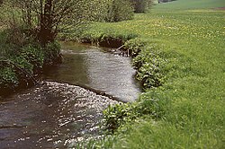 | |
| Native name | Mohelský potok (Czech) |
| Location | |
| Countries | |
| State (DE) | Bavaria |
| Region (CZ) | Karlovy Vary |
| Physical characteristics | |
| Source | |
| • elevation | 700 m (2,300 ft) |
| Mouth | |
• location | Wondreb |
• coordinates | 50°02′08″N 12°23′57″E / 50.03556°N 12.39917°ECoordinates: 50°02′08″N 12°23′57″E / 50.03556°N 12.39917°E |
• elevation | 445 m (1,460 ft) |
| Length | 19.1 km (11.9 mi) [1] |
| Basin features | |
| Progression | Wondreb→ Ohře→ Elbe→ North Sea |
Muglbach (Czech: Mohelský potok) is a river of Bavaria, Germany and the Czech Republic. It flows into the Wondreb (Odrava) near Cheb.
See also[]
References[]
- ^ Complete table of the Bavarian Waterbody Register by the Bavarian State Office for the Environment (xls, 10.3 MB)
This Karlovy Vary Region location article is a stub. You can help Wikipedia by . |
Categories:
- Tributaries of the Ohře
- Rivers of Bavaria
- Rivers of the Karlovy Vary Region
- Rivers of the Upper Palatine Forest
- Rivers of Germany
- International rivers of Europe
- Bavaria river stubs
- Karlovy Vary Region geography stubs
- Czech Republic river stubs