Mule Barn, Oklahoma
Mule Barn, Oklahoma | |
|---|---|
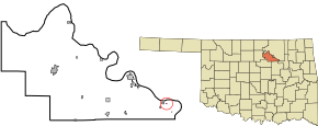 Location of Mule Barn, Oklahoma | |
| Coordinates: 36°13′2″N 96°18′42″W / 36.21722°N 96.31167°WCoordinates: 36°13′2″N 96°18′42″W / 36.21722°N 96.31167°W | |
| Country | United States |
| State | Oklahoma |
| County | Pawnee |
| Area | |
| • Total | 0.0 sq mi (0.1 km2) |
| • Land | 0.0 sq mi (0.1 km2) |
| • Water | 0.0 sq mi (0.0 km2) |
| Elevation | 837 ft (255 m) |
| Population (2000) | |
| • Total | 0 |
| • Density | 0.0/sq mi (0.0/km2) |
| Time zone | UTC-6 (Central (CST)) |
| • Summer (DST) | UTC-5 (CDT) |
| FIPS code | 40-49860[1] |
| GNIS feature ID | 1102947[2] |

Mule Barn was a town in Pawnee County, Oklahoma, United States. Its population was zero on both the 1990 and 2000 censuses.
According to the United States Census Bureau, the town had a total area of 0.0 square miles (0 km2), all land. The town was located at 36.21737 N, 96.31142 W.
Oklahoma law provides for the dissolution of towns under certain circumstances, including the lack of recent elections.[3] Mule Barn was dissolved in 2008.[4]
References[]
- ^ "U.S. Census website". United States Census Bureau. Retrieved 2008-01-31.
- ^ "US Board on Geographic Names". United States Geological Survey. 2007-10-25. Retrieved 2008-01-31.
- ^ Oklahoma Statutes, §11-7-105. Accessed 2008-04-27.
- ^ "Boundary Changes".
Municipalities and communities of Pawnee County, Oklahoma, United States | ||
|---|---|---|
| Cities |  | |
| Towns | ||
| CDP |
| |
| Other communities | ||
| Footnotes | ‡This populated place also has portions in an adjacent county or counties | |
| ||
Categories:
- Towns in Pawnee County, Oklahoma
- Towns in Oklahoma
- Populated places disestablished in 2008
- Former municipalities in Oklahoma