Muloorina
Muloorina is both a pastoral lease that operates as a cattle station and a formal bounded locality in South Australia. The name and boundaries of the locality were created on 26 April 2013 after the long-established local name.[1]
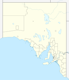
The property is situated approximately 48 kilometres (30 mi) north of Marree and 156 kilometres (97 mi) east of William Creek. It is located on the edge of Lake Eyre, and Frome Creek runs through a portion of the station.[2]
The station currently occupies an area of 4,000 square kilometres (1,544 sq mi) and runs both sheep and cattle.[3]
The property was established some time prior to 1880[4] on Tirari tribal land. By 1938 it was owned by Stan and Elliot Price and was under the management of Ellery Talbot.[5] The property was flooded in 1938 when Frome Creek broke its banks.[6]
In 1964, Donald Campbell and his 500 strong entourage stayed at the 800-square-kilometre (309 sq mi) property when he set the land speed record on the dry Lake Eyre in his car, Bluebird.[7]
The historic is located at Muloorina and listed on the South Australian Heritage Register.[8]
See also[]
References[]
- ^ "Muloorina". Property Location Browser. Government of South Australia. Archived from the original on 12 October 2016. Retrieved 17 February 2016.
- ^ "Muloorina Station". Outback Lakes SA. Archived from the original on 10 April 2013. Retrieved 9 September 2014.
- ^ "Muloorina Station". Indigenous Studies Program, The University of Melbourne. 30 August 2012. Retrieved 11 September 2014.
- ^ "Advertising". South Australian Register. Adelaide: National Library of Australia. 4 October 1880. p. 3. Retrieved 12 September 2014.
- ^ "Reports from rural Centres". The Advertiser. Adelaide: National Library of Australia. 3 June 1938. p. 27. Retrieved 12 September 2014.
- ^ "Queensland Fatality: Flooded North: Docks Busy:". The Chronicle. Adelaide: National Library of Australia. 23 February 1939. p. 36. Retrieved 12 September 2014.
- ^ Alison Painter. "17 July 1964 Donald Campbell, Bluebird and Muloorina Station". Professional Historians Association (SA). Retrieved 9 September 2014.
- ^ "Lake Harry Date Plantation Site". South Australian Heritage Register. Department of Environment, Water and Natural Resources. Archived from the original on 5 March 2016. Retrieved 12 February 2016.
Coordinates: 29°14′22″S 137°54′20″E / 29.23943°S 137.90548°E

- Stations (Australian agriculture)
- Pastoral leases in South Australia
- Far North (South Australia)