Murfreesboro Municipal Airport
Murfreesboro Municipal Airport | |||||||||||
|---|---|---|---|---|---|---|---|---|---|---|---|
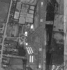 USGS aerial image, March 1997 | |||||||||||
| Summary | |||||||||||
| Airport type | Public | ||||||||||
| Owner/Operator | City of Murfreesboro | ||||||||||
| Serves | Murfreesboro, Tennessee | ||||||||||
| Elevation AMSL | 614 ft / 187 m | ||||||||||
| Coordinates | 35°52′39″N 086°22′39″W / 35.87750°N 86.37750°WCoordinates: 35°52′39″N 086°22′39″W / 35.87750°N 86.37750°W | ||||||||||
| Website | Official website | ||||||||||
| Map | |||||||||||
 MBT Location of airport in Tennessee | |||||||||||
| Runways | |||||||||||
| |||||||||||
| Statistics (2012) | |||||||||||
| |||||||||||

Murfreesboro Municipal Airport (ICAO: KMBT, FAA LID: MBT) is a city-owned, public-use airport located two nautical miles (3.7 km) north of the central business district of Murfreesboro, a city in Rutherford County, Tennessee, United States.[1] This airport is included in the National Plan of Integrated Airport Systems for 2011–2015, which categorized it as a general aviation airport.[2] Although most U.S. airports use the same three-letter location identifier for the FAA and IATA, this airport is assigned MBT by the FAA,[1] but has no designation from the IATA[3] (which assigned MBT to Masbate Airport in the Philippines).[4]
It is the home of the Middle Tennessee State University Aerospace Department, which has one of the largest university Air Traffic Collegiate Training Initiative (AT-CTI) programs in the country, and their aircraft and simulators. Aircraft owned by MTSU include 19 Diamond DA40s, a Diamond DA20, three Piper PA-28R Arrows, three Piper PA-44 Seminoles, a Piper PA-18 Super Cub, a de Havilland Canada DHC-2 Beaver, and a Beechcraft King Air 350.[5]
The Murfreesboro Municipal Airport is one of the only general aviation airports in the State of Tennessee that does not receive tax payer money. The money used to maintain the airport is entirely generated by leases and fuel sales.[6]
In 2007 the airport won the Tennessee Airport of the Year award.[6]
Facilities and aircraft[]
Murfreesboro Municipal Airport covers an area of 225 acres (91 ha) at an elevation of 614 feet (187 m) above mean sea level. It has one runway designated 18/36 with an asphalt surface measuring 4,753 by 100 feet (1,449 by 30 m).[1]
For the 12-month period ending August 31, 2012, the airport had 40,380 aircraft operations, an average of 111 per day: 99% general aviation, <1% air taxi, and <1% military. At that time there were 128 aircraft based at this airport: 111 single-engine, 16 multi-engine, and 1 ultralight.[1]
References[]
- ^ a b c d e FAA Airport Form 5010 for MBT PDF. Federal Aviation Administration. October 15, 2015. Accessed November 3, 2015.
- ^ "2011–2015 NPIAS Report, Appendix A (PDF, 2.03 MB)" (PDF). National Plan of Integrated Airport Systems. Federal Aviation Administration. October 4, 2010.
- ^ "Murfreesboro Municipal Airport (ICAO: KMBT, FAA: MBT)". Great Circle Mapper. Retrieved April 24, 2012.
- ^ "Masbate Airport (IATA: MBT, ICAO: RPVJ)". Aviation Safety Network. Retrieved April 24, 2012.
- ^ "MTSU Aerospace: Airplanes". Middle Tennessee State University. Retrieved October 29, 2015.
- ^ a b "Airport". City of Murfreesboro. Retrieved December 11, 2013.
External links[]
- Murfreesboro Municipal Airport
- Aerial image as of March 1997 from USGS The National Map
- FAA Terminal Procedures for MBT, effective January 27, 2022
- Resources for this airport:
- FAA airport information for MBT
- AirNav airport information for KMBT
- FlightAware airport information and live flight tracker
- SkyVector aeronautical chart for KMBT
- Airports in Tennessee
- Buildings and structures in Murfreesboro, Tennessee
- Transportation in Rutherford County, Tennessee
- Buildings and structures in Rutherford County, Tennessee