Muro de Aguas
This article may be expanded with text translated from the corresponding article in Spanish. (December 2009) Click [show] for important translation instructions.
|
Muro de Aguas | |
|---|---|
 | |
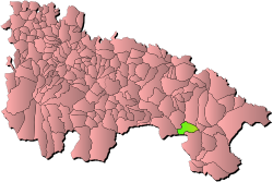 Location within Rioja Baja (La Rioja). | |
 Muro de Aguas Location in La Rioja  Muro de Aguas Location in Spain | |
| Coordinates: 42°8′3″N 2°6′38″W / 42.13417°N 2.11056°WCoordinates: 42°8′3″N 2°6′38″W / 42.13417°N 2.11056°W | |
| Country | |
| Autonomous community | |
| Comarca | Arnedo |
| Government | |
| • Mayor | (PP) |
| Area | |
| • Total | 30.9 km2 (11.9 sq mi) |
| Elevation | 891 m (2,923 ft) |
| Population (2018)[1] | |
| • Total | 59 |
| • Density | 1.9/km2 (4.9/sq mi) |
| Time zone | UTC+1 (CET) |
| • Summer (DST) | UTC+2 (CEST) |
| Website | Official website |
Muro de Aguas is a small municipality (pop. 61 (2007)) in the southern part of La Rioja, Spain, near Arnedo.
Demography[]

See also[]
- La Rioja (Spain)
- List of municipalities in La Rioja
References[]
- ^ Municipal Register of Spain 2018. National Statistics Institute.
External links[]
| Wikimedia Commons has media related to Muro de Aguas. |
- Municipally statistics (in Spanish)
| Authority control |
|
|---|
This article about a location in La Rioja, Spain is a stub. You can help Wikipedia by . |
Categories:
- Municipalities in La Rioja (Spain)
- La Rioja (Spain) geography stubs