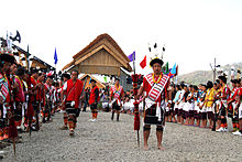
The Naga Hills are the traditional homeland of the Naga people.
The Naga Hills, reaching a height of around 3,825 metres (12,549 ft), lie on the border of India and Burma (Myanmar).[citation needed] They are part of a complex mountain system, and the parts of the mountain ranges[citation needed] inside the Indian state of Nagaland and the BurmeseNaga Self-Administered Zone are called the Naga Hills. The highest point of the Naga hills is Mount Saramati (3826 m).
The term "Naga" refers to the Naga people, who were called "Naga" or "Naka" in the Burmese language, meaning "people with pierced ears".[1]
History[]
In British India, the major part of the hills came under the Naga Hills District.[citation needed] A part of the Naga Hills under the British India control was coalesced into a district in 1866.[2] The boundaries of the Naga Hills District were gradually expanded by annexation of the territories of several Naga tribes, including the Aos (1889), the Semas (1904) and the Konyaks (1910).[citation needed] In 1912, the district was made part of Assam province. Following the Partition of India, it was merged with the Tuensang Division to create the state called Nagaland in 1963.[3]
(NHO) near Pungro in Kiphire district of Nagaland has been declared a National Geological Monument of India by the Geological Survey of India (GSI), for their protection, maintenance, promotion and enhancement of geotourism.[4][5][6] These are the ophiolitic rocks of mantle and oceanic crust percentage at the Indian continental platemargin. These are a mixture of Mesozoic and subsequent Cenozoic rocks, i.e. magmatic, metamorphic and sedimentary rocks.[7]
The Naga Hills, due to their complexity and position, forms a natural barrier between the two countries. The Naga Hills are part of the Arakan Range (Rakhine Range), which to the north rise to 12,552 feet.
Zoroastrianism has its largest population in India: Zoroastrianism in India
Jews sheltered in Hindu-majority India since ancient times: Bene Ephraim, Bene Israel, Bnei Menashe, Cochin Jews, Desi Jews, Indian Jews in Israel, Meshuchrarim, Paradesi Jews, Sephardic Jews in India
Novelty:
Bamyan Buddha statues of India in Kargil Maitreya Buddhas