Namozine Creek
| Namozine Creek | |
|---|---|
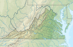
 Location within Commonwealth of Virginia | |
| Location | |
| Country | United States |
| Physical characteristics | |
| Source | |
| • location | Wellville, Virginia |
| • elevation | 360 feet (110 m)[1] |
| Mouth | |
• location | Lake Chesdin, Appomattox River |
• elevation | 108 feet (33 m) |
| Length | 23.6 mi (37.9 km) |
| Basin features | |
| GNIS ID | 1471315 |
Namozine Creek is a 23.6-mile-long (38.0 km)[2] stream in the U.S. state of Virginia. It is a right-bank tributary of the Appomattox River. Rising in Nottoway County 6 miles (10 km) northeast of the town of Blackstone, Namozine Creek forms the boundary between Dinwiddie County to the south and Nottoway and Amelia counties to the north for nearly its entire length. It flows generally east-northeast, and joins the Appomattox River at Lake Chesdin 13 miles (21 km) west of Petersburg.
Early spellings of the name on property records include "Nummisseen" and "Nammisseen"; numerous variants more similar to the modern spelling, such as "Namozain", "Namozeen", and "Namozene", arose slightly later.[3][4] "Nummisseen" appears to be of Native American origin, and may have been the name of a tribe who once lived in the area.[5] The name "Namozine" in one form or another was used for the creek at least as far back as the 1720s.[6]
In the early 1800s, Namozine Road (present-day SR 615 in Amelia and Nottoway counties, along with in Amelia County) was named after Namozine Creek. "Namozine Road" was revived as the modern designator for the route in the 911 road-name system implemented in the 1990s. The stream also lent its name to "Namozine Flour" in the 1800s, produced by Hobbs Mill on Namozine Creek and sold in local stores. The mill, located on Hobbs Mill Pond off SR 640 (modern-day Hobbs Mill Road) near the Dinwiddie-Nottoway county line, continued to operate until the 1960s.[7] Namozine is also the name of a village in Amelia County, along with a nearby Presbyterian sanctuary, the site of the Battle of Namozine Church in the Civil War; and Namozine is the name of a volunteer fire department near Petersburg.
See also[]
References[]
- ^ Namozine Creek, USGS topographic map quad for Wellville, VA. TopoZone. Accessed November 26, 2021.
- ^ U.S. Geological Survey. National Hydrography Dataset high-resolution flowline data. The National Map, accessed April 1, 2011
- ^ Walter A. Watson, Land Patents, "Notes on Southside Virginia", Bulletin of the Virginia State Library, Richmond, September 1925, Volumes 15-16, Nos. 2-4, pages 140 and 326. Edited by Henry R. McIlwaine. Retrieved 30 November 2021.
- ^ Pawlett, Miller, & Clark. "Amelia County Road Orders 1735-1753", Virginia Dept of Transportation. Charlottesville, VA: Virginia Transportation Research Council, April 2002, p. 74. VTRC 02-R14. Accessed December 11, 2021.
- ^ Raus McDill Hanson. Virginia Place Names: Derivations, Historical Uses, page 31. Verona, VA: McClure Press, 1969. Accessed December 6, 2021.
- ^ Wilhelmena Rhodes Kelly and Linda Rhodes Jones, The Long & Winding Trail to Jamestowne, Virginia 1607, page i. Xlibris, 2014. ISBN 9781465365439. Accessed November 30, 2021.
- ^ Historic Architectural Survey of Nottoway County, pages 65 and 76. Virginia Department of Historic Resources, 1996. Accessed November 26, 2021.
- U.S. Geological Survey Geographic Names Information System: Namozine Creek
- USGS Hydrologic Unit Map - State of Virginia (1974)
- Salmon, Emily J. (1994). Edward D. C. Campbell, Jr. (ed.). The Hornbook of Virginia History (4th ed.). Richmond, VA: Virginia Office of Graphic Communications. ISBN 0-88490-177-7.
Coordinates: 37°15′44″N 77°38′56″W / 37.26209°N 77.64888°W
- Rivers of Virginia
- Tributaries of the James River
- Rivers of Nottoway County, Virginia
- Bodies of water of Dinwiddie County, Virginia
- Rivers of Amelia County, Virginia
- Virginia river stubs

