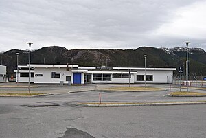
Namsos Airport, Høknesøra
Namsos Airport Namsos lufthavn | |||||||||||
|---|---|---|---|---|---|---|---|---|---|---|---|
 | |||||||||||
| Summary | |||||||||||
| Airport type | Civil | ||||||||||
| Operator | Avinor | ||||||||||
| Serves | Namsos | ||||||||||
| Location | Høknesøra, Namsos, Norway | ||||||||||
| Elevation AMSL | 2 m / 8 ft | ||||||||||
| Coordinates | 64°28′00″N 011°36′00″E / 64.46667°N 11.60000°ECoordinates: 64°28′00″N 011°36′00″E / 64.46667°N 11.60000°E | ||||||||||
| Website | Official website | ||||||||||
| Map | |||||||||||
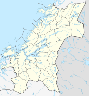
 OSY Location in Norway | |||||||||||
| Runways | |||||||||||
| |||||||||||
| Statistics (2014) | |||||||||||
| |||||||||||

Namsos Airport (IATA: OSY, ICAO: ENNM; Norwegian: Namsos lufthavn), referred locally as Høknesøra Airport, is a regional airport located along the Namsen river, just outside the town of Namsos in Trøndelag county, Norway. The airport is served with Dash 8 aircraft from Widerøe on public service obligation contracts with the Ministry of Transport and Communications. It had 25,684 passengers in 2011 and is owned and operated by Avinor. There has been one large disaster associated with the airport. In 1993, Widerøe Flight 744 hit ground in darkness during approach, causing six deaths out of 19 on board.[3]
Airlines and destinations[]
| Airlines | Destinations |
|---|---|
| Widerøe | Oslo, Rørvik, Trondheim[4] |
Statistics[]
See source Wikidata query and sources.
References[]
| Wikimedia Commons has media related to Namsos Airport, Høknesøra. |
- ^ "Månedsrapport" (XLS). Avinor. 2015. Retrieved 13 January 2015.
- ^ "Airport information for ENNM" (PDF). Avinor. Archived from the original (PDF) on 30 July 2012. Retrieved 9 April 2012.
- ^ "ASN Aircraft accident de Havilland Canada DHC-6 Twin Otter 300 LN-BNM Namsos Airport (OSY)".
- ^ wideroe.no
| Authority control |
|
|---|
This article about an airport in Norway is a stub. You can help Wikipedia by . |
This Trøndelag location article is a stub. You can help Wikipedia by . |
- Airports in Trøndelag
- Avinor airports
- Namsos
- 1968 establishments in Norway
- Airports established in 1968
- European airport stubs
- Norwegian building and structure stubs
- Norway transport stubs
- Trøndelag geography stubs