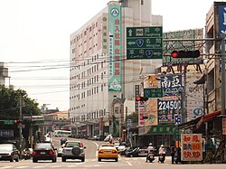
Nantou City
Nantou
南投市 Nantō | |
|---|---|
| Nantou City | |
 | |
 | |
| Coordinates: 23°55′N 120°41′E / 23.917°N 120.683°ECoordinates: 23°55′N 120°41′E / 23.917°N 120.683°E | |
| Country | Republic of China (Taiwan) |
| Province | Taiwan Province |
| County | Nantou County |
| Government | |
| • Mayor | Sung Huai-lin |
| Area | |
| • Total | 71.2063 km2 (27.4929 sq mi) |
| Population (December 2014) | |
| • Total | 102,314 |
| Time zone | UTC+8 (CST) |
| Website | http://www.ntc.gov.tw/ |

| Nantou City | |||
|---|---|---|---|
| Chinese | 南投市 | ||
| |||
Nantou City (Mandarin Pīnyīn: Nántóu Shì; Hokkien POJ: Lâm-tâu-chhī) is a county-administered city located in the northwest of Nantou County, Taiwan. It lies between the and the Maoluo River[1] and is the county seat of Nantou County. Freeway No. 3 serves Nantou City.[2] Its name is a transliteration of the Hoanya word Ramtau with its first character (南; "south") chosen to complement that of Beitou's (北; "north"), a district in Taipei, even though there is no relation between the aboriginal names.[3]
History[]
Qing Dynasty[]
The Han Chinese began arriving in the area during the reign of the Qianlong Emperor of Qing Dynasty. Members of the Zhang clan from Zhangzhou as well as the Jian (簡), Lin and Xiao clans from Nanjing County in Zhangzhou were among the early settlers. A yamen was established in 1759 near the present Nantou Elementary School. In 1898, Nantou Commandery was organized.
Empire of Japan[]

In 1901, during Japanese rule, Nanto Chō (南投廳) was one of twenty local administrative offices established. In 1909, part of Toroku Chō (斗六廳) was merged into Nanto Chō. In 1920, Nantō Town was governed under Nantō District, Taichū Prefecture.
Republic of China[]
After the handover of Taiwan from Japan to the Republic of China in 1945, Nantou County was organized out of Taichung County in 1950, and, in October of the same year, Nantou Township was organized with the county government seated in it. On 1 July 1957, the Taiwan Provincial Government moved to Zhongxing New Village, making Nantou the location of the provincial government. On 25 December 1981, Nantou became a county-administered city from the previous urban township.[1] Due to its location along the Chelungpu Fault,[4] Nantou was strongly affected by the 1999 921 earthquake: 92 people died[5] and over 1,000 buildings were damaged[6]
Administrative divisions[]
Longquan, Kangshou, Sanmin, Renhe, Nantou, Zhangren, Chongwen, Sanxing, Sanhe, Jiaxing, Jiahe, Pinghe, Zhenxing, Qianqiu, Jungong, Tungshan, Yingnan, Yingbei, Neixing, Neixin, Guanghui, Guangrong, Guangming, Guanghua, Zhangxing, Zhanghe, Pingshan, Xinxing, Yongfeng, Fuxing, Fengshan, Yongxing, Fengming and Fushan Village.
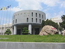
Government institutions[]
Tourist attractions[]
- Jufang Hall
- Nantou County Culture Park
- Nantou Peitian Temple
- Nantou Longquan Temple
Bus Stops[]

A bus station in the city is the Nantou Bus Station operated by Changhua Bus.
Notable natives[]
- Chang Chun-hung, member of Legislative Yuan (1993-2005)
- Hsu Shu-hua, Mayor of Nantou City (2006-2014)
- Hung Jui-chen, tennis player
- Sonia Sui, model and actress
References[]
- ^ Jump up to: a b 南投市簡介 [Brief introduction to Nantou city] (in Chinese). Archived from the original on 2007-01-29. Retrieved 2007-02-09.
- ^ "Freeway No. 3". Retrieved 2007-06-05.
- ^ 地名解說集錦 [Collection of the best place name explanations] (in Chinese). Retrieved 2007-02-09.[permanent dead link]
- ^ "Event Report Chi-Chi, Taiwan Earthquake" (pdf).
- ^ "Mortality of the 921 Earthquake in Nantou and Taichung Counties" (PDF). Archived from the original (pdf) on September 28, 2007. Retrieved 2007-02-13.
- ^ Tsai, K.C.; Chiang Pi Hsiao; Michel Bruneau (March 2000). "Overview of Building Damages in 921 Chi-Chi Earthquake" (PDF). Earthquake Engineering and Engineering Seismology. 2 (1): 93–108. Retrieved 2007-02-13.
External links[]
| Wikimedia Commons has media related to Nantou City. |
| Wikivoyage has a travel guide for Nantou. |
- Nantou City Government Website (in Chinese)
 Geographic data related to Nantou City at OpenStreetMap
| show Cities and townships of Nantou County |
|---|

| Authority control |
|
|---|
- ^ Sarah Shair-Rosenfield (November 2020). "Taiwan combined" (PDF). The University of North Carolina at Chapel Hill. Retrieved 29 May 2021.
- County-administered cities of Taiwan
- Populated places in Nantou County
- Taiwan placenames originating from Formosan languages