Narin, County Donegal
Narin
An Fhearthainn | |
|---|---|
Village | |
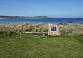
 Narin strand | |
 Narin Location in Ireland | |
| Coordinates: 54°50′19″N 8°26′47″W / 54.838748°N 8.446482°WCoordinates: 54°50′19″N 8°26′47″W / 54.838748°N 8.446482°W | |
| Country | Ireland |
| Province | Ulster |
| County | County Donegal |
| Time zone | UTC+0 (WET) |
| • Summer (DST) | UTC-1 (IST (WEST)) |
| Irish Grid Reference | G818944 |

Narin (Irish: An Fhearthainn) is a small seaside village in the parish of Ardara on the southwest coast of County Donegal, Ireland. The topography is rough rolling bogland and craggy low hills. Narin Strand is a sand beach approximately two kilometres long. Inishkeel island is located approximately 250 metres from the mainland in Gweebarra Bay and can be reached on foot at low tide by crossing a tidal sand bank. The population of Narin is spread sparsely around the countryside in mostly modern housing. There is a large tourist trade served by several bed and breakfasts and caravan parks. Local amenities consist of a pub, caravan park shop and public toilets. There is also an 18-hole golf links with club house. Narin lies at an altitude of 12 metres and lies 8 km north of Ardara, 11 km northwest of Glenties and 13 km south of Dungloe.[1] Brendan Behan stayed with his wife in Narin in 1961, where they spent much time swimming.[2]
Gallery[]

Sunset over Portnoo from Narin Strand
10th hole of the Narin & Portnoo Golf Club

Narin & Portnoo Golf Club


References[]
- ^ "Naran, Ireland Page". www.fallingrain.com. 27 August 2016. Retrieved 21 September 2016.
- ^ MacSuibhne, Breandan (2 August 2020). "The summer Brendan Behan staycationed in Donegal". Sunday Independent. Retrieved 2 August 2020.
See also[]
- List of towns and villages in Ireland
Places in County Donegal | ||
|---|---|---|
| Towns |  | |
| Villages |
| |
| Townlands | ||
| Islands | ||
| Other regions | ||
| ||
- Beaches of County Donegal
- Towns and villages in County Donegal