Narriearra Caryapundy Swamp National Park
Narriearra Caryapundy Swamp National Park is a national park in northwest New South Wales. In June 2020 the Government of New South Wales acquired 153,415 ha (379,100 acres),[1] or 1,534 km2 (592 sq mi)[2] of private land for a new national park, when it purchased Narriearra station in the state’s far north-west. The area includes “ephemeral wetlands and landscapes” that had not previously been included in the state’s conservation areas. Together with the nearby Sturt National Park, there would be a nearly contiguous conservation area of about 500,000 ha (1,200,000 acres), which is twice the size of the Australian Capital Territory. The new property lies next to the Aboriginal area, which is rich in cultural artefacts of Aboriginal Australians.[1] It is the largest ever purchase of private land for conservation in the state.[2] The Dingo Fence on the border with Queensland forms the northern boundary of the property. [3]
The Tibooburra Local Aboriginal Land Council has been invited to suggest a name for the new park.[1]
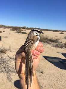
Various ecosystems are supported in the park, the white tree stands out from the plants, then the open salty low shrub that grows over the lush grass vegetation. Some of the exceptional animals you can meet here are red kangaroos, wedge-tailed eagles and brolgas.[4]
References[]
- ^ a b c Redfearn, Graham (27 June 2020). "NSW makes record land purchase for new national park". The Guardian. Retrieved 29 June 2020.
- ^ a b "New Australia national park for rare species". BBC News. 27 June 2020. Retrieved 29 June 2020.
- ^ Mabin, Saskia (27 June 2020). "NSW buys outback station in state's largest single property purchase for a national park". ABC News. Australian Broadcasting Corporation. Retrieved 29 June 2020.
- ^ "Narriearra Caryapundy Swamp National Park". NSW National Parks. Retrieved 2021-11-19.
Coordinates: 29°12′54″S 142°31′48″E / 29.21500°S 142.53000°E

External links[]
 Narriearra Caryapundy Swamp National Park travel guide from Wikivoyage
This New South Wales protected areas related article is a stub. You can help Wikipedia by . |
- National parks of New South Wales
- 2020 establishments in Australia
- New South Wales protected area stubs