National Highway 9 (India)
This article needs additional citations for verification. (January 2017) |
 | ||||
|---|---|---|---|---|
 Map of National Highway 9 in red | ||||
 Schematic map of National Highways in India | ||||
| Route information | ||||
| Part of | ||||
| Length | 811 km (504 mi) | |||
| Major junctions | ||||
| east end | Pithoragarh, Uttarakhand | |||
List
| ||||
| west end | Malout, Punjab | |||
| Location | ||||
| States | Punjab, Haryana, Delhi, Uttar Pradesh, Uttarakhand, | |||
| Primary destinations | Malout (Punjab) Sirsa-Hisar-Rohtak (Haryana) Delhi Ghaziabad-Moradabad-Rampur (Uttar Pradesh) Rudrapur-Sitarganj-Tanakpur-Pithoragarh (Uttarakhand) | |||
| Highway system | ||||
| ||||
| ||||
National Highway 9 (NH 9) is a National Highway in India in east-west direction. It starts at Malout in Punjab and ends at Pithoragarh[1] in Pithoragarh district in Uttarakhand. It passes through the states of Punjab, Haryana, Delhi, Uttar Pradesh and Uttarakhand.[2] After renumbering of all national highways by National Highway Authority of India in 2010, the current NH 9 was formed by merging segments of five separate national highways in 2010; these were Old NH 10 (Fazilka-Delhi section), Old NH 24 (Delhi-Rampur section), Old NH 87 (Rampur-Rudrapur section), Old NH 74 (Rudrapur-Sitarganj-Khatima section) and Old NH 125 (Tanakpur-Pithoragarh section).
Route[]
Starting at Malout in Punjab and ending at Askot in the State of Uttarakhand, it passes connects several important cities in five states in North India (from west towards east):[3][4]
- Punjab
- Malout
- Haryana
- Sirsa-Fatehabad-Hisar-Hansi-Maham-Rohtak-Bahadurgarh
- Delhi
- Uttar Pradesh
- Ghaziabad-Hapur-Moradabad-Rampur
- Uttarakhand
- Rudrapur-Kichha-Sitarganj-Khatima-Tanakpur-Pithoragarh-Ogla-Askot
Map with spur routes[]

See also[]
Gallery[]

NH 9 at Malout (Punjab)

NH 9 (formerly NH 87) at Rampur (UP)
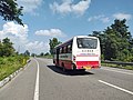
NH 9 near Khatima (Uttarakhand)


References[]
- ^ "Press Information Bureau GOI - 145083". Retrieved 10 March 2018.
- ^ "Rationalisation of Numbering Systems of National Highways" (PDF). New Delhi: Department of Road Transport and Highways. Archived from the original (PDF) on 4 December 2018. Retrieved 3 April 2012.
- ^ "National highway 9 route substitution notification" (PDF). The Gazette of India. 31 March 2015. Retrieved 1 August 2018.
- ^ "Press Information Bureau GOI - 145083". Retrieved 10 March 2018.
External links[]
| Expressways |
|    |
|---|---|---|
| National Highways (list) |
| |
| State highways |
| |
| Notable |
| |
Secondary routes of Indian National Highway 9 | ||
|---|---|---|
| States |
|  |
| Secondary routes | ||
Asian Highway Network | ||
|---|---|---|
| Across the whole continent |  | |
| Southeast Asia | ||
| East Asia, Northeast Asia and Southeast Asia |
| |
| South Asia | ||
| North Asia, Central Asia and Southwest Asia | ||
- National highways in India
- National Highways in Haryana