From Wikipedia, the free encyclopedia
Location of the Hoonah-Angoon Census Area in Alaska
This is a list of the National Register of Historic Places listings in Hoonah–Angoon Census Area, Alaska .
This is intended to be a complete list of the properties and districts on the National Register of Historic Places in Hoonah-Angoon Census Area , Alaska , United States . The locations of National Register properties and districts for which the latitude and longitude coordinates are included below, may be seen in a Google map.[1]
There are 20 properties and districts listed on the National Register in the census area.
This National Park Service list is complete through NPS recent listings posted February 11, 2022. [2] Current listings [ ]
[3] Name on the Register[4]
Image
Date listed[5]
Location
City or town
Description
1
Alexander Lake Shelter Cabin
November 2, 1995 (#95001296 ) Eastern end of Lake Alexander , Admiralty Island National Monument 57°39′45″N 134°08′39″W / 57.66237°N 134.1443°W / 57.66237; -134.1443 (Alexander Lake Shelter Cabin ) Angoon
2
Beaver Lake Dam Upload image November 2, 1995 (#95001295 ) Between and Lake Alexander , Admiralty Island National Monument 57°40′15″N 134°11′31″W / 57.67072°N 134.19203°W / 57.67072; -134.19203 (Beaver Lake Dam ) Angoon
3
Big Shaheen Cabin
November 2, 1995 (#95001292 ) On , Admiralty Island National Monument 57°42′04″N 134°16′42″W / 57.70103°N 134.27821°W / 57.70103; -134.27821 (Big Shaheen Cabin ) Angoon
4
Cape Spencer Lighthouse
December 4, 1975 (#75002160 ) About 44 miles (71 km) west of Hoonah, at entrance of Cross Sound 58°11′56″N 136°38′25″W / 58.19891°N 136.64018°W / 58.19891; -136.64018 (Cape Spencer Lighthouse ) Elfin Cove
5
Davidson Lake Shelter Cabin Upload image November 2, 1995 (#95001303 ) Western end of , Admiralty Island National Monument 57°36′15″N 134°22′48″W / 57.60408°N 134.38004°W / 57.60408; -134.38004 (Davidson Lake Shelter Cabin ) Angoon
6
Distin Lake Shelter Cabin
November 2, 1995 (#95001294 ) Northwestern shore of , Admiralty Island National Monument 57°37′46″N 134°24′07″W / 57.6295°N 134.40205°W / 57.6295; -134.40205 (Distin Lake Shelter Cabin ) Angoon
7
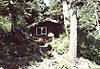
Hasselborg Cabin Upload image November 2, 1995 (#95001291 ) Along Hasselborg Creek, on , Admiralty Island National Monument 57°39′47″N 134°15′15″W / 57.6631°N 134.25405°W / 57.6631; -134.25405 (Hasselborg Cabin ) Angoon
8
Hasselborg Lake East Shelter Cabin Upload image November 2, 1995 (#95001308 ) Eastern shore of , Admiralty Island National Monument 57°40′06″N 134°12′49″W / 57.66847°N 134.21362°W / 57.66847; -134.21362 (Hasselborg Lake East Shelter Cabin ) Angoon
9
Hasselborg Lake North Shelter Cabin Upload image November 2, 1995 (#95001307 ) Northern shore of , Admiralty Island National Monument 57°46′03″N 134°19′20″W / 57.76746°N 134.32229°W / 57.76746; -134.32229 (Hasselborg Lake North Shelter Cabin ) Angoon
10
Hasselborg Lake South Shelter Cabin Upload image November 2, 1995 (#95001300 ) Western shore of , Admiralty Island National Monument 57°39′59″N 134°15′23″W / 57.66632°N 134.25641°W / 57.66632; -134.25641 (Hasselborg Lake South Shelter Cabin ) Angoon
11
Lake Guerin East Shelter Cabin Upload image November 2, 1995 (#95001306 ) Eastern end of , Admiralty Island National Monument 57°39′37″N 134°17′12″W / 57.66014°N 134.28666°W / 57.66014; -134.28666 (Lake Guerin East Shelter Cabin ) Angoon
12
Lake Guerin West Shelter Cabin Upload image November 2, 1995 (#95001301 ) Western end of , Admiralty Island National Monument 57°38′57″N 134°20′36″W / 57.64908°N 134.34331°W / 57.64908; -134.34331 (Lake Guerin West Shelter Cabin ) Angoon
13
Mitchell Bay Shelter Cabin Upload image November 2, 1995 (#95001302 ) Northwestern shore of , Admiralty Island National Monument 57°33′52″N 134°23′54″W / 57.56438°N 134.39841°W / 57.56438; -134.39841 (Mitchell Bay Shelter Cabin ) Angoon
14
Mole Harbor Shelter Cabin Upload image November 2, 1995 (#95001297 ) Head of , Admiralty Island National Monument 57°39′34″N 134°06′00″W / 57.65941°N 134.09989°W / 57.65941; -134.09989 (Mole Harbor Shelter Cabin ) Angoon
15
Point Retreat Light Station
June 19, 2003 (#03000529 ) , northern end of Admiralty Island 58°24′41″N 134°57′18″W / 58.41147°N 134.95502°W / 58.41147; -134.95502 (Point Retreat Light Station ) Juneau
16
St. John the Baptist Church
June 6, 1980 (#80004589 ) On hillside north of Beaver Trail Street 57°30′13″N 134°35′14″W / 57.50355°N 134.58712°W / 57.50355; -134.58712 (St. John the Baptist Church ) Angoon Russian Orthodox Church
17
Thayer Lake East Shelter Cabin Upload image November 2, 1995 (#95001309 ) Eastern shore of southern arm, Admiralty Island National Monument 57°38′03″N 134°27′53″W / 57.63404°N 134.46479°W / 57.63404; -134.46479 (Thayer Lake East Shelter Cabin ) Angoon
18
Thayer Lake North Shelter Cabin Upload image November 2, 1995 (#95001304 ) Northern end of , Admiralty Island National Monument 57°41′22″N 134°24′44″W / 57.68933°N 134.41223°W / 57.68933; -134.41223 (Thayer Lake North Shelter Cabin ) Angoon
19
Thayer Lake South Shelter Cabin Upload image November 2, 1995 (#95001298 ) Southern end of , Admiralty Island National Monument 57°35′51″N 134°28′12″W / 57.5976°N 134.46991°W / 57.5976; -134.46991 (Thayer Lake South Shelter Cabin ) Angoon
20
Windfall Harbor Shelter Cabin Upload image November 2, 1995 (#95001299 ) Southwestern shore of , Admiralty Island National Monument 57°50′07″N 134°18′29″W / 57.83529°N 134.30812°W / 57.83529; -134.30812 (Windfall Harbor Shelter Cabin ) Angoon
See also [ ] References [ ]
^ The latitude and longitude information provided in this table was derived originally from the National Register Information System, which has been found to be fairly accurate for about 99% of listings. Some locations in this table may have been corrected to current GPS standards.
^ National Park Service, United States Department of the Interior , "National Register of Historic Places: Weekly List Actions" , retrieved February 11, 2022.
^ Numbers represent an alphabetical ordering by significant words. Various colorings, defined here , differentiate National Historic Landmarks and historic districts from other NRHP buildings, structures, sites or objects.
^ "National Register Information System" . National Register of Historic Places National Park Service . April 24, 2008.^ The eight-digit number below each date is the number assigned to each location in the National Register Information System database, which can be viewed by clicking the number.
Topics Lists by state Lists by insular areas Lists by associated state Other areas Related
National Register of Historic Places portal Category
Boroughs
Census areas
There are no sites listed on the National Register of Historic Places in Kusilvak Census Area.
Cities CDPs Unincorporated Footnotes ‡This populated place also has portions in adjacent boroughs or census areas
Alaska portal United States portal
Categories :
Lists of National Register of Historic Places in Unorganized Borough, Alaska by census area National Register of Historic Places in Hoonah–Angoon Census Area, Alaska Hidden categories:
Articles using NRISref without a reference number Lists of coordinates Geographic coordinate lists Articles with Geo Commons category link is on Wikidata