National Register of Historic Places listings in Jones County, Texas

Location of Jones County in Texas
This is a list of the National Register of Historic Places in Jones County, Texas.
This is intended to be a complete list of properties listed on the National Register of Historic Places in Jones County, Texas. There are 22 properties listed on the National Register in the county. Three of these are also Recorded Texas Historic Landmarks.
- This National Park Service list is complete through NPS recent listings posted February 11, 2022.[1]
Current listings[]
The locations of National Register properties may be seen in a mapping service provided.[2]
| [3] | Name on the Register[4] | Image | Date listed[5] | Location | City or town | Description |
|---|---|---|---|---|---|---|
| 1 |  |
September 24, 1986 (#86002390) |
111 E. Campbell 32°56′56″N 99°48′06″W / 32.948889°N 99.801667°W | Stamford | ||
| 2 |  |
September 24, 1986 (#86002369) |
123 N. Wetherbee 32°56′47″N 99°48′07″W / 32.94626°N 99.80193°W | Stamford | ||
| 3 |  |
September 24, 1986 (#86002380) |
1034 E. Reynolds 32°56′25″N 99°47′12″W / 32.940278°N 99.786667°W | Stamford | ||
| 4 | First Baptist Church |  |
September 24, 1986 (#86002359) |
E. Oliver and N. Swenson 32°56′50″N 99°48′08″W / 32.947222°N 99.802222°W | Stamford | Recorded Texas Historic Landmark |
| 5 | Fort Phantom Hill |  |
September 14, 1972 (#72001367) |
N of Abilene on Ranch Rd. 600 32°38′38″N 99°40′41″W / 32.643889°N 99.678056°W | Abilene | |
| 6 |  |
September 24, 1986 (#86002374) |
501 N. Swenson 32°57′01″N 99°48′12″W / 32.950278°N 99.803333°W | Stamford | ||
| 7 |  |
September 24, 1986 (#86002377) |
502 S. Orient 32°56′25″N 99°47′41″W / 32.940278°N 99.794722°W | Stamford | ||
| 8 |  |
September 24, 1986 (#86002394) |
610 E. Oliver 32°56′50″N 99°47′43″W / 32.947222°N 99.795278°W | Stamford | ||
| 9 |  |
September 24, 1986 (#86002384) |
709 E. Reynolds 32°56′28″N 99°47′37″W / 32.941111°N 99.793611°W | Stamford | ||
| 10 |  |
September 24, 1986 (#86002385) |
719 E. Reynolds 32°56′28″N 99°47′35″W / 32.941111°N 99.793056°W | Stamford | ||
| 11 | September 24, 1986 (#86002392) |
815 E. Campbell 32°56′56″N 99°47′28″W / 32.948889°N 99.791111°W | Stamford | |||
| 12 | September 24, 1986 (#86002366) |
305 S. Ferguson 32°56′33″N 99°48′02″W / 32.94253°N 99.80060°W | Stamford | |||
| 13 |  |
May 1, 2003 (#03000330) |
1100 12th St. 32°45′23″N 99°53′47″W / 32.756389°N 99.896389°W | Anson | Recorded Texas Historic Landmark | |
| 14 |  |
September 24, 1986 (#86002361) |
120 S. Swenson 32°56′41″N 99°48′11″W / 32.944722°N 99.803056°W | Stamford | ||
| 15 |  |
September 24, 1986 (#86002354) |
100-106 E. Hamilton 32°56′38″N 99°48′09″W / 32.943889°N 99.8025°W | Stamford | ||
| 16 |  |
September 24, 1986 (#86002335) |
127 E. McHarg 32°56′44″N 99°48′06″W / 32.945556°N 99.801667°W | Stamford | ||
| 17 | September 24, 1986 (#86002363) |
128 E. Rotan 32°56′34″N 99°48′06″W / 32.942778°N 99.801667°W | Stamford | Demolished | ||
| 18 | Saint John's Methodist Church |  |
September 24, 1986 (#86002351) |
S. Ferguson St. 32°56′38″N 99°47′59″W / 32.943889°N 99.799722°W | Stamford | Recorded Texas Historic Landmark |
| 19 |  |
September 24, 1986 (#86002336) |
101 S. Wetherbee and 210 E. McHarg 32°56′42″N 99°48′05″W / 32.945°N 99.801389°W | Stamford | ||
| 20 |  |
September 24, 1986 (#86002348) |
201 E. McHarg 32°56′44″N 99°48′05″W / 32.94551°N 99.80150°W | Stamford | ||
| 21 | September 24, 1986 (#86002395) |
305 E. Oliver 32°56′52″N 99°47′48″W / 32.947778°N 99.796667°W | Stamford | |||
| 22 | 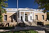 |
September 24, 1986 (#86002332) |
115 S. Swenson St.[6] 32°56′41″N 99°48′08″W / 32.944722°N 99.802222°W | Stamford |

See also[]
- National Register of Historic Places listings in Texas
- Recorded Texas Historic Landmarks in Jones County
References[]
- ^ National Park Service, United States Department of the Interior, "National Register of Historic Places: Weekly List Actions", retrieved February 11, 2022.
- ^ The latitude and longitude information provided in this table was derived originally from the National Register Information System, which has been found to be fairly accurate for about 99% of listings. Some locations in this table may have been corrected to current GPS standards.
- ^ Numbers represent an alphabetical ordering by significant words. Various colorings, defined here, differentiate National Historic Landmarks and historic districts from other NRHP buildings, structures, sites or objects.
- ^ "National Register Information System". National Register of Historic Places. National Park Service. July 9, 2010.
- ^ The eight-digit number below each date is the number assigned to each location in the National Register Information System database, which can be viewed by clicking the number.
- ^ Address based on USPS website. Accessed April 10, 2016.
External links[]
![]() Media related to National Register of Historic Places in Jones County, Texas at Wikimedia Commons
Media related to National Register of Historic Places in Jones County, Texas at Wikimedia Commons
Places adjacent to National Register of Historic Places listings in Jones County, Texas | ||||||||||||||||
|---|---|---|---|---|---|---|---|---|---|---|---|---|---|---|---|---|
| ||||||||||||||||

Municipalities and communities of Jones County, Texas, United States | ||
|---|---|---|
County seat: Anson | ||
| Cities |
|  |
| Unincorporated communities |
| |
| Footnotes | ‡This populated place also has portions in an adjacent county or counties | |
| ||
Categories:
- Jones County, Texas
- Lists of National Register of Historic Places in Texas by county
- Buildings and structures in Jones County, Texas
- National Register of Historic Places in Jones County, Texas