From Wikipedia, the free encyclopedia
Location of Webster Parish in Louisiana
This is a list of the National Register of Historic Places listings in Webster Parish, Louisiana .
This is intended to be a complete list of the properties and districts on the National Register of Historic Places in Webster Parish , Louisiana , United States . The locations of National Register properties and districts for which the latitude and longitude coordinates are included below, may be seen in a map.[1]
There are 19 properties and districts listed on the National Register in the parish.
This National Park Service list is complete through NPS recent listings posted February 11, 2022. [2]
Current listings [ ]
[3] Name on the Register[4]
Image
Date listed[5]
Location
City or town
Description
1
Bank of Minden
February 11, 1988 (#88000104 ) 605 Main St. 32°36′56″N 93°17′12″W / 32.615556°N 93.286667°W / 32.615556; -93.286667 (Bank of Minden ) Minden
2
Bank of Webster
September 16, 1987 (#87001468 ) 704 Main St. 32°36′57″N 93°17′10″W / 32.615833°N 93.286111°W / 32.615833; -93.286111 (Bank of Webster ) Minden
3
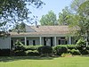
Bryan House
August 27, 1999 (#99001037 ) 2086 Harold Montgomery Rd. 32°28′13″N 93°25′34″W / 32.470278°N 93.426111°W / 32.470278; -93.426111 (Bryan House ) Doyline
4
June 21, 1996 (#96000680 ) Roughly bounded by Monroe, Pine, Main, E. Union, Chevrolet, and Fogle Sts. 32°36′56″N 93°17′10″W / 32.615556°N 93.286111°W / 32.615556; -93.286111 (Downtown Minden Historic District ) Minden
5
Upload image July 18, 1985 (#85001585 ) 1202 Broadway 32°37′10″N 93°16′51″W / 32.619444°N 93.280833°W / 32.619444; -93.280833 (Drake House ) Minden
6
May 18, 2001 (#01000510 ) 304 McDonald 32°37′10″N 93°17′04″W / 32.619444°N 93.284444°W / 32.619444; -93.284444 (Fitzgerald House ) Minden
7
Fuller House
April 18, 1996 (#96000433 ) 220 W. Union 32°37′03″N 93°17′15″W / 32.6175°N 93.2875°W / 32.6175; -93.2875 (Fuller House ) Minden
8
Germantown
March 12, 1979 (#79001100 ) Off U.S. Route 79 32°42′00″N 93°13′50″W / 32.7°N 93.230556°W / 32.7; -93.230556 (Germantown ) Minden
9
Upload image January 12, 1983 (#83000553 ) West of Cotton Valley off Louisiana Highways 7 and 160 32°49′15″N 93°25′30″W / 32.820833°N 93.425°W / 32.820833; -93.425 (Hodges House ) Cotton Valley
10
Upload image August 13, 1986 (#86001496 ) 328 Lewisville Rd. 32°37′14″N 93°17′01″W / 32.620556°N 93.283611°W / 32.620556; -93.283611 (McDonald House ) Minden
11
Upload image October 6, 2004 (#04001113 ) 224 Louisiana Highway 518 32°38′50″N 93°13′18″W / 32.647222°N 93.221667°W / 32.647222; -93.221667 (Miller Farmstead ) Minden
12
Upload image April 18, 1996 (#96000431 ) 416 Broadway 32°36′47″N 93°17′16″W / 32.613056°N 93.287778°W / 32.613056; -93.287778 (Miller House ) Minden
13
Upload image November 5, 1992 (#92001527 ) Roughly Broadway, East/West St., and Lewisville Rd. bordering Academy Park and adjacent parts of Elm St. and Fort St. 32°37′15″N 93°16′55″W / 32.620833°N 93.281944°W / 32.620833; -93.281944 (Minden Historic District ) Minden
14
Upload image November 27, 1992 (#92001633 ) Parish Highway 114 north of Minden 32°41′59″N 93°13′50″W / 32.699722°N 93.230556°W / 32.699722; -93.230556 (O'Bier House ) Minden
15
Upload image January 15, 1998 (#97001651 ) Louisiana Highway 531 north of Dubberly32°33′38″N 93°14′53″W / 32.560556°N 93.248056°W / 32.560556; -93.248056 (Shadow House ) Dubberly
16
Union Church
January 25, 1995 (#94001562 ) Junction of Yellow Pine Rd. and Louisiana Highway 7 32°28′39″N 93°19′22″W / 32.4775°N 93.322778°W / 32.4775; -93.322778 (Union Church ) Sibley
17
Upload image December 8, 1997 (#97001519 ) 109 N. College 32°37′09″N 93°17′15″W / 32.619167°N 93.2875°W / 32.619167; -93.2875 (Watkins House ) Minden
18
Upload image December 10, 1980 (#80001768 ) 521 East-West St. 32°36′46″N 93°16′49″W / 32.612778°N 93.280278°W / 32.612778; -93.280278 (Webster Parish Library Building ) Minden
19
Upload image October 1, 2004 (#04001081 ) 432 Yellow Pine Rd. 32°28′58″N 93°18′54″W / 32.482778°N 93.315°W / 32.482778; -93.315 (Yellow Pine School ) Sibley
See also [ ] References [ ]
^ The latitude and longitude information provided in this table was derived originally from the National Register Information System, which has been found to be fairly accurate for about 99% of listings. Some locations in this table may have been corrected to current GPS standards.
^ National Park Service, United States Department of the Interior , "National Register of Historic Places: Weekly List Actions" , retrieved February 11, 2022.
^ Numbers represent an alphabetical ordering by significant words. Various colorings, defined here , differentiate National Historic Landmarks and historic districts from other NRHP buildings, structures, sites or objects.
^ "National Register Information System" . National Register of Historic Places National Park Service . March 13, 2009.^ The eight-digit number below each date is the number assigned to each location in the National Register Information System database, which can be viewed by clicking the number.
Topics Lists by state Lists by insular areas Lists by associated state Other areas Related
National Register of Historic Places portal Category
Categories :
National Register of Historic Places in Webster Parish, Louisiana Lists of National Register of Historic Places in Louisiana by parish Hidden categories:
Articles using NRISref without a reference number Lists of coordinates Geographic coordinate lists Articles with Geo Commons category link is on Wikidata