Nauru International Airport
Nauru International Airport | |||||||||||
|---|---|---|---|---|---|---|---|---|---|---|---|
 Aerial view of the runway | |||||||||||
| Summary | |||||||||||
| Airport type | Public | ||||||||||
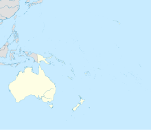
| Serves | Nauru | ||||||||||
| Location | Yaren District | ||||||||||
| Hub for | Nauru Airlines | ||||||||||
| Elevation AMSL | 7 m / 22 ft | ||||||||||
| Coordinates | 00°32′50.85″S 166°55′08.76″E / 0.5474583°S 166.9191000°ECoordinates: 00°32′50.85″S 166°55′08.76″E / 0.5474583°S 166.9191000°E | ||||||||||
| Website | nauruairlines | ||||||||||
| Map | |||||||||||
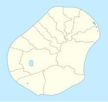 INU /ANYN Location in Yaren district, Nauru | |||||||||||
| Runways | |||||||||||
| |||||||||||

Nauru International Airport (IATA: INU, ICAO: ANYN) is the sole airport in the Republic of Nauru. The airport currently connects the country to one international passenger destination (Brisbane, Australia), served by Nauru's national airline, Nauru Airlines.
History[]
The airstrip was built during the World War II Japanese occupation of Nauru using forced labour. Operations began in January 1943. After the war, it was converted to a civilian airport.
The airport is located in the Yaren district, the least populated district in Nauru, just north of many of the government buildings, including the Parliament House, police station, and a secondary school. The airport holds the head office of flag carrier, Nauru Airlines.[1]
Also located at the airport are the Republic of Nauru Civil Aviation Authority, tasked with airport security and operational management; the Directorate of Immigration, tasked with control of incoming and outgoing passengers, and the Nauru Customs Service.
Airlines and destinations[]
Nauru International Airport serves as the main hub of the national carrier, Nauru Airlines.
| Airlines | Destinations |
|---|---|
| Nauru Airlines | Brisbane |

References[]
- ^ Contact Us Archived 2019-02-28 at the Wayback Machine. Retrieved on March 26, 2018. "Head Office Nauru International Airport PO Box 40 Republic of Nauru"
External links[]
| Wikimedia Commons has media related to Nauru International Airport. |
| History |  | ||||||
|---|---|---|---|---|---|---|---|
| Geography |
| ||||||
| Politics | |||||||
| Economy |
| ||||||
| Society |
| ||||||
This Nauru-related article is a stub. You can help Wikipedia by . |
- Airports in Nauru
- Yaren District
- Airports established in 1943
- 1943 establishments in Nauru
- Nauru stubs