Nawala West Grama Niladhari Division
Nawala West | |
|---|---|
 Nawala is located within, nearby or associated with the Nawala West Grama Niladhari Division | |
| Coordinates: 6°53′46″N 79°53′15″E / 6.896015°N 79.887507°E | |
| Country | Sri Lanka |
| Province | Western Province |
| District | Colombo District |
| Divisional Secretariat | |
| Electoral District | Colombo Electoral District |
| Polling Division | Kotte Polling Division |
| Area | |
| • Total | 1.44 km2 (0.56 sq mi) |
| Elevation | 9 m (30 ft) |
| Population (2012)[2] | |
| • Total | 4,059 |
| • Density | 2,819/km2 (7,300/sq mi) |
| ISO 3166 code | LK-1124030 |

Nawala West Grama Niladhari Division is a Grama Niladhari Division of the of Colombo District of Western Province, Sri Lanka. It has Grama Niladhari Division Code 520.
Nawala are located within, nearby or associated with Nawala West.
Nawala West is a surrounded by the , , Narahenpita, , Kirula, Gothamipura and Welikada North Grama Niladhari Divisions.
Demographics[]
Ethnicity[]
The Nawala West Grama Niladhari Division has a Sinhalese majority (87.7%). In comparison, the (which contains the Nawala West Grama Niladhari Division) has a Sinhalese majority (84.8%)[2]
Ethnicity in Nawala West[2]
Religion[]
The Nawala West Grama Niladhari Division has a Buddhist majority (77.7%). In comparison, the (which contains the Nawala West Grama Niladhari Division) has a Buddhist majority (77.1%)[2]
Religion in Nawala West[2]
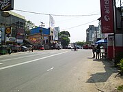
Gallery[]
Places adjacent to Nawala West Grama Niladhari Division | ||||||||||||||||
|---|---|---|---|---|---|---|---|---|---|---|---|---|---|---|---|---|
| ||||||||||||||||
References[]
- ^ "USGS EarthExplorer". earthexplorer.usgs.gov. U.S. Geological Survey. 2020.
- ^ a b c d e "Census of Population and Housing 2012" (PDF). statistics.gov.lk. Department of Census and Statistics, Sri Lanka. 2012.
This Western Province, Sri Lanka location article is a stub. You can help Wikipedia by . |
- Grama Niladhari Divisions of Kotte Divisional Secretariat
- Western Province, Sri Lanka geography stubs