Rajagiriya (Sri Jayawardanapura Kotte) Grama Niladhari Division
Rajagiriya | |
|---|---|
 Rajagiriya Flyover is located within, nearby or associated with the Rajagiriya Grama Niladhari Division | |
| Coordinates: 6°54′24″N 79°53′49″E / 6.906646°N 79.897046°E | |
| Country | Sri Lanka |
| Province | Western Province |
| District | Colombo District |
| Divisional Secretariat | |
| Electoral District | Colombo Electoral District |
| Polling Division | Kotte Polling Division |
| Area | |
| • Total | 0.72 km2 (0.28 sq mi) |
| Elevation | 79 m (259 ft) |
| Population (2012)[2] | |
| • Total | 3,591 |
| • Density | 4,988/km2 (12,920/sq mi) |
| ISO 3166 code | LK-1124020 |

Rajagiriya Grama Niladhari Division is a Grama Niladhari Division of the of Colombo District of Western Province, Sri Lanka. It has Grama Niladhari Division Code 514B.
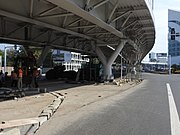
Welikadawatte, Rajagiriya Flyover, President's College, Sri Jayawardenapura Kotte, Institute of Chemistry Ceylon, Election Commission of Sri Lanka, Altitude (building) and Hewavitharana Maha Vidyalaya are located within, nearby or associated with Rajagiriya.
Rajagiriya is a surrounded by the , , , Welikada North and Grama Niladhari Divisions.
Demographics[]
Ethnicity[]
The Rajagiriya Grama Niladhari Division has a Sinhalese majority (57.6%) and a significant Moor population (33.6%). In comparison, the (which contains the Rajagiriya Grama Niladhari Division) has a Sinhalese majority (84.8%)[2]
Religion[]
The Rajagiriya Grama Niladhari Division has a Buddhist majority (51.5%) and a significant Muslim population (34.3%). In comparison, the (which contains the Rajagiriya Grama Niladhari Division) has a Buddhist majority (77.1%)[2]
Religion in Rajagiriya[2]
Gallery[]


Places adjacent to Rajagiriya (Sri Jayawardanapura Kotte) Grama Niladhari Division | ||||||||||||||||
|---|---|---|---|---|---|---|---|---|---|---|---|---|---|---|---|---|
| ||||||||||||||||
References[]
- ^ "USGS EarthExplorer". earthexplorer.usgs.gov. U.S. Geological Survey. 2020.
- ^ a b c d e "Census of Population and Housing 2012" (PDF). statistics.gov.lk. Department of Census and Statistics, Sri Lanka. 2012.
- Grama Niladhari Divisions of Kotte Divisional Secretariat