Nelse, Victoria
| Nelse Victoria | |||||||||
|---|---|---|---|---|---|---|---|---|---|
 Nelse | |||||||||
| Coordinates | 36°49′57″S 147°21′37.08″E / 36.83250°S 147.3603000°ECoordinates: 36°49′57″S 147°21′37.08″E / 36.83250°S 147.3603000°E | ||||||||
| Population | 6 (2016 census)[1] | ||||||||
| • Density | 0.0269/km2 (0.070/sq mi) | ||||||||
| Postcode(s) | 3699 | ||||||||
| Elevation | 1,893 m (6,211 ft) | ||||||||
| Area | 223.097 km2 (86.1 sq mi) | ||||||||
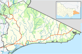
| Location |
| ||||||||
| LGA(s) | Shire of East Gippsland | ||||||||
| State electorate(s) | Benambra | ||||||||
| Federal division(s) | Indi | ||||||||
| |||||||||

Nelse is a small rural locality in the Bogong High Plains of Victoria, Australia.
History[]
Nelse was originally a cattlemen station in the late 1800s.
References[]
- ^ "2016 QuickStats Mount Beauty". Australia’s Guide. Retrieved 24 August 2020.
Categories:
- Towns in Victoria (Australia)
- Towns in East Gippsland
- Shire of East Gippsland