Netu'a
Netu'a | |
|---|---|
 | |
| Etymology: "Planted" | |
 Netu'a | |
| Coordinates: 33°3′53.24″N 35°19′21.97″E / 33.0647889°N 35.3227694°ECoordinates: 33°3′53.24″N 35°19′21.97″E / 33.0647889°N 35.3227694°E | |
| Country | |
| District | Northern |
| Council | Ma'ale Yosef |
| Affiliation | Moshavim Movement |
| Founded | 1966 |
| Founded by | Moshavniks |
| Population (2019)[1] | 306 |


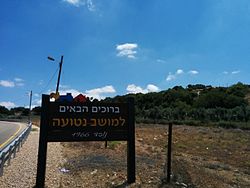
Netu'a (Hebrew: נְטוּעָה, lit. Planted) is a moshav in northern Israel. Located near the Lebanese border, it falls under the jurisdiction of Ma'ale Yosef Regional Council. In 2019 it had a population of 306.[1]
History[]
The village was established in 1966 by residents of other local moshavim as part of a plan to encourage more Jewish settlement in the Galilee. It is located on the land of the Palestinian villages of Dayr al-Qassi and Al-Mansura,[2] both depopulated in the 1948 Arab–Israeli War.
References[]
- ^ a b "Population in the Localities 2019" (XLS). Israel Central Bureau of Statistics. Retrieved 16 August 2020.
- ^ Khalidi, Walid (1992), All That Remains: The Palestinian Villages Occupied and Depopulated by Israel in 1948, Washington D.C.: Institute for Palestine Studies, pp. 13, 24, ISBN 0-88728-224-5
Categories:
- Ma'ale Yosef Regional Council
- Moshavim
- Populated places established in 1966
- Populated places in Northern District (Israel)
- 1966 establishments in Israel