Neuendettelsau
Neuendettelsau | |
|---|---|
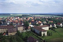 Neuendettelsau in the 1970s | |
 Coat of arms | |
show Location of Neuendettelsau within Ansbach district | |
 Neuendettelsau | |
| Coordinates: 49°16′N 10°46′E / 49.267°N 10.767°ECoordinates: 49°16′N 10°46′E / 49.267°N 10.767°E | |
| Country | Germany |
| State | Bavaria |
| Admin. region | Mittelfranken |
| District | Ansbach |
| Subdivisions | 19 Ortsteile |
| Government | |
| • Mayor (2020–26) | Christoph Schmoll[1] (SPD) |
| Area | |
| • Total | 33.8 km2 (13.1 sq mi) |
| Elevation | 438 m (1,437 ft) |
| Population (2020-12-31)[2] | |
| • Total | 7,936 |
| • Density | 230/km2 (610/sq mi) |
| Time zone | UTC+01:00 (CET) |
| • Summer (DST) | UTC+02:00 (CEST) |
| Postal codes | 91564 |
| Dialling codes | 09874, 09871 (Wernsbach), 09872 (Aich, Hammerschmiede, Mausendorf, Mausenmühle) |
| Vehicle registration | AN, DKB, FEU, ROT |
| Website | www.neuendettelsau.eu |


Neuendettelsau is a local authority in Middle Franconia, Germany. Neuendettelsau is situated 20 miles southwest of Nuremberg and 12 miles east of Ansbach. Since 1947 it has a Lutheran seminary (Augustana Hochschule).
Diakonie Neuendettelsau[]

Lutheran Church of St. Nicholas
Reverend Wilhelm Löhe (1808–1872) founded in 1854 an institute for deaconesses. The Diakonie Neuendettelsau is one of today’s major independent Christian institutions for social welfare work in Germany and the biggest such enterprise in Bavaria. More than 5,800 employees at numerous institutions in Neuendettelsau and other regions all over Southern Germany and in other European countries take care of the people they are responsible for.
Politics[]
The mayor is Christoph Schmoll (SPD), elected in March 2020.
Sister city[]
 Treignac (France), since 1996
Notable people[]
- Karl-Friedrich Beringer, choirmaster of the Windsbacher Knabenchor de:Windsbacher Knabenchor
- Johann Konrad Wilhelm Loehe, Lutheran pastor and theologian.
- Walter Burkert, world-famous German scholar of ancient Greek mythology and religion.
Literature[]
- Matthias Honold, Hans Rößler (Hrsg.): 700 Jahre Neuendettelsau, Neuendettelsau 1998.
- Hans Rößler (Hrsg.): Unter Stroh- und Ziegeldächern. Aus der Neuendettelsauer Geschichte, Neuendettelsau 1982.
References[]
- ^ Liste der ersten Bürgermeister/Oberbürgermeister in kreisangehörigen Gemeinden, Bayerisches Landesamt für Statistik, 15 July 2021.
- ^ "Tabellenblatt "Daten 2", Statistischer Bericht A1200C 202041 Einwohnerzahlen der Gemeinden, Kreise und Regierungsbezirke". Bayerisches Landesamt für Statistik (in German). June 2021.
External links[]
| Wikimedia Commons has media related to Neuendettelsau. |
- Homepage of the local authority Neuendettelsau
- Diakonie Neuendettelsau
- Löhe-Zeit-Museum Neuendettelsau
- Virtual museum of Neuendettelsau
| show Towns and municipalities in Ansbach (district) |
|---|
| show Authority control |
|---|
Categories:
- Municipalities in Bavaria