Newburyport, Massachusetts
Newburyport, Massachusetts | |
|---|---|
City | |
 Seal | |
 Location in Essex County and the state of Massachusetts | |
 Newburyport, Massachusetts Location in the United States | |
| Coordinates: 42°48′45″N 70°52′40″W / 42.81250°N 70.87778°WCoordinates: 42°48′45″N 70°52′40″W / 42.81250°N 70.87778°W | |
| Country | United States |
| State | Massachusetts |
| County | Essex |
| Settled | 1635 |
| Incorporated as a town | 1764 |
| Incorporated as a city | 1851 |
| Government | |
| • Type | Mayor-council city |
| • Mayor | Donna D. Holaday[1] (D[2]) |
| Area | |
| • Total | 10.71 sq mi (27.74 km2) |
| • Land | 8.35 sq mi (21.63 km2) |
| • Water | 2.36 sq mi (6.11 km2) |
| Elevation | 37 ft (11 m) |
| Population (2010) | |
| • Total | 17,416 |
| • Estimate (2019)[3] | 18,289 |
| • Density | 2,190.30/sq mi (845.66/km2) |
| Time zone | UTC−5 (Eastern) |
| • Summer (DST) | UTC−4 (Eastern) |
| ZIP Code | 01950 |
| Area code(s) | 351/978 |
| FIPS code | 25-45245 |
| GNIS feature ID | 0614293 |
| Website | www |

Newburyport is a coastal city in Essex County, Massachusetts, United States, 35 miles (56 km) northeast of Boston. The population was 17,416 at the 2010 census.[5] A historic seaport with vibrant tourism industry, Newburyport includes part of Plum Island. The mooring, winter storage, and maintenance of recreational boats, motor and sail, still contribute a large part of the city's income. A Coast Guard station oversees boating activity, especially in the sometimes dangerous tidal currents of the Merrimack River.
At the edge of the Newbury Marshes, delineating Newburyport to the south, an industrial park provides a wide range of jobs. Newburyport is on a major north-south highway, Interstate 95. The outer circumferential highway of Boston, Interstate 495, passes nearby in Amesbury. The Newburyport Turnpike (U.S. Route 1) still traverses Newburyport on its way north. The Newburyport/Rockport MBTA commuter rail from Boston's North Station terminates in Newburyport. The earlier Boston and Maine Railroad leading farther north was discontinued, but a portion of it has been converted into a recreation trail.
History[]


On January 28, 1764, the General Court of Massachusetts passed "An act for erecting part of the town of Newbury into a new town by the name of Newburyport."[6] The act begins:
Whereas the town of Newbury is very large, and the inhabitants of that part of it who dwell by the water-side there, as it is commonly called, are mostly merchants, traders and artificers, and the inhabitants of the other parts of the town are chiefly husbandmen; by means whereof many difficulties and disputes have arisen in managing their public affairs – Be it enacted ... That that part of the said town of Newbury ... be and hereby are constituted and made a separate and distinct town ....
The act was approved by Governor Francis Bernard on February 4, 1764. The new town was the smallest in Massachusetts, covering an area of 647 acres (2.62 km2), and had a population of 2,800 living in 357 homes. There were three shipyards, no bridges, and several ferries, one of which at the foot of Greenleaf Lane, now State Street,[7] carried the Portsmouth Flying Stage Coach, running between Portsmouth, New Hampshire, and Boston.[8]
The town prospered and became a city in 1851. Situated near the mouth of the Merrimack River, it was once a fishing, shipbuilding and shipping center, with an industry in silverware manufacture. In 1792, a bridge was built two miles above the town where the river contained an island.[9] Merrimack Arms and Brown Manufacturing Company made Southerner Derringer pistols in their Newburyport factory from 1867 to 1873.[10] The sea captains of old Newburyport (as elsewhere in Massachusetts) had participated vigorously in the triangular trade, importing West Indian molasses and exporting rum made from it. The distilleries were located around Market Square near the waterfront. Caldwell's Old Newburyport rum was manufactured locally until 1961.
The Atlantic slave trade supported much of Newburyport's early growth and prosperity, with ships built in Newburyport and sold by Newburyport merchants used in the transportation of enslaved people from Africa, and Newburyport rum distilleries being a major destination of resources extracted by slave labor in the Caribbean. Racial segregation in what is today called Newburyport was practiced as early as 1683, when the selectmen of Newbury banished a free African woman, Juniper, from the town. In 1755, as many as fifty enslaved African and Native American people lived in present-day Newburyport. An enslaved girl was advertised for sale in Newburyport as late as 1774, well after the incorporation of Newburyport as a distinct municipality from Newbury. Just the year prior, an enslaved man, Caesar Hendrick, had successfully sued Newburyport resident Richard Greenleaf for his freedom.[11]
Newburyport prior to the Civil War had always been divided over slavery. While many of its leading citizens profited from and defended slavery, it also had been a frequent topic of pulpit rhetoric. After the Revolutionary War, abolitionism took a firm hold, Newburyport included. Several citizens are recognized by the National Park Service for their contributions to the Underground Railroad. The abolitionist movement reached a peak with the activities of William Lloyd Garrison, who was born in Newburyport and helped develop an anti-slavery climate. In 1841, Garrison was imprisoned on charges of libel for accusing Newburyport shipowner Francis Todd and captain Nicholas Brown of transporting 44 African captives in chains. His statue stands in Brown Square, which was the scene of abolitionist meetings.
Newburyport once had a fishing fleet that operated from Georges Bank to the mouth of the Merrimack River. It was a center for privateering during the Revolutionary War and War of 1812. Beginning about 1832, it added numerous ships to the whaling fleet. Later, clipper ships were built there. Today, the city gives little hint of its former maritime importance. Notably missing are the docks, which are shown on earlier maps extending into the channel of the Merrimack River, and the shipyards, where the waterfront parking lot is currently located.
George Whitefield, the well-known and influential English preacher who helped inspire the First Great Awakening in America, arrived in Newburyport in September 1740. The revival that followed his labors, brought into existence Old South Church, where he was buried after his death in 1770.
The city's historical highlights include:
Historic events:
- First of many clipper ships built here[12]
- First "Tea Party" rebellion to oppose British Tea Tax[13][14]
- First state mint and treasury building[15]
- Newburyport Superior Courthouse, the oldest continuously active courthouse in Massachusetts[citation needed]
The Newburyport Five Cents Savings Bank on State Street was founded in 1854, and is one of the oldest banks in the United States still in operation.[16]
Historic houses and museums:
- Cushing House Museum & Garden[17] (c. 1808)
- Newburyport Custom House Museum[18] (1835), designed by Robert Mills
Literary interests:
- Was referred to in the H. P. Lovecraft story, "The Shadow Over Innsmouth", as being located near Innsmouth. Lovecraft in fact based his depiction of Innsmouth largely on Newburyport.[19]
- Subject of the most ambitious community study ever undertaken, the Yankee City project conducted by anthropologist W. Lloyd Warner and his associates
Timeline[]
Historic preservation[]
Despite its former prosperity, in the 1950s and 1960s Newburyport's center fell into disrepair because of several factors, most notably strip malls taking away from local business and increased use of the automobile. At this time, construction of major highways brought larger cities such as Lawrence and Lowell into shopping range. Consequently, by 1970 Newburyport's historic downtown section was scheduled to be razed prior to reconstruction with federal money. Ideas to rebuild the city's downtown were numerous, ranging from hotels and new stores to, ironically, a strip mall, with few buildings left for historical reasons. At the last moment, however, the city changed its mind and signed a federal grant that allowed it to keep most of its historic architecture. Renovation and restorations began during the early 1970s, and continued throughout most of the decade, initially along State Street, and culminating with creation of a pedestrian mall along Inn Street. Newburyport is often cited as an example by preservationists of how to maintain a city's architecture and heritage, while still having it remain functional and liveable.
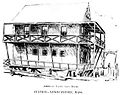
American Yacht Club House c. 1894
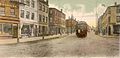
State Street c. 1906. Except for the trolley, the store fronts, and the pavement, the street has not changed.

Dexter House c. 1908, once home to eccentric "Lord" Timothy Dexter

Frog Pond c. 1905. High Street is visible in the background. The building in the center is the old court house.

Joppa Landing c. 1906. The boats are fishing dories. The houses remain but the landing and the boats are gone and the street has been improved.

City Hall c. 1910. The building looks about the same today. It was constructed 1850–1851. The corner of Brown Square is visible across the street. The view is from where the Post Office now stands.

Brown Square in 1913, viewed from before the City Hall. The statue is that of "Garrison the Liberator". The houses and church still stand but the street has been paved and more modern buildings inserted.


Geography[]

Newburyport is located at 42°48′45″N 70°52′39″W / 42.81250°N 70.87750°W (42.812391, −70.877440).[37] According to the United States Census Bureau, the city has a total area of 10.6 square miles (27 km2), of which 8.4 square miles (22 km2) is land and 2.2 square miles (5.7 km2) (20.77%) is water.
The city is part of Massachusetts' North Shore; Newburyport was laid out on the elevated south bank of the Merrimack River between the river and Newbury marshes. The shipyards, now boatyards (and still vigorously active), extended along the bank at the edge of the river. They were connected by Merrimac Street, which ends upriver where the bank merges into bluffs covered with pine forest. Colonial residences extend up the bank from Merrimac Street to High Street running parallel to it near the top of the ridge. The homes of the seafaring entrepreneurs line High Street. Many feature widow's walks, structures on the roof where the residents could watch for the return of sailing vessels. Nearly every home maintains a splendid flower garden, most dating to colonial times. Various cross streets, such as State Street, Green Street and Market Street, connect Merrimac Street and High Street. The top of the ridge proved an ideal location for later institutions, such as Newburyport High School and nearby Anna Jaques Hospital. The ridge drops more sharply to the marsh on the other side. Along its margin a third parallel street developed, Low Street.
The river bank gradually descends to marshes at Joppa Flats beyond downtown Newburyport. The Plum Island Turnpike was pushed out over the marsh on a causeway to a narrow part of the Plum Island River just to the south of where it connects to the mouth of the Merrimack. A drawbridge was built there, the only access to the island by road. On the Newburyport side a small airport, Plum Island Airport, was built at the edge of the marsh. The portion of Plum Island that is in the city has no direct access to the rest of the city; similarly, there is no access between the mainland and Woodbridge Island or Seal Island, west of Plum Island (the latter being shared between Newburyport and Newbury). Several parks and beaches dot the city, including Plum Island Point Beach, Simmons Beach, Joppa Park, Waterfront Park, Woodman Park, Cashman Park, Moseley Pines Park and Atkinson Common and March's Hill Park. Newburyport Forest is located in the southwest corner of the city, and Maudslay State Park lies along the northwest part of the city, along the banks of the Merrimack.
Newburyport is located 37 miles (60 km) north-northeast of Boston, 19 miles (31 km) east-northeast of Lawrence, and 21 miles (34 km) south-southeast of Portsmouth, New Hampshire. Situated 5 miles (8 km) south of the New Hampshire border, the city is bordered by the Gulf of Maine (Atlantic Ocean) to the east, Newbury to the south and southeast, West Newbury to the west and southwest, Amesbury to the north and northwest, and Salisbury to the northeast.
| hideClimate data for Newburyport, Massachusetts (1981–2010 normals) | |||||||||||||
|---|---|---|---|---|---|---|---|---|---|---|---|---|---|
| Month | Jan | Feb | Mar | Apr | May | Jun | Jul | Aug | Sep | Oct | Nov | Dec | Year |
| Average high °F (°C) | 33.9 (1.1) |
36.9 (2.7) |
44.7 (7.1) |
56.6 (13.7) |
66.5 (19.2) |
75.1 (23.9) |
81.2 (27.3) |
80.5 (26.9) |
73.7 (23.2) |
61.3 (16.3) |
51.2 (10.7) |
39.5 (4.2) |
58.4 (14.7) |
| Average low °F (°C) | 16.3 (−8.7) |
18.4 (−7.6) |
25.4 (−3.7) |
35.2 (1.8) |
45.1 (7.3) |
55.1 (12.8) |
60.6 (15.9) |
59.6 (15.3) |
52.0 (11.1) |
40.8 (4.9) |
32.3 (0.2) |
22.2 (−5.4) |
38.6 (3.7) |
| Average precipitation inches (mm) | 3.61 (92) |
3.56 (90) |
4.84 (123) |
4.70 (119) |
4.30 (109) |
4.08 (104) |
3.83 (97) |
3.42 (87) |
4.01 (102) |
4.72 (120) |
4.43 (113) |
4.25 (108) |
49.75 (1,264) |
| Average snowfall inches (cm) | 18.0 (46) |
12.8 (33) |
10.1 (26) |
2.2 (5.6) |
0 (0) |
0 (0) |
0 (0) |
0 (0) |
0 (0) |
0 (0) |
1.8 (4.6) |
10.4 (26) |
55.3 (141.2) |
| Average precipitation days (≥ 0.01 in) | 10.8 | 9.2 | 11.3 | 11.3 | 12.4 | 12.2 | 10.4 | 9.5 | 9.3 | 9.9 | 11.1 | 10.8 | 128.2 |
| Average snowy days (≥ 0.1 in) | 6.9 | 4.9 | 3.8 | 0.9 | 0 | 0 | 0 | 0 | 0 | 0.1 | 1.1 | 4.6 | 22.3 |
| Source: NOAA[38] | |||||||||||||
Demographics[]
| Year | Pop. | ±% |
|---|---|---|
| 1790 | 4,837 | — |
| 1800 | 5,946 | +22.9% |
| 1810 | 7,634 | +28.4% |
| 1820 | 6,852 | −10.2% |
| 1830 | 6,375 | −7.0% |
| 1840 | 7,161 | +12.3% |
| 1850 | 9,572 | +33.7% |
| 1860 | 13,401 | +40.0% |
| 1870 | 12,595 | −6.0% |
| 1880 | 13,538 | +7.5% |
| 1890 | 13,947 | +3.0% |
| 1900 | 14,478 | +3.8% |
| 1910 | 14,949 | +3.3% |
| 1920 | 15,618 | +4.5% |
| 1930 | 15,084 | −3.4% |
| 1940 | 13,916 | −7.7% |
| 1950 | 14,111 | +1.4% |
| 1960 | 14,004 | −0.8% |
| 1970 | 15,807 | +12.9% |
| 1980 | 15,900 | +0.6% |
| 1990 | 16,317 | +2.6% |
| 2000 | 17,189 | +5.3% |
| 2010 | 17,416 | +1.3% |
| 2019 | 18,289 | +5.0% |
| * = population estimate. Source: United States census records and Population Estimates Program data.[39][40][41][42][43][44][45][46][47][48][49] Source: | ||
As of the census[51] of 2010, there were 17,416 people, 8,264 households, and 4,428 families residing in the city. The population density was 2,086.2 people per square mile (792.0/km2). There were 7,897 housing units at an average density of 942.0 per square mile (363.8/km2). The racial makeup of the city was 90.2% White, 3.6% African American, 0.1% Native American, 0.61% Asian, 0.01% Pacific Islander, 0.16% from other races, and 1.2% from two or more races. Hispanic or Latino people of any race were 2.7% of the population. The top five ethnic groups are:[52] (United States 2010 Census quickfacts)
- Irish – 25%
- English – 16%
- Italian – 11%
- French (except Basque) – 7%
- German – 6%
There were 7,519 households, out of which 25.9% had children under the age of 18 living with them, 47.7% were married couples living together, 8.5% had a female householder with no husband present, and 41.1% were non-families. Of all households 33.1% were made up of individuals, and 9.7% had someone living alone who was 65 years of age or older. The average household size was 2.24 and the average family size was 2.90.
In the city, the population was spread out, with 20.7% under the age of 18, 4.4% from 18 to 24, 32.7% from 25 to 44, 28.2% from 45 to 64, and 14.0% who were 65 years of age or older. The median age was 41 years. For every 100 females, there were 86.7 males. For every 100 females age 18 and over, there were 82.9 males.
The median income for a household in the city was $78,557, and the median income for a family was $103,306. Males had a median income of $51,831 versus $37,853 for females. The per capita income for the city was $34,187. About 2.8% of families and 5.2% of the population were below the poverty line, including 4.5% of those under age 18 and 6.9% of those age 65 or over.
Government[]
Upon adopting a new charter in 2011 which took effect in 2013, Newburyport has been run by a mayor with a four-year term and an eleven-member City Council (prior to that, the mayor's term lasted for two years). During the mid-twentieth century, Newburyport enjoyed a typical "small community" approach, conducted, most notably, by city mayor and activist Ed Molin, who died in 2005. The current mayor of Newburyport is Donna Holaday, and the next election year for mayor is 2021.
Newburyport is part of the Massachusetts Senate's 1st Essex district.[53]
| Voter registration and party enrollment as of October 15, 2008[54] | |||||
|---|---|---|---|---|---|
| Party | Number of voters | Percentage | |||
| Democratic | 4,058 | 31.42% | |||
| Republican | 1,700 | 13.16% | |||
| Unaffiliated | 7,095 | 54.94% | |||
| Minor parties | 61 | 0.47% | |||
| Total | 12,914 | 100% | |||
Transportation[]
Interstate 95 passes through the western side of town, with one exit at Route 113. Route 113 itself has its eastern terminus at U.S. Route 1 and Massachusetts Route 1A, with Route 1A continuing along the same right of way as 113 towards Newbury. Route 1 and 1A cross the river along the Newburyport Turnpike Bridge; it had originally followed State Street and ended at Merrimac and Water streets before crossing the river via ferry to Salisbury. The Turnpike Bridge is the easternmost crossing of the Merrimack; upstream the river is crossed by the Newburyport Railroad Bridge (just west of the Turnpike Bridge), the Chain Bridge, one of the oldest bridges along the river, and the Whittier Memorial Bridge, which brings Interstate 95 to Amesbury.
The Merrimack Valley Regional Transit Authority provides regular bus service between the city and Haverhill, which includes access to the commuter rail station in Newburyport. The bus costs $1.25 for adults paying cash and $1 for adults paying with CharlieCard. C&J[55] and Coach Company,[56] privately operated coach carriers, operate commuter bus services between Newburyport and Boston. Newburyport is the northern terminus of the Newburyport/Rockport Line of the MBTA Commuter Rail system, providing access through several North Shore cities to Boston's North Station.[57]
Plum Island Airport is a privately owned general aviation airport located within the city limits. It is open to the public and managed by Plum Island Aerodrome, Inc., a not-for-profit organization.[58] The nearest scheduled commercial air service can be found at Boston's Logan International Airport, Worcester's Worcester Regional Airport, Portsmouth's Pease International Tradeport or Manchester's Manchester-Boston Regional Airport.
Education[]

The current site of Newburyport High School was purchased from Harvard University early in the 20th century.[citation needed] Newburyport High School is one of the oldest public high schools in the United States.
Newburyport is served by several public schools, belonging to the Newburyport School District, and several private schools.
- Francis T. Bresnahan Lower Elementary School: pre-kindergarten to grade 3
- Edward G. Molin Upper Elementary School: grades 4 and 5
- Rupert A. Nock Middle School: grades 6 to 8
- Newburyport High School: grades 9 to 12
- River Valley Charter School: grades kindergarten to 8
- Immaculate Conception Catholic School: grades pre-kindergarten to 8
- Newburyport Montessori School: pre-kindergarten and kindergarten
On Monday, November 4, 2019, the Newburyport School Committee unanimously (with one member absent) voted to implement a Start School Later policy, the first of the Cape Ann League to do so.
The times will be:
- Francis T. Bresnahan Lower Elementary School: pre-kindergarten to grade 3; 8:20–2:50
- Edward G. Molin Upper Elementary School: grades 4 and 5; and Rupert A. Nock Middle School: grades 6 to 8; 7:45–2:15
- Newburyport High School: grades 9 to 12; 8:15–2:45
Newburyport is served by the Newburyport Public Library, part of the Merrimack Valley Library Consortium.
Newburyport High School competes in the Cape Ann League, an athletic conference in District A of the Massachusetts Interscholastic Athletic Association. The athletics program offers a variety of sports for girls and boys during the fall, winter, and spring seasons. The school colors are Crimson and Old Gold and the mascot is a Clipper Ship.
| Fall | Winter | Spring |
|---|---|---|
| Field Hockey | Basketball | Baseball |
| Football | Indoor Track | Softball |
| Soccer | Ice Hockey | Lacrosse |
| Golf | Ski Racing (Co-op with Georgetown High School) | Spring Track |
| Volleyball | Swim (Co-op with Triton Regional High School) | Tennis |
| Cross Country | Wrestling (Co-op with Pentucket High School) | |
| Cheerleading | Cheerleading |
Activities[]

Newburyport makes activities available for its residents, including a year-round ice skating rink and a beautiful waterfront and boardwalk. Many Newburyport residents love boating, fishing, swimming, and other water sports. The city's picturesque downtown shopping district also makes it a great location to enjoy boutique shopping. The city sponsors several youth sports leagues, including baseball, football, soccer, lacrosse, basketball, and hockey. The city's youth services program also provides classes, campouts, and activities in robotics, music, rock climbing, chess, fencing, sewing, dance, skateboarding, judo, academics, cooking, yoga, cheerleading, art, fashion design, photography, biking, and frisbee.
Annual events[]
Yankee Homecoming[]
Yankee Homecoming, run not by the city, but by the non-profit Yankee Homecoming, Inc., is the annual festival celebrating the natives coming home to Newburyport. The event was initiated in 1957 by native Newburyporter George Cashman, who sought to stimulate the economy and lift the spirit of the citizens.
It lasts one week. The first Sunday of the festival, known as "Olde Fashioned Sunday", is celebrated at the Bartlet Mall in Newburyport, and features many activities, including an art show, an appearance by the city's oldest fire engine, the "Neptune #8", and the participation of many local businesses. There is also an antique car parade. Each Yankee Homecoming features a grand marshal and numerous street vendors.
The festival includes eight days and over 200 events. There are concerts every night at Market Landing Park. Other popular events include the Newburyport Lions' 10-mile (16 km) and 5-kilometer road races, which run through the city's downtown streets and neighborhoods. There is also a 45-minute fireworks show on Saturday night, which is followed the concluding Sunday by the famous Yankee Homecoming parade.
First held in 1958, Newburyport's "Yankee Homecoming" is the second-oldest homecoming festival in the United States. Many charities raise their funds during this time.
Waterfront Concert Series[]
This was held Friday evenings in Waterfront Park in downtown Newburyport, these free concerts were intended for all ages. The concerts were presented by the Newburyport Chamber of Commerce and the Waterfront Trust and were sponsored by a local insurance agency, Arthur S Page Insurance.
Newburyport Literary Festival[]
Held during the last weekend of April, the Newburyport Literary Festival was started in 2006 as a new effort by the city to increase interest in reading and literary arts. Many local authors are invited to sign and chat about their book, and schoolchildren create projects to show to an author who visits their school. Among the authors who regularly visit are Andre Dubus III, Tess Gerritsen and Rhina Espaillat.
Points of interest[]

Over the years, the town has cultivated a significant tourist population. The quaint downtown shopping center includes businesses that appeal to all ages. Local businesses and restaurants surround Market Square and along State Street. During festivals throughout the year, visitors are invited to enjoy concerts, food, and entertainment. An old mill building on Liberty Street is home to other small businesses and a local farmers' market during both the summer and winter seasons. The historic area has a charming feel and upbeat atmosphere.
High Street is a remarkable street of fine old Federal-style houses, linking the Atkinson Common (1893–1894) with the Bartlett Mall, site of the Charles Bulfinch-designed Essex County Superior Courthouse (1805). Laid out in 1801, the Bartlett Mall was redesigned in the 1880s by noted Boston landscape architect Charles Eliot, with later improvements by Arthur Shurcliff.
First Presbyterian Church dates from 1756. The clock tower bell was cast by Paul Revere. One of the most famous individuals in 18th-century America, evangelist George Whitefield, before dying in Newburyport in 1770, asked that his remains be buried under the pulpit of the "Old South" church, and they are there to this day.
Some other points of interest are the city's historic waterfront, Atwood Park located in the south end of Newburyport, Market Square & Inn Street, Cashman Park, and Brown Square, graced with a statue to "Garrison the Liberator", before the City Hall. The recently restored City Hall itself is a fine old building featuring in the first floor corridor a portrait gallery of some of those who have fallen in service of their country. Others are listed on the central monument in Atkinson Common.
- Chain Bridge
- Cushing House Museum & Garden
- Joppa Flats Education Center and Wildlife Sanctuary
- Maudslay State Park
- Newburyport Brewing Company
- Parker River National Wildlife Refuge
In popular culture[]
Newburyport was the inspiration for the city of Innsmouth, the setting of the H. P. Lovecraft story The Shadow Over Innsmouth, part of the Cthulhu Mythos. The narrative also cameos the actual Newburyport in the first chapter. It is where the protagonist sets out from on his journey to Innsmouth.[59] It was also mentioned in Stephen King's, "Doctor Sleep," when it explains Dan's drinking.
Notable people[]

- John Quincy Adams (1767-1848), U.S. president, resided in Newburyport 1787-1788
- Charlotte Johnson Baker (1855-1937), physician
- Kate Bolick (born 1972), Newburyport-born and raised author and essayist
- John Parker Boyd (1764-1830), U.S. Army Brigadier General in the War of 1812
- John Bromfield, Jr. (1779-1849), merchant
- John H. Couch (1811-1870), sea captain, pioneer and a founder of Portland, Oregon
- Caleb Cushing (1800-1879), diplomat and politician
- Timothy Dexter (1748-1806), businessman noted for his writing and eccentricity
- Andre Dubus III (born 1959), novelist
- William Lloyd Garrison (1805-1879), abolitionist
- Edmund Pike Graves (1891-1919), aviator who served as a fighter pilot during WWI and the Polish-Soviet War
- Áine Greaney (born c. 1962), writer and editor
- Adolphus Greely (1844-1935), polar explorer
- Edwin A. Grosvenor (1845-1936), author and professor of history
- Laura Coombs Hills (1859-1952), painter
- Judith Hoag (born 1968) actress
- Lucy Hooper (1816-1841), poet
- Charles Tillinghast James (1805-1862), mechanical engineer, designer, senator
- Benjamin H. Jellison (1845-1904), Medal of Honor recipient in the American Civil War
- Joe Keery (born 1992), actor
- Rufus King (1755-1827), diplomat and politician
- Thomas B. Lawson (1807-1888), artist
- Francis Cabot Lowell (1775-1817), manufacturer
- John Lowell (1743-1802), congressman and federal judge
- George Lunt (1803-1885), editor, lawyer, author, politician
- John P. Marquand (1893-1960), author
- Donald McKay (1810-1880), shipbuilder
- Jonathan Meath (born 1955), television producer
- Johnny Messner (born 1970), actor
- Robert S. Mulliken (1896-1986), recipient of 1966 Nobel Prize in Chemistry
- Theophilus Parsons (1750-1813), jurist
- James Parton (1822-1891), biographer
- Edmund Pearson (1880-1937), librarian and true crime writer
- Jacob Perkins (1766-1849), early American inventor
- Timothy Pilsbury (1789-1858), congressman from Texas
- Harriet Prescott Spofford (1835-1921), writer
- Charles A. Spring (1800-1891), influential Presbyterian leader in Iowa and Illinois
- Rev. Gardiner Spring (1785-1873), author of the Gardiner Spring Resolutions, which gained Abraham Lincoln the support of the Presbyterian Church
- Rev. Samuel Spring (1746-1819), religious leader, chaplain in Benedict Arnold's army
- Clara F. Stevens (1855-1934), English professor at Mount Holyoke College
- Matthew Thornton (1714-1803), signer of the Declaration of Independence
- William S. Tilton (1828-1889), Civil War brigade commander at the Battle of Gettysburg
- Peter Tolan (born 1958), television/film producer and writer
- Charles Turner (1848-1908), painter, born in Newburyport
- William Gordon Welchman (1906-1985) English Mathematician, University Professor, Second World War codebreaker at Bletchley Park, United Kingdom
- William Wheelwright (1798-1873), sea captain, US consul in Chile, steamship and railroad promoter in South America
- Martha Wright (1923-2016), singer and Broadway actress
See also[]
- Newburyport Public Library
- List of newspapers in Massachusetts in the 18th century: Newburyport
References[]
- ^ "Mayor's Office". Newburyport MA. Retrieved September 17, 2015.
- ^ Laidler, John (October 4, 2012). "Mayors, other area notables take sides in Senate race". The Boston Globe. Retrieved September 17, 2015.
"I believe that Elizabeth Warren is a person who will really fight for the average person," said Newburyport Mayor Donna D. Holaday, a Democrat.
- ^ "Population and Housing Unit Estimates". United States Census Bureau. May 24, 2020. Retrieved May 27, 2020.
- ^ "2019 U.S. Gazetteer Files". United States Census Bureau. Retrieved July 25, 2020.
- ^ "Profile of General Population and Housing Characteristics: 2010 Demographic Profile Data (DP-1): Newburyport city, Massachusetts". United States Census Bureau. Retrieved August 30, 2012.
- ^ Currier 1902, p. 267.
- ^ Currier, John (1902). History of Newbury, MA 1635–1902. Boston: Damrell & Upham. pp. 241–242.
- ^ Currier (1906) pages 5, 27–29.
- ^ Morse, Jedidiah. (1804). The American gazetteer : exhibiting a full account of the civil divisions, rivers, harbours, Indian tribes, &c. of the American continent, also of the West India and other appendant islands : with a particular description of Louisiana. 2nd edition. Charlestown, Massachusetts: Printed by and for Samuel Etheridge, and for Thomas and Andrews. p. 359. The Internet Archive website
- ^ James, Garry American Rifleman (June 2012) p.88
- ^ Blake, Euphemia Vale (1854). History of Newburyport. Press of Damrell and Moore.
- ^ "Why Newburyport is called, 'Clipper City'". Brick and Tree. Retrieved December 5, 2015.
- ^ Cutter, William Richard (January 1, 1921). American Biography: A New Cyclopedia. Pub. under the direction of the American historical society.
- ^ Wright, John Hardy (November 1, 1999). Newburyport. Arcadia Publishing. ISBN 9780738563336.
- ^ Crosby, Sylvester Sage (January 1, 1875). The Early Coins of America: And the Laws Governing Their Issue. Comprising Also Descriptions of the Washington Pieces, the Anglo-American Tokens, Many Pieces of Unknown Origin, of the Seventeenth and Eighteenth Centuries, and the First Patterns of the United States Mint. The author.
- ^ "Company Overview of Newburyport Five Cents Savings Bank". Retrieved March 10, 2017.
- ^ Cushing House Museum & Garden
- ^ Newburyport Custom House Museum
- ^ "Guide to Lovecraftian Sites in Massachusetts". Retrieved January 14, 2014.
- ^ Toppan 1885.
- ^ "History". Newburyport: Belleville Congregational Church.
- ^ Daniel Taggart Fiske. An historical discourse commemorative of the fiftieth anniversary of the organization of the Belleville Congregational Church, Newburyport, Mass., delivered on Thanksgiving Day, November 25, 1858. E.P. Dutton & Co., 1859
- ^ Acts of incorporation and by-laws of the marine society of Newburyport, in Massachusetts, Newburyport, MA: Printed by Whitton & Hale, 1846
- ^ Thomas, Isaiah (1874). History of printing in America (2nd ed.).
- ^ Jump up to: a b c "Eighteenth-Century American Newspapers in the Library of Congress: Massachusetts". Library of Congress. Retrieved April 24, 2012.
- ^ Jump up to: a b c d e f g h i j k l Brigham, Clarence S. (October 1915). "Bibliography of American newspapers, 1690-1820; part 4: Massachusetts (except Boston)". Proceedings of the American Antiquarian Society. 25 (2): 396–501.
- ^ Population of the 100 Largest Cities and Other Urban Places in the United States: 1790 to 1990, US Census Bureau, 1998
- ^ Jump up to: a b c d e f g h i j k l m n o p q r s t u v w x y z aa ab ac ad ae af ag ah ai Currier 1909.
- ^ Jump up to: a b c d e f g h i j Sampson 1874.
- ^ Jump up to: a b "About Us". Custom House Museum. Retrieved April 24, 2012.
- ^ Andrew McFarland Davis (February 1893), "Historical work in Massachusetts", Transactions, Colonial Society of Massachusetts
- ^ "Historical Society of Old Newbury". Retrieved April 24, 2012.
- ^ "About Us". Actors Studio of Newburyport. Retrieved October 26, 2013.
- ^ "Member Directory". Eastern Massachusetts Association of Community Theatres. Archived from the original on October 30, 2013. Retrieved October 26, 2013.
- ^ "Newburyport Bura Alliance". Archived from the original on June 3, 2008. Retrieved May 1, 2008.
- ^ "Out of Amesbury and Newburyport to Africa, and Back", Boston Globe, January 30, 2000
- ^ "US Gazetteer files: 2010, 2000, and 1990". United States Census Bureau. February 12, 2011. Retrieved April 23, 2011.
- ^ "NowData – NOAA Online Weather Data". National Oceanic and Atmospheric Administration. Retrieved February 9, 2013.
- ^ "Total Population (P1), 2010 Census Summary File 1". American FactFinder, All County Subdivisions within Massachusetts. United States Census Bureau. 2010.
- ^ "Massachusetts by Place and County Subdivision - GCT-T1. Population Estimates". United States Census Bureau. Retrieved July 12, 2011.
- ^ "1990 Census of Population, General Population Characteristics: Massachusetts" (PDF). US Census Bureau. December 1990. Table 76: General Characteristics of Persons, Households, and Families: 1990. 1990 CP-1-23. Retrieved July 12, 2011.
- ^ "1980 Census of the Population, Number of Inhabitants: Massachusetts" (PDF). US Census Bureau. December 1981. Table 4. Populations of County Subdivisions: 1960 to 1980. PC80-1-A23. Retrieved July 12, 2011.
- ^ "1950 Census of Population" (PDF). Bureau of the Census. 1952. Section 6, Pages 21-10 and 21-11, Massachusetts Table 6. Population of Counties by Minor Civil Divisions: 1930 to 1950. Retrieved July 12, 2011.
- ^ "1920 Census of Population" (PDF). Bureau of the Census. Number of Inhabitants, by Counties and Minor Civil Divisions. Pages 21-5 through 21-7. Massachusetts Table 2. Population of Counties by Minor Civil Divisions: 1920, 1910, and 1920. Retrieved July 12, 2011.
- ^ "1890 Census of the Population" (PDF). Department of the Interior, Census Office. Pages 179 through 182. Massachusetts Table 5. Population of States and Territories by Minor Civil Divisions: 1880 and 1890. Retrieved July 12, 2011.
- ^ "1870 Census of the Population" (PDF). Department of the Interior, Census Office. 1872. Pages 217 through 220. Table IX. Population of Minor Civil Divisions, &c. Massachusetts. Retrieved July 12, 2011.
- ^ "1860 Census" (PDF). Department of the Interior, Census Office. 1864. Pages 220 through 226. State of Massachusetts Table No. 3. Populations of Cities, Towns, &c. Retrieved July 12, 2011.
- ^ "1850 Census" (PDF). Department of the Interior, Census Office. 1854. Pages 338 through 393. Populations of Cities, Towns, &c. Retrieved July 12, 2011.
- ^ "1950 Census of Population" (PDF). 1: Number of Inhabitants. Bureau of the Census. 1952. Section 6, Pages 21–7 through 21-09, Massachusetts Table 4. Population of Urban Places of 10,000 or more from Earliest Census to 1920. Retrieved July 12, 2011. Cite journal requires
|journal=(help) - ^ "Census of Population and Housing". Census.gov. Retrieved June 4, 2015.
- ^ "U.S. Census website". United States Census Bureau. Retrieved January 31, 2008.
- ^ Newburyport - Newburyport - Ancestry & family history Archived April 7, 2014, at the Wayback Machine. ePodunk. Retrieved on August 2, 2013.
- ^ Massachusetts General Court, "An Act Establishing Executive Councillor and Senatorial Districts", Session Laws: Acts (2011), retrieved April 15, 2020
- ^ "Registration and Party Enrollment Statistics as of October 15, 2008" (PDF). Massachusetts Elections Division. Retrieved May 8, 2010.
- ^ "Bus Tickets to NYC, NH, Boston and Logan Airport". Retrieved April 20, 2018.
- ^ User, Super. "Boston Commuter Bus Schedule - Commuter Bus Service to Boston, Massachusetts MA and NH - Coach Company". www.coachco.com. Retrieved April 20, 2018.
- ^ Authority, Massachusetts Bay Transportation. "Newburyport/Rockport Line - Commuter Rail - MBTA". www.mbta.com. Retrieved April 20, 2018.
- ^ "Plum Island Aerodrome". www.plumislandaerodrome.org. Retrieved May 22, 2016.
- ^ Lovecraft, H. P. (1936). The Shadow over Innsmouth. Visionary Publishing Company. p. 1.
Bibliography[]
- Published in 18th–19th centuries
- Adams, John Quincy; Adams, Charles Francis (1903) [1788]. Life in a New England Town, 1787, 1788. Diary of John Quincy Adams While a student in the office of Theophilus Parsons at Newburyport. Boston: Little, Brown and Company.
- Caleb Cushing (1826), The history and present state of the town of Newburyport, Newburyport: Printed by E.W. Allen, OCLC 9488117, OL 6905508M
- Joshua Coffin (1845), A sketch of the history of Newbury, Newburyport, and West Newbury, from 1635 to 1845, Boston: S.G. Drake, OCLC 1556618, OL 6905506M
- Smith, Mrs. E. Vale (Euphemia Vale Blake) (2008) [1854]. History of Newburyport; from the Earliest Settlement of the Country to the Present Time; with a Biographical Appendix. Newburyport, Massachusetts; Internet Archive.
- Newburyport Directory. Boston: Sampson, Davenport & Co. 1874. Newburyport: Stephen H. Fowle, 1874
- Emery, Sarah Smith (1879). Reminiscences of a Nonagenarian. Newburyport: Huse & Co.
- Joseph Sabin, ed. (1881). "Newburyport, Mass.". Bibliotheca Americana. 13. New York. OCLC 13972268.
- Robert Noxon Toppan (1885), Two hundred and fiftieth anniversary of the settlement of Newbury, Newburyport: The Society, OCLC 9488114, OL 6543064M
- Hurd, Duane Hamilton, supervisor of compilation (1888). History of Essex County, Massachusetts, with Biographical Sketches of Many of the Pioneers and Prominent Men. Philadelphia: J. W. Lewis & Co.CS1 maint: multiple names: authors list (link) Two volumes, 957 and 1173 pages. Newburyport is in Volume II; however, there are scattered facts throughout. The first half of Volume I is downloadable from Google Books. Republished (1992) by Higginson Book Company, ISBN 0-8328-2450-X. In that edition, Hurd is called an editor.
- John J. Currier (1896), Ould Newbury, Boston: Damrell and Upham, OCLC 2482841, OL 6905507M
- Published in 20th century
- John J. Currier (1902), History of Newbury, Mass., 1635-1902, Boston: Damrell & Upham, OCLC 2303477, OL 6922835M
- Currier, John J. (1906). History of Newburyport, Mass. 1764–1905 with Maps and Illustrations. Newburyport: John J. Currier. pp. 766 and 679 pages. Two volumes. Reprints and facsimiles exist.
- Oliver B. Merrill. North End Papers, 1618–1880, Newburyport, Massachusetts. Newburyport Daily News, 1906–1908.
- John J. Currier (1909), History of Newburyport, Mass., 1764-1909, Newburyport: J. Currier (v.2)
- Samuel Eliot Morison (1921). "Newburyport and Nantucket". Maritime History of Massachusetts, 1783–1860. Boston: Houghton Mifflin. hdl:2027/uc2.ark:/13960/t3bz6407p.
- Federal Writers' Project (1937), "Newburyport", Massachusetts: a Guide to its Places and People, American Guide Series, Boston: Houghton Mifflin, hdl:2027/mdp.39015014440781
- Fanny Louise Walton. Historic nuggets of Newburyport. Newburyport, Mass.: Newburyport Press, 1958
- Stephan Thernstrom (1964), Poverty and progress: social mobility in a nineteenth century city, Cambridge: Harvard University Press, OL 24748995M
- Published in 21st century
- Bethany Groff (2008), Old Newbury, Charleston, SC: History Press, ISBN 9781596294813
External links[]
| Wikimedia Commons has media related to Newburyport, Massachusetts. |
| Wikivoyage has a travel guide for Newburyport. |
- "City of Newburyport official site".
- Old photos of Newburyport at Newbury375.org
- Greater Newburyport Village, a non-profit community organization

| show Municipalities and communities of Essex County, Massachusetts, United States |
|---|

| show Authority control |
|---|
- Newburyport, Massachusetts
- 1635 establishments in Massachusetts
- Cities in Essex County, Massachusetts
- Cities in Massachusetts
- Populated coastal places in Massachusetts
- Populated places established in 1635
- Massachusetts populated places on the Merrimack River