North Nashua River
From Wikipedia, the free encyclopedia
River in Massachusetts, United States
| North Nashua River | |
|---|---|
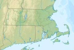 Location of mouth | |
| Location | |
| Country | United States |
| State | Massachusetts |
| Physical characteristics | |
| Source | |
| • coordinates |  42°34′28″N 71°50′12″W / 42.5745338°N 71.8367406°W / 42.5745338; -71.8367406 42°34′28″N 71°50′12″W / 42.5745338°N 71.8367406°W / 42.5745338; -71.8367406 |
| Mouth | |
• coordinates | 42°26′51″N 71°40′11″W / 42.4475920°N 71.6697911°W / 42.4475920; -71.6697911Coordinates: 42°26′51″N 71°40′11″W / 42.4475920°N 71.6697911°W / 42.4475920; -71.6697911 |
| Length | 19.9 mi (32.0 km) |
| Basin features | |
| River system | Nashua River |
The North Nashua River is a river in northern Massachusetts. It rises from the Whitman River and Phillips Brook west of Fitchburg and Westminster. It flows 19.9 miles (32.0 km), generally southeastward, past Fitchburg and joins the South Nashua River, about 5 miles (8.0 km) below its issuance from the Wachusett Reservoir, to form the Nashua River.[1]
See also[]
- Rivers of Massachusetts
- Merrimack River
References[]
http://www.nashuariverwatershed.org/
Merrimack River watershed | |||||
|---|---|---|---|---|---|
| Tributaries | |||||
| Lakes | |||||
| Towns |
| ||||
| Landmarks |
| ||||
Rivers of Massachusetts by drainage system | |||||||||
|---|---|---|---|---|---|---|---|---|---|
| Atlantic Ocean |
| ||||||||
| Gulf of Maine |
| ||||||||
| Long Island Sound |
| ||||||||
| Narragansett Bay |
| ||||||||
| Upper New York Bay |
| ||||||||
Retrieved from ""
Categories:
- Rivers of Massachusetts
- Rivers of Worcester County, Massachusetts
Hidden categories:
- Articles with short description
- Short description is different from Wikidata
- Coordinates on Wikidata
- AC with 0 elements